Avon is a home rule municipality located in Eagle County, Colorado, United States. The town population was 6,072 at the 2020 United States Census. The town is a part of the Edwards, CO Micropolitan Statistical Area. Avon is the gateway to the Beaver Creek Resort which lies about two miles (3 km) south of the town. It was the previous site of Vail Resorts before the company moved its physical headquarters to Broomfield, Colorado, in 2006. The town is the home of Liberty Skis, an independent ski manufacturing company.
| Name: | Avon town |
|---|---|
| LSAD Code: | 43 |
| LSAD Description: | town (suffix) |
| State: | Colorado |
| County: | Eagle County |
| Elevation: | 7,431 ft (2,265 m) |
| Total Area: | 8.424 sq mi (21.819 km²) |
| Land Area: | 8.349 sq mi (21.625 km²) |
| Water Area: | 0.075 sq mi (0.194 km²) |
| Total Population: | 6,072 |
| Population Density: | 727/sq mi (281/km²) |
| ZIP code: | 81620 |
| Area code: | 970 |
| FIPS code: | 0804110 |
| GNISfeature ID: | 0204667 |
| Website: | www.avon.org |
Online Interactive Map
Click on ![]() to view map in "full screen" mode.
to view map in "full screen" mode.
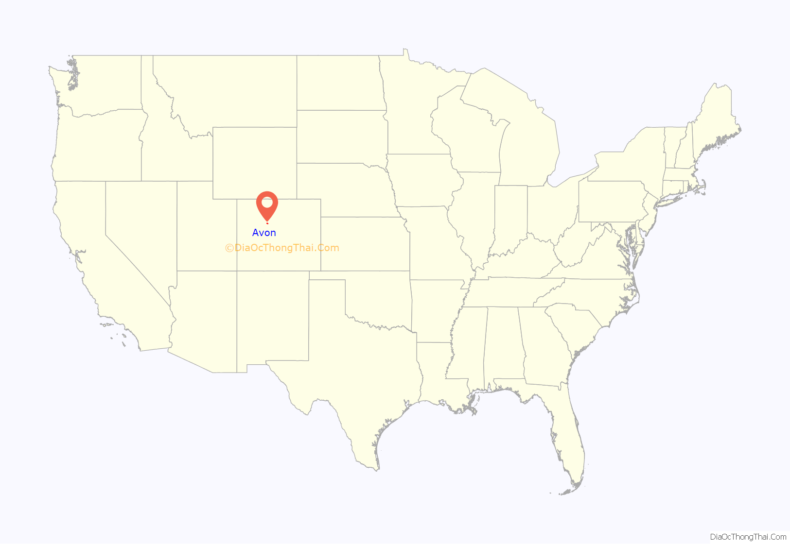
Avon location map. Where is Avon town?
History
The town began as a railway station in 1889. Originally spelled “Avin”, the name was later changed to “Avon”. Avon was incorporated in August 1978.
Avon Road Map
Avon city Satellite Map
Geography
Avon is located at 39°38′18″N 106°31′18″W / 39.63833°N 106.52167°W / 39.63833; -106.52167 (39.638254, -106.521797), along Interstate 70, U.S. Highway 6, and the Eagle River.
At the 2020 United States Census, the town had a total area of 5,392 acres (21.819 km) including 48 acres (0.194 km) of water. The town rests at 7,430 feet (2265 m) elevation.
One popular destination within Avon is Nottingham Lake, which offers a beach area and paddleboard/pedalboat rentals in the summer. Next to the lake is the Harry A. Nottingham Park and Pavilion, which serves as the location for an annual art festival, a summer concert series, and other activities.
See also
Map of Colorado State and its subdivision:- Adams
- Alamosa
- Arapahoe
- Archuleta
- Baca
- Bent
- Boulder
- Broomfield
- Chaffee
- Cheyenne
- Clear Creek
- Conejos
- Costilla
- Crowley
- Custer
- Delta
- Denver
- Dolores
- Douglas
- Eagle
- El Paso
- Elbert
- Fremont
- Garfield
- Gilpin
- Grand
- Gunnison
- Hinsdale
- Huerfano
- Jackson
- Jefferson
- Kiowa
- Kit Carson
- La Plata
- Lake
- Larimer
- Las Animas
- Lincoln
- Logan
- Mesa
- Mineral
- Moffat
- Montezuma
- Montrose
- Morgan
- Otero
- Ouray
- Park
- Phillips
- Pitkin
- Prowers
- Pueblo
- Rio Blanco
- Rio Grande
- Routt
- Saguache
- San Juan
- San Miguel
- Sedgwick
- Summit
- Teller
- Washington
- Weld
- Yuma
- Alabama
- Alaska
- Arizona
- Arkansas
- California
- Colorado
- Connecticut
- Delaware
- District of Columbia
- Florida
- Georgia
- Hawaii
- Idaho
- Illinois
- Indiana
- Iowa
- Kansas
- Kentucky
- Louisiana
- Maine
- Maryland
- Massachusetts
- Michigan
- Minnesota
- Mississippi
- Missouri
- Montana
- Nebraska
- Nevada
- New Hampshire
- New Jersey
- New Mexico
- New York
- North Carolina
- North Dakota
- Ohio
- Oklahoma
- Oregon
- Pennsylvania
- Rhode Island
- South Carolina
- South Dakota
- Tennessee
- Texas
- Utah
- Vermont
- Virginia
- Washington
- West Virginia
- Wisconsin
- Wyoming
