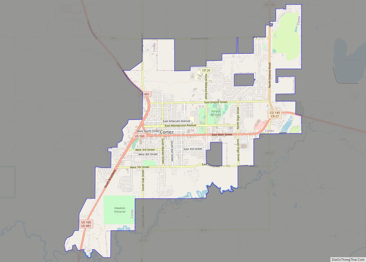
Cortez (/ˈkɔːrtɛz/ (listen)) is a home rule municipality that is the county seat and the most populous municipality of Montezuma County, Colorado, United States. The city population was 8,766 at the 2020 United States Census.
| Name: | Cortez city |
|---|---|
| LSAD Code: | 25 |
| LSAD Description: | city (suffix) |
| State: | Colorado |
| County: | Montezuma County |
| Elevation: | 6,191 ft (1,887 m) |
| Total Area: | 6.274 sq mi (16.249 km²) |
| Land Area: | 6.230 sq mi (16.136 km²) |
| Water Area: | 0.044 sq mi (0.113 km²) |
| Total Population: | 8,766 |
| Population Density: | 1,407/sq mi (543/km²) |
| ZIP code: | 81321 |
| Area code: | 970 |
| FIPS code: | 0817375 |
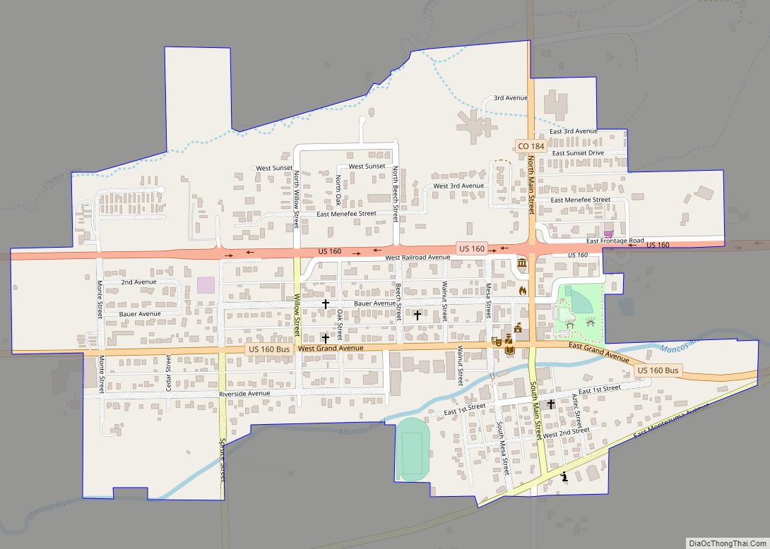
Online Interactive Map
Click on ![]() to view map in "full screen" mode.
to view map in "full screen" mode.
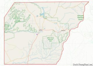
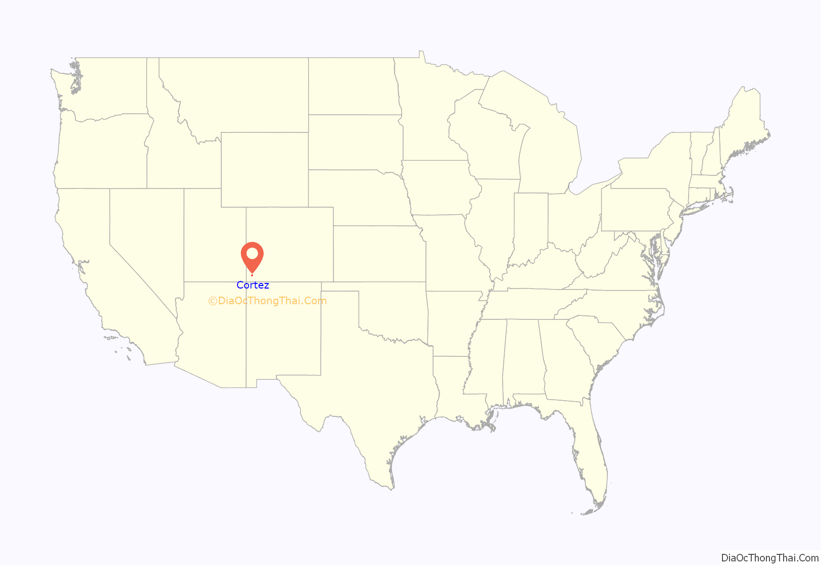
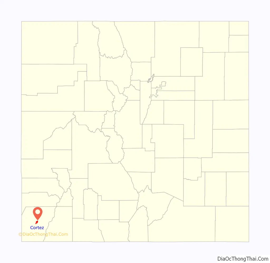
Cortez location map. Where is Cortez city?
History
In 1886, the town was built to provide housing for the men working on the tunnels and irrigation ditches required to divert water out of the Dolores River and into Montezuma Valley. The town was named for Spanish conquistador Hernán Cortés.
It is a popular stop for tourists, who stay there because of its central location among surrounding attractions, such as Mesa Verde National Park, Monument Valley, and the Four Corners.
Prehistoric sites
There are many prehistoric sites in the Cortez area, listed on the Colorado State Register of Historic Properties or both the state register and the National Register of Historic Places: They include large parks or centers, such as Crow Canyon Archaeological Center, Canyon of the Ancients National Monument, Hovenweep National Monument, and Mesa Verde National Park. There are also smaller or individuals sites, such as Cowboy Wash, Hawkins Pueblo and cliff dwellings, Lowry Ruin, Mitchell Springs Archeological Site, also known as the Mitchell Springs Ruin Group, Mud Springs Pueblo, and Yucca House National Monument. Within the McElmo Drainage Unit (AD 1075-1300) is Cannonball Ruins, Maxwell Community, Roy’s Ruin, Sand Canyon Archaeological District, and Wallace Ruin.
Historic trails or byways
The following are trails or byways through the Cortez area:
- Old Spanish National Historic Trail
- San Juan Skyway National Scenic Byway
- Trail of the Ancients
1959 U-2 emergency landing
A Lockheed U-2 reconnaissance aircraft made an emergency nighttime forced landing August 3, 1959, at the Cortez Municipal Airport. Republic of China Air Force Major Hsi-Chun Mike Hua was on a training flight originating at Laughlin AFB, Texas; the U-2 aircraft engine flamed out at 70,000 feet MSL. Maj. Hua established best glide and was able to navigate through a valley to a lighted airport that wasn’t on his map, of the existence of which he was unaware until he found it. The airport was the only one in the area with a lighted runway which was illuminated overnight.
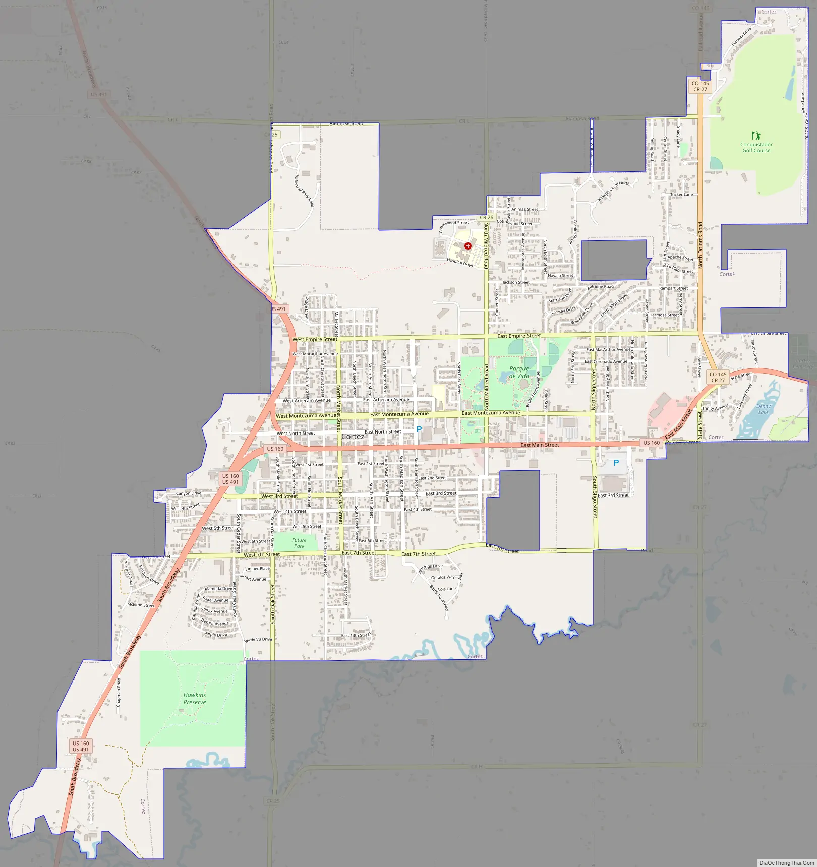
Cortez Road Map
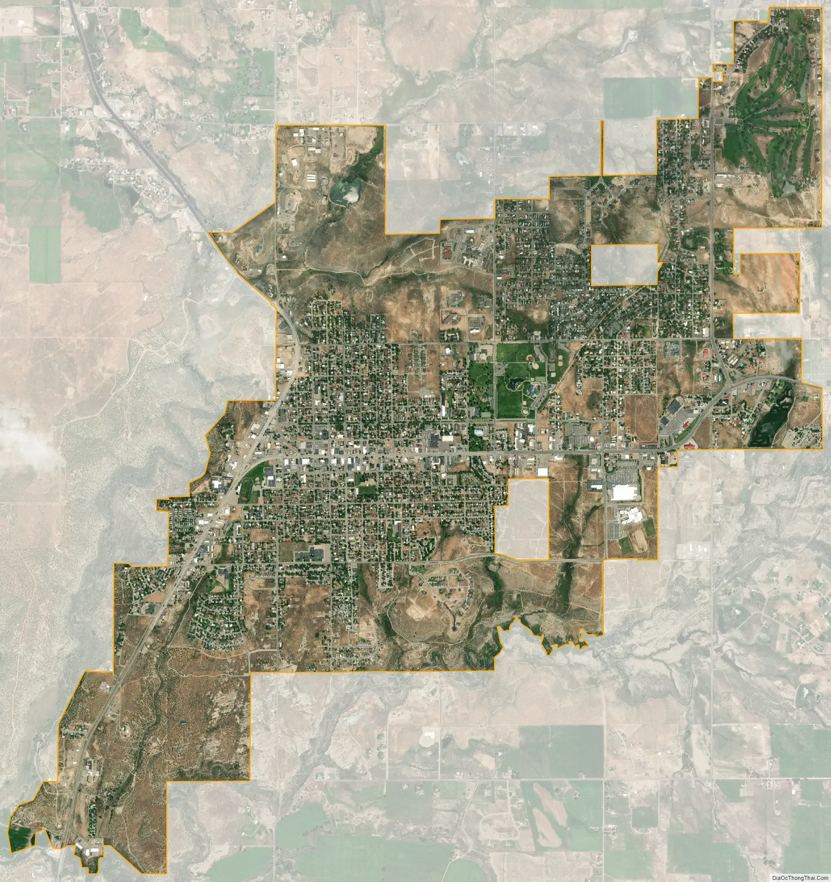
Cortez city Satellite Map
Geography
Cortez is located at 37°20′57″N 108°34′45″W / 37.34917°N 108.57917°W / 37.34917; -108.57917 (37.349270, -108.579225).
At the 2020 United States Census, the city had a total area of 4,015 acres (16.249 km) including 28 acres (0.113 km) of water.
Cortez is located in the area of the southwest known as the “High Desert”, as are most of northwestern, western, southwestern, and southern Colorado.
Climate
Cortez has a dry-summer continental climate (Köppen Dsb), though it borders on a semi-arid climate (BSk) due to low precipitation. The city has hot summer days and cold winter nights, the latter a result of its elevation.
See also
Map of Colorado State and its subdivision:- Adams
- Alamosa
- Arapahoe
- Archuleta
- Baca
- Bent
- Boulder
- Broomfield
- Chaffee
- Cheyenne
- Clear Creek
- Conejos
- Costilla
- Crowley
- Custer
- Delta
- Denver
- Dolores
- Douglas
- Eagle
- El Paso
- Elbert
- Fremont
- Garfield
- Gilpin
- Grand
- Gunnison
- Hinsdale
- Huerfano
- Jackson
- Jefferson
- Kiowa
- Kit Carson
- La Plata
- Lake
- Larimer
- Las Animas
- Lincoln
- Logan
- Mesa
- Mineral
- Moffat
- Montezuma
- Montrose
- Morgan
- Otero
- Ouray
- Park
- Phillips
- Pitkin
- Prowers
- Pueblo
- Rio Blanco
- Rio Grande
- Routt
- Saguache
- San Juan
- San Miguel
- Sedgwick
- Summit
- Teller
- Washington
- Weld
- Yuma
- Alabama
- Alaska
- Arizona
- Arkansas
- California
- Colorado
- Connecticut
- Delaware
- District of Columbia
- Florida
- Georgia
- Hawaii
- Idaho
- Illinois
- Indiana
- Iowa
- Kansas
- Kentucky
- Louisiana
- Maine
- Maryland
- Massachusetts
- Michigan
- Minnesota
- Mississippi
- Missouri
- Montana
- Nebraska
- Nevada
- New Hampshire
- New Jersey
- New Mexico
- New York
- North Carolina
- North Dakota
- Ohio
- Oklahoma
- Oregon
- Pennsylvania
- Rhode Island
- South Carolina
- South Dakota
- Tennessee
- Texas
- Utah
- Vermont
- Virginia
- Washington
- West Virginia
- Wisconsin
- Wyoming