Cutler Bay is an incorporated town in Miami-Dade County, Florida, United States, established in 2005. With a population of 45,425 as of the 2020 census, Cutler Bay is the 9th most populous of the 34 municipalities that make up Miami’s urban core, and the 33rd most populous of the 163 municipalities that make up the Miami-Fort Lauderdale-Pompano Beach Metropolitan Area.
| Name: | Cutler Bay town |
|---|---|
| LSAD Code: | 43 |
| LSAD Description: | town (suffix) |
| State: | Florida |
| County: | Miami-Dade County |
| Incorporated: | November 9, 2005 |
| Total Area: | 10.29 sq mi (26.64 km²) |
| Land Area: | 9.89 sq mi (25.61 km²) |
| Water Area: | 0.40 sq mi (1.03 km²) |
| Total Population: | 45,425 |
| Population Density: | 4,594.42/sq mi (1,773.99/km²) |
| Area code: | 305, 786 |
| FIPS code: | 1215968 |
| Website: | www.cutlerbay-fl.gov |
Online Interactive Map
Click on ![]() to view map in "full screen" mode.
to view map in "full screen" mode.
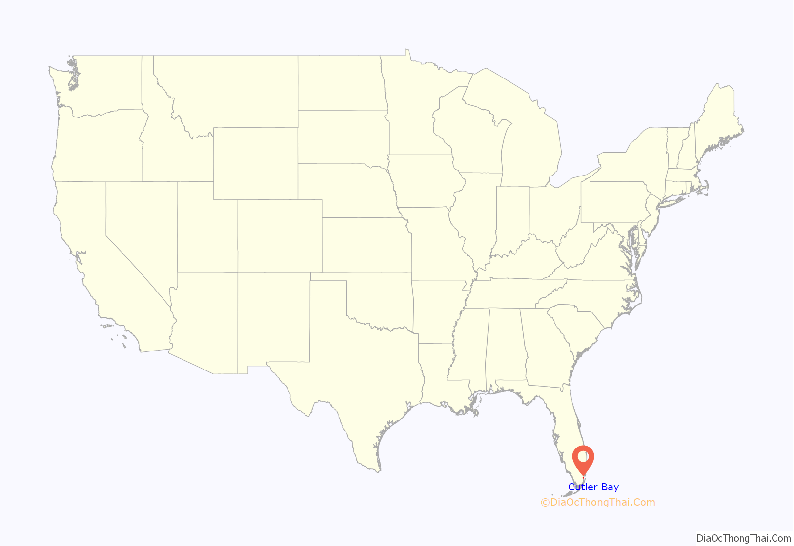
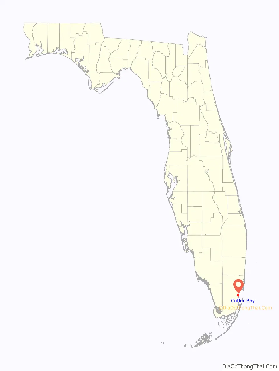
Cutler Bay location map. Where is Cutler Bay town?
History
The town was named after Dr. William Cutler of Massachusetts, who visited the area north of the town around 1880 and encouraged others to settle in what became the pioneer town of Cutler.
The Charles Deering Estate, located in nearby Palmetto Bay, contains the Cutler Fossil Site where mammoths, saber-toothed tigers and California condors are among the many fossil records. The park holds archeological evidence of Native American habitation of the land 10,000 years ago. Tequesta burial mounds are also found there. The area called Cutler Ridge had been called the “Hunting Ground” by some of the earliest Caucasian settlers in the area, circa 1825.
In the early 1900s the Florida East Coast Railway was extended south to Cutler, which was located near what is now the Charles Deering Estate. Cutler then served as the place where people settling in the undeveloped Homestead, area went to get their supplies.
In 1992, Hurricane Andrew made landfall near Cutler Ridge. The storm left the area in “almost total destruction”. The dense vegetation near the shore and the dense subdivision development of the area are thought to have been factors which mitigated the extent of areas impacted by flood damage caused by Andrew. However, nearly every building suffered major damage from the wind, and the damage in Florida was estimated at $25 billion, the most expensive natural disaster in US history to that point.
In May 2002, the Cutler Bay Steering Committee company met to discuss the formation of a municipal advisory committee, where the committee would advise on the incorporation of the Cutler Ridge area into the city of Cutler Ridge. The decision to incorporate was spurred in part by the efforts to recover from Hurricane Andrew. The proposed incorporation boundaries included Southwest 184th Street on the north and Southwest 216th and 224th streets on the south. In addition, the west boundary would include the Turnpike, U.S. 1 and Southwest 112th Avenue, and Biscayne Bay would serve as the east boundary.
In April 2005, the Charter committee members looked at over a dozen names for the city, ranging from “Pine Ridge” and “Cutler Bay” to just “Cutler”. They reduced the choices to “Cutler Ridge” and “Old Cutler Bay”. In November 2005, voters approved the charter and chose the name “Cutler Bay” for the county’s 35th municipality, over “Cutler Ridge” by a vote of 1,920 to 1,403. In the months following the name change, many of those born and raised in the area that had been known as Cutler Ridge since the 1870s refused to accept the new name.
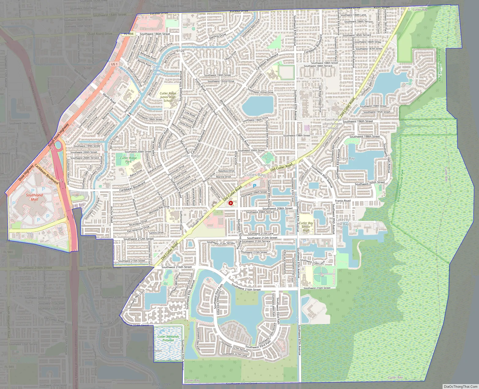
Cutler Bay Road Map
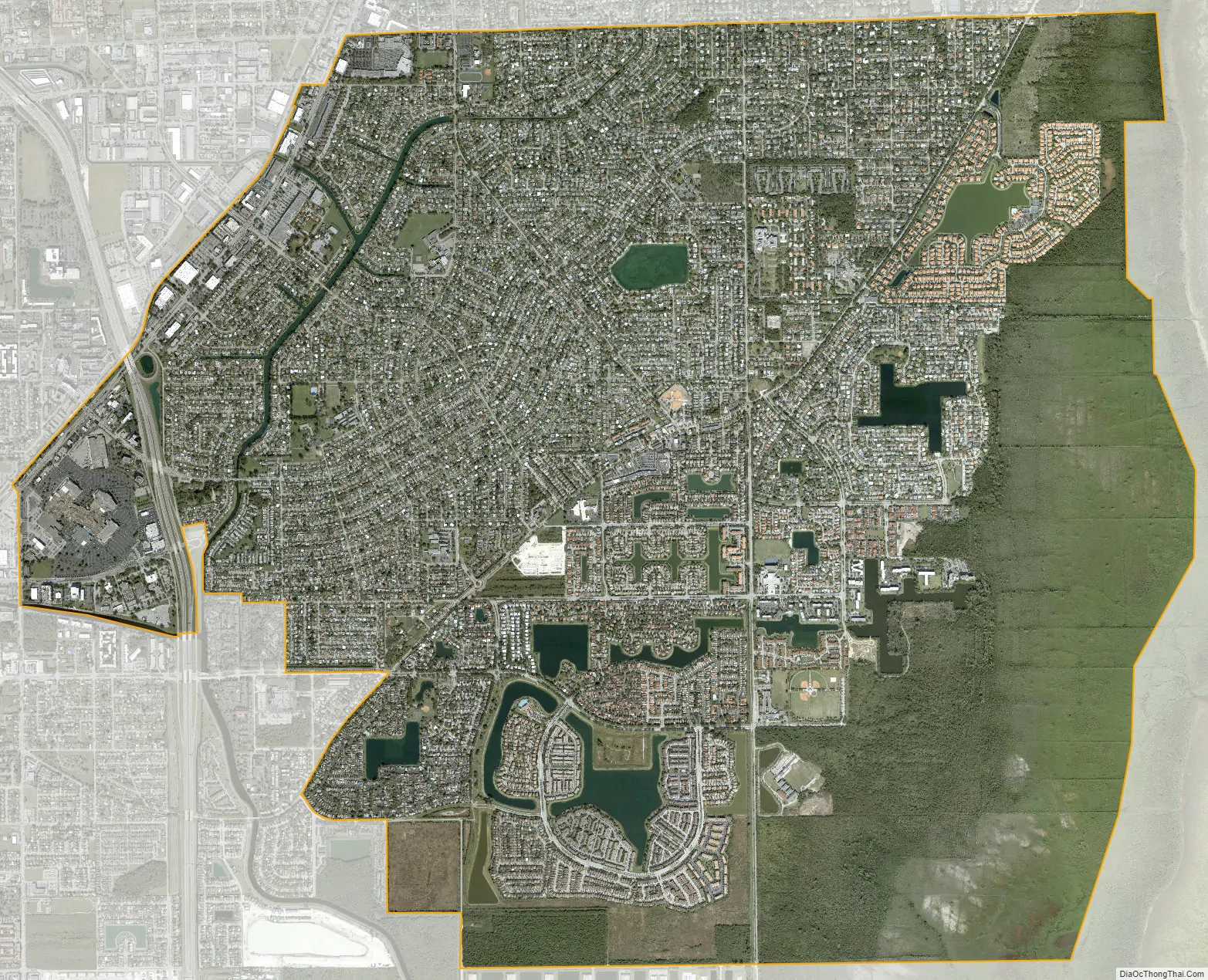
Cutler Bay city Satellite Map
Geography
Cutler Bay is located at 25°34′58″N 80°20′48″W / 25.582684°N 80.346799°W / 25.582684; -80.346799Coordinates: 25°34′58″N 80°20′48″W / 25.582684°N 80.346799°W / 25.582684; -80.346799, just west of Biscayne Bay and 18 miles (29 km) southwest of downtown Miami.
The town’s northern border runs from SW 184th Street (Eureka Drive) east of US 1 to the coast. The southern border is SW 232nd Street, north of Black Point Marina, the largest public marina in the Miami area. The town’s boundaries include the northeast section of Biscayne National Park, areas formerly known as Cutler Ridge to the west, and the neighborhood and former CDP of Lakes by the Bay to the east. The town is bordered to the north by the village of Palmetto Bay, to the west by unincorporated South Miami Heights, and to the southwest by unincorporated Goulds.
According to the United States Census Bureau, the town of Cutler Bay has a total area of 10.3 square miles (27 km). 9.9 square miles (26 km) of it are land and 0.4 square miles (1.0 km) of it (3.87%) are water.
Cutler Ridge, an ancient coral formation, stretches from south Miami, where it rises approximately 22 feet (6.7 m) above sea level, through the Cutler Bay area, at a height of 14 feet (4.3 m), to Homestead, Florida, where it is about 8 feet (2.4 m). Cutler Ridge has been incorporated into the hurricane emergency plans for the area as lands east of the ridge are subject to storm surge, but areas west of the ridge would generally be protected.
Due to Cutler Bay’s position in a flat, low-lying coastal wetland area on Biscayne Bay, the area is prone to flooding. During the rainy season, Cutler Bay’s many canals, channels, and lakes are frequently full of water, and the groundwater table also is full and close to the surface. Flood hazards include rainfall from tropical storms, hurricanes, and other heavy rain events.
See also
Map of Florida State and its subdivision:- Alachua
- Baker
- Bay
- Bradford
- Brevard
- Broward
- Calhoun
- Charlotte
- Citrus
- Clay
- Collier
- Columbia
- Desoto
- Dixie
- Duval
- Escambia
- Flagler
- Franklin
- Gadsden
- Gilchrist
- Glades
- Gulf
- Hamilton
- Hardee
- Hendry
- Hernando
- Highlands
- Hillsborough
- Holmes
- Indian River
- Jackson
- Jefferson
- Lafayette
- Lake
- Lee
- Leon
- Levy
- Liberty
- Madison
- Manatee
- Marion
- Martin
- Miami-Dade
- Monroe
- Nassau
- Okaloosa
- Okeechobee
- Orange
- Osceola
- Palm Beach
- Pasco
- Pinellas
- Polk
- Putnam
- Saint Johns
- Saint Lucie
- Santa Rosa
- Sarasota
- Seminole
- Sumter
- Suwannee
- Taylor
- Union
- Volusia
- Wakulla
- Walton
- Washington
- Alabama
- Alaska
- Arizona
- Arkansas
- California
- Colorado
- Connecticut
- Delaware
- District of Columbia
- Florida
- Georgia
- Hawaii
- Idaho
- Illinois
- Indiana
- Iowa
- Kansas
- Kentucky
- Louisiana
- Maine
- Maryland
- Massachusetts
- Michigan
- Minnesota
- Mississippi
- Missouri
- Montana
- Nebraska
- Nevada
- New Hampshire
- New Jersey
- New Mexico
- New York
- North Carolina
- North Dakota
- Ohio
- Oklahoma
- Oregon
- Pennsylvania
- Rhode Island
- South Carolina
- South Dakota
- Tennessee
- Texas
- Utah
- Vermont
- Virginia
- Washington
- West Virginia
- Wisconsin
- Wyoming


