DeBary is a city in Volusia County, Florida, United States, on the eastern shore of the St. Johns River near Lake Monroe. According to the 2020 U.S. Census, the city had a population of 20,696. It is part of the Deltona–Daytona Beach–Ormond Beach, FL metropolitan statistical area, which was home to 553,284 people in 2019.
| Name: | DeBary city |
|---|---|
| LSAD Code: | 25 |
| LSAD Description: | city (suffix) |
| State: | Florida |
| County: | Volusia County |
| Incorporated: | December 31, 1993 |
| Elevation: | 56 ft (17 m) |
| Land Area: | 18.95 sq mi (49.08 km²) |
| Water Area: | 2.84 sq mi (7.34 km²) |
| Population Density: | 1,174.61/sq mi (453.51/km²) |
| Area code: | 386 |
| FIPS code: | 1216675 |
| GNISfeature ID: | 0281364 |
| Website: | www.debary.org |
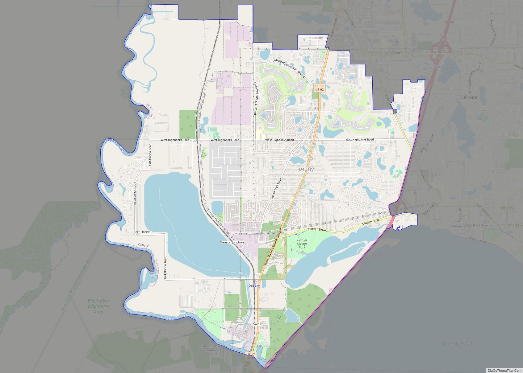
Online Interactive Map
Click on ![]() to view map in "full screen" mode.
to view map in "full screen" mode.
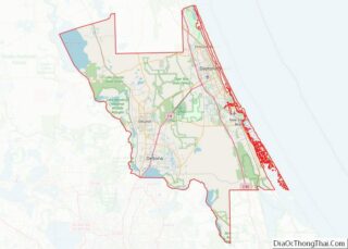
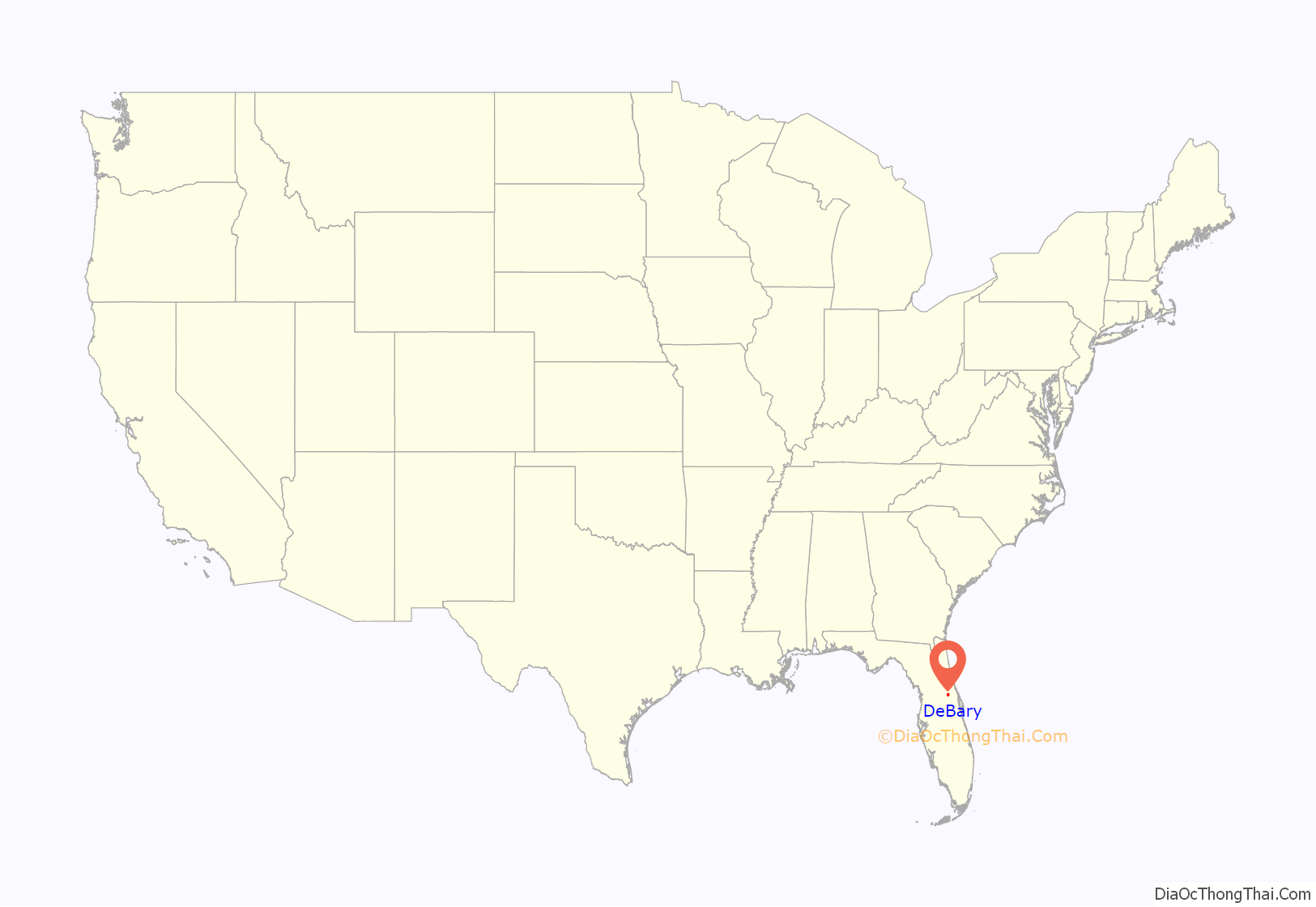
DeBary location map. Where is DeBary city?

History
The Timucuan Indians once lived in the vicinity of Lake Monroe, where the domain of Chief Utina extended to just north of Lake George. They hunted, fished, and gathered plants and berries from the forest. By 1760, however, the Timucua had disappeared and been replaced by the Seminole tribe from Alabama and Georgia. Florida was acquired from Spain in 1821, but the Seminole Wars delayed settlement. In 1866, Elijah Watson of Enterprise sold land to Oliver and Amanda Arnett on the northern shore of the St. Johns River at Lake Monroe, where they built a house.
The couple in turn sold 400 acres (1.6 km) in 1871 to (Samuel) Frederick deBary, a wealthy wine merchant from New York City, and that same year, he erected a hunting lodge. Called “DeBary Hall”, the 8,000-sq-ft (700-m), 20-room Italianate mansion featured a two-tiered veranda, stables, an ice house, and the state’s first swimming pool, fed by a spring. Visitors included Presidents Ulysses S. Grant and Grover Cleveland. Over time, he acquired an additional 9,000 acres (36 km), planting orange groves and pecan trees. Some debate remains as to whether this was actually the first pool in Florida, as a St. Augustine pool has also made the same claim. One possibility is that this was the first spring-fed pool in the state, In 1875, deBary bought a small steamboat, the George M. Bird, to transport his horses and dogs along the St. Johns River for hunting expeditions, and also to take fruit to market. He established the DeBary Merchants’ Line in 1876, a steamship service contracted to carry mail between Jacksonville and Enterprise. It acquired the sidewheeler Frederick DeBary. In 1883, the firm merged with the Baya Line, owned by Colonel H.T. Baya, to create the DeBary-Baya Merchants’ Line, with 13 steamboats and a crew of 3,000 running to Sanford. The DeBary-Baya Merchants’ Line sold its business in 1889 to the Clyde Line, which survived until 1928.
Frederick deBary died in 1898, and his mansion is today a restored museum, listed on the National Register of Historic Places in 1972. The estate, reduced to 10 acres (40,000 m), now features the community’s oldest building, the Arnett House. Incorporated in 1993, the City of DeBary is named for its noted settler.
DeBary Road Map
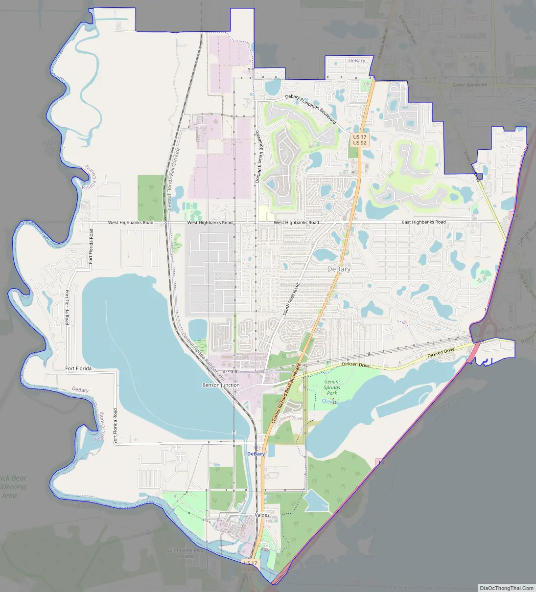
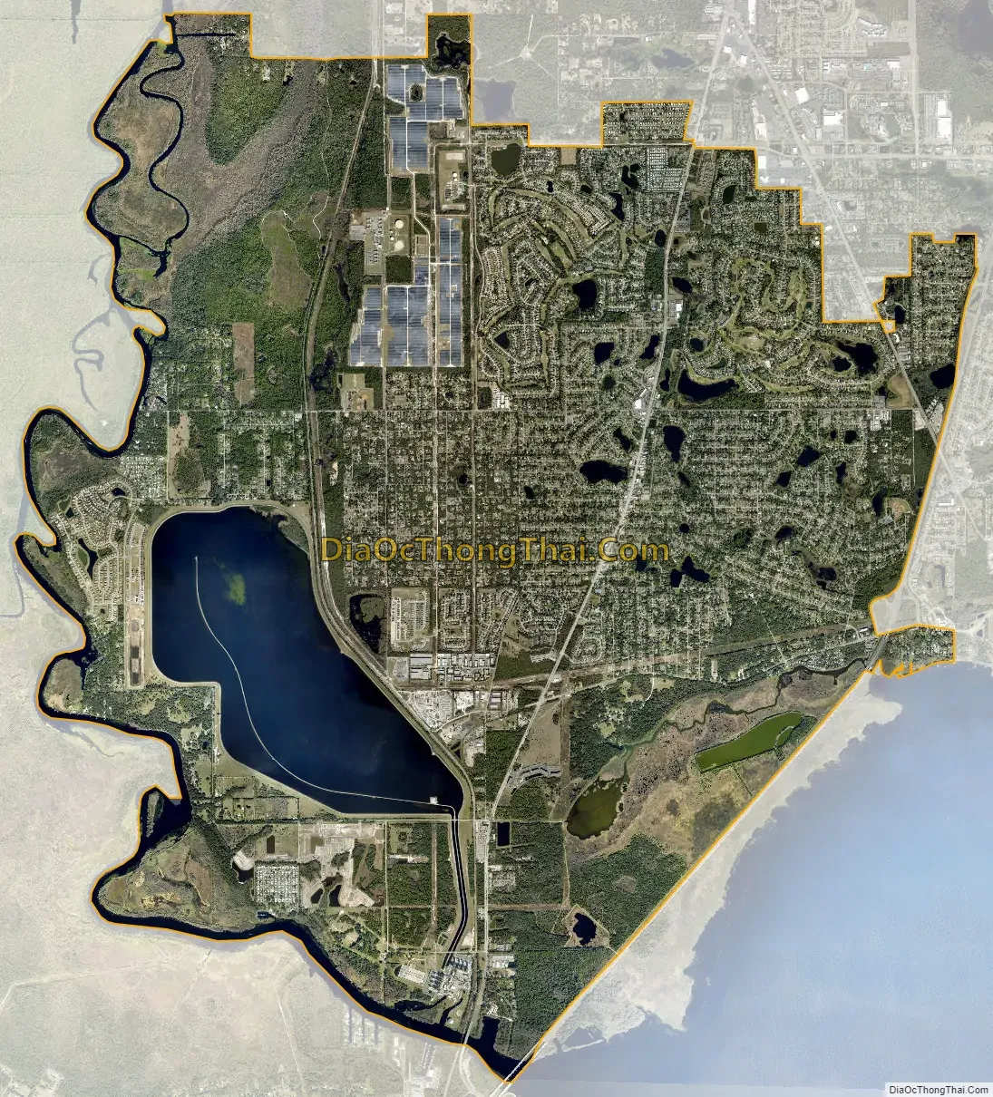
DeBary city Satellite Map
Geography
DeBary is located at 28°53′03″N 81°18′40″W / 28.884224°N 81.310995°W / 28.884224; -81.310995.
According to the United States Census Bureau, the city has a total area of 21.4 square miles (55 km), of which 18.2 square miles (47 km) are land and 3.2 square miles (8.3 km) (15.02%) are covered by water.
See also
Map of Florida State and its subdivision:- Alachua
- Baker
- Bay
- Bradford
- Brevard
- Broward
- Calhoun
- Charlotte
- Citrus
- Clay
- Collier
- Columbia
- Desoto
- Dixie
- Duval
- Escambia
- Flagler
- Franklin
- Gadsden
- Gilchrist
- Glades
- Gulf
- Hamilton
- Hardee
- Hendry
- Hernando
- Highlands
- Hillsborough
- Holmes
- Indian River
- Jackson
- Jefferson
- Lafayette
- Lake
- Lee
- Leon
- Levy
- Liberty
- Madison
- Manatee
- Marion
- Martin
- Miami-Dade
- Monroe
- Nassau
- Okaloosa
- Okeechobee
- Orange
- Osceola
- Palm Beach
- Pasco
- Pinellas
- Polk
- Putnam
- Saint Johns
- Saint Lucie
- Santa Rosa
- Sarasota
- Seminole
- Sumter
- Suwannee
- Taylor
- Union
- Volusia
- Wakulla
- Walton
- Washington
- Alabama
- Alaska
- Arizona
- Arkansas
- California
- Colorado
- Connecticut
- Delaware
- District of Columbia
- Florida
- Georgia
- Hawaii
- Idaho
- Illinois
- Indiana
- Iowa
- Kansas
- Kentucky
- Louisiana
- Maine
- Maryland
- Massachusetts
- Michigan
- Minnesota
- Mississippi
- Missouri
- Montana
- Nebraska
- Nevada
- New Hampshire
- New Jersey
- New Mexico
- New York
- North Carolina
- North Dakota
- Ohio
- Oklahoma
- Oregon
- Pennsylvania
- Rhode Island
- South Carolina
- South Dakota
- Tennessee
- Texas
- Utah
- Vermont
- Virginia
- Washington
- West Virginia
- Wisconsin
- Wyoming