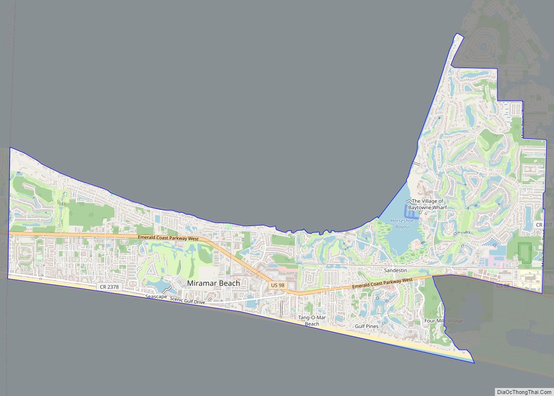
Miramar Beach is a census-designated place (CDP) in Walton County, Florida, United States. The population was 6,146 at the 2010 census. Although many other coastal localities in Florida have appended “Beach” to their names to distinguish themselves from an adjacent inland or cross-bay municipality – such as Miami Beach, St. Pete Beach, Fort Myers Beach, Panama City Beach, Melbourne Beach, Cocoa Beach, and Jacksonville Beach – the city of Miramar, Florida is actually over 450 miles (720 km) away in South Florida. Miramar Beach is due east of Destin, Florida. It is often considered to be part of the city of Destin. However, it has its own ZIP code (32550) and is in Walton County, whereas Destin is in Okaloosa County.
| Name: | Miramar Beach CDP |
|---|---|
| LSAD Code: | 57 |
| LSAD Description: | CDP (suffix) |
| State: | Florida |
| County: | Walton County |
| Elevation: | 20 ft (6 m) |
| Total Area: | 7.36 sq mi (19.07 km²) |
| Land Area: | 7.02 sq mi (18.19 km²) |
| Water Area: | 0.34 sq mi (0.88 km²) |
| Total Population: | 8,002 |
| Population Density: | 1,139.56/sq mi (439.97/km²) |
| ZIP code: | 32550 |
| Area code: | 850 |
| FIPS code: | 1246000 |
| GNISfeature ID: | 286975 |
Online Interactive Map
Click on ![]() to view map in "full screen" mode.
to view map in "full screen" mode.
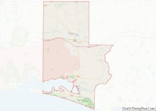
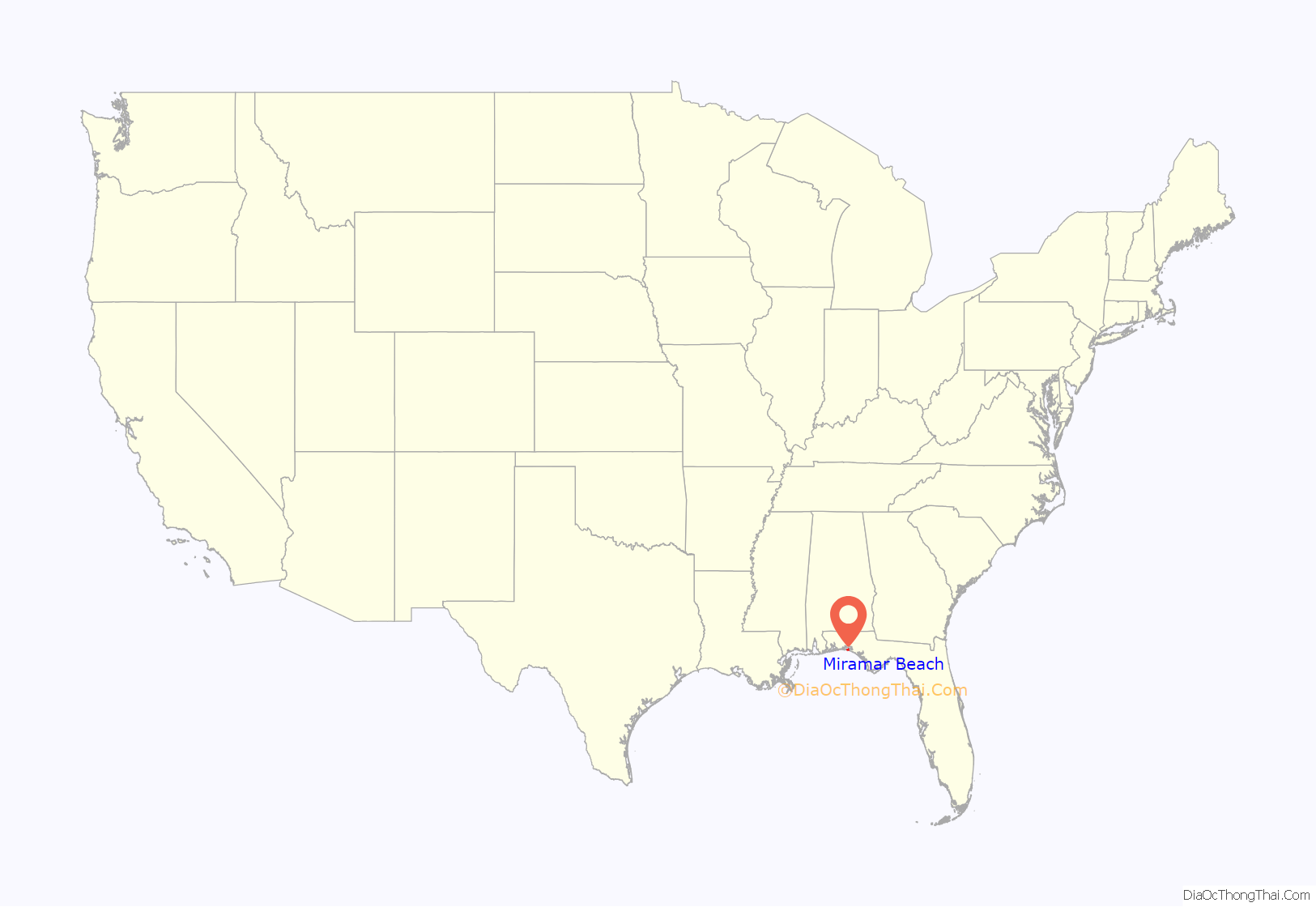
Miramar Beach location map. Where is Miramar Beach CDP?
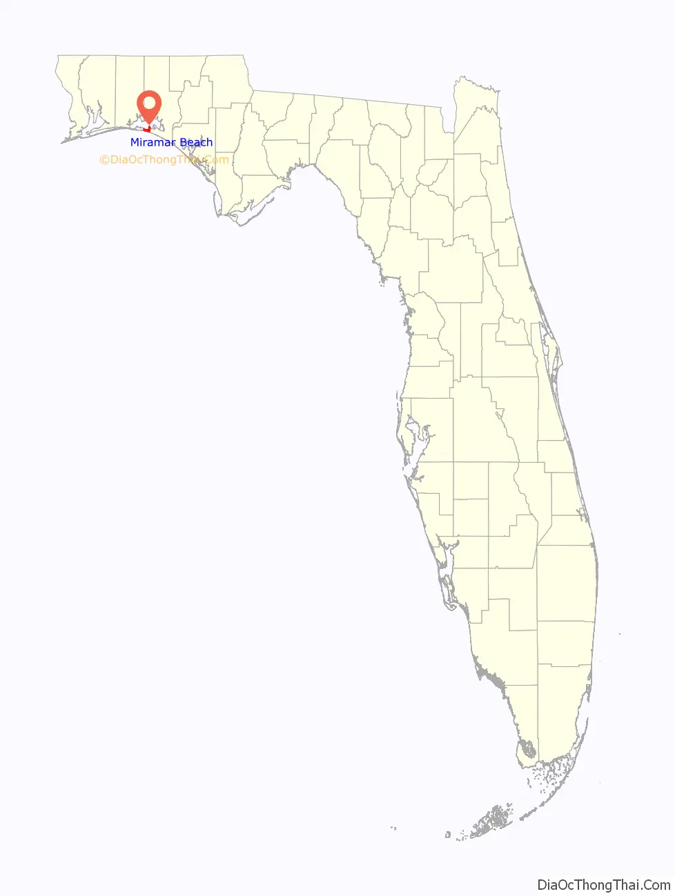
Miramar Beach Road Map
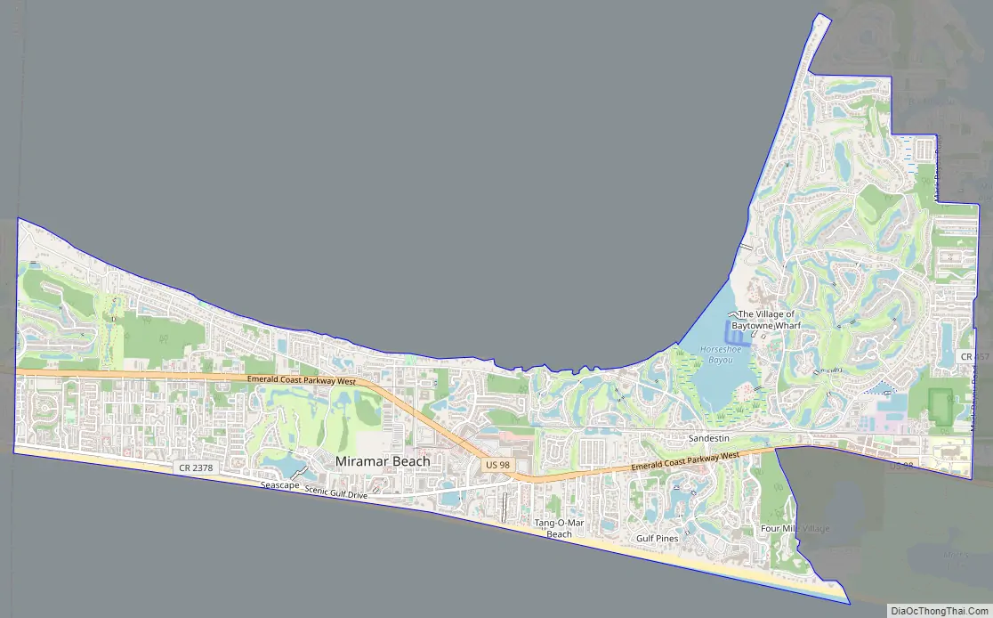
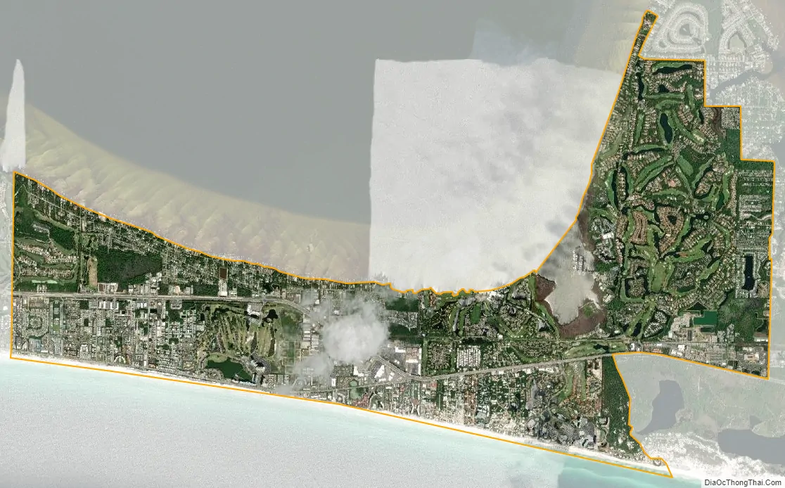
Miramar Beach city Satellite Map
Geography
Miramar Beach is located in the southwestern corner of Walton County at 30°22′58″N 86°21′21″W / 30.38278°N 86.35583°W / 30.38278; -86.35583 (30.382698, -86.355962).
The CDP is located along the Gulf Coast. U.S. Route 98 is the main route through the CDP, and leads east 47 mi (76 km) to Panama City and west 9 mi (14 km) to Destin.
According to the United States Census Bureau, the total area of 4.7 square miles (12 km), of which 4.6 square miles (12 km) is land and 0.1 square miles (0.26 km) (2.54%) is water.
See also
Map of Florida State and its subdivision:- Alachua
- Baker
- Bay
- Bradford
- Brevard
- Broward
- Calhoun
- Charlotte
- Citrus
- Clay
- Collier
- Columbia
- Desoto
- Dixie
- Duval
- Escambia
- Flagler
- Franklin
- Gadsden
- Gilchrist
- Glades
- Gulf
- Hamilton
- Hardee
- Hendry
- Hernando
- Highlands
- Hillsborough
- Holmes
- Indian River
- Jackson
- Jefferson
- Lafayette
- Lake
- Lee
- Leon
- Levy
- Liberty
- Madison
- Manatee
- Marion
- Martin
- Miami-Dade
- Monroe
- Nassau
- Okaloosa
- Okeechobee
- Orange
- Osceola
- Palm Beach
- Pasco
- Pinellas
- Polk
- Putnam
- Saint Johns
- Saint Lucie
- Santa Rosa
- Sarasota
- Seminole
- Sumter
- Suwannee
- Taylor
- Union
- Volusia
- Wakulla
- Walton
- Washington
- Alabama
- Alaska
- Arizona
- Arkansas
- California
- Colorado
- Connecticut
- Delaware
- District of Columbia
- Florida
- Georgia
- Hawaii
- Idaho
- Illinois
- Indiana
- Iowa
- Kansas
- Kentucky
- Louisiana
- Maine
- Maryland
- Massachusetts
- Michigan
- Minnesota
- Mississippi
- Missouri
- Montana
- Nebraska
- Nevada
- New Hampshire
- New Jersey
- New Mexico
- New York
- North Carolina
- North Dakota
- Ohio
- Oklahoma
- Oregon
- Pennsylvania
- Rhode Island
- South Carolina
- South Dakota
- Tennessee
- Texas
- Utah
- Vermont
- Virginia
- Washington
- West Virginia
- Wisconsin
- Wyoming