Key Biscayne is an island town in Miami-Dade County, Florida, United States. The population was 14,809 at the 2020 census, up from 12,344 in 2010.
| Name: | Key Biscayne village |
|---|---|
| LSAD Code: | 47 |
| LSAD Description: | village (suffix) |
| State: | Florida |
| County: | Miami-Dade County |
| Incorporated: | June 18, 1991 |
| Elevation: | 3 ft (1 m) |
| Total Area: | 1.71 sq mi (4.42 km²) |
| Land Area: | 1.25 sq mi (3.23 km²) |
| Water Area: | 0.46 sq mi (1.19 km²) 8.63% |
| Total Population: | 14,809 |
| Population Density: | 11,875.70/sq mi (4,584.30/km²) |
| ZIP code: | 33149 |
| Area code: | 305, 786 |
| FIPS code: | 1236300 |
| GNISfeature ID: | 0285075 |
| Website: | www.keybiscayne.fl.gov |
Online Interactive Map
Click on ![]() to view map in "full screen" mode.
to view map in "full screen" mode.
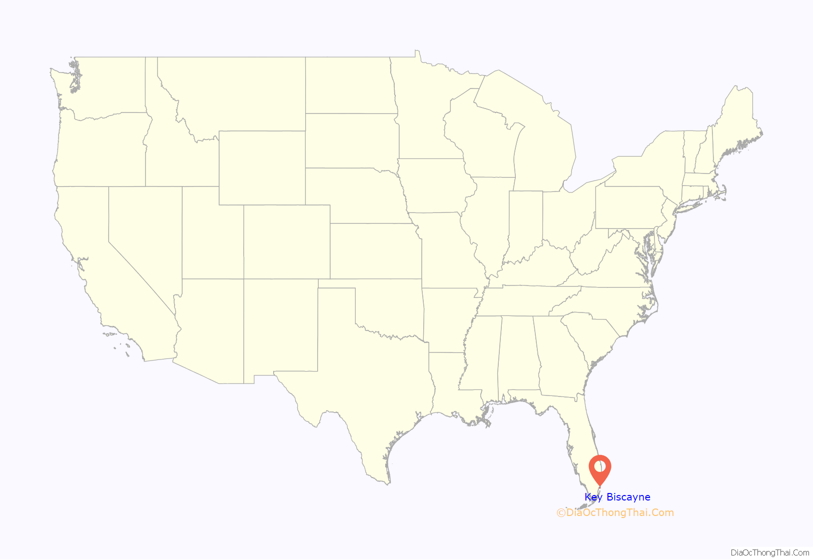
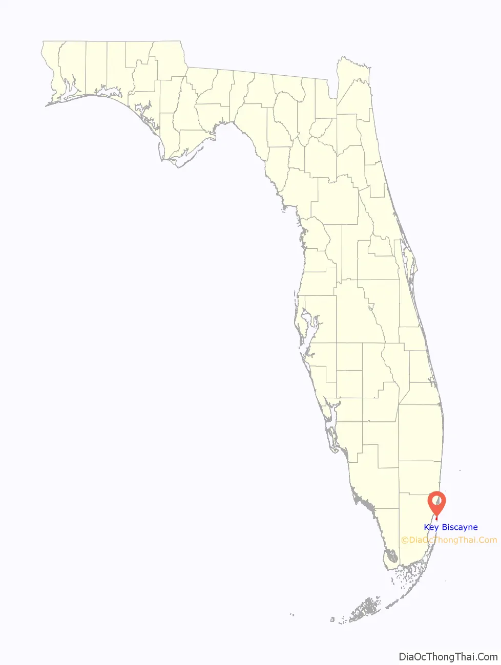
Key Biscayne location map. Where is Key Biscayne village?
History
While there had been earlier schemes to develop a town on Key Biscayne, it wasn’t until the opening of the 4-mile-long (6.4 km) Rickenbacker Causeway from Miami to Virginia Key and on to Key Biscayne in 1947 that the island was opened up to large-scale residential development. The northern two-thirds of the island had been operated as the largest coconut plantation in the continental United States during the first half of the 20th century. In 1940 the Matheson family donated over 800 acres (3.2 km) of their land to Dade County for a public park (Crandon Park) in exchange for a commitment that the county would build a causeway to the island. The remaining Matheson property, stretching across the middle of the island, was then sold off to developers. Starting in 1951, the Mackle Construction Company offered new homes on the island for US$9,540, with just US$500 down. A U.S. Post Office contract branch was opened, the Community Church started holding services in an old coconut-husking shed, and the Key Biscayne Elementary School opened in 1952.
The southern third of Key Biscayne, which included Cape Florida, was owned by James Deering and, after his death, by his brother Charles, for 35 years. In 1948 José Manuel Áleman, a Cuban politician in exile, bought the Cape Florida property from the Deering estate. After Áleman died in 1951, his widow, Elena Santeiro Garcia, added to her Cape Florida property by buying an ocean-to-bay strip that had been part of the Matheson property. This strip included a canal that had been dug by William Matheson in the 1920s, and which extended from the bay across most of the island. The land north of this canal was developed as part of what is now the Village of Key Biscayne. Garcia sold the Cape Florida property in 1966 to the state of Florida. This land became Bill Baggs Cape Florida State Park, which opened January 1, 1967.
U.S. President Richard Nixon purchased the first of his three waterfront homes, forming a compound known as the Florida White House, in 1969 to be close to his close friend and confidant Bebe Rebozo and industrialist Robert Abplanalp (inventor of the modern spray can valve). Bebe Rebozo, owner of the Key Biscayne Bank, was indicted for laundering a $100,000 donation from Howard Hughes to the Nixon election campaign. President Kennedy and Nixon met for the first time after the 1960 election loss by Nixon in an oceanfront villa at the old Key Biscayne Hotel. Plans for the Watergate break-in at Democratic headquarters were discussed at the Key Biscayne Nixon compound and, as the Watergate scandal unfolded, Nixon spent more time in seclusion there. Nixon visited Key Biscayne more than 50 times between 1969 and 1973. The U.S. Department of Defense spent $400,000 constructing a helicopter landing pad in Biscayne Bay adjacent to the Nixon compound, and when Nixon sold his property, including the helicopter pad, there were public accusations that he enriched himself at taxpayer expense.
The area was incorporated as a new municipality in 1991, which made it the first new city in Miami-Dade County in over fifty years. Rafael Conte was elected the first mayor along with members of the founding Village Council including Clifford Brody, Mortimer Fried, Michael Hill, Bautista Tedin, Lucas Keller, Luis Lauredo, Joe Rasco, and Raymond Sullivan. The municipality’s first manager was C. Samuel Kissinger and the first clerk was Guido Inguanzo. The incorporation of the village, which was overseen by Alfred Brewer, provided local control over taxes and future development.
In 1992, Hurricane Andrew flooded some homes and businesses on Key Biscayne, impacting insurance. The eye wall passed over uninhabited Bill Baggs Cape Florida State Park which received the brunt of the storm. The storm damage was a blessing for the park because it destroyed all the non-native vegetation that the state had been trying to eradicate. Federal and state funding allowed the replanting with native vegetation, making the park a showplace natural area. The town is in Evacuation Zone A. A 2017 study found that the town could be partly flooded at high tides by 2045 after sea-level rise. Property values fell. In November 2020, the town voted to approve a $100 million bond to protect itself.
In recent years, the construction of several large resort hotels, condominium complexes and shopping centers on the island has affected the once bucolic island life, as commercialism has continued to accelerate at a frenetic pace. The village has its own fire, police and public elementary and middle school. The millage tax rate remains one of the lowest of any municipality in Miami-Dade County. In 2004, the village completed the construction of a civic center including fire, police and administration buildings and a recreation and community center with indoor multi use courts, outdoor swimming pool and a renowned musical theater program.
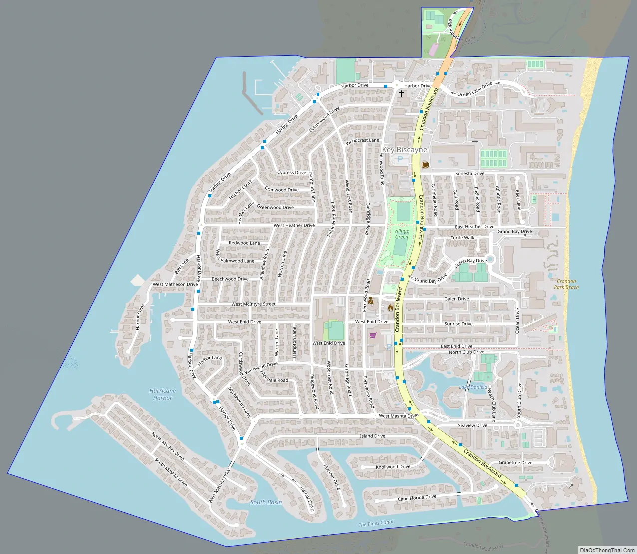
Key Biscayne Road Map
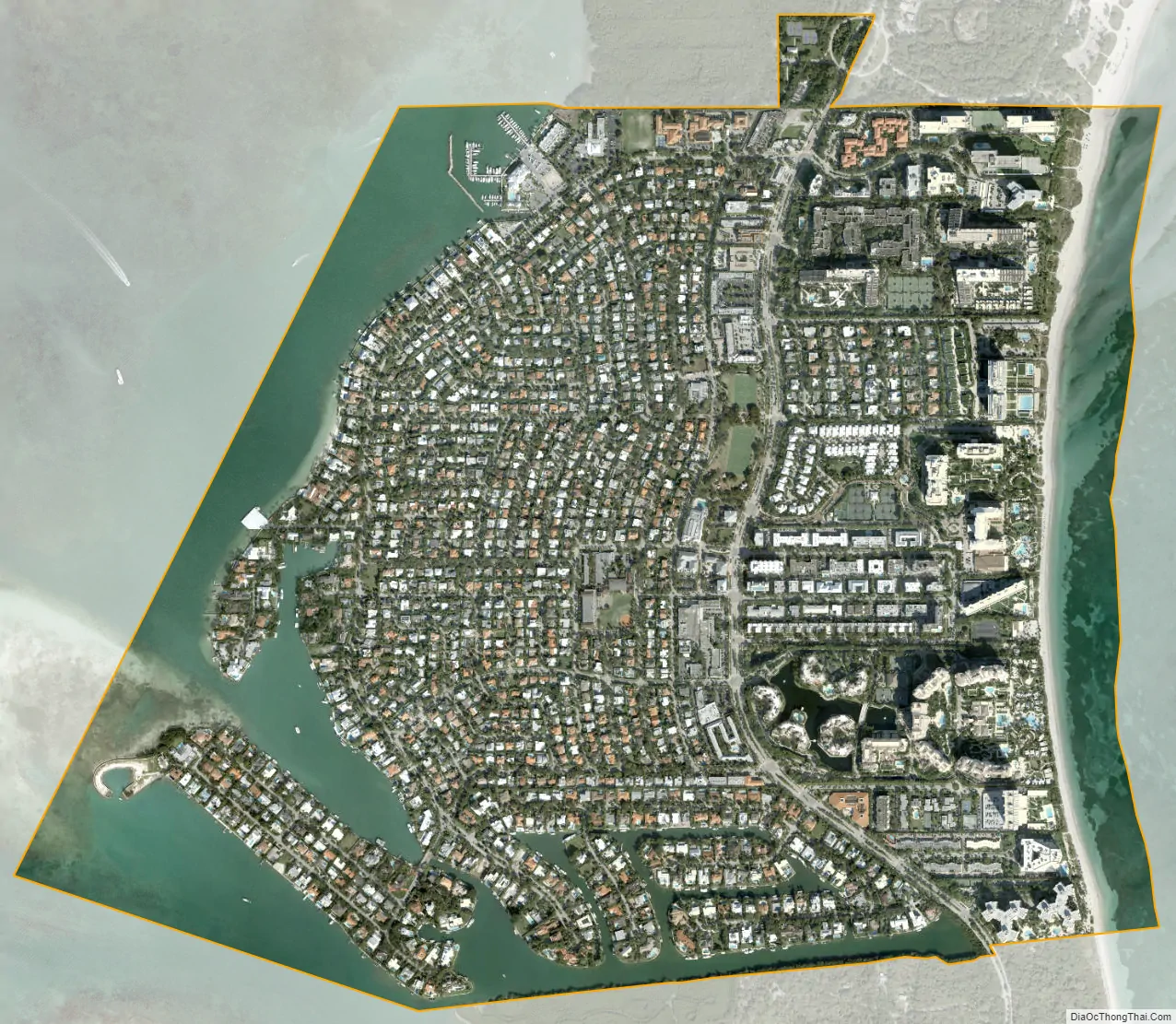
Key Biscayne city Satellite Map
Geography
Key Biscayne lies south of Miami Beach and east of Miami. The village is connected to Miami via the Rickenbacker Causeway, originally built in 1947. Because of its low elevation and direct exposure to the Atlantic Ocean, it is usually among the first Miami areas to be evacuated before an oncoming hurricane.
According to the U.S. Census Bureau, the town has a total area of 1.7 square miles (4.4 km). 1.2 square miles (3.1 km) of it are land and 0.5 square miles (1 km) of it (27.0%) are water. The village is bordered on the north by Crandon Park, a Miami-Dade County park; on the south by Bill Baggs Cape Florida State Park; on the east by the Atlantic Ocean; and on the west by Biscayne Bay.
See also
Map of Florida State and its subdivision:- Alachua
- Baker
- Bay
- Bradford
- Brevard
- Broward
- Calhoun
- Charlotte
- Citrus
- Clay
- Collier
- Columbia
- Desoto
- Dixie
- Duval
- Escambia
- Flagler
- Franklin
- Gadsden
- Gilchrist
- Glades
- Gulf
- Hamilton
- Hardee
- Hendry
- Hernando
- Highlands
- Hillsborough
- Holmes
- Indian River
- Jackson
- Jefferson
- Lafayette
- Lake
- Lee
- Leon
- Levy
- Liberty
- Madison
- Manatee
- Marion
- Martin
- Miami-Dade
- Monroe
- Nassau
- Okaloosa
- Okeechobee
- Orange
- Osceola
- Palm Beach
- Pasco
- Pinellas
- Polk
- Putnam
- Saint Johns
- Saint Lucie
- Santa Rosa
- Sarasota
- Seminole
- Sumter
- Suwannee
- Taylor
- Union
- Volusia
- Wakulla
- Walton
- Washington
- Alabama
- Alaska
- Arizona
- Arkansas
- California
- Colorado
- Connecticut
- Delaware
- District of Columbia
- Florida
- Georgia
- Hawaii
- Idaho
- Illinois
- Indiana
- Iowa
- Kansas
- Kentucky
- Louisiana
- Maine
- Maryland
- Massachusetts
- Michigan
- Minnesota
- Mississippi
- Missouri
- Montana
- Nebraska
- Nevada
- New Hampshire
- New Jersey
- New Mexico
- New York
- North Carolina
- North Dakota
- Ohio
- Oklahoma
- Oregon
- Pennsylvania
- Rhode Island
- South Carolina
- South Dakota
- Tennessee
- Texas
- Utah
- Vermont
- Virginia
- Washington
- West Virginia
- Wisconsin
- Wyoming


