Lisbon is an unincorporated community and census-designated place (CDP) in Lake County, Florida, United States. The population was 260 at the 2000 census. It is part of the Orlando–Kissimmee Metropolitan Statistical Area.
| Name: | Lisbon CDP |
|---|---|
| LSAD Code: | 57 |
| LSAD Description: | CDP (suffix) |
| State: | Florida |
| County: | Lake County |
| Elevation: | 72 ft (22 m) |
| Total Area: | 1.93 sq mi (5.01 km²) |
| Land Area: | 1.79 sq mi (4.64 km²) |
| Water Area: | 0.14 sq mi (0.37 km²) |
| Total Population: | 229 |
| Population Density: | 127.72/sq mi (49.32/km²) |
| ZIP code: | 34788 |
| Area code: | 352 |
| FIPS code: | 1240750 |
| GNISfeature ID: | 2403236 |
Online Interactive Map
Click on ![]() to view map in "full screen" mode.
to view map in "full screen" mode.
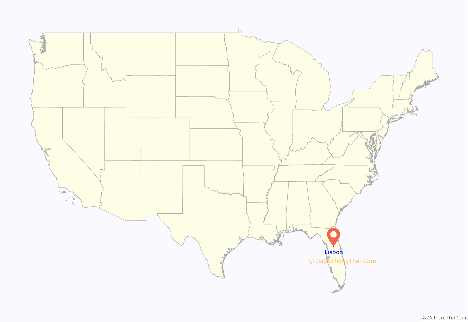
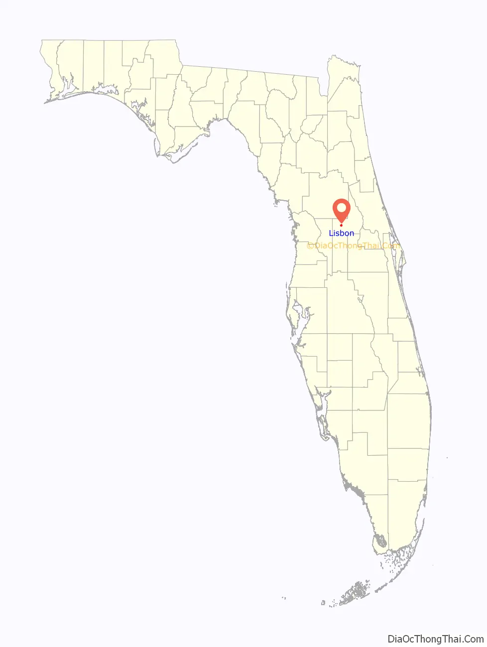
Lisbon location map. Where is Lisbon CDP?
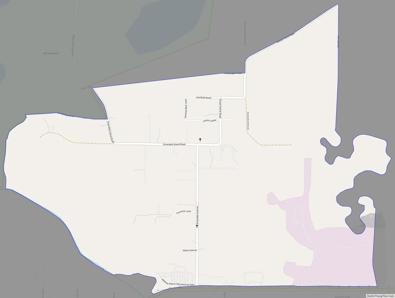
Lisbon Road Map
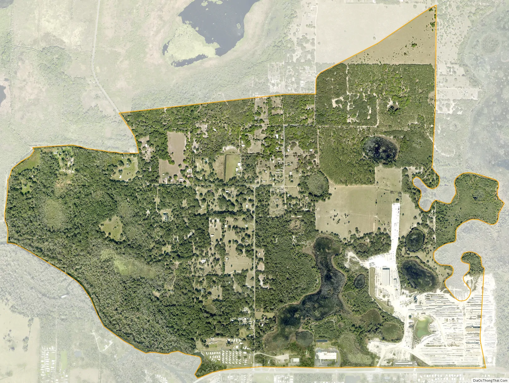
Lisbon city Satellite Map
Geography
Lisbon is located in central Lake County at 28°53′7″N 81°47′14″W / 28.88528°N 81.78722°W / 28.88528; -81.78722 (28.885413, -81.787225), in an area between Lake Yale to the northeast, Lake Eustis to the southeast, and Lake Griffin to the southwest. It is 8 miles (13 km) northwest of Tavares, the Lake county seat, 8 miles west of Eustis, and 8 miles northeast of Leesburg.
According to the United States Census Bureau, the CDP has a total area of 1.9 square miles (4.9 km), of which 1.7 square miles (4.5 km) are land and 0.2 square miles (0.4 km), or 7.63%, are water.
Lisbon has low rolling landscape with elevations ranging from 30ft to 60ft.
Climate
See also
Map of Florida State and its subdivision:- Alachua
- Baker
- Bay
- Bradford
- Brevard
- Broward
- Calhoun
- Charlotte
- Citrus
- Clay
- Collier
- Columbia
- Desoto
- Dixie
- Duval
- Escambia
- Flagler
- Franklin
- Gadsden
- Gilchrist
- Glades
- Gulf
- Hamilton
- Hardee
- Hendry
- Hernando
- Highlands
- Hillsborough
- Holmes
- Indian River
- Jackson
- Jefferson
- Lafayette
- Lake
- Lee
- Leon
- Levy
- Liberty
- Madison
- Manatee
- Marion
- Martin
- Miami-Dade
- Monroe
- Nassau
- Okaloosa
- Okeechobee
- Orange
- Osceola
- Palm Beach
- Pasco
- Pinellas
- Polk
- Putnam
- Saint Johns
- Saint Lucie
- Santa Rosa
- Sarasota
- Seminole
- Sumter
- Suwannee
- Taylor
- Union
- Volusia
- Wakulla
- Walton
- Washington
- Alabama
- Alaska
- Arizona
- Arkansas
- California
- Colorado
- Connecticut
- Delaware
- District of Columbia
- Florida
- Georgia
- Hawaii
- Idaho
- Illinois
- Indiana
- Iowa
- Kansas
- Kentucky
- Louisiana
- Maine
- Maryland
- Massachusetts
- Michigan
- Minnesota
- Mississippi
- Missouri
- Montana
- Nebraska
- Nevada
- New Hampshire
- New Jersey
- New Mexico
- New York
- North Carolina
- North Dakota
- Ohio
- Oklahoma
- Oregon
- Pennsylvania
- Rhode Island
- South Carolina
- South Dakota
- Tennessee
- Texas
- Utah
- Vermont
- Virginia
- Washington
- West Virginia
- Wisconsin
- Wyoming


