North Miami is a suburban city located in northeast Miami-Dade County, Florida, United States, about 10 miles (16 km) north of Miami. The city lies on Biscayne Bay and hosts the Biscayne Bay Campus of Florida International University, and the North Miami campus of Johnson & Wales University. Originally the town of “Arch Creek”, the area was incorporated as the “Town of Miami Shores”, which was renamed the “Town of North Miami” in 1931. It was reincorporated as a city in 1953.
The city is also home to the Oleta River State Park, which is the state’s largest urban park.
As of 2020, the population recorded by the U.S. Census Bureau is 60,191. North Miami is the seventh largest city in Miami-Dade County.
| Name: | North Miami city |
|---|---|
| LSAD Code: | 25 |
| LSAD Description: | city (suffix) |
| State: | Florida |
| County: | Miami-Dade County |
| Elevation: | 7 ft (3.96 m) |
| Total Area: | 10.05 sq mi (26.03 km²) |
| Land Area: | 8.46 sq mi (21.91 km²) |
| Water Area: | 1.59 sq mi (4.12 km²) 15.32% |
| Total Population: | 60,191 |
| Population Density: | 6,000/sq mi (2,300/km²) |
| FIPS code: | 1249450 |
| GNISfeature ID: | 0287837 |
| Website: | www.northmiamifl.gov |
Online Interactive Map
Click on ![]() to view map in "full screen" mode.
to view map in "full screen" mode.
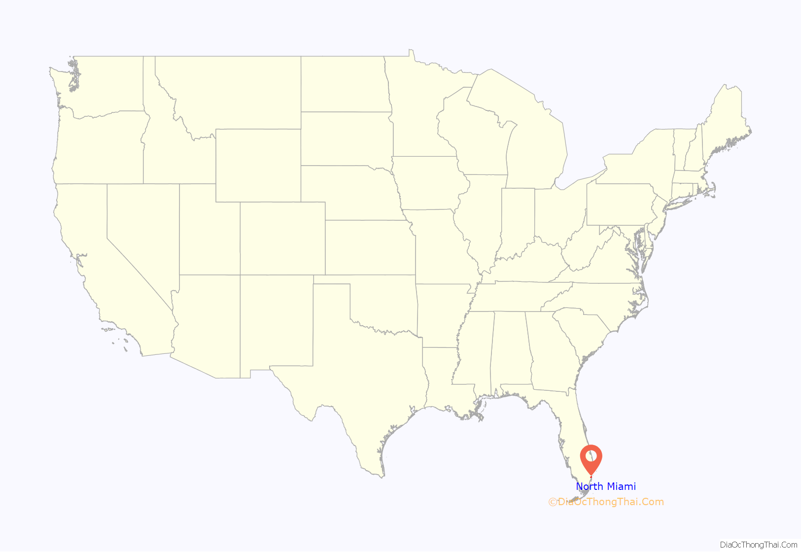
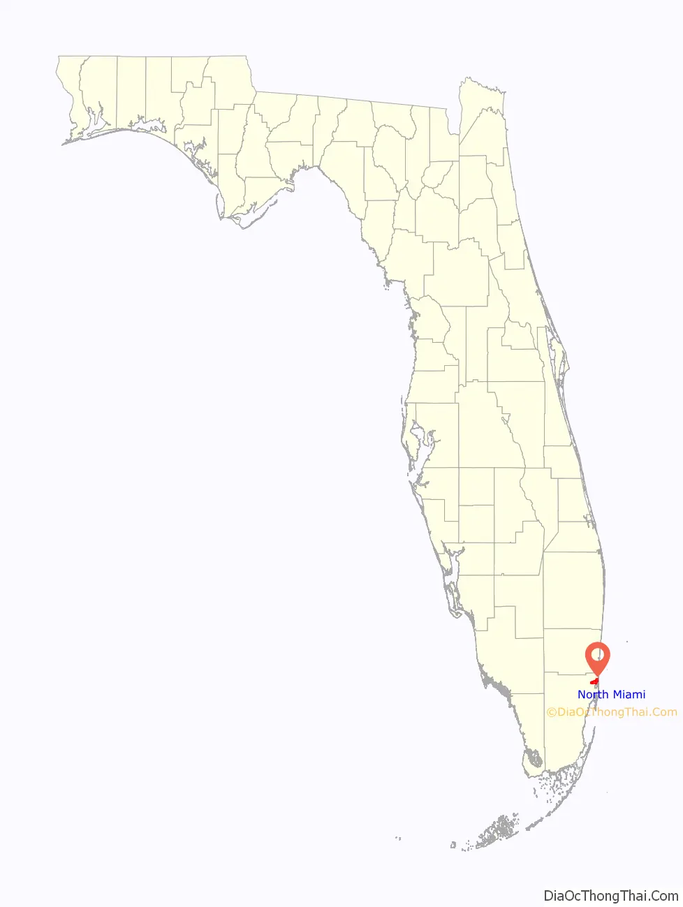
North Miami location map. Where is North Miami city?
History
Early history
In the final phase of Indian inhabitation of the area that eventually became “North Miami”, United States Army soldiers in 1856 cut a Military Trail through nearly impassable thickets and rivers connecting Fort Lauderdale to Fort Dallas at the mouth of the Miami River. This eight-foot trail, Dade County’s first roadway, crossed a unique natural bridge—a natural limestone bridge spanning 40 feet (12 m) across the creek that no longer stands in Arch Creek Memorial Park—in an area that would attract a settlement that early on would be known as “Arch Creek”. Even before 1890, a handful of adventuresome pioneers spent brief periods around the Arch Creek Natural Bridge, a centuries-old Indian settlement.
In 1891, Mr. Ilhe was the first to put down roots in the Arch Creek vicinity. He purchased 80 acres (320,000 m) from the State of Florida at one dollar an acre in the area of today’s N.E. 116th Street and Biscayne Boulevard. The place was so remote that his nearest northern neighbor was thought to live in Ft. Lauderdale. Mr. Ihle built a temporary palmetto frond shelter. During the next 27 years he grew shallots, coontie, squashes, bananas, sugar cane, Puerto Rican pineapples, lemons, guavas, limes, rose apples, Jamaican apples, and tomatoes.
By 1905 the area surrounding the nine-year-old Arch Creek Railroad Depot had become the community’s hub. It was located at 125th Street and the F.E.C. tracks. That year a post office and a school were opened nearby. By 1912, eighteen homes, a church, a general store, a blacksmith shop, and two tomato packing houses were located around the railroad. The population was estimated at less than one hundred. Farming was still the principal occupation.
The Florida land boom that was underway in the 1920s spread to the Arch Creek farming community. The Biscayne Canal was dug in 1924 to remove farmland from flooded conditions. But as a consequence, the soil began to lose its moisture, and the farming which had been the backbone of the economy was no longer profitable. However, in step with the times, this drained land became available for partitioning, lot sales, and development.
Birth of North Miami
Thirty-eight out of the forty-seven registered voters, at the encouragement of developers E.C. Harner, Earl Irons, and Arthur Griffing, showed up and voted to incorporate into a town on February 5, 1926. North Miami, between 1926 and 1931, was named “Town of Miami Shores”, partially because its early eastern boundary was the Atlantic Ocean. The Town limits were: bounded on the south by Miami and Miami Beach, on the east by the Atlantic Ocean, on the west by 17th Avenue, and on the north by a line which approximates Golden Glades Drive or 166th Street. Incorporation moved costs from developers to residents and lot purchasers. Late in 1926, a bond issue of $287,000 was passed to build streets, sidewalks, a town hall, a water system, and fire protection.
The devastating September 1926 hurricane burst the real estate land speculation. The local community recovered from the damage, but lot sales came to a stop, and the northern tourist’s names showed up in great numbers on the delinquent tax list. Some money from the bond issue was used to build a Spanish-Mediterranean style city hall building at N.E. 8th Avenue and 125th Street in 1928. The City Hall also housed the police and fire departments. In the 1930s a new water plant and gravity tank were installed behind City Hall. The first newspaper, The Miami Shores Bulletin, was published in 1927–1928 and chronicled the events of the times. The historic William Jennings Bryan school was constructed in 1928 on the same spot where the Arch Creek Elementary School had burned down the year before.
The 1930s
Seven miles (11 km) of Atlantic oceanfront beachland property from the Broward County line southward to Surfside were removed from the town limits as a result of a 1931 Florida Supreme Court decision. The 1926 hurricane ended plans for a causeway to deliver municipal services to that area of town. With no services being received, the beach area instituted a lengthy court lawsuit to separate and form their own community.
The wealthy Shoreland Company, located to the south of the Town, lobbied the 1931 Florida Legislature to officially grant their huge development the name “Village of Miami Shores“. The Legislature did so. It also passed an official act abolishing “Town of Miami Shores” as a name. The next step was for the local population to choose a new name. The municipality was renamed The Town of North Miami.
During the Depression years, in 1933, Mrs. Cecille Sevier and Mrs. Ella S. Klefeker became the first two women elected to the Town Council. The 1940s census stated that 1,973 inhabitants lived in the “Town of North Miami”.
Post World War II growth
At the end of World War II in 1945, the large and constant influx of former military veterans and their young families changed the face of North Miami by ushering in a great growth period. Homebuilding, road building, shops, stores, and office business construction now continued for decades almost without stopping. By 1951 it was reported nationally that North Miami was one of the fastest-growing towns in the United States. During this time, the growing community needed a high school, so in 1951 construction started for North Miami High School. In August 1954, North Miami High School opened its doors for the children of the growing community.
Partially to meet this challenge of fast growth, the voters of North Miami in 1952 voted to adopt a new charter and a new name. The new charter, enacted as an official statute of the Florida Legislature on May 27, 1953, provided for the establishment of a full-time administrative head (City Manager form of government) to carry out the policies of the elected Mayor/Council. The new and present name officially introduced on this date—the City of North Miami.
North Miami is known for its large Haitian-American population. In 2001, voters made Republican Josaphat Celestin the first Haitian American mayor of a large Miami-Dade County community. In 2009, voters made Democrat and Haitian immigrant Andre Pierre mayor of North Miami. In 2013, voters made Haitian American Lucie Tondreau the city’s first female Haitian-American Mayor; she soon left office following about being criminally charged. In 2014, voters made Haitian immigrant Dr. Smith Joseph mayor of North Miami. In 2019, voters made Philippe Bien-Aime, who was born in Haiti and migrated to the US in 1993, mayor of North Miami.
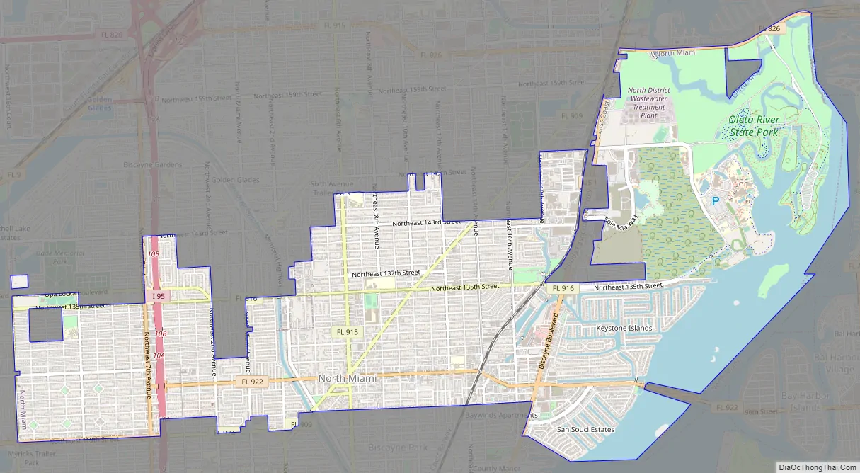
North Miami Road Map
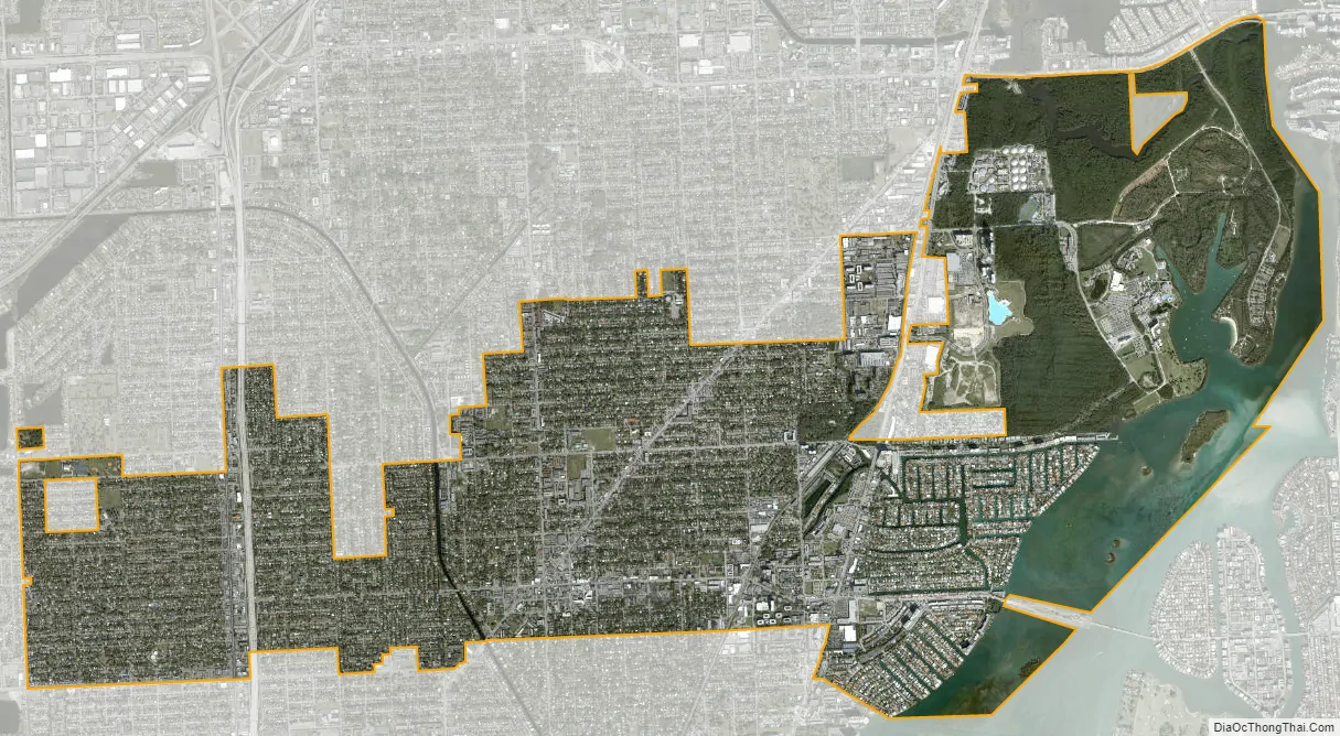
North Miami city Satellite Map
Geography
North Miami is located at 25°53′42″N 80°11′09″W / 25.895022°N 80.185747°W / 25.895022; -80.185747.
According to the United States Census Bureau, the city has a total area of 10.0 square miles (26 km). 8.5 square miles (22 km) of it is land and 1.5 square miles (3.9 km) of it (15.32%) is water.
Climate
North Miami has a tropical monsoon climate (Köppen climate classification Am). Summers are very hot and long lasting with very warm nights with very plentiful and heavy rainfall. Winters are short, warm, and dry.
Surrounding areas
- Golden Glades, North Miami Beach
- Opa-locka Sunny Isles Beach
- Westview Sunny Isles Beach, Biscayne Bay, Bay Harbor Islands
- Westview Biscayne Bay
- Pinewood, Unincorporated Miami-Dade County, Biscayne Park
See also
Map of Florida State and its subdivision:- Alachua
- Baker
- Bay
- Bradford
- Brevard
- Broward
- Calhoun
- Charlotte
- Citrus
- Clay
- Collier
- Columbia
- Desoto
- Dixie
- Duval
- Escambia
- Flagler
- Franklin
- Gadsden
- Gilchrist
- Glades
- Gulf
- Hamilton
- Hardee
- Hendry
- Hernando
- Highlands
- Hillsborough
- Holmes
- Indian River
- Jackson
- Jefferson
- Lafayette
- Lake
- Lee
- Leon
- Levy
- Liberty
- Madison
- Manatee
- Marion
- Martin
- Miami-Dade
- Monroe
- Nassau
- Okaloosa
- Okeechobee
- Orange
- Osceola
- Palm Beach
- Pasco
- Pinellas
- Polk
- Putnam
- Saint Johns
- Saint Lucie
- Santa Rosa
- Sarasota
- Seminole
- Sumter
- Suwannee
- Taylor
- Union
- Volusia
- Wakulla
- Walton
- Washington
- Alabama
- Alaska
- Arizona
- Arkansas
- California
- Colorado
- Connecticut
- Delaware
- District of Columbia
- Florida
- Georgia
- Hawaii
- Idaho
- Illinois
- Indiana
- Iowa
- Kansas
- Kentucky
- Louisiana
- Maine
- Maryland
- Massachusetts
- Michigan
- Minnesota
- Mississippi
- Missouri
- Montana
- Nebraska
- Nevada
- New Hampshire
- New Jersey
- New Mexico
- New York
- North Carolina
- North Dakota
- Ohio
- Oklahoma
- Oregon
- Pennsylvania
- Rhode Island
- South Carolina
- South Dakota
- Tennessee
- Texas
- Utah
- Vermont
- Virginia
- Washington
- West Virginia
- Wisconsin
- Wyoming


