Chadwick is a village in Carroll County, Illinois, United States. The population was 481 at the 2020 census, down from 551 at the 2010 census.
| Name: | Chadwick village |
|---|---|
| LSAD Code: | 47 |
| LSAD Description: | village (suffix) |
| State: | Illinois |
| County: | Carroll County |
| Incorporated: | Approximately 1853. (Incorporation approved Sept. 26, 1882.) |
| Elevation: | 801 ft (244 m) |
| Total Area: | 0.31 sq mi (0.81 km²) |
| Land Area: | 0.31 sq mi (0.81 km²) |
| Water Area: | 0.00 sq mi (0.00 km²) |
| Total Population: | 481 |
| Population Density: | 1,546.62/sq mi (596.35/km²) |
| Area code: | 815 |
| FIPS code: | 1712294 |
| Website: | www.chadwickil.com |
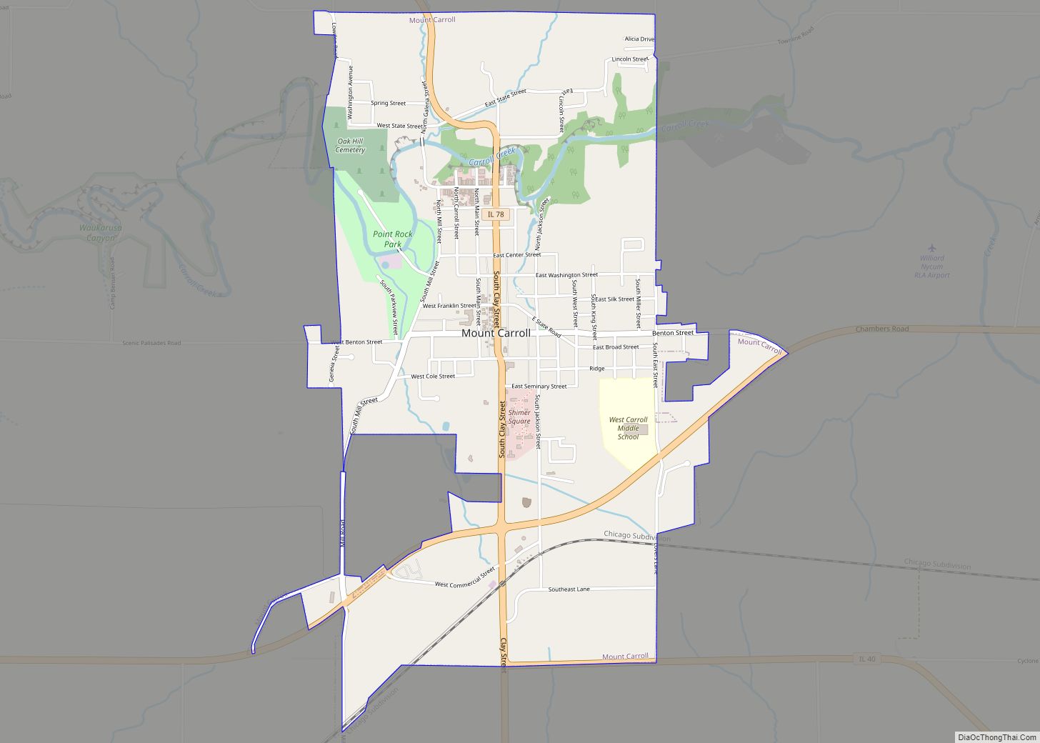
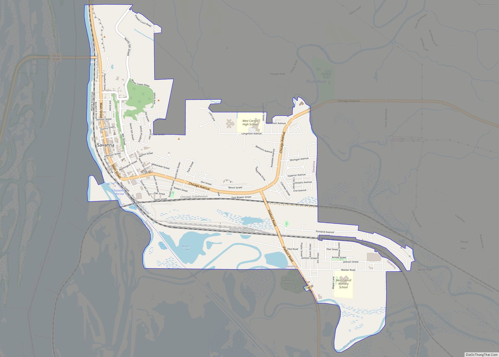
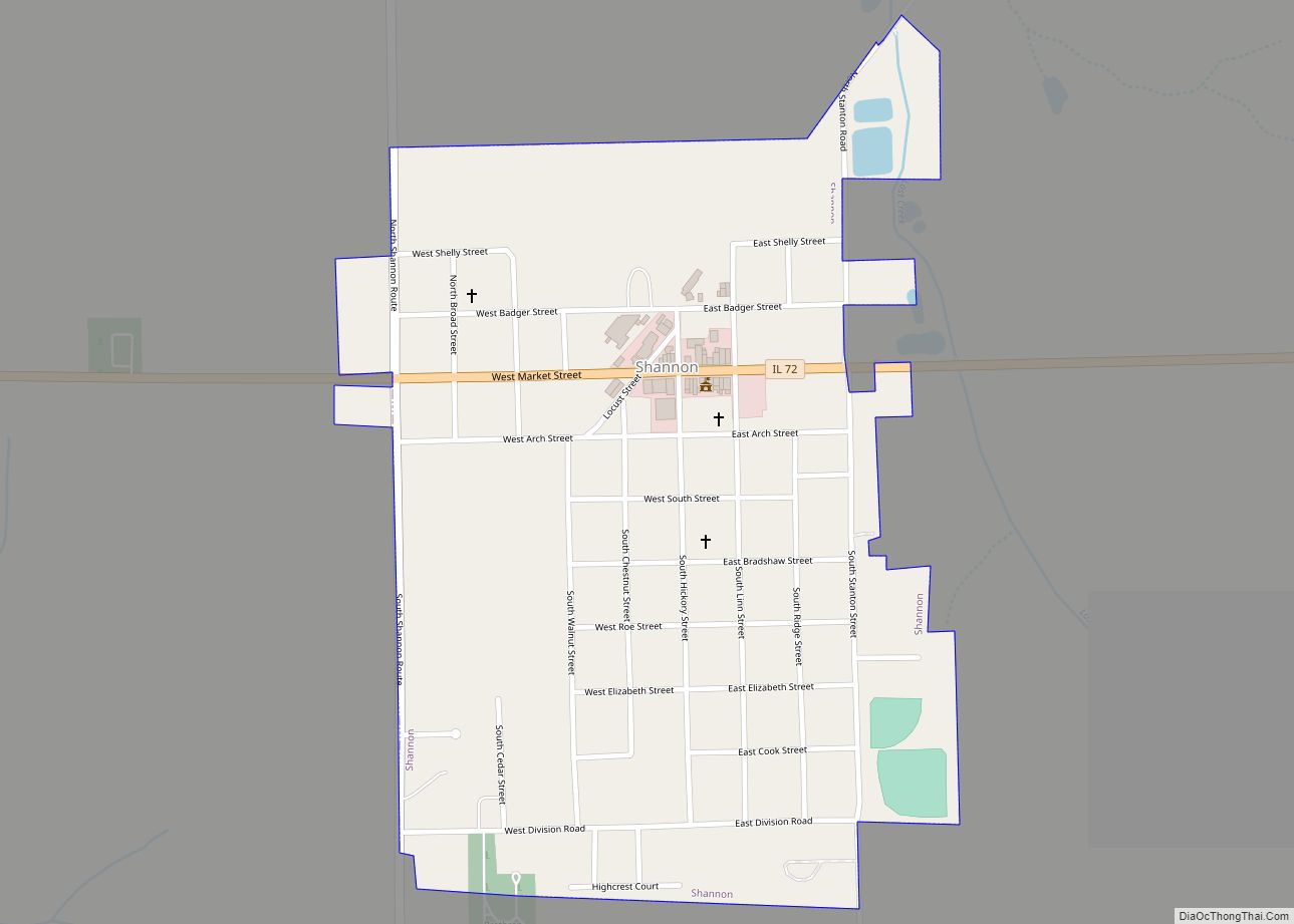
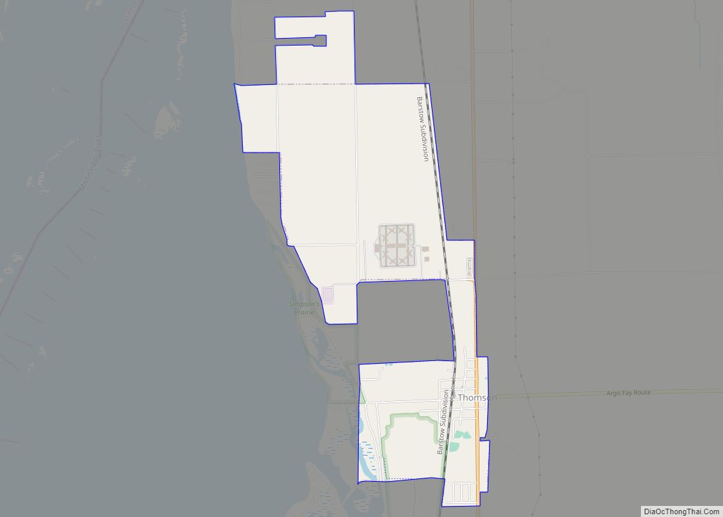
Online Interactive Map
Click on ![]() to view map in "full screen" mode.
to view map in "full screen" mode.
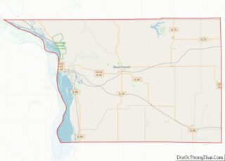
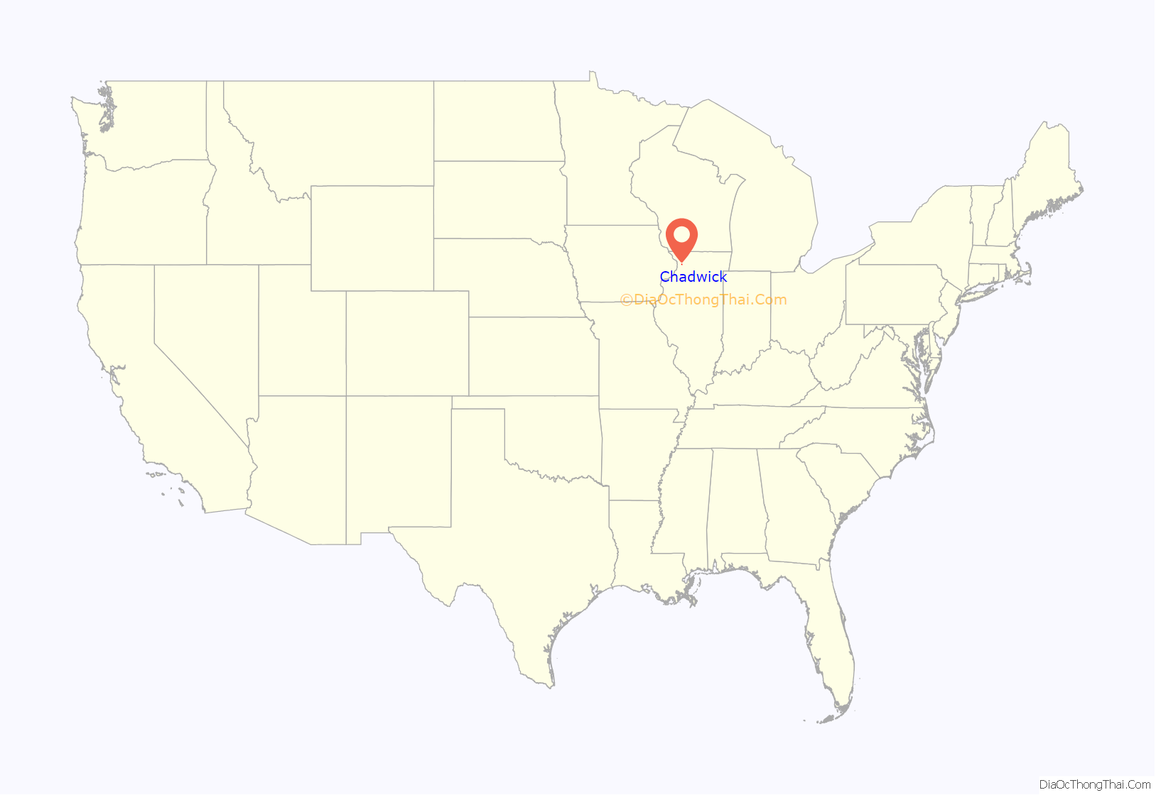
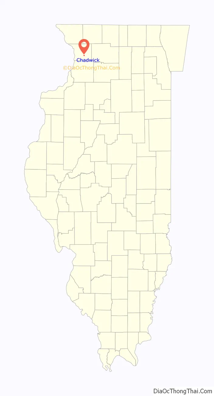
Chadwick location map. Where is Chadwick village?
History
Chadwick is the youngest community in Carroll County and had its beginnings circa 1853 when Jacob Isenhart built the first house on the prairie.
In 1866, when the Chicago, Burlington and Quincy Railroad extended its line from Aurora to Savanna, no provision was made for town sites, so the St. Paul Land Company was organized to acquire land along the right-of-way. The company decided that 60 acres (240,000 m) which comprised the original town site and belonged to Alexander Snow of Lanark would be an ideal location. The Land Company offered the Snows $100 per acre but Lanark merchants had persuaded the Snows that their land was worth $125; neither party would yield. When the land company started looking elsewhere the farmers in the community raised $1,500, to make up the difference. The land company named the new town Chadwick in honor of one of its officials. The original plot of the town was filed for record on April 12, 1886.
Decreasing population caused a call to incorporate the town. Incorporation papers for Chadwick were approved on Sept. 26, 1882. Following incorporation a village board was elected and a police magistrate and marshal appointed.
The first railroad station was a manure spreader on the south side of the track equipped with the necessary wiring and telegraph instruments for receiving and sending messages on the movement of trains. A new station was built in 1887. Frank Lacy was the first agent but was a telegraph operator only. There were no tickets for sale and passengers paid their fares on the train. The station was enlarged in 1926.
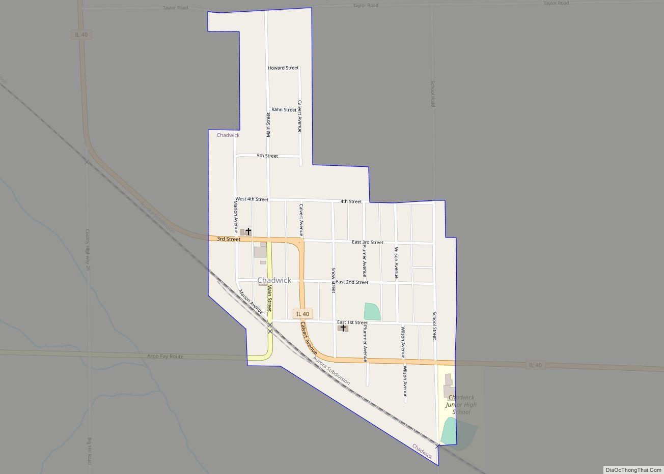
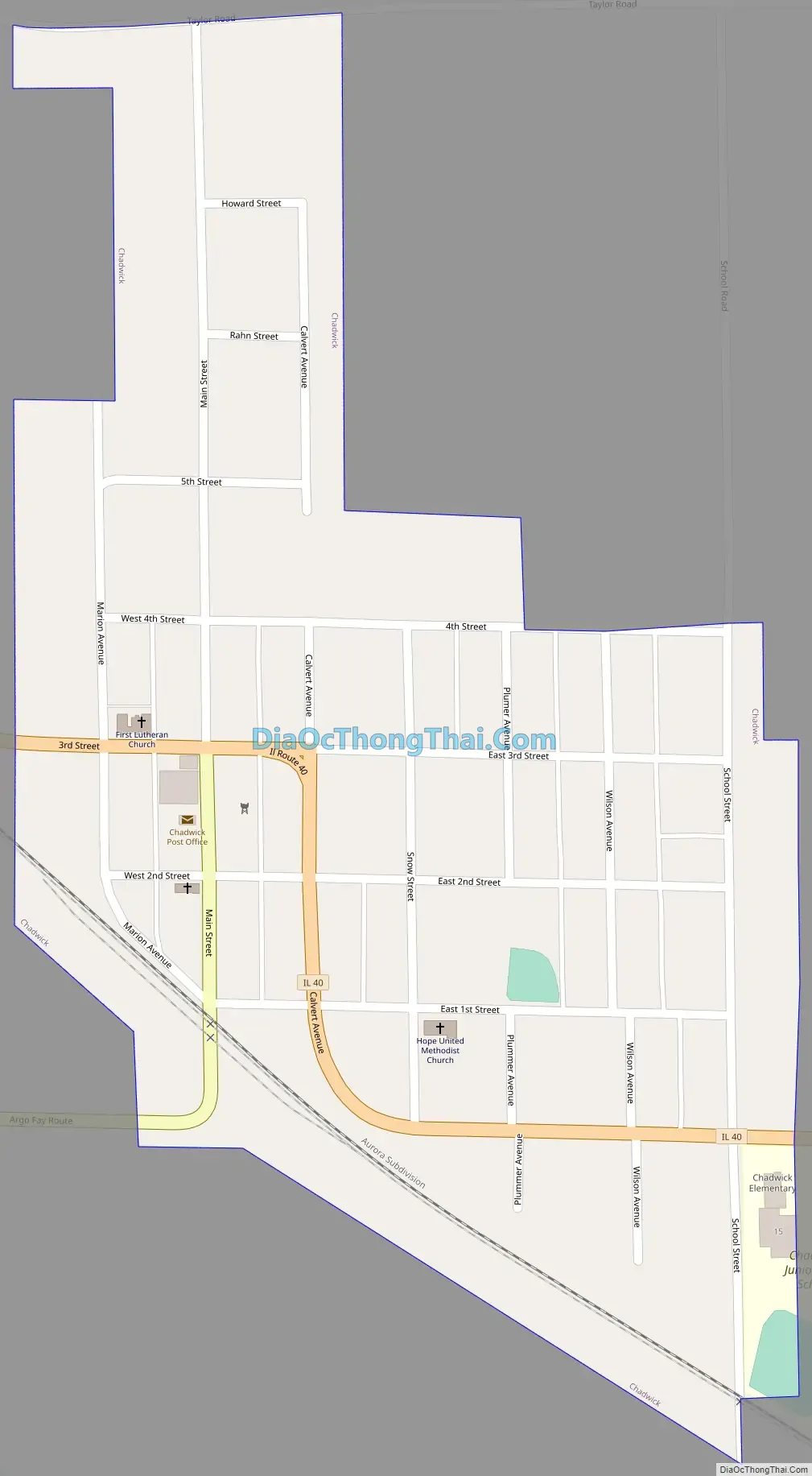
Chadwick Road Map
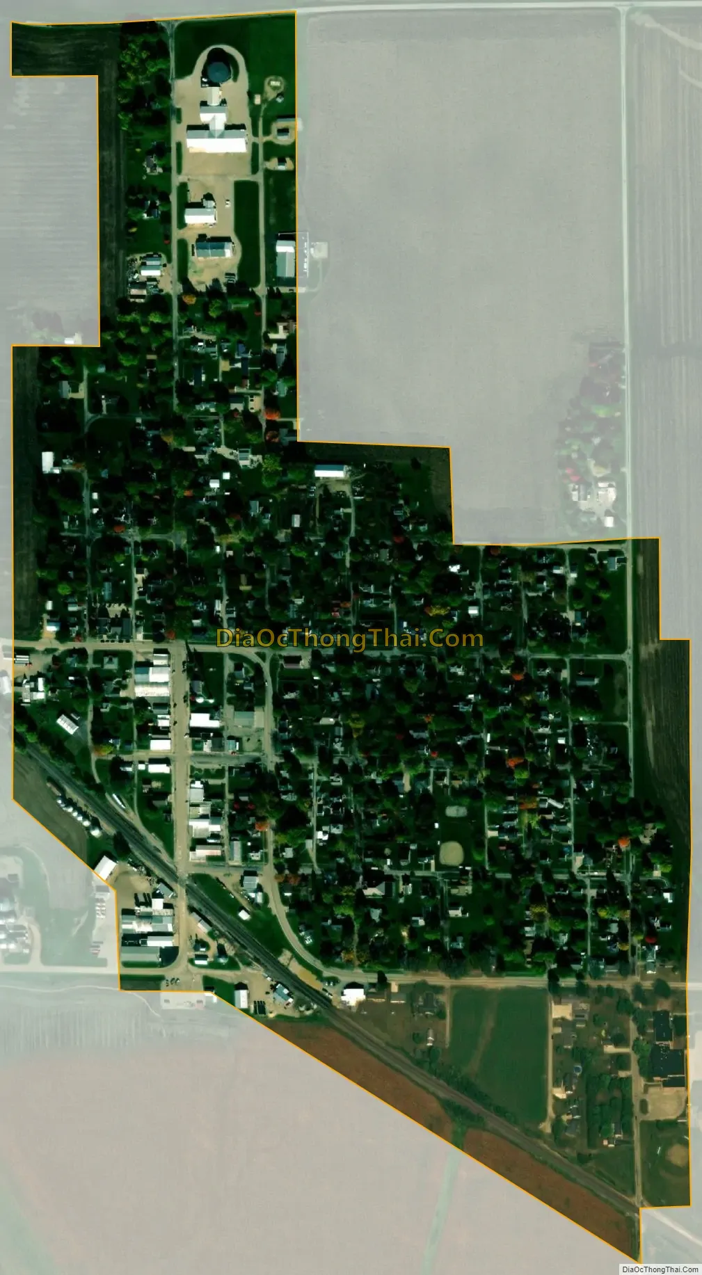
Chadwick city Satellite Map
Geography
Chadwick is located at 42°0′51″N 89°53′21″W / 42.01417°N 89.88917°W / 42.01417; -89.88917 (42.014081, -89.889078).
According to the 2021 census gazetteer files, Chadwick has a total area of 0.31 square miles (0.80 km), all land.
See also
Map of Illinois State and its subdivision:- Adams
- Alexander
- Bond
- Boone
- Brown
- Bureau
- Calhoun
- Carroll
- Cass
- Champaign
- Christian
- Clark
- Clay
- Clinton
- Coles
- Cook
- Crawford
- Cumberland
- De Kalb
- De Witt
- Douglas
- Dupage
- Edgar
- Edwards
- Effingham
- Fayette
- Ford
- Franklin
- Fulton
- Gallatin
- Greene
- Grundy
- Hamilton
- Hancock
- Hardin
- Henderson
- Henry
- Iroquois
- Jackson
- Jasper
- Jefferson
- Jersey
- Jo Daviess
- Johnson
- Kane
- Kankakee
- Kendall
- Knox
- La Salle
- Lake
- Lake Michigan
- Lawrence
- Lee
- Livingston
- Logan
- Macon
- Macoupin
- Madison
- Marion
- Marshall
- Mason
- Massac
- McDonough
- McHenry
- McLean
- Menard
- Mercer
- Monroe
- Montgomery
- Morgan
- Moultrie
- Ogle
- Peoria
- Perry
- Piatt
- Pike
- Pope
- Pulaski
- Putnam
- Randolph
- Richland
- Rock Island
- Saint Clair
- Saline
- Sangamon
- Schuyler
- Scott
- Shelby
- Stark
- Stephenson
- Tazewell
- Union
- Vermilion
- Wabash
- Warren
- Washington
- Wayne
- White
- Whiteside
- Will
- Williamson
- Winnebago
- Woodford
- Alabama
- Alaska
- Arizona
- Arkansas
- California
- Colorado
- Connecticut
- Delaware
- District of Columbia
- Florida
- Georgia
- Hawaii
- Idaho
- Illinois
- Indiana
- Iowa
- Kansas
- Kentucky
- Louisiana
- Maine
- Maryland
- Massachusetts
- Michigan
- Minnesota
- Mississippi
- Missouri
- Montana
- Nebraska
- Nevada
- New Hampshire
- New Jersey
- New Mexico
- New York
- North Carolina
- North Dakota
- Ohio
- Oklahoma
- Oregon
- Pennsylvania
- Rhode Island
- South Carolina
- South Dakota
- Tennessee
- Texas
- Utah
- Vermont
- Virginia
- Washington
- West Virginia
- Wisconsin
- Wyoming