Pana /ˈpeɪnə/ is a small town in Christian County, Illinois, United States. A small portion is in Shelby County. The population was 5,199 at the 2020 census.
| Name: | Pana city |
|---|---|
| LSAD Code: | 25 |
| LSAD Description: | city (suffix) |
| State: | Illinois |
| County: | Christian County, Shelby County |
| Elevation: | 679 ft (207 m) |
| Total Area: | 4.16 sq mi (10.78 km²) |
| Land Area: | 3.86 sq mi (9.99 km²) |
| Water Area: | 0.31 sq mi (0.80 km²) |
| Total Population: | 5,199 |
| Population Density: | 1,348.29/sq mi (520.59/km²) |
| Area code: | 217 |
| FIPS code: | 1757472 |
| Website: | www.cityofpana.org |
Online Interactive Map
Click on ![]() to view map in "full screen" mode.
to view map in "full screen" mode.
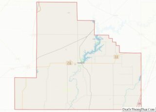
Pana location map. Where is Pana city?


History
The area around Pana was first organized as Stone Coal Precinct in 1845. The county’s precincts became townships in 1856, and Stone Coal Precinct became Pana Township, Christian County, Illinois. In 1856, the village of Pana was incorporated. The name “Pana” is believed to have been derived from the indigenous tribe, the Pawnee. It developed at the intersection of east–west and north–south railroads, and had supplies of fuel and water for the steam engines of the railroad.
This became a center of coal mining in the late 19th and early 20th centuries. In April 1899 what is known as the Pana riot broke out after a violent confrontation between black and white miners. Initially a white man was killed (by a policeman, it was later discovered), and white union miners attacked black replacement workers who had been recruited from Alabama. Six additional people were killed: one white (likely also shot by a white man) and five blacks; in addition, six more black miners were wounded. While the immediate violence was quelled, blacks felt tremendous hostility. Rather than return to Alabama and the Jim Crow South, from where they had been recruited, 211 of the nearly 300 African Americans remaining in town moved west to Weir, Kansas, to work at another mine.
It came to be known as the City of Roses, a nickname coined by local newsmen, the Jordan Brothers. Many major florists and growers set up shop here. At one time, there were 109 greenhouses in Pana.
Kitchell Park was added to the National Register of Historic Places in 1992. The Louis Jehle House, added to the National Register in 1995, is also located in Pana.
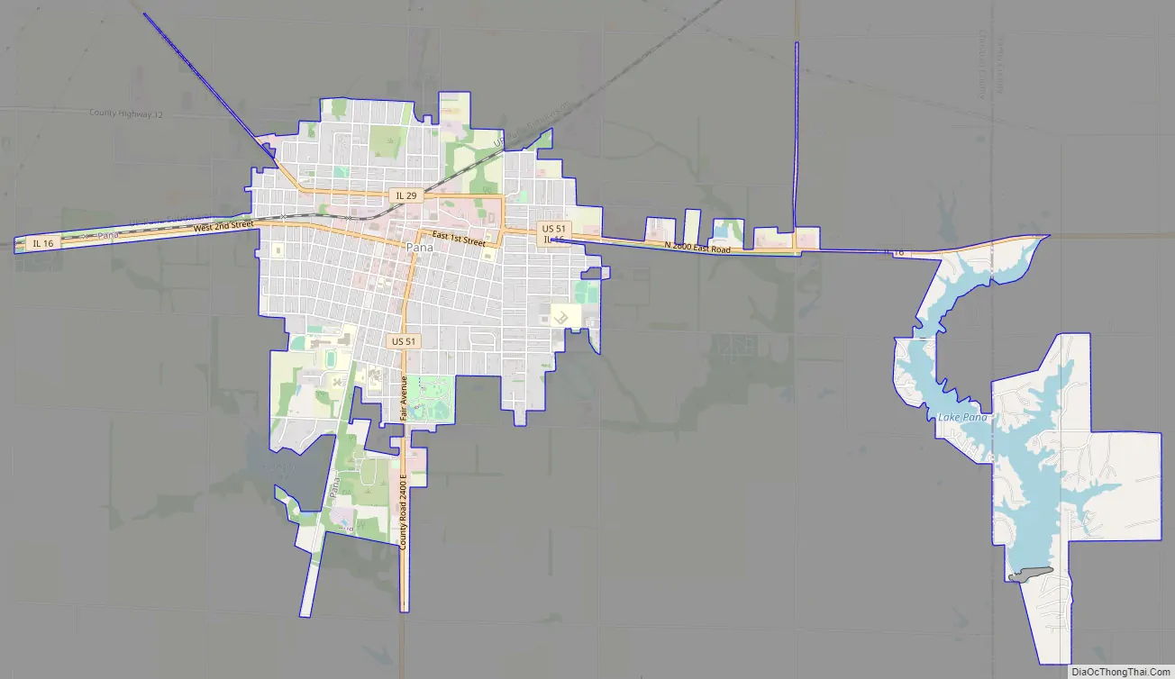
Pana Road Map
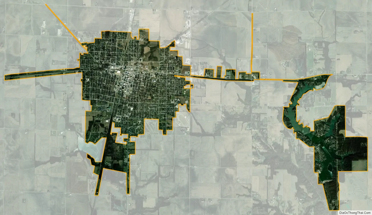
Pana city Satellite Map
Geography
According to the 2021 census gazetteer files, Pana has a total area of 4.16 square miles (10.77 km), of which 3.86 square miles (10.00 km) (or 92.60%) is land and 0.31 square miles (0.80 km) (or 7.40%) is water.
Climate
See also
Map of Illinois State and its subdivision:- Adams
- Alexander
- Bond
- Boone
- Brown
- Bureau
- Calhoun
- Carroll
- Cass
- Champaign
- Christian
- Clark
- Clay
- Clinton
- Coles
- Cook
- Crawford
- Cumberland
- De Kalb
- De Witt
- Douglas
- Dupage
- Edgar
- Edwards
- Effingham
- Fayette
- Ford
- Franklin
- Fulton
- Gallatin
- Greene
- Grundy
- Hamilton
- Hancock
- Hardin
- Henderson
- Henry
- Iroquois
- Jackson
- Jasper
- Jefferson
- Jersey
- Jo Daviess
- Johnson
- Kane
- Kankakee
- Kendall
- Knox
- La Salle
- Lake
- Lake Michigan
- Lawrence
- Lee
- Livingston
- Logan
- Macon
- Macoupin
- Madison
- Marion
- Marshall
- Mason
- Massac
- McDonough
- McHenry
- McLean
- Menard
- Mercer
- Monroe
- Montgomery
- Morgan
- Moultrie
- Ogle
- Peoria
- Perry
- Piatt
- Pike
- Pope
- Pulaski
- Putnam
- Randolph
- Richland
- Rock Island
- Saint Clair
- Saline
- Sangamon
- Schuyler
- Scott
- Shelby
- Stark
- Stephenson
- Tazewell
- Union
- Vermilion
- Wabash
- Warren
- Washington
- Wayne
- White
- Whiteside
- Will
- Williamson
- Winnebago
- Woodford
- Alabama
- Alaska
- Arizona
- Arkansas
- California
- Colorado
- Connecticut
- Delaware
- District of Columbia
- Florida
- Georgia
- Hawaii
- Idaho
- Illinois
- Indiana
- Iowa
- Kansas
- Kentucky
- Louisiana
- Maine
- Maryland
- Massachusetts
- Michigan
- Minnesota
- Mississippi
- Missouri
- Montana
- Nebraska
- Nevada
- New Hampshire
- New Jersey
- New Mexico
- New York
- North Carolina
- North Dakota
- Ohio
- Oklahoma
- Oregon
- Pennsylvania
- Rhode Island
- South Carolina
- South Dakota
- Tennessee
- Texas
- Utah
- Vermont
- Virginia
- Washington
- West Virginia
- Wisconsin
- Wyoming