Burlington is a city in Ward County, North Dakota, United States. It was founded in 1883, the third in a series that included two earlier settlements. Despite this, Burlington is still the oldest city in Ward County, as well as north-western and north central North Dakota. On February 28, 1884, as it was the only city in the then-newly formed Imperial Ward County (now split into Ward, Renville, Mountrail, and Burke counties), it was made the county seat, a position it held until 1888. The population was 1,291 at the 2020 census. Burlington is part of the Minot Micropolitan Statistical Area.
| Name: | Burlington city |
|---|---|
| LSAD Code: | 25 |
| LSAD Description: | city (suffix) |
| State: | North Dakota |
| County: | Ward County |
| Founded: | 1883 |
| Incorporated: | February 28, 1884 |
| Elevation: | 1,608 ft (490 m) |
| Total Area: | 1.91 sq mi (4.94 km²) |
| Land Area: | 1.91 sq mi (4.94 km²) |
| Water Area: | 0.00 sq mi (0.00 km²) |
| Population Density: | 677.33/sq mi (261.58/km²) |
| ZIP code: | 58722 |
| Area code: | 701 |
| FIPS code: | 3810940 |
| GNISfeature ID: | 1034752 |
| Website: | burlingtonnd.gov |
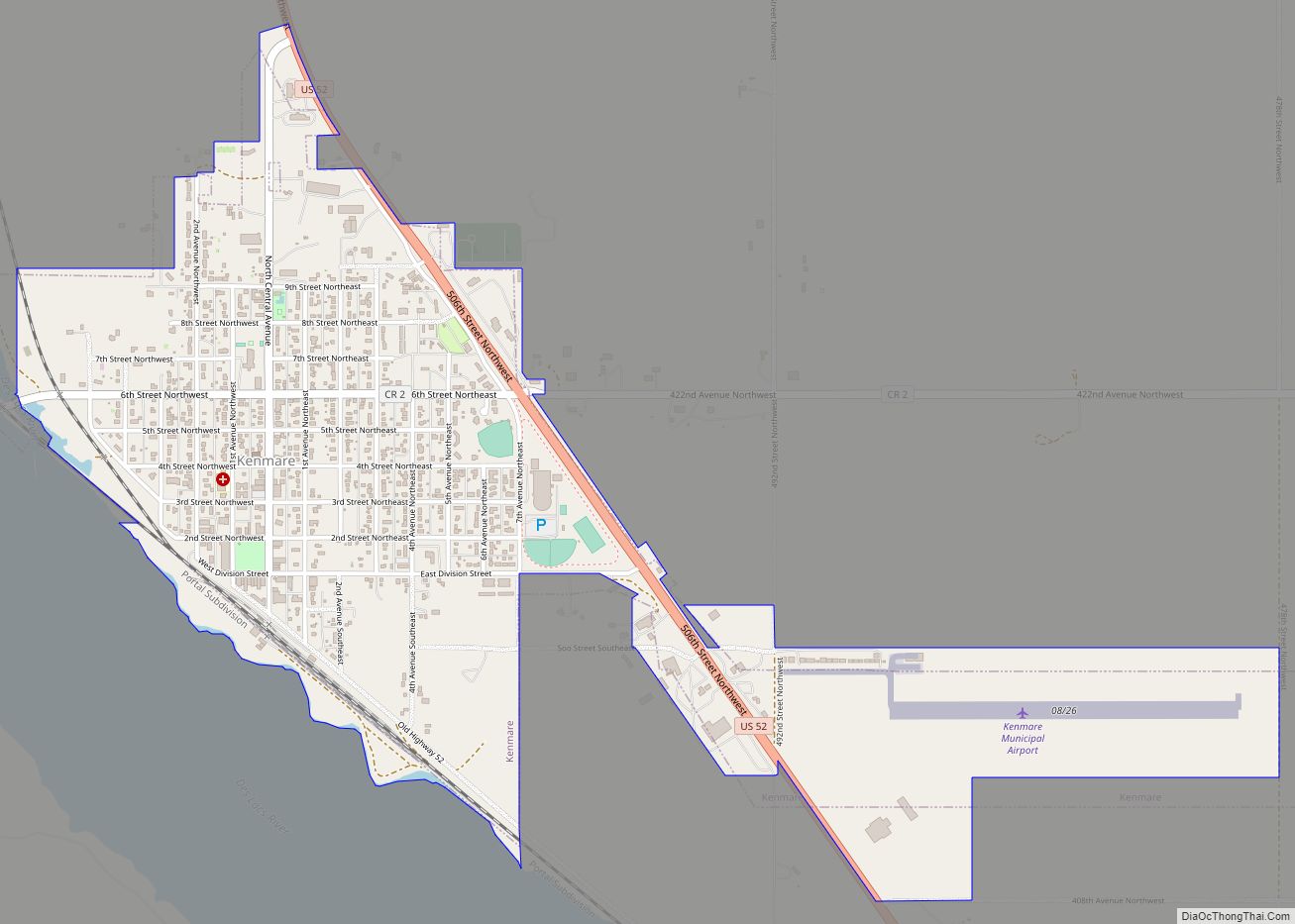
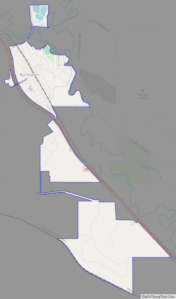
Online Interactive Map
Click on ![]() to view map in "full screen" mode.
to view map in "full screen" mode.
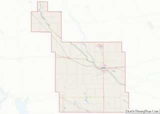
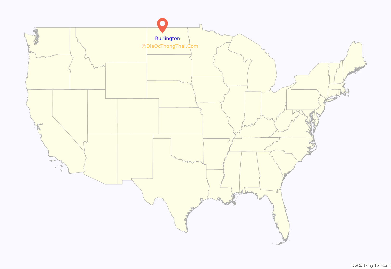
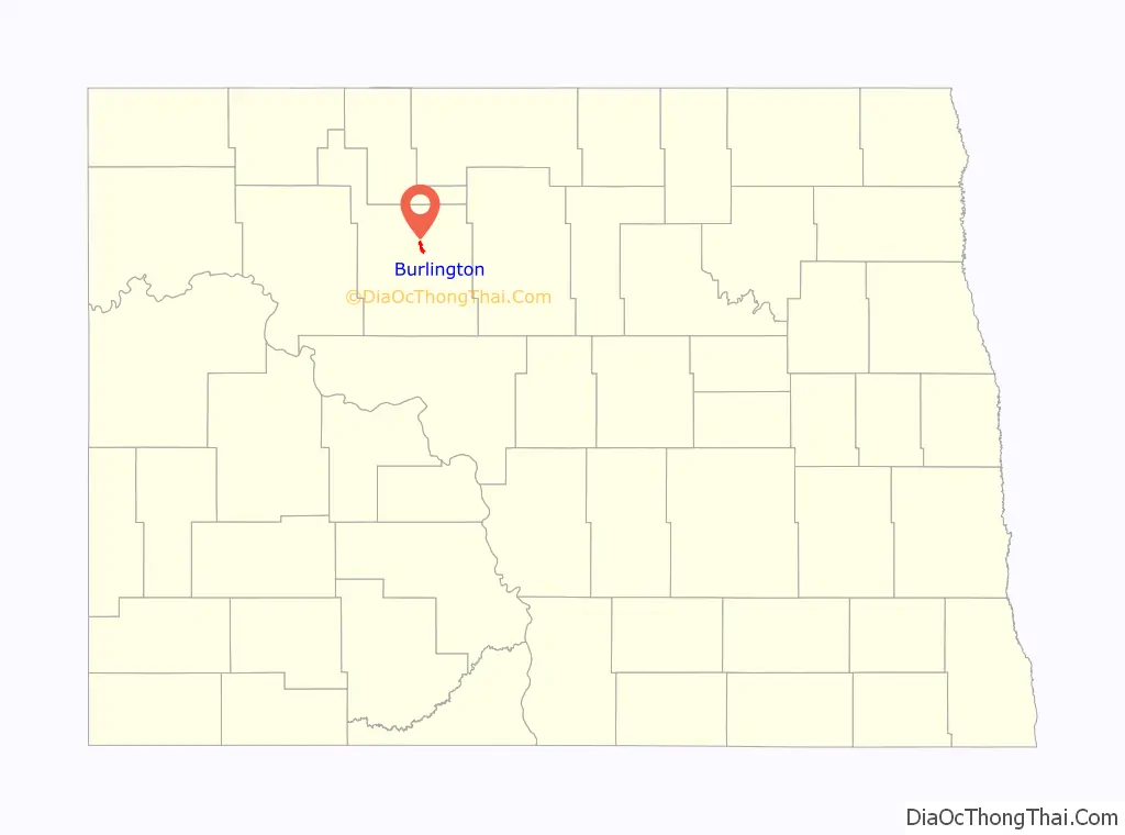
Burlington location map. Where is Burlington city?
History
Burlington and its former settlements were founded by James Johnson and James Colton (the men who also settled Larimore, North Dakota) in Dakota Territory in the late 1870s. Earlier settlements were The Forks, and later Colton (named after James Colton), which are considered forerunners of the city. Its current name was given to it by James Johnson during the creation of the post office, and was the name of his hometown of Burlington, Iowa. “The Forks” was used as a name for Burlington, alluding to its geographic location at the confluence of the Des Lacs and Mouse Rivers.
In the early 1890s, the Burlington Reporter became the first newspaper in western North Dakota. It would in the future be renamed to the Minot Daily News.
In 1997, Raymond Kuntz from Burlington testified before the United States Senate that he believed his son, Richard, committed suicide due to the influence of the band Marilyn Manson.
On January 18, 2002, a severe train derailment east of the city sent a gigantic cloud of anhydrous ammonia toward Minot and Burlington. Power to Burlington, Des Lacs, and Berthold was knocked out due to damage to poles near the derailment site. The power company serving these towns built a temporary connection to a neighboring electric cooperative’s system to provide limited power until the site was sufficiently cleaned up to permit permanent repairs to be completed. Residents were unable to access radios or televisions due to this, although messages went out advising people to stay inside. One man died and many of the area’s citizens were sickened by the noxious gas. The incident was one of the more major chemical spills in the country. In early 2006, court cases were heard in Minneapolis, Minnesota, against Canadian Pacific Railway, the owner and operator of the derailed train. The anhydrous ammonia spill was the largest such spill in U.S. history. This incident was used by Eric Klinenberg in his book Fighting for Air: The Battle to Control America’s Media as an example of the failure of mass media, specifically local radio stations, to disseminate information to the public in an emergency.
On June 24, 2011, 80% of the city was evacuated when floodwaters swept through the town during the flooding of the Mouse River, in flooding which also greatly affected Minot. In some cases, many homes were not accessible for months afterward, and some damage to homes and infrastructure still wasn’t fully repaired as of 2016. Post-flood, most of the homes that were directly next to the Mouse River (and some next to the Des Lacs) were demolished as part of a new flood control plan.
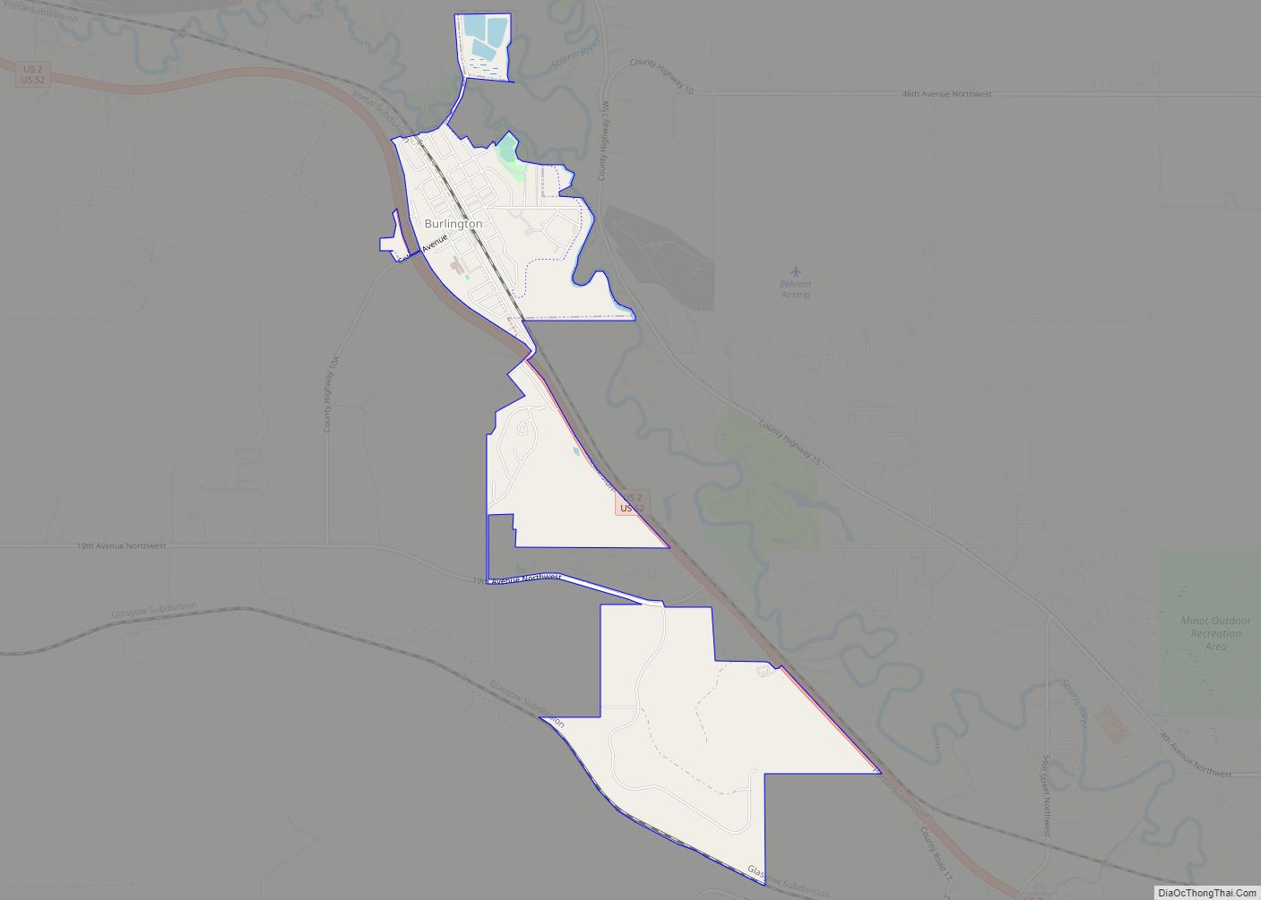
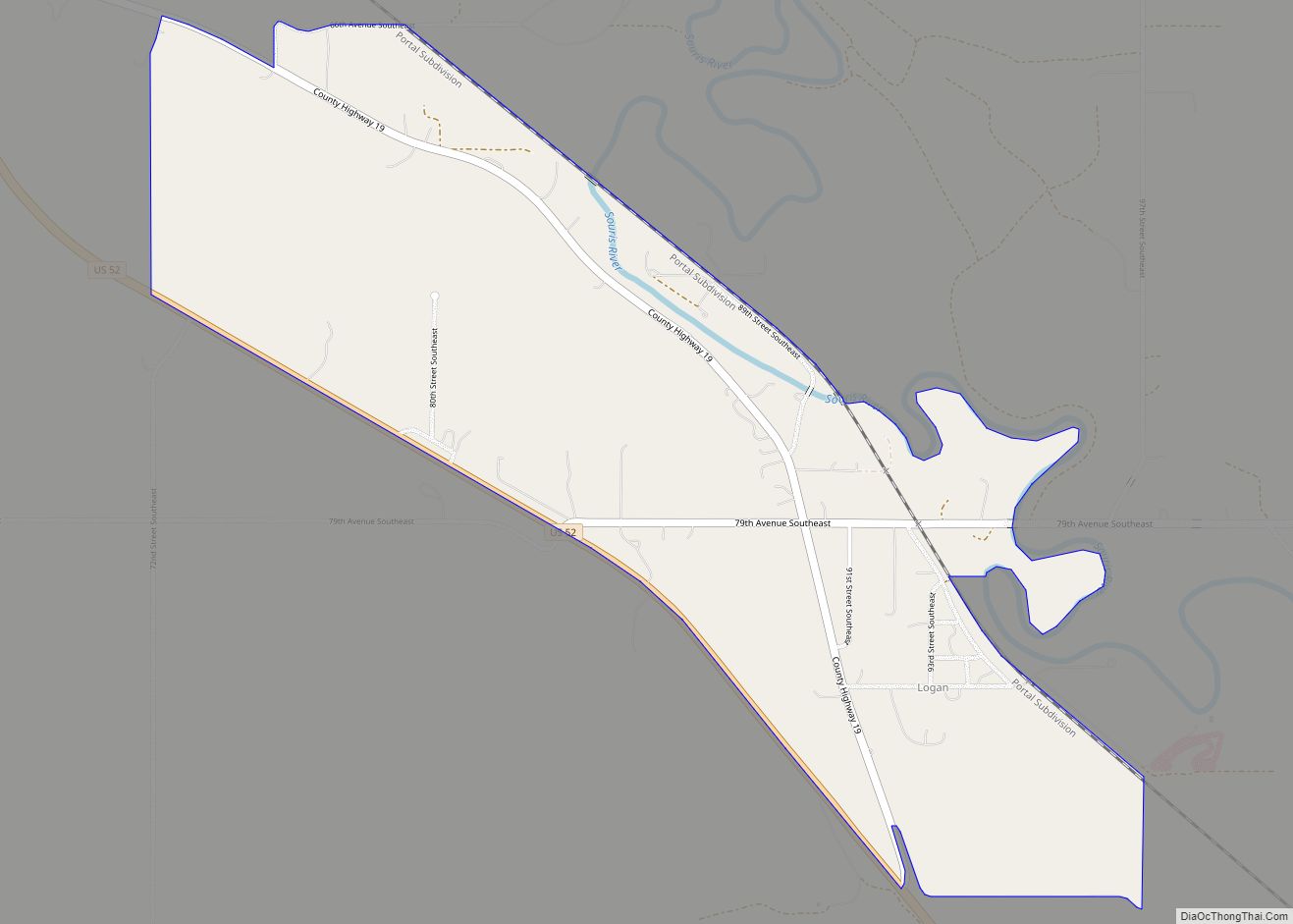
Burlington Road Map
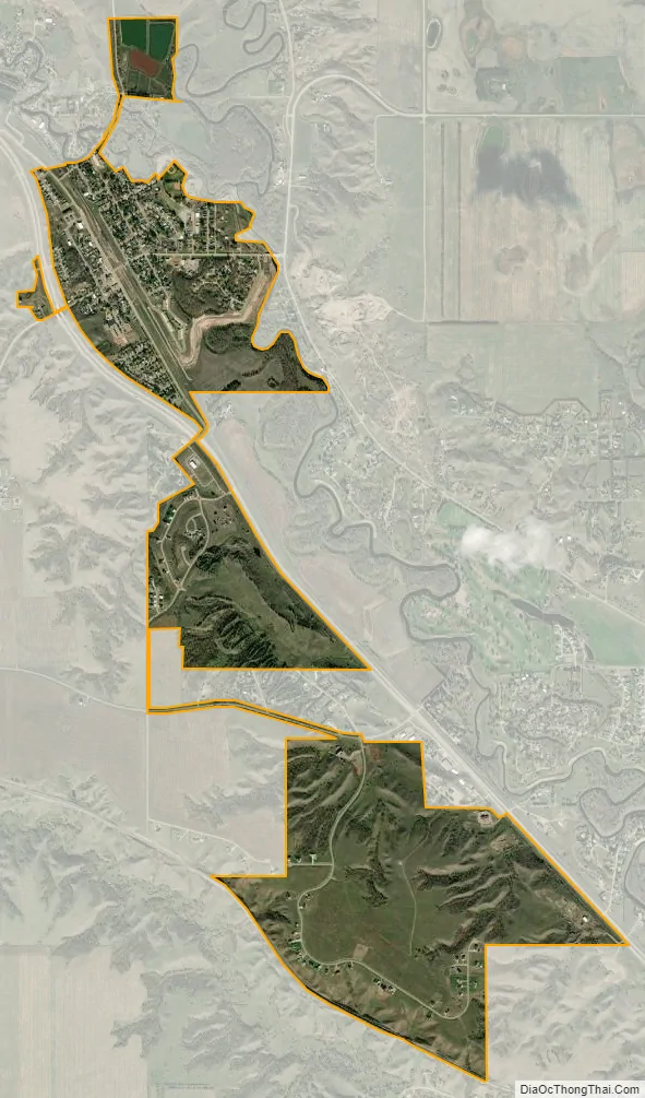
Burlington city Satellite Map
Geography
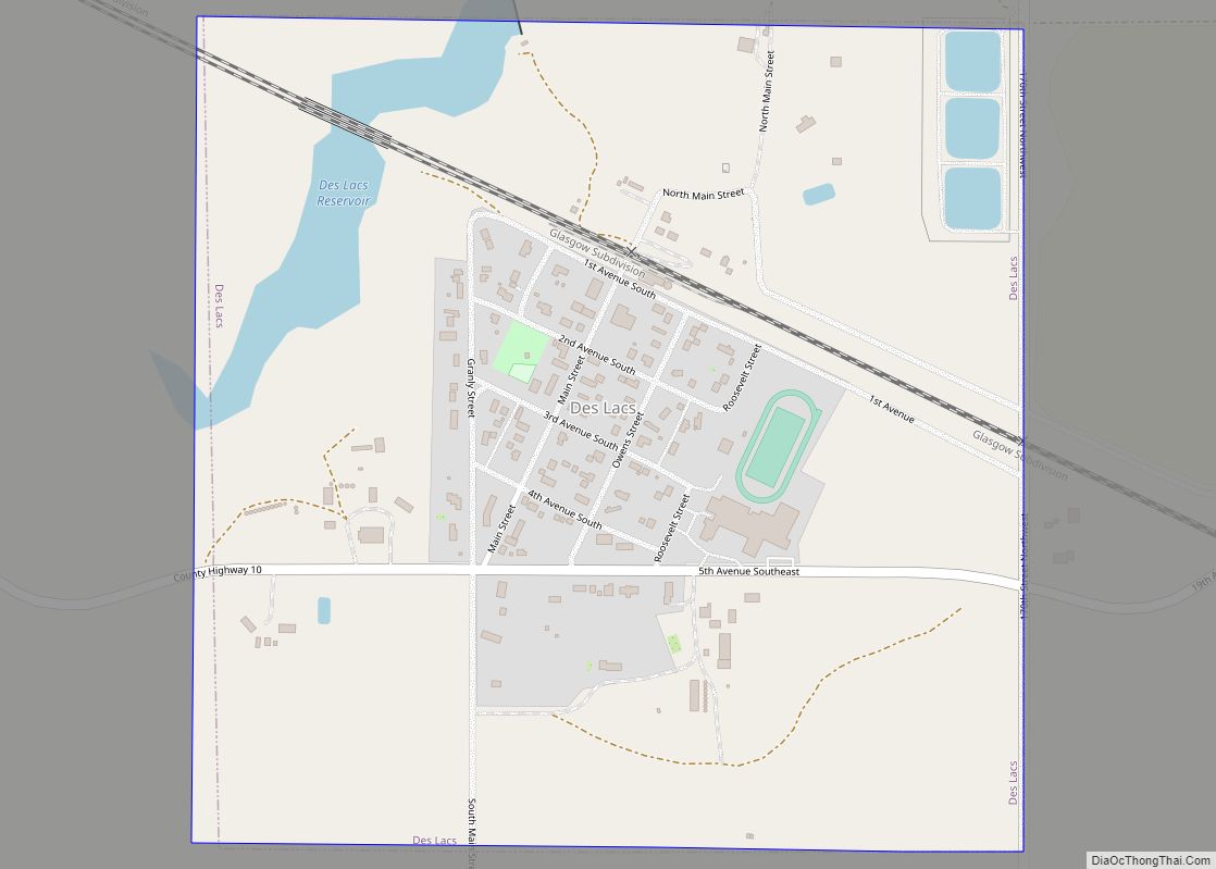
Burlington is located on the Drift Prairie of north central North Dakota at 48°16′39″N 101°25′40″W / 48.277475°N 101.427694°W / 48.277475; -101.427694 (48.277475, −101.427694), directly next to the confluence of the Des Lacs and the Mouse Rivers, in Burlington Township, North Dakota, and Kirkelie Township, North Dakota. According to the United States Census Bureau, the city has a total area of 0.64 square miles (1.66 km), all land.
Climate
This climatic region is typified by large seasonal temperature differences, with warm to hot (and often humid) summers and cold (sometimes severely cold) winters. According to the Köppen Climate Classification system, Burlington has a humid continental climate, abbreviated “Dfb” on climate maps.
See also
Map of North Dakota State and its subdivision:- Adams
- Barnes
- Benson
- Billings
- Bottineau
- Bowman
- Burke
- Burleigh
- Cass
- Cavalier
- Dickey
- Divide
- Dunn
- Eddy
- Emmons
- Foster
- Golden Valley
- Grand Forks
- Grant
- Griggs
- Hettinger
- Kidder
- Lamoure
- Logan
- McHenry
- McIntosh
- McKenzie
- McLean
- Mercer
- Morton
- Mountrail
- Nelson
- Oliver
- Pembina
- Pierce
- Ramsey
- Ransom
- Renville
- Richland
- Rolette
- Sargent
- Sheridan
- Sioux
- Slope
- Stark
- Steele
- Stutsman
- Towner
- Traill
- Walsh
- Ward
- Wells
- Williams
- Alabama
- Alaska
- Arizona
- Arkansas
- California
- Colorado
- Connecticut
- Delaware
- District of Columbia
- Florida
- Georgia
- Hawaii
- Idaho
- Illinois
- Indiana
- Iowa
- Kansas
- Kentucky
- Louisiana
- Maine
- Maryland
- Massachusetts
- Michigan
- Minnesota
- Mississippi
- Missouri
- Montana
- Nebraska
- Nevada
- New Hampshire
- New Jersey
- New Mexico
- New York
- North Carolina
- North Dakota
- Ohio
- Oklahoma
- Oregon
- Pennsylvania
- Rhode Island
- South Carolina
- South Dakota
- Tennessee
- Texas
- Utah
- Vermont
- Virginia
- Washington
- West Virginia
- Wisconsin
- Wyoming