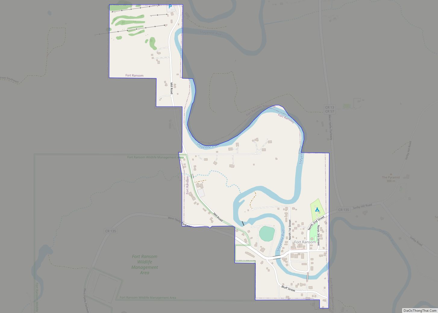
Fort Ransom is a city in Ransom County, North Dakota, United States. The population was 91 at the 2020 census. Fort Ransom was founded in 1880 with the first merchants arriving in 1878.
| Name: | Fort Ransom city |
|---|---|
| LSAD Code: | 25 |
| LSAD Description: | city (suffix) |
| State: | North Dakota |
| County: | Ransom County |
| Elevation: | 1,135 ft (346 m) |
| Total Area: | 0.31 sq mi (0.80 km²) |
| Land Area: | 0.31 sq mi (0.80 km²) |
| Water Area: | 0.00 sq mi (0.00 km²) |
| Total Population: | 91 |
| Population Density: | 295.45/sq mi (114.17/km²) |
| ZIP code: | 58033 |
| Area code: | 701 |
| FIPS code: | 3827580 |
| GNISfeature ID: | 1029016 |
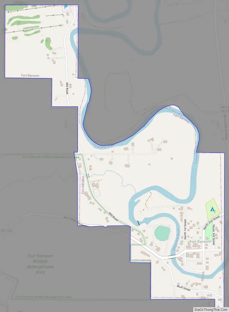
Online Interactive Map
Click on ![]() to view map in "full screen" mode.
to view map in "full screen" mode.
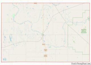
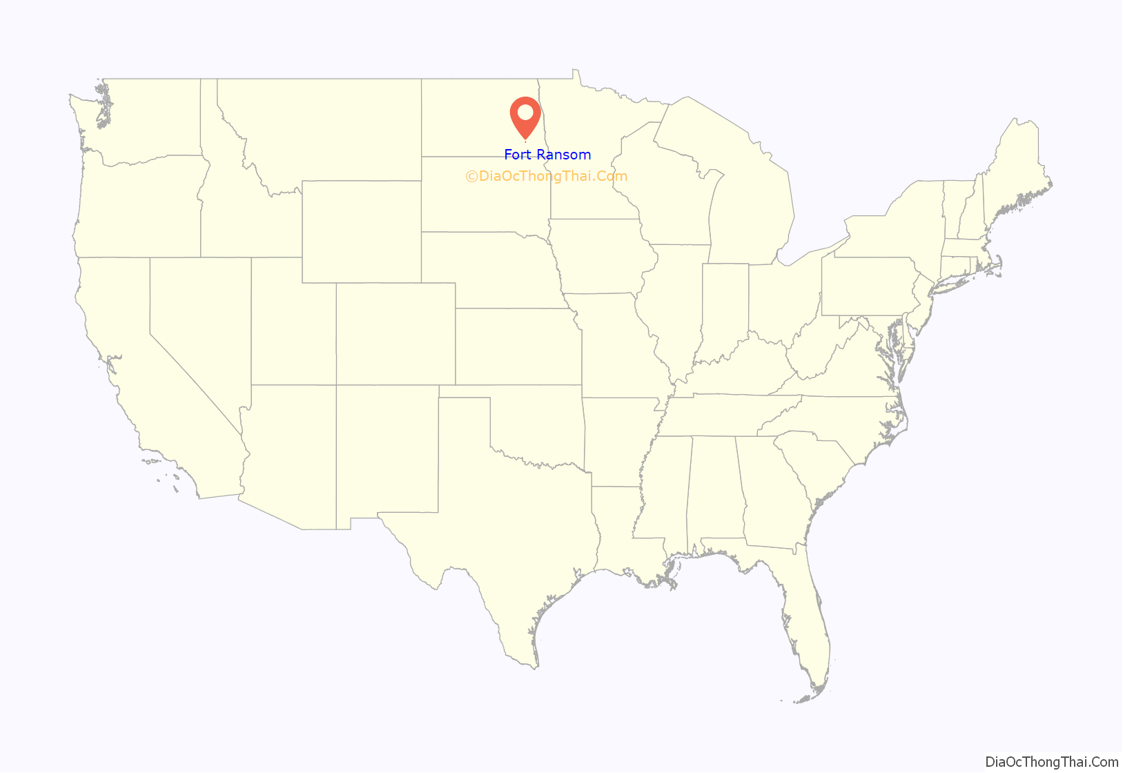
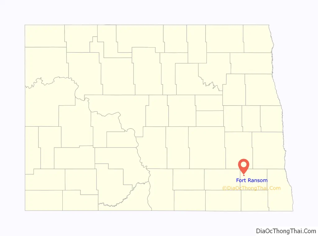
Fort Ransom location map. Where is Fort Ransom city?
History
The Fort Ransom Military Post was established in 1867. It was built to protect settlers and railroad workers who were working on the Northern Pacific Railroad between Fargo and Bismarck. It was named for distinguished Civil War veteran Major General Thomas E.G. Ransom. The fort was built on top of Grizzly Bear Hill, a site chosen by Brigadier General Alfred H. Terry.
Fort Ransom was dismantled in 1872 and the materials were used to build Fort Seward at Jamestown, North Dakota in Stutsman County. The army had determined that protection of the Northern Pacific Railroad crew at the James River crossing was a higher priority than protecting the overland route. The final disposition of the military reservation took place on July 14, 1880, when it was turned over to the Department of Interior for survey and sale to homesteaders.
The original site of the fort is located to the southwest of the town of Fort Ransom and 3 miles south of Fort Ransom State Park.
Fort Ransom Road Map
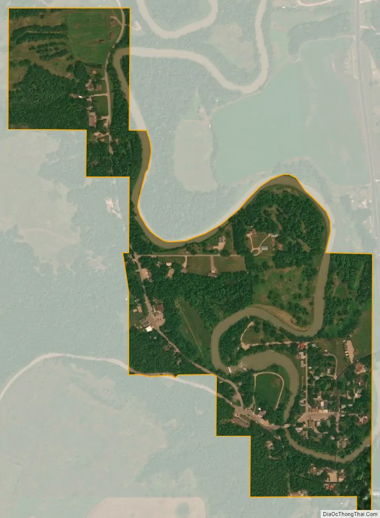
Fort Ransom city Satellite Map
Geography
Fort Ransom is located at 46°31′16″N 97°55′45″W / 46.52111°N 97.92917°W / 46.52111; -97.92917 (46.521154, -97.929141). Fort Ransom is located in the Sheyenne River valley. Fort Ransom State Park is located nearby.
According to the United States Census Bureau, the city has a total area of 0.30 square miles (0.78 km), all land. The only waterfall in North Dakota is located between Fort Ransom and Lisbon, ND.
See also
Map of North Dakota State and its subdivision:- Adams
- Barnes
- Benson
- Billings
- Bottineau
- Bowman
- Burke
- Burleigh
- Cass
- Cavalier
- Dickey
- Divide
- Dunn
- Eddy
- Emmons
- Foster
- Golden Valley
- Grand Forks
- Grant
- Griggs
- Hettinger
- Kidder
- Lamoure
- Logan
- McHenry
- McIntosh
- McKenzie
- McLean
- Mercer
- Morton
- Mountrail
- Nelson
- Oliver
- Pembina
- Pierce
- Ramsey
- Ransom
- Renville
- Richland
- Rolette
- Sargent
- Sheridan
- Sioux
- Slope
- Stark
- Steele
- Stutsman
- Towner
- Traill
- Walsh
- Ward
- Wells
- Williams
- Alabama
- Alaska
- Arizona
- Arkansas
- California
- Colorado
- Connecticut
- Delaware
- District of Columbia
- Florida
- Georgia
- Hawaii
- Idaho
- Illinois
- Indiana
- Iowa
- Kansas
- Kentucky
- Louisiana
- Maine
- Maryland
- Massachusetts
- Michigan
- Minnesota
- Mississippi
- Missouri
- Montana
- Nebraska
- Nevada
- New Hampshire
- New Jersey
- New Mexico
- New York
- North Carolina
- North Dakota
- Ohio
- Oklahoma
- Oregon
- Pennsylvania
- Rhode Island
- South Carolina
- South Dakota
- Tennessee
- Texas
- Utah
- Vermont
- Virginia
- Washington
- West Virginia
- Wisconsin
- Wyoming