East Grand Forks (also known as EGF) is a city in Polk County, Minnesota, United States. The population was 9,176 at the 2020 Census, making it the largest community in Polk County.
It is located in the Red River Valley region along the eastern bank of the Red River of the North, directly across from the larger city of Grand Forks, North Dakota. The cities of Grand Forks and East Grand Forks form the center of the Grand Forks, ND–MN Metropolitan Statistical Area, which is often called Greater Grand Forks. The population was 104,362 at the 2020 Census.
| Name: | East Grand Forks city |
|---|---|
| LSAD Code: | 25 |
| LSAD Description: | city (suffix) |
| State: | Minnesota |
| County: | Polk County |
| Founded: | 1887 |
| Elevation: | 833 ft (254 m) |
| Land Area: | 5.95 sq mi (15.40 km²) |
| Water Area: | 0.00 sq mi (0.00 km²) |
| Population Density: | 1,543.22/sq mi (595.80/km²) |
| ZIP code: | 56721 |
| Area code: | 218 |
| FIPS code: | 2717612 |
| GNISfeature ID: | 0643079 |
| Website: | egf.mn |
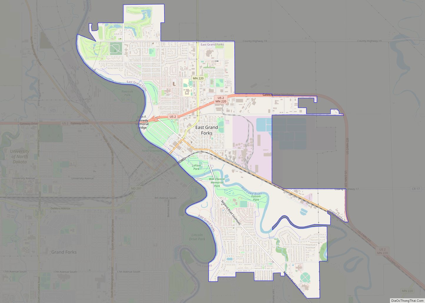
Online Interactive Map
Click on ![]() to view map in "full screen" mode.
to view map in "full screen" mode.
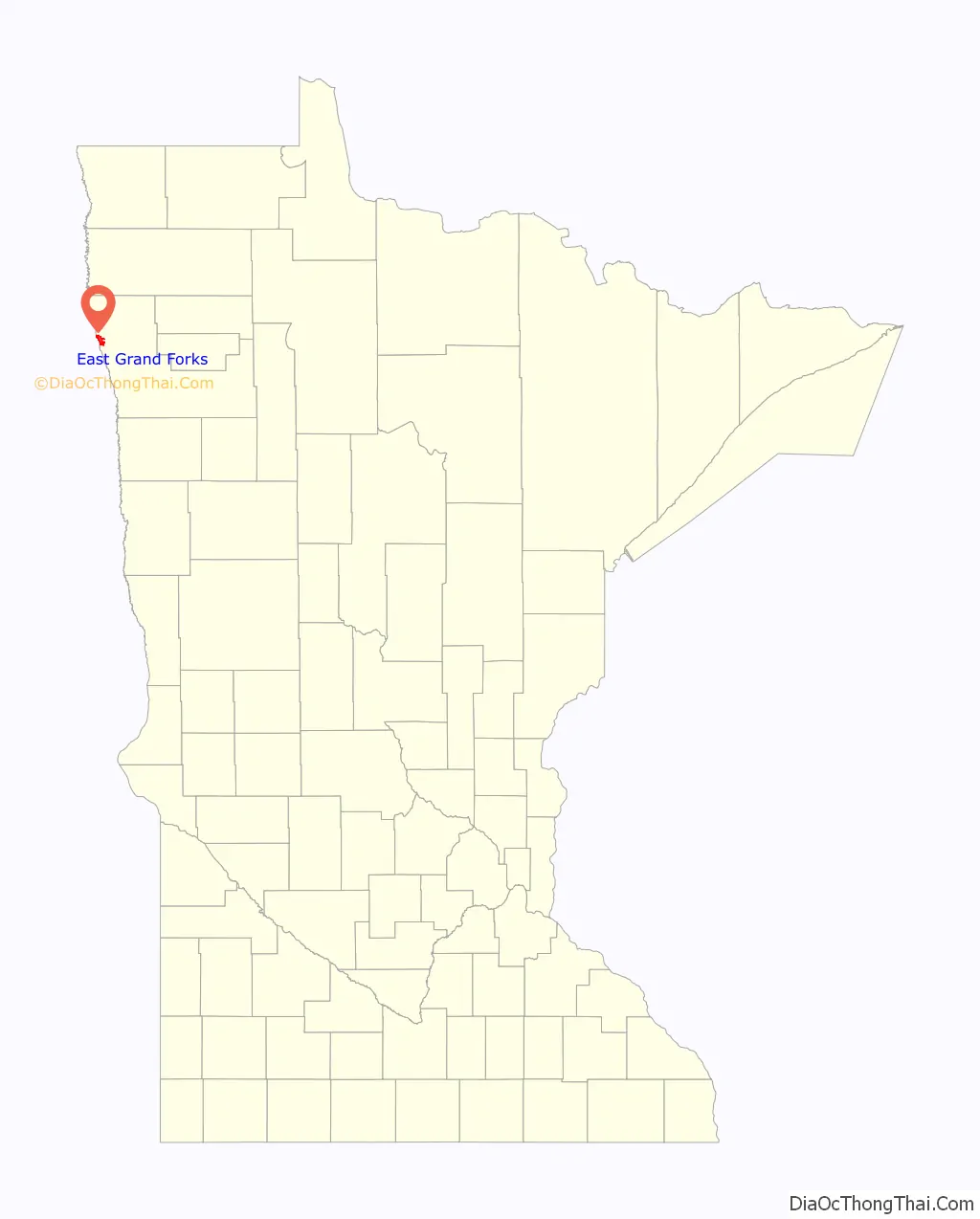
East Grand Forks location map. Where is East Grand Forks city?

History
A post office called East Grand Forks has been in operation since 1883. The city was named for its location east of Grand Forks, North Dakota. East Grand Forks was incorporated in 1887.
Flood of 1997
East Grand Forks, along with Grand Forks, was heavily damaged by a major flood in 1997. The entire city was under a mandatory evacuation and almost no homes were spared damage. After the flood, several neighborhoods had to be demolished because of damage. The city cleared development from the floodplain bordering the Red and Red Lake rivers. It developed a large park known as the Greater Grand Forks Greenway to provide a new recreation area for residents along the river. A similar park was developed in Grand Forks, North Dakota on the opposite side of the river. The parklands, with trees and a variety of greenery, can absorb floodwaters and help protect the cities naturally. Moving residential and business development out of these areas also helps prevent future flood damage. In addition, a new system of dikes was constructed to protect the city from future flooding.
The city has rebuilt. New businesses attracted to the downtown include a Cabela’s sporting goods store and Moore Theaters.
East Grand Forks Road Map
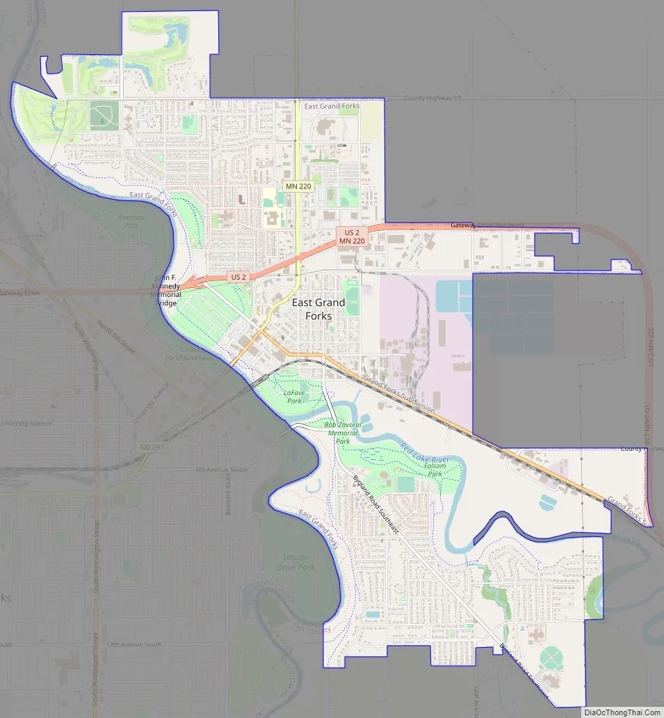
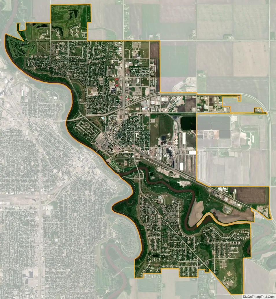
East Grand Forks city Satellite Map
Geography
East Grand Forks is located in the flat, fertile Red River Valley, formed by the ancient glacial Lake Agassiz.
East Grand Forks developed on both sides of the Red Lake River, which joins with the Red River in town. The main part of town is located north of the river; this was the original section which developed as the downtown area, as well as several early residential neighborhoods. The area south of the river is known as “The Point.” The land narrows almost to a peninsula at the confluence of the Red and Red Lake rivers. “The Point” contains more residential development.
According to the United States Census Bureau, the city has a total area of 5.91 square miles (15.31 km), all land.
See also
Map of Minnesota State and its subdivision:- Aitkin
- Anoka
- Becker
- Beltrami
- Benton
- Big Stone
- Blue Earth
- Brown
- Carlton
- Carver
- Cass
- Chippewa
- Chisago
- Clay
- Clearwater
- Cook
- Cottonwood
- Crow Wing
- Dakota
- Dodge
- Douglas
- Faribault
- Fillmore
- Freeborn
- Goodhue
- Grant
- Hennepin
- Houston
- Hubbard
- Isanti
- Itasca
- Jackson
- Kanabec
- Kandiyohi
- Kittson
- Koochiching
- Lac qui Parle
- Lake
- Lake of the Woods
- Lake Superior
- Le Sueur
- Lincoln
- Lyon
- Mahnomen
- Marshall
- Martin
- McLeod
- Meeker
- Mille Lacs
- Morrison
- Mower
- Murray
- Nicollet
- Nobles
- Norman
- Olmsted
- Otter Tail
- Pennington
- Pine
- Pipestone
- Polk
- Pope
- Ramsey
- Red Lake
- Redwood
- Renville
- Rice
- Rock
- Roseau
- Saint Louis
- Scott
- Sherburne
- Sibley
- Stearns
- Steele
- Stevens
- Swift
- Todd
- Traverse
- Wabasha
- Wadena
- Waseca
- Washington
- Watonwan
- Wilkin
- Winona
- Wright
- Yellow Medicine
- Alabama
- Alaska
- Arizona
- Arkansas
- California
- Colorado
- Connecticut
- Delaware
- District of Columbia
- Florida
- Georgia
- Hawaii
- Idaho
- Illinois
- Indiana
- Iowa
- Kansas
- Kentucky
- Louisiana
- Maine
- Maryland
- Massachusetts
- Michigan
- Minnesota
- Mississippi
- Missouri
- Montana
- Nebraska
- Nevada
- New Hampshire
- New Jersey
- New Mexico
- New York
- North Carolina
- North Dakota
- Ohio
- Oklahoma
- Oregon
- Pennsylvania
- Rhode Island
- South Carolina
- South Dakota
- Tennessee
- Texas
- Utah
- Vermont
- Virginia
- Washington
- West Virginia
- Wisconsin
- Wyoming