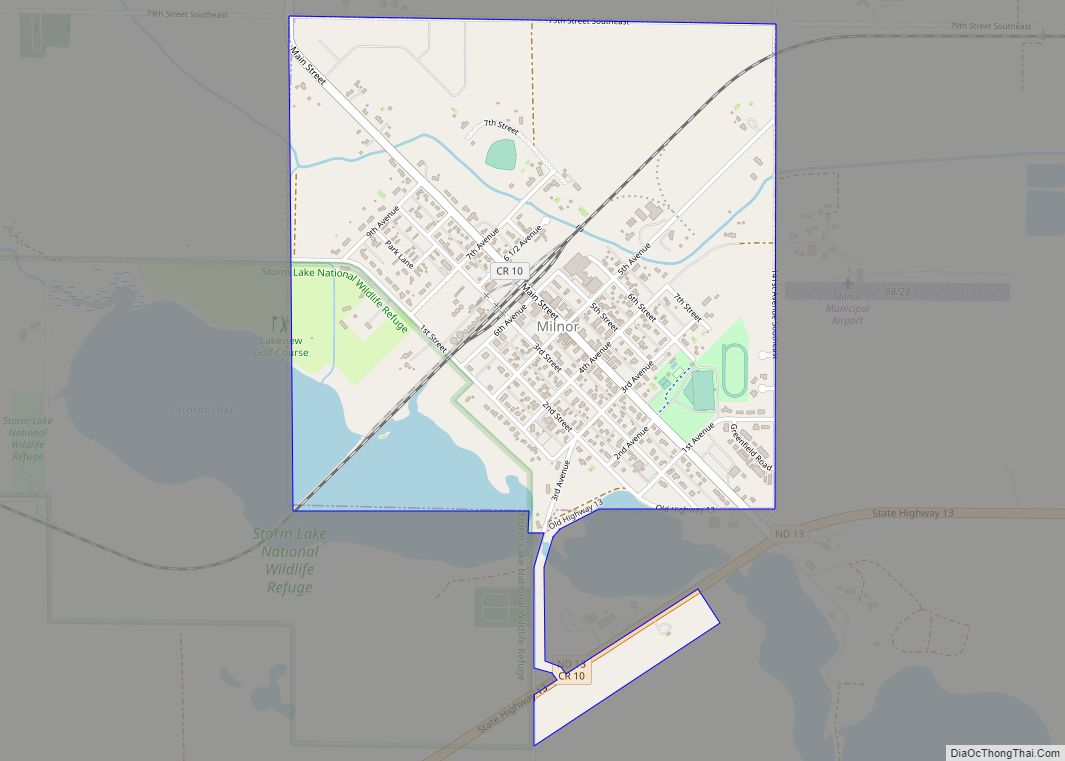
Milnor is a city in Sargent County, North Dakota, United States. The population was 624 at the 2020 census.
| Name: | Milnor city |
|---|---|
| LSAD Code: | 25 |
| LSAD Description: | city (suffix) |
| State: | North Dakota |
| County: | Sargent County |
| Founded: | 1883 |
| Elevation: | 1,102 ft (336 m) |
| Total Area: | 1.08 sq mi (2.79 km²) |
| Land Area: | 1.00 sq mi (2.59 km²) |
| Water Area: | 0.08 sq mi (0.20 km²) |
| Total Population: | 624 |
| Population Density: | 623.38/sq mi (240.59/km²) |
| ZIP code: | 58060 |
| Area code: | 701 |
| FIPS code: | 3852940 |
| GNISfeature ID: | 1035008 |
| Website: | milnornd.com |
Online Interactive Map
Click on ![]() to view map in "full screen" mode.
to view map in "full screen" mode.
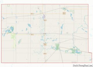
Milnor location map. Where is Milnor city?


History
Milnor was founded in 1883 and officially named the same year. The city was named after William Edward Milnor, the first telegrapher at the Milnor Station, and WM Milnor Roberts, a famous civil engineer. It was the first city to be founded in Sargent County.
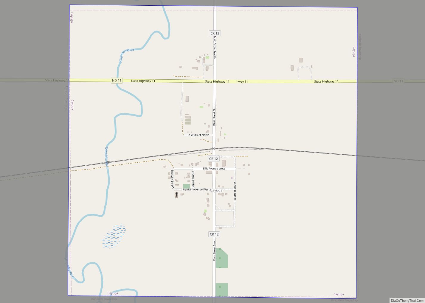
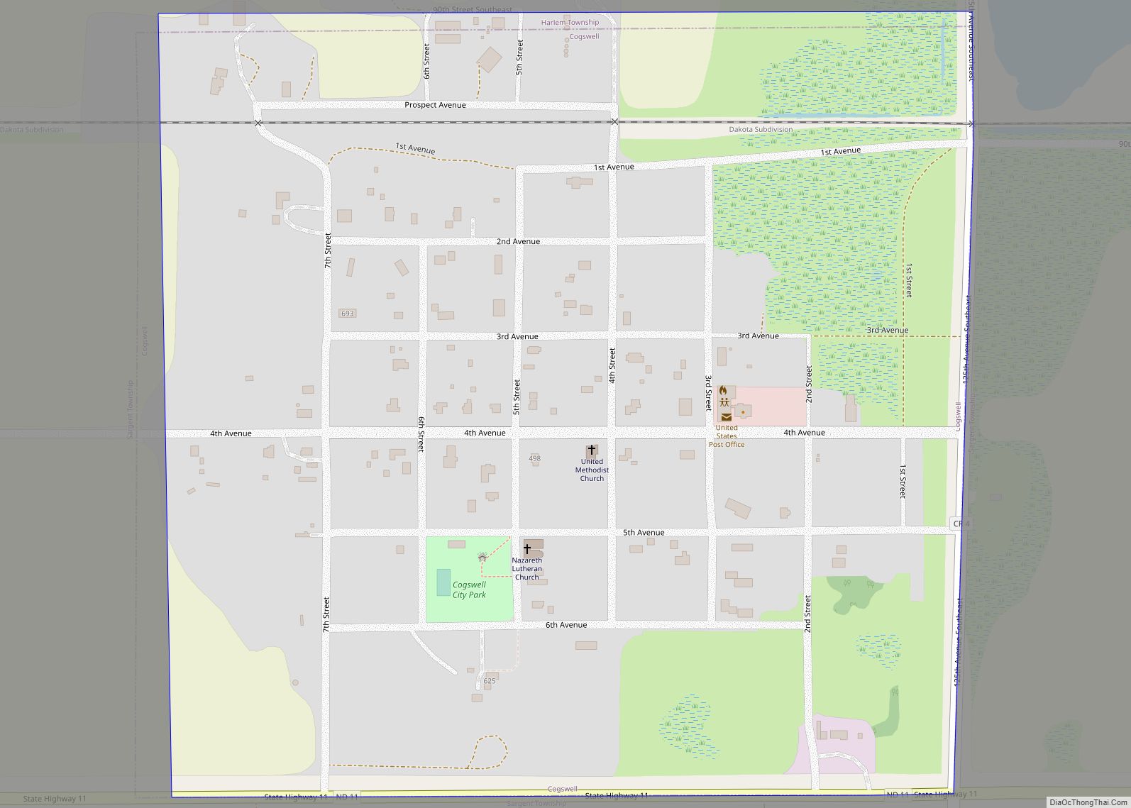
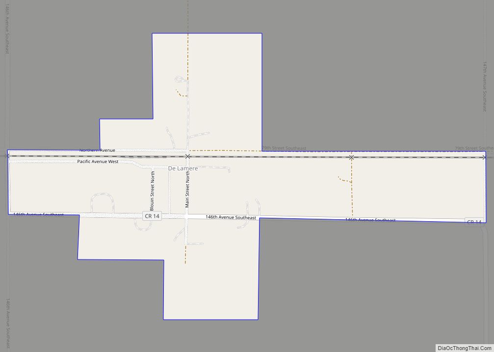
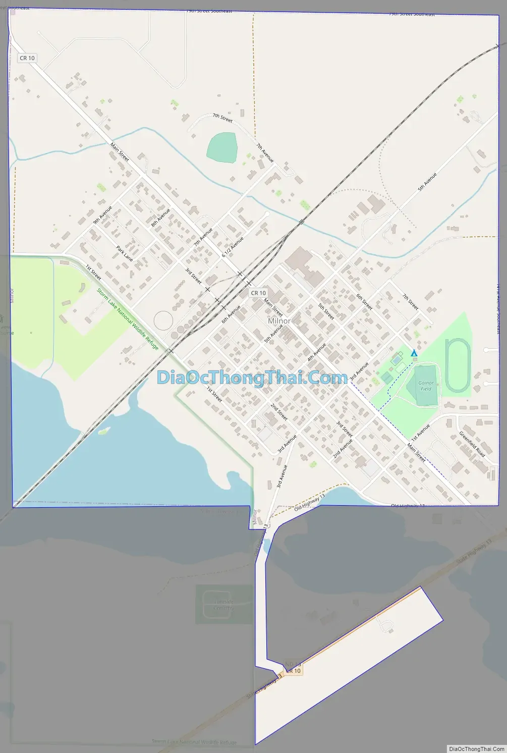
Milnor Road Map
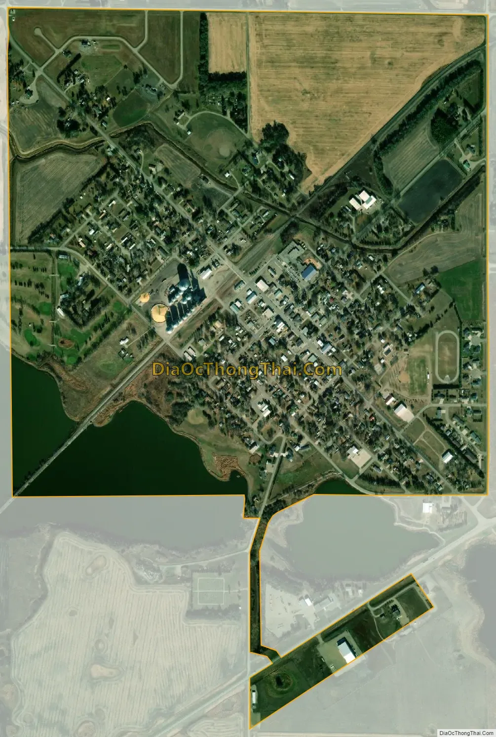
Milnor city Satellite Map
Geography
Milnor is located at 46°15′30″N 97°27′21″W / 46.25833°N 97.45583°W / 46.25833; -97.45583 (46.258208, -97.455834).Sundale is approximately five miles northwest of Milnor.
According to the United States Census Bureau, the city has a total area of 1.01 square miles (2.62 km), of which 0.94 square miles (2.43 km) is land and 0.07 square miles (0.18 km) is water.
See also
Map of North Dakota State and its subdivision:- Adams
- Barnes
- Benson
- Billings
- Bottineau
- Bowman
- Burke
- Burleigh
- Cass
- Cavalier
- Dickey
- Divide
- Dunn
- Eddy
- Emmons
- Foster
- Golden Valley
- Grand Forks
- Grant
- Griggs
- Hettinger
- Kidder
- Lamoure
- Logan
- McHenry
- McIntosh
- McKenzie
- McLean
- Mercer
- Morton
- Mountrail
- Nelson
- Oliver
- Pembina
- Pierce
- Ramsey
- Ransom
- Renville
- Richland
- Rolette
- Sargent
- Sheridan
- Sioux
- Slope
- Stark
- Steele
- Stutsman
- Towner
- Traill
- Walsh
- Ward
- Wells
- Williams
- Alabama
- Alaska
- Arizona
- Arkansas
- California
- Colorado
- Connecticut
- Delaware
- District of Columbia
- Florida
- Georgia
- Hawaii
- Idaho
- Illinois
- Indiana
- Iowa
- Kansas
- Kentucky
- Louisiana
- Maine
- Maryland
- Massachusetts
- Michigan
- Minnesota
- Mississippi
- Missouri
- Montana
- Nebraska
- Nevada
- New Hampshire
- New Jersey
- New Mexico
- New York
- North Carolina
- North Dakota
- Ohio
- Oklahoma
- Oregon
- Pennsylvania
- Rhode Island
- South Carolina
- South Dakota
- Tennessee
- Texas
- Utah
- Vermont
- Virginia
- Washington
- West Virginia
- Wisconsin
- Wyoming