Akron is a village in Erie County, New York, United States. The population was 2,868 at the 2010 census. The name derives from the Greek word ἄκρον signifying a summit or high point. It is part of the Buffalo–Niagara Falls Metropolitan Statistical Area. Akron is located in the town of Newstead on the west and north slopes of a hill. NY 93 passes through the village.
| Name: | Akron village |
|---|---|
| LSAD Code: | 47 |
| LSAD Description: | village (suffix) |
| State: | New York |
| County: | Erie County |
| Elevation: | 741 ft (226 m) |
| Total Area: | 2.01 sq mi (5.21 km²) |
| Land Area: | 2.01 sq mi (5.21 km²) |
| Water Area: | 0.00 sq mi (0.00 km²) |
| Total Population: | 2,888 |
| Population Density: | 1,435.39/sq mi (554.34/km²) |
| ZIP code: | 14001 |
| Area code: | 716 |
| FIPS code: | 3600441 |
| GNISfeature ID: | 0942224 |
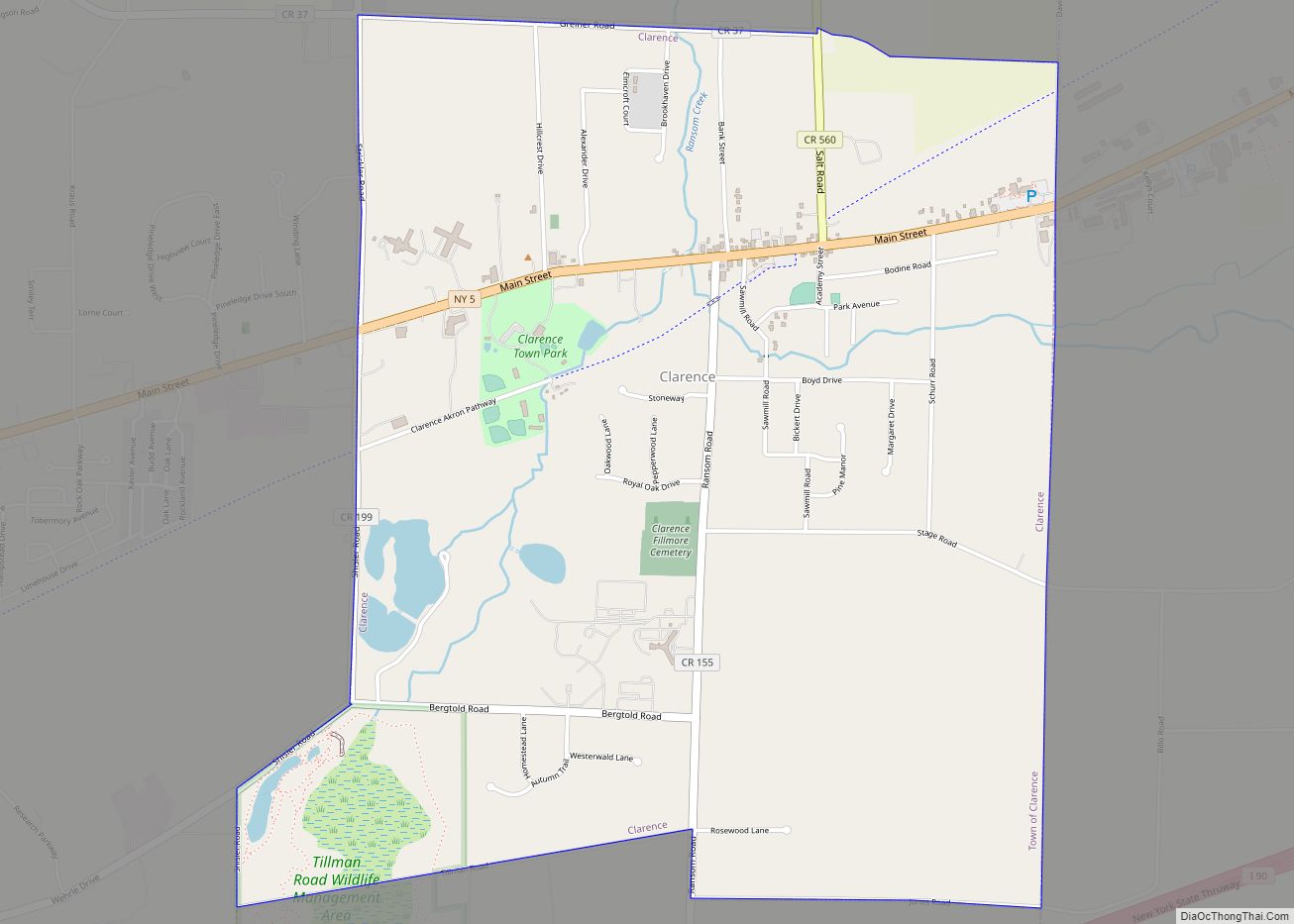
Online Interactive Map
Click on ![]() to view map in "full screen" mode.
to view map in "full screen" mode.
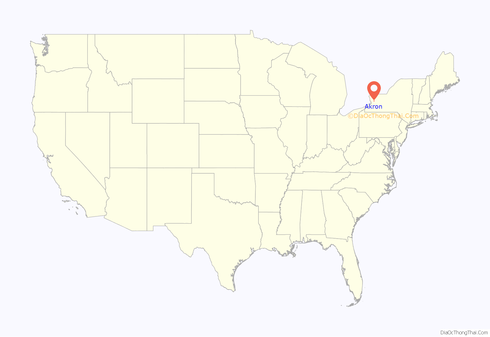
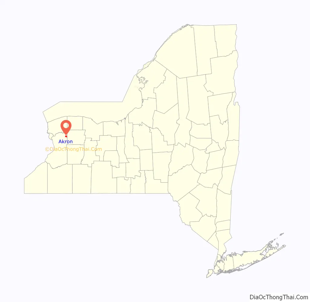
Akron location map. Where is Akron village?
History
The village was developed after land was purchased from local Native Americans. The site of the village was first settled circa 1829, centered on Akron Falls, which provided water power. Akron became an incorporated village in 1849. The village absorbed the community of Fallkirk in its growth. In 1880, the population of Akron was about 1,050. It was then an important cement-producing center, due to local deposits of gypsum. Besides production of cement, the village also produced cigars.
Notable people
- Dick Beyer, former pro wrestler
- Marlow Cook (1926–2016), United States Senator, (R-KY)
- Robert J. Gamble, former U.S. Representative and United States Senator, (R-SD)
- Clark L. Hull, notable psychologist
- Gordon Klingenschmitt, American activist and former American military chaplain and one-term member of the Colorado state legislature
- Dennis E. Nolan, career U.S. Army officer and headed the first modern American military combat intelligence function
- Jack Owen, musician
- Bill Paxon, former U.S. congressman
- Thomas C. Perry, Mayor 1987-1991
- Darrin Pfeiffer, musician
- J. C. Tretter, professional football player
- Alex Webster, musician
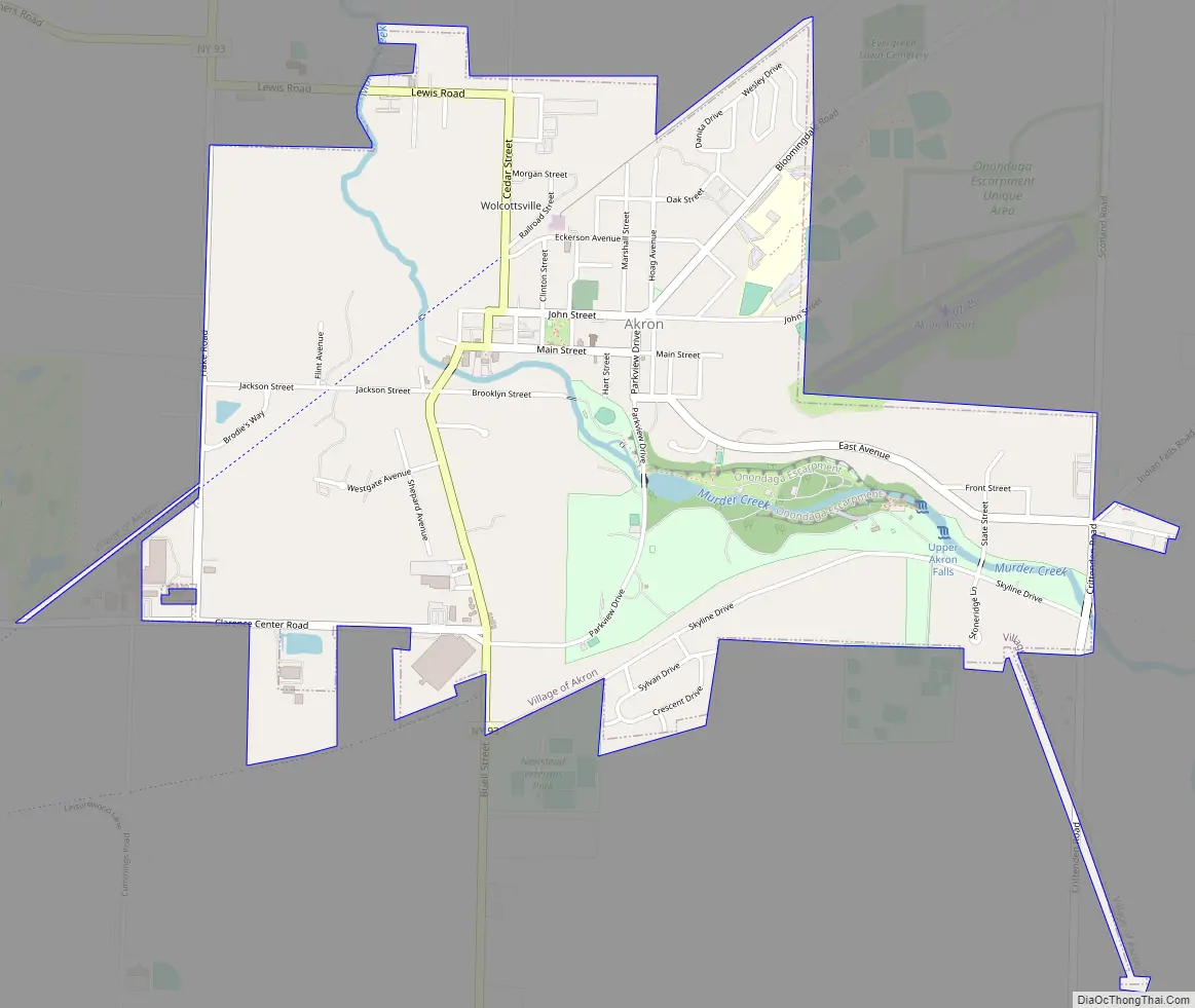
Akron Road Map
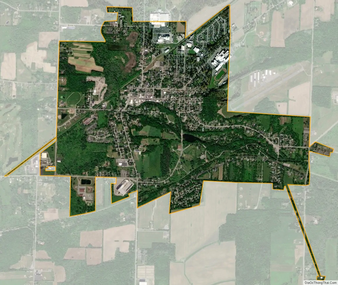
Akron city Satellite Map
Geography
Akron is located at 43°1′10″N 78°29′41″W / 43.01944°N 78.49472°W / 43.01944; -78.49472 (43.019309, -78.494644). The village is northeast of Buffalo.
According to the United States Census Bureau, the village has a total area of 2.0 square miles (5.2 km), all land.
Akron is adjacent to the Tonawanda Reservation of the Seneca, but most of the reservation is in Genesee County. A small general aviation airport, Akron Airport, is on high ground on the eastern side of the village. Much of Akron Falls County Park is within the village. The falls are a feature of Murder Creek, which passes through the park and the village flowing in a northwesterly direction.
See also
Map of New York State and its subdivision:- Albany
- Allegany
- Bronx
- Broome
- Cattaraugus
- Cayuga
- Chautauqua
- Chemung
- Chenango
- Clinton
- Columbia
- Cortland
- Delaware
- Dutchess
- Erie
- Essex
- Franklin
- Fulton
- Genesee
- Greene
- Hamilton
- Herkimer
- Jefferson
- Kings
- Lake Ontario
- Lewis
- Livingston
- Madison
- Monroe
- Montgomery
- Nassau
- New York
- Niagara
- Oneida
- Onondaga
- Ontario
- Orange
- Orleans
- Oswego
- Otsego
- Putnam
- Queens
- Rensselaer
- Richmond
- Rockland
- Saint Lawrence
- Saratoga
- Schenectady
- Schoharie
- Schuyler
- Seneca
- Steuben
- Suffolk
- Sullivan
- Tioga
- Tompkins
- Ulster
- Warren
- Washington
- Wayne
- Westchester
- Wyoming
- Yates
- Alabama
- Alaska
- Arizona
- Arkansas
- California
- Colorado
- Connecticut
- Delaware
- District of Columbia
- Florida
- Georgia
- Hawaii
- Idaho
- Illinois
- Indiana
- Iowa
- Kansas
- Kentucky
- Louisiana
- Maine
- Maryland
- Massachusetts
- Michigan
- Minnesota
- Mississippi
- Missouri
- Montana
- Nebraska
- Nevada
- New Hampshire
- New Jersey
- New Mexico
- New York
- North Carolina
- North Dakota
- Ohio
- Oklahoma
- Oregon
- Pennsylvania
- Rhode Island
- South Carolina
- South Dakota
- Tennessee
- Texas
- Utah
- Vermont
- Virginia
- Washington
- West Virginia
- Wisconsin
- Wyoming