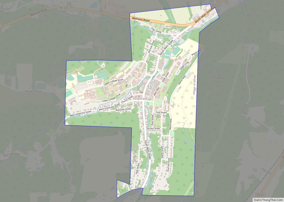
Alfred is a village located in the town of Alfred in Allegany County, New York, United States. The population was 4,174 at the 2010 census. The village lies in the north-central part of the town of Alfred on the eastern edge of Allegany County. It is named after Alfred the Great.
Alfred is located in the hills of western New York along the Southern Tier. The layout of the valley is such that the lowest part contains the village, and upon the hills to the east and west are Alfred University and Alfred State College, respectively. The valley was originally called Kanakadea (or Canakadea, or other spellings) by Native Americans. Local folklore states that Kanakadea means “where the earth meets the sky”.
Alfred is located in the 607 (telephone) area code, 14802 zip (postal) code, and is in the second poorest county in the state (Allegany). The closest cities are Hornell and Olean.
The elevation of Alfred is about 1,700 feet (520 m) but rises to a high point of 2,355 feet (718 m) at the summit of Jericho Hill just south of the village. The hills greatly affect the weather in the region, which results in quick changes as well as different conditions in neighboring valleys.
The village hosts the annual Hot Dog Day festival (early April).
The village is home to one of the largest optical telescopes in New York state, at the Stull Observatory at Alfred University. Alfred State College is also located in the village.
| Name: | Alfred village |
|---|---|
| LSAD Code: | 47 |
| LSAD Description: | village (suffix) |
| State: | New York |
| County: | Allegany County |
| Elevation: | 1,765 ft (538 m) |
| Total Area: | 1.19 sq mi (3.08 km²) |
| Land Area: | 1.19 sq mi (3.08 km²) |
| Water Area: | 0.00 sq mi (0.00 km²) |
| Total Population: | 4,026 |
| Population Density: | 3,383.19/sq mi (1,306.43/km²) |
| ZIP code: | 14802 |
| Area code: | 607 |
| FIPS code: | 3601198 |
| GNISfeature ID: | 0942313 |
| Website: | www.alfredny.org |
Online Interactive Map
Click on ![]() to view map in "full screen" mode.
to view map in "full screen" mode.
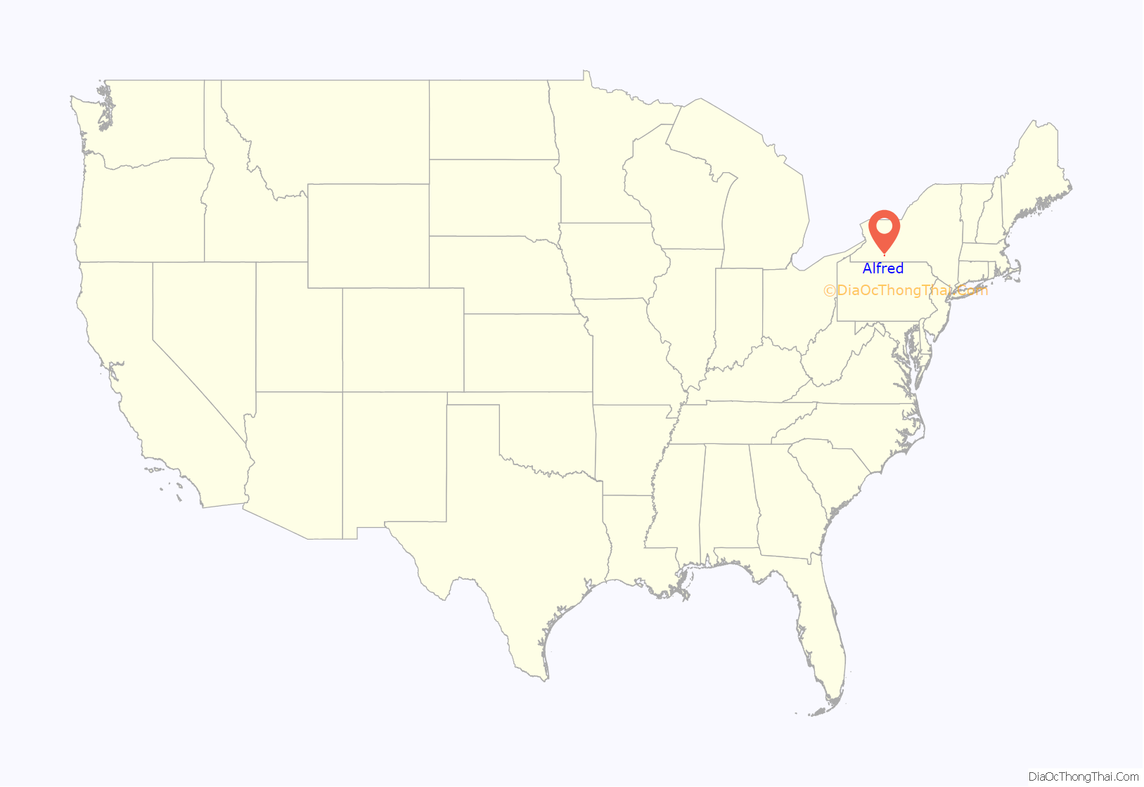
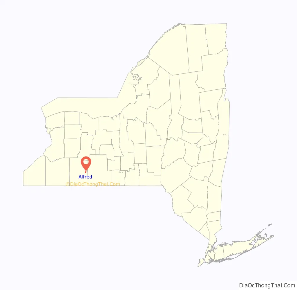
Alfred location map. Where is Alfred village?
History
The village was first settled circa 1807 and was incorporated in 1881. The village was previously called “Alfred Centre”.
The following are listed on the National Register of Historic Places: Alfred Village Historic District, Alumni Hall, Fireman’s Hall, Allen Steinheim Museum and the Terra Cotta Building.
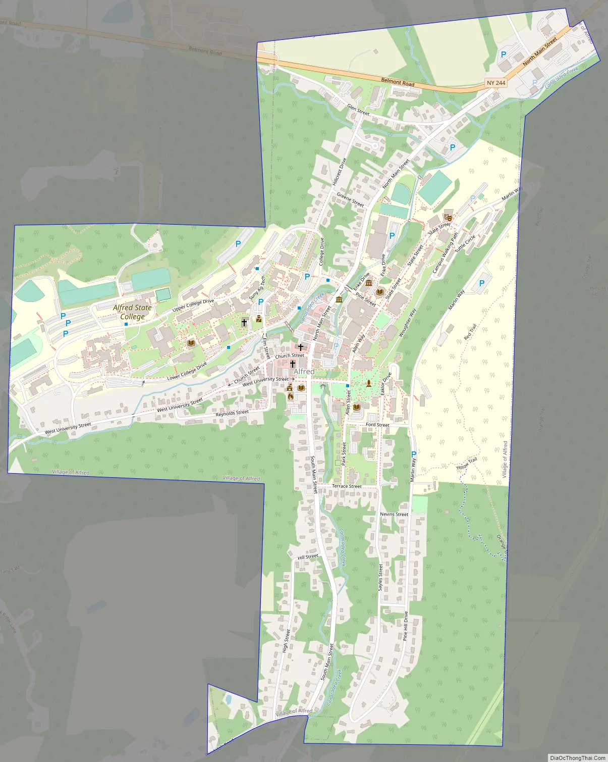
Alfred Road Map
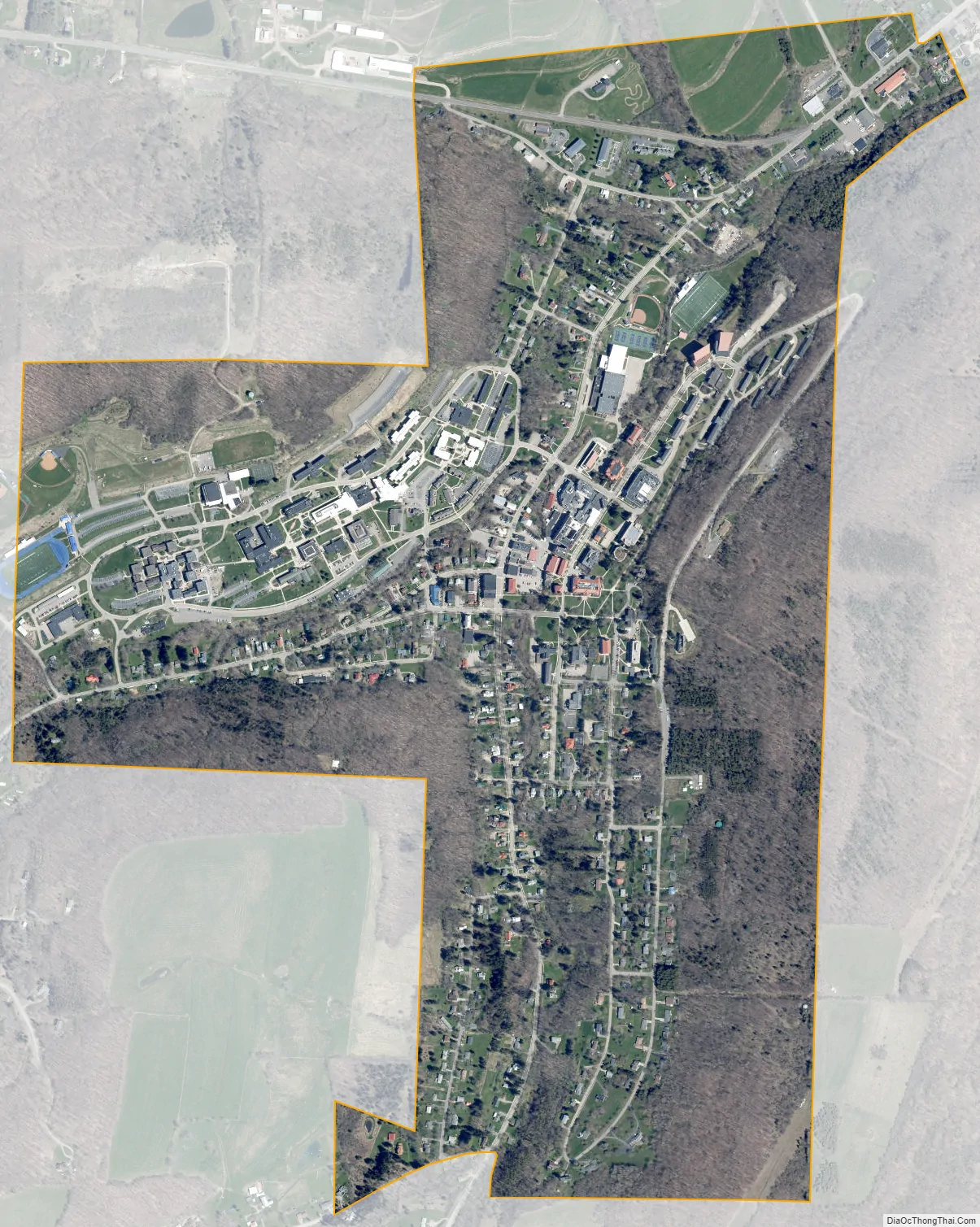
Alfred city Satellite Map
Geography
Alfred is approximately located at 42.3° north latitude, 77.8° west longitude.
According to the United States Census Bureau, the village has a total area of 1.2 square miles (3.1 km), all land. A small stream, Kanakadea Creek, flows through the center of the village, then to the Canisteo River, part of the Susquehanna River watershed. The topography is steep hill country, part of the Allegheny Plateau, a physiographic region that is part of the Appalachian Mountains.
See also
Map of New York State and its subdivision:- Albany
- Allegany
- Bronx
- Broome
- Cattaraugus
- Cayuga
- Chautauqua
- Chemung
- Chenango
- Clinton
- Columbia
- Cortland
- Delaware
- Dutchess
- Erie
- Essex
- Franklin
- Fulton
- Genesee
- Greene
- Hamilton
- Herkimer
- Jefferson
- Kings
- Lake Ontario
- Lewis
- Livingston
- Madison
- Monroe
- Montgomery
- Nassau
- New York
- Niagara
- Oneida
- Onondaga
- Ontario
- Orange
- Orleans
- Oswego
- Otsego
- Putnam
- Queens
- Rensselaer
- Richmond
- Rockland
- Saint Lawrence
- Saratoga
- Schenectady
- Schoharie
- Schuyler
- Seneca
- Steuben
- Suffolk
- Sullivan
- Tioga
- Tompkins
- Ulster
- Warren
- Washington
- Wayne
- Westchester
- Wyoming
- Yates
- Alabama
- Alaska
- Arizona
- Arkansas
- California
- Colorado
- Connecticut
- Delaware
- District of Columbia
- Florida
- Georgia
- Hawaii
- Idaho
- Illinois
- Indiana
- Iowa
- Kansas
- Kentucky
- Louisiana
- Maine
- Maryland
- Massachusetts
- Michigan
- Minnesota
- Mississippi
- Missouri
- Montana
- Nebraska
- Nevada
- New Hampshire
- New Jersey
- New Mexico
- New York
- North Carolina
- North Dakota
- Ohio
- Oklahoma
- Oregon
- Pennsylvania
- Rhode Island
- South Carolina
- South Dakota
- Tennessee
- Texas
- Utah
- Vermont
- Virginia
- Washington
- West Virginia
- Wisconsin
- Wyoming