Amagansett /ˌæməˈɡænsət/ is a census-designated place that roughly corresponds to the hamlet by the same name in the Town of East Hampton in Suffolk County, New York, United States, on the South Shore of Long Island. As of the 2010 United States Census, the CDP population was 1,165. Amagansett hamlet was founded in 1680.
| Name: | Amagansett CDP |
|---|---|
| LSAD Code: | 57 |
| LSAD Description: | CDP (suffix) |
| State: | New York |
| County: | Suffolk County |
| Elevation: | 30 ft (9 m) |
| Total Area: | 9.65 sq mi (24.98 km²) |
| Land Area: | 6.59 sq mi (17.06 km²) |
| Water Area: | 3.06 sq mi (7.92 km²) |
| Total Population: | 1,824 |
| Population Density: | 276.87/sq mi (106.90/km²) |
| ZIP code: | 11930 |
| Area code: | 631 |
| FIPS code: | 3601594 |
| GNISfeature ID: | 0942409 |
Online Interactive Map
Click on ![]() to view map in "full screen" mode.
to view map in "full screen" mode.
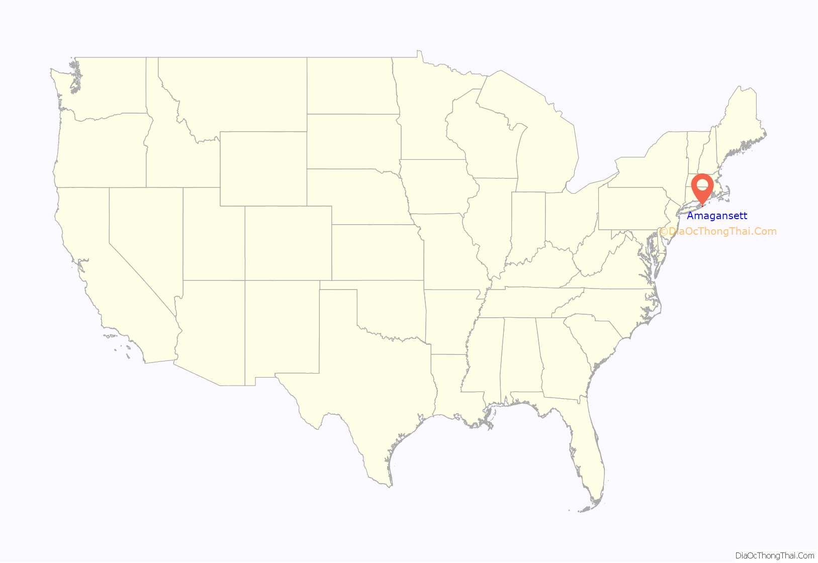
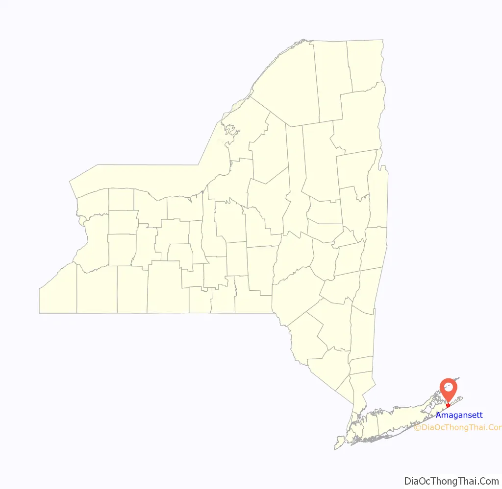
Amagansett location map. Where is Amagansett CDP?
History
Amagansett derives its name from the Montaukett name for “place of good water” from a water source near what today is Indian Wells beach.
Unlike the rest of the Hamptons, Amagansett was initially settled by the Baker, Conklin, and Barnes families, descendants of English settlers, and the Dutch brothers Abraham and Jacob Schellinger, the sons of a New Amsterdam merchant who moved to East Hampton between 1680 and 1690 after the English took over New Amsterdam.
During Operation Pastorius, a failed Nazi attack on the United States staged in June 1942, during World War II, four German spies were dropped off from a submarine on Atlantic Avenue beach in Amagansett, where they made their way to the village’s Long Island Rail Road station and boarded a train for New York. A Coast Guardsman assigned to watch the beach noticed the suspicious strangers on the beach and notified the police and the FBI.
In the spring of 2007 the original Coast Guard station, which had been moved to a private residence in 1966 to protect it from demolition, was moved back to near its original location at Atlantic Avenue beach. The Coast Guard barracks are now part of the East Hampton Town Marine Museum which includes exhibits from the town maritime history, including whaling relics and a cannon from the American Revolution ship HMS Culloden which ran aground at Montauk.
In 1998 President Bill Clinton, who was vacationing in East Hampton, gave a Saturday radio address from the Amagansett Fire House.
Amagansett includes a section of Further Lane, which is a block from the ocean, and has one of the biggest collections of mansions in East Hampton. In 2007, one of the estates sold for $107 million, the highest price for a private residential property.
As part of the settlement, several 18th and 19th century buildings which had been moved to the estate to prevent demolition were moved elsewhere in the town—including five that were moved to form a campus for the East Hampton town government.
“Amagansett”, a pictorial history of the hamlet, was published in 1997 by Carleton Kelsey, longtime director of the Amagansett Free Library and former town clerk, and Lucinda Mayo, descendant of one of Amagansett’s 17th century founders.
Many houses and other buildings still stand from the 19th and even 18th century in Amagansett, Montauk, the Hamptons and other Long Island communities.
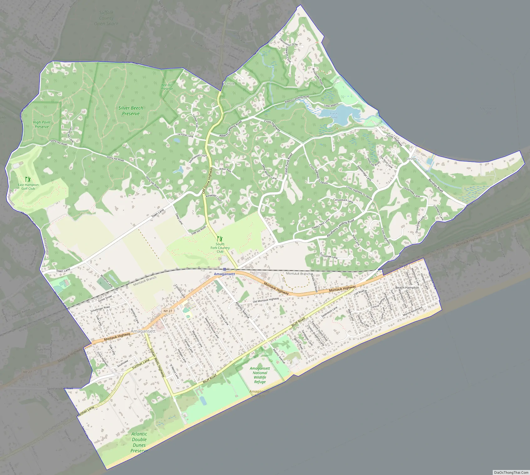
Amagansett Road Map
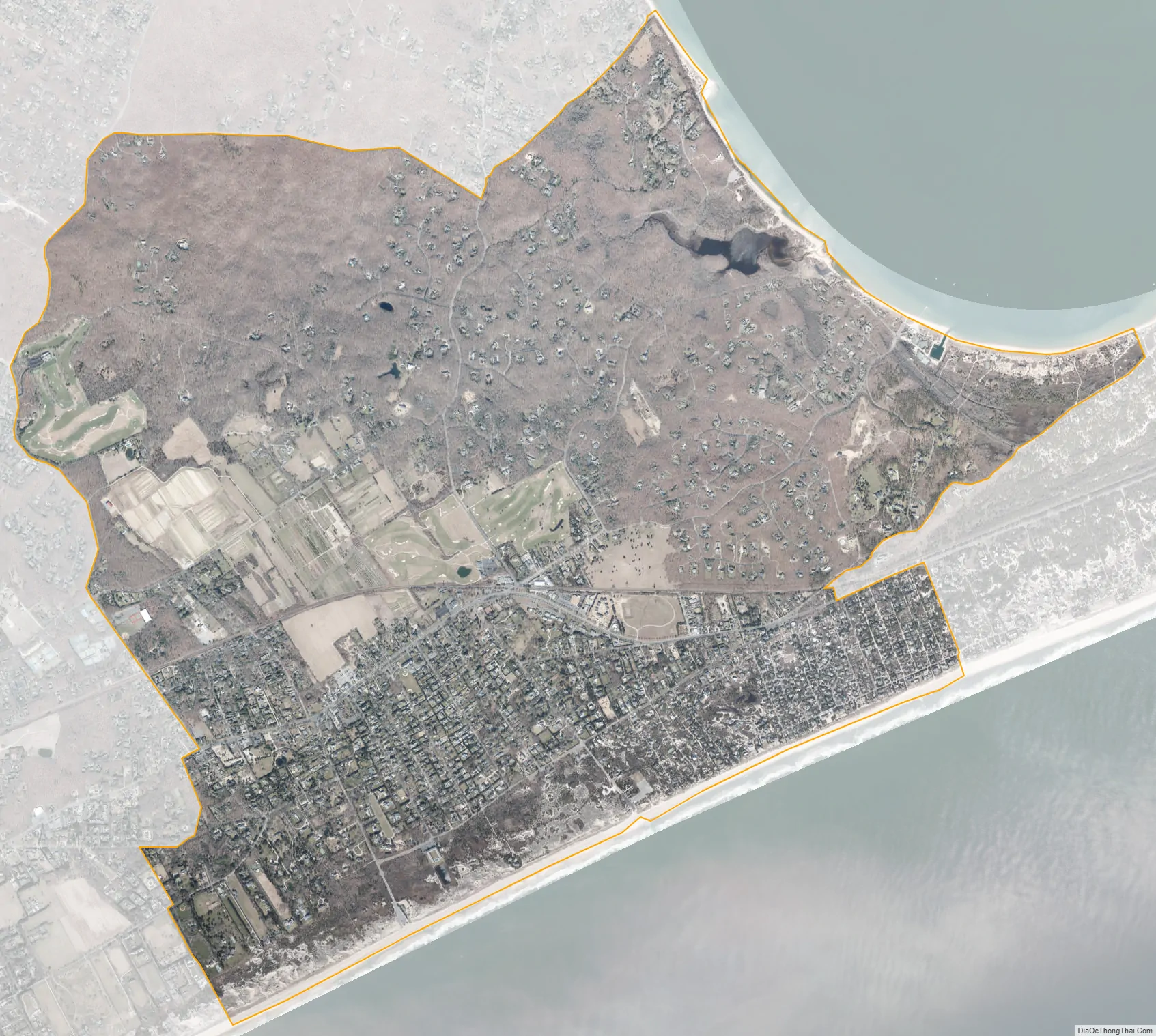
Amagansett city Satellite Map
Geography
According to the United States Census Bureau, the CDP has a total area of 6.6 square miles (17.0 km), of which 6.5 square miles (16.9 km) is land and 0.039 square miles (0.1 km), or 0.37%, is water.
At the end of the last ice age, Amagansett stood at the eastern tip of Long Island. At that time, Montauk was an island on its own in the Atlantic. In the intervening several thousand years, ocean currents, or littoral drift, filled in space with sand. This area is now known as Napeague.
Distinct places within Amagansett include Amagansett village, Beach Hampton, and the Devon Colony on Gardiner’s Bay. Other places of geographic significance include the “Walking Dunes” in Napeague and the Atlantic Double Dunes, which are protected by The Nature Conservancy and local and federal governments.
See also
Map of New York State and its subdivision:- Albany
- Allegany
- Bronx
- Broome
- Cattaraugus
- Cayuga
- Chautauqua
- Chemung
- Chenango
- Clinton
- Columbia
- Cortland
- Delaware
- Dutchess
- Erie
- Essex
- Franklin
- Fulton
- Genesee
- Greene
- Hamilton
- Herkimer
- Jefferson
- Kings
- Lake Ontario
- Lewis
- Livingston
- Madison
- Monroe
- Montgomery
- Nassau
- New York
- Niagara
- Oneida
- Onondaga
- Ontario
- Orange
- Orleans
- Oswego
- Otsego
- Putnam
- Queens
- Rensselaer
- Richmond
- Rockland
- Saint Lawrence
- Saratoga
- Schenectady
- Schoharie
- Schuyler
- Seneca
- Steuben
- Suffolk
- Sullivan
- Tioga
- Tompkins
- Ulster
- Warren
- Washington
- Wayne
- Westchester
- Wyoming
- Yates
- Alabama
- Alaska
- Arizona
- Arkansas
- California
- Colorado
- Connecticut
- Delaware
- District of Columbia
- Florida
- Georgia
- Hawaii
- Idaho
- Illinois
- Indiana
- Iowa
- Kansas
- Kentucky
- Louisiana
- Maine
- Maryland
- Massachusetts
- Michigan
- Minnesota
- Mississippi
- Missouri
- Montana
- Nebraska
- Nevada
- New Hampshire
- New Jersey
- New Mexico
- New York
- North Carolina
- North Dakota
- Ohio
- Oklahoma
- Oregon
- Pennsylvania
- Rhode Island
- South Carolina
- South Dakota
- Tennessee
- Texas
- Utah
- Vermont
- Virginia
- Washington
- West Virginia
- Wisconsin
- Wyoming


