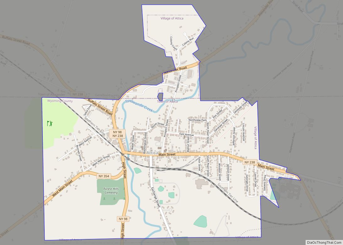
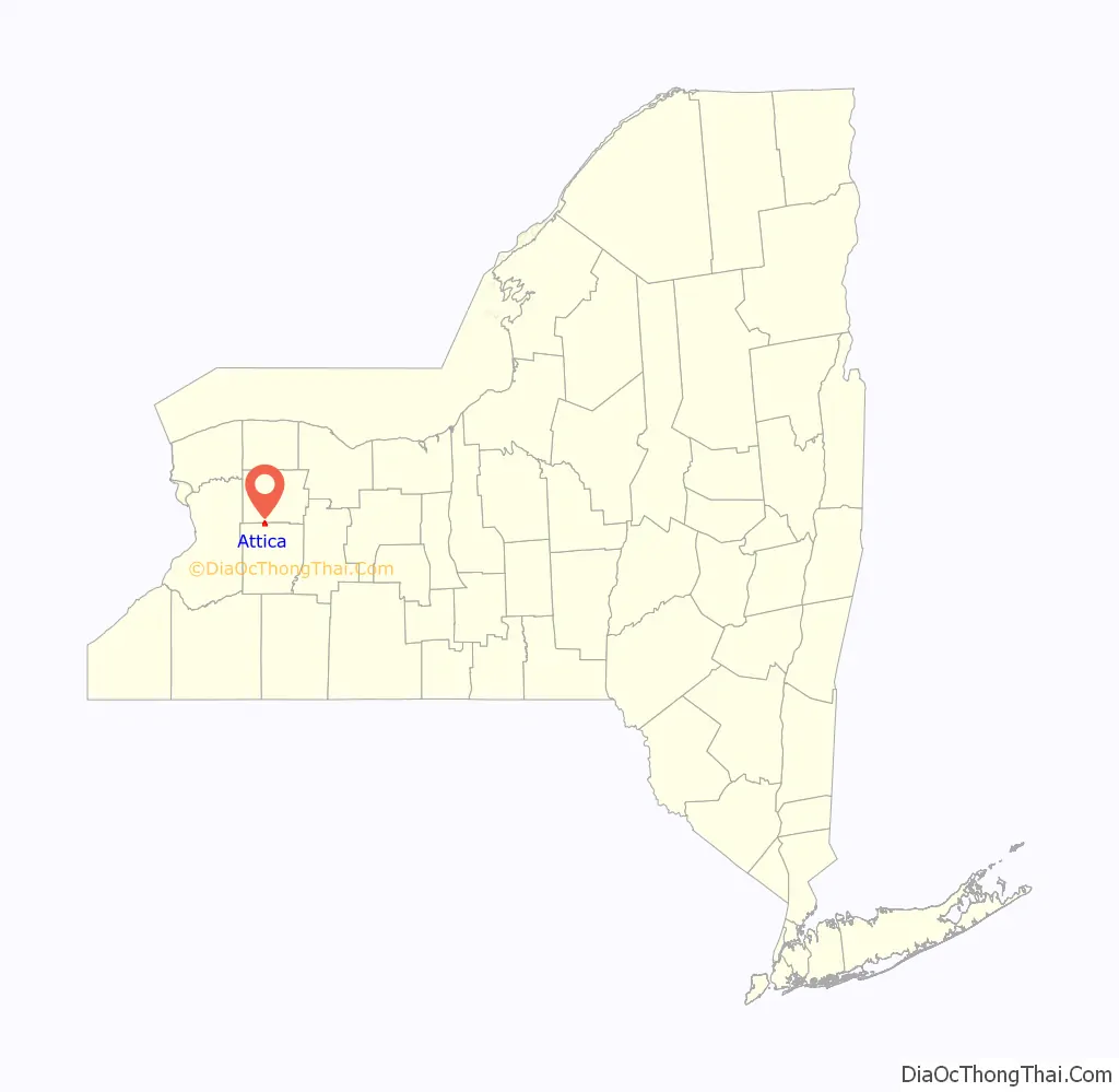
Attica is a village in Wyoming and Genesee counties, New York, United States. The population was 2,547 at the 2010 census.
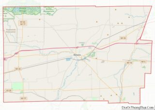
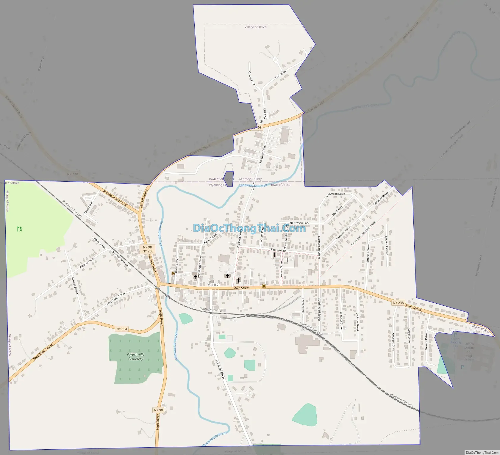
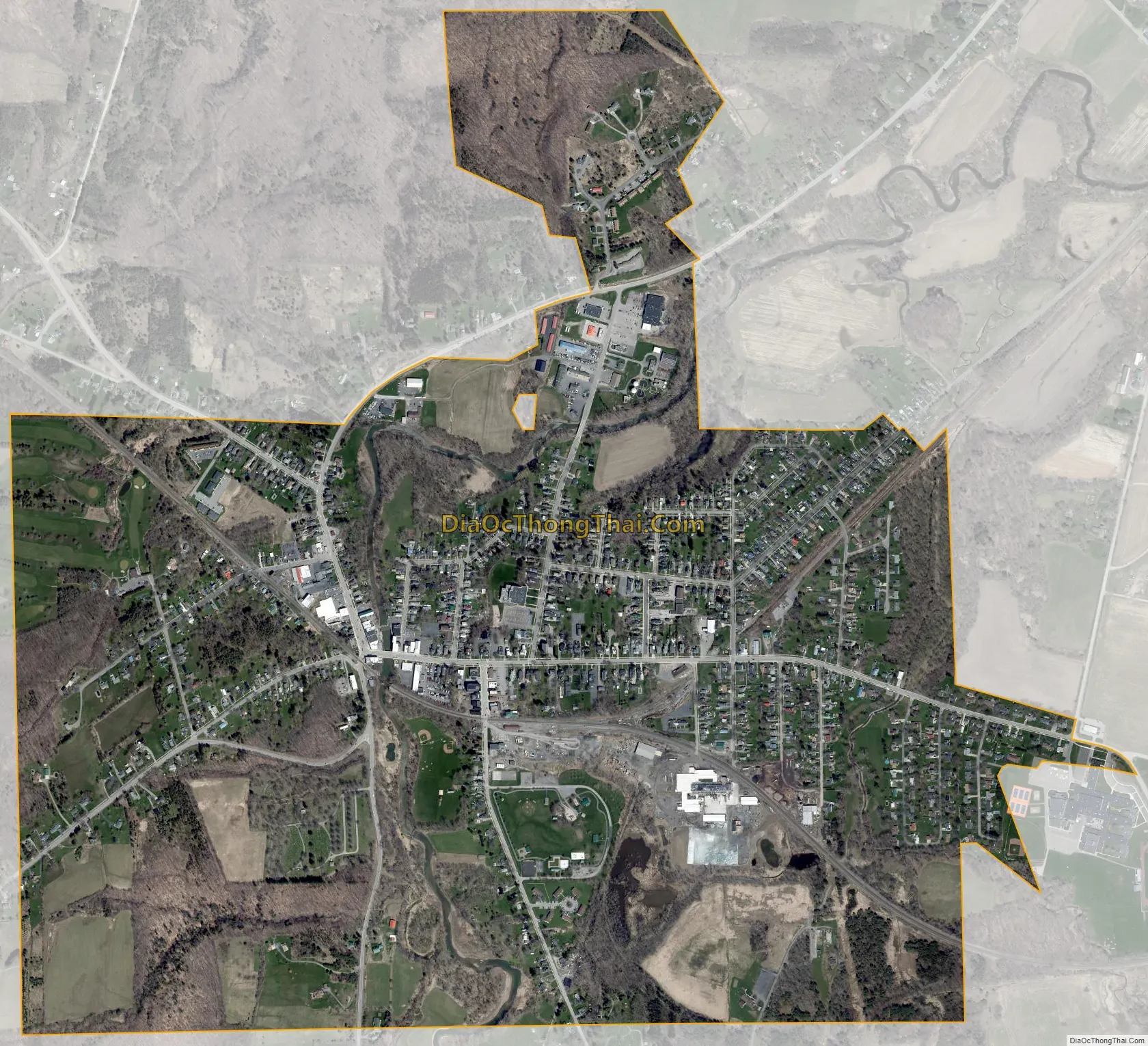
The village is on the northern border of Wyoming County. The village lies mostly within the town of Attica, but the northern part of the village is within the adjacent town of Alexander in Genesee County.
| Name: | Attica village |
|---|---|
| LSAD Code: | 47 |
| LSAD Description: | village (suffix) |
| State: | New York |
| County: | Genesee County, Wyoming County |
| Incorporated: | May 2, 1837 (1837-05-02) |
| Elevation: | 981 ft (299 m) |
| Total Area: | 1.69 sq mi (4.38 km²) |
| Land Area: | 1.69 sq mi (4.38 km²) |
| Water Area: | 0.00 sq mi (0.00 km²) |
| Total Population: | 2,450 |
| Population Density: | 1,448.85/sq mi (559.40/km²) |
| ZIP code: | 14011 |
| Area code: | 585 |
| FIPS code: | 3603001 |
| GNISfeature ID: | 0942677 |
| Website: | www.attica.org |
Online Interactive Map
Click on ![]() to view map in "full screen" mode.
to view map in "full screen" mode.
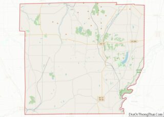
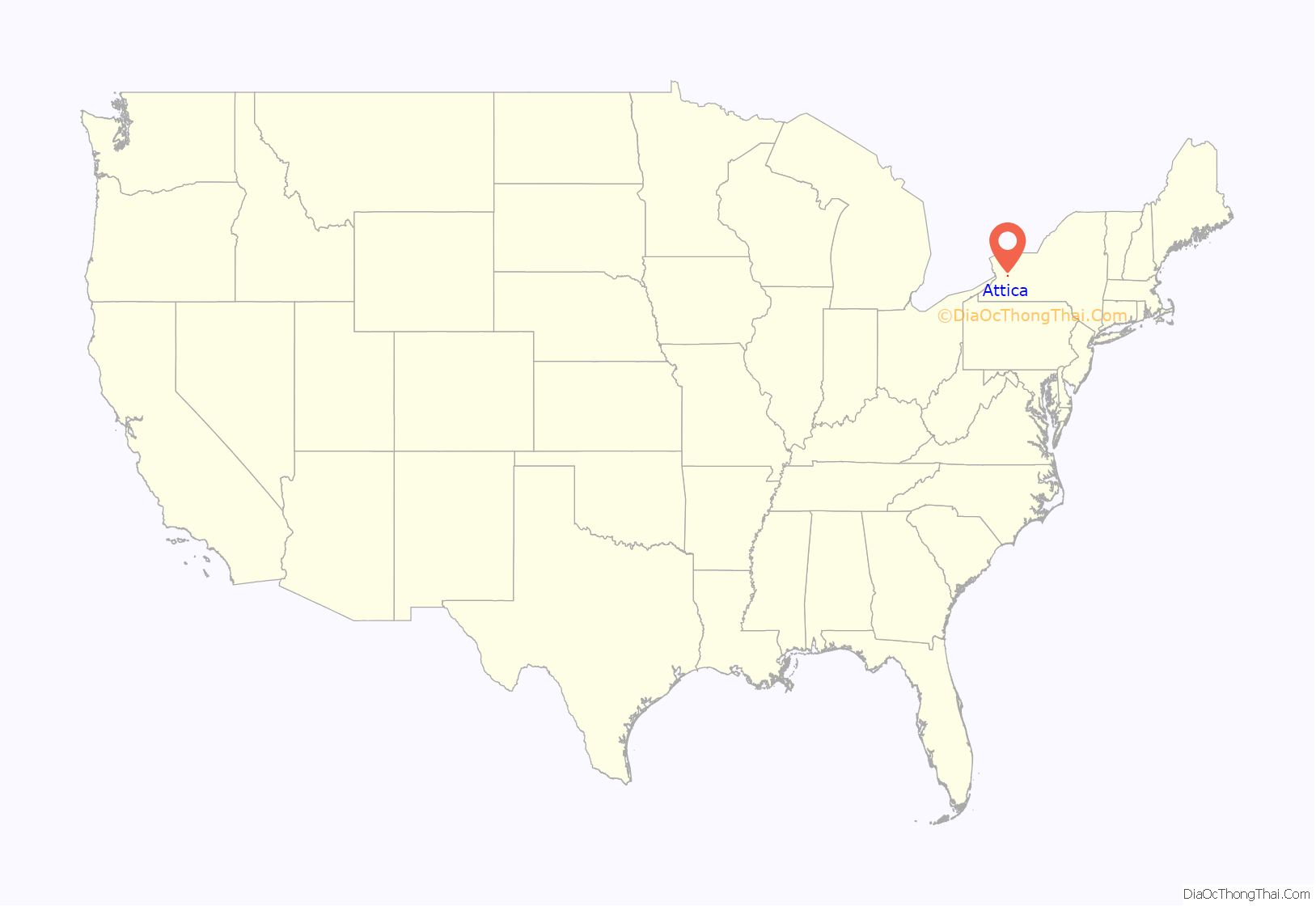
Attica location map. Where is Attica village?
History
In 1802, Zerah Phelps became the first European-American landowner in the Attica area, which had for centuries been part of territory of the Seneca Nation, one of the Five Nations of the Iroquois Confederacy. As allies of the British, they were mostly forced out of New York after the American Revolution, when the Crown ceded control of its territory to the new United States.
He built and owned a gristmill, and was also the first business owner in Attica. By 1810 the settlement had grown into a town., Malaria and plague drove the settlers to higher ground. During the War of 1812, many people fled to this area from Buffalo, which was vulnerable to British attack from the Great Lakes.
In 1837, Phelps’ Settlement was incorporated, becoming the village of Attica. The village is named after a region in Greece.
In 1854, Dr. Orin Davis established a health institute to which people from around the country traveled for treatment.
In 1883, Eugene Norton created what became known as the Pineapple Cheese Factory. In 1918 the company’s molds and patents were sold to the Kraft Cheese Company. The Stevens family has bred and raised thoroughbred livestock. One of their horses took first prize at the World’s Fair. Agriculture remains an important element of community culture and economy.
As New York State began to expand its penal system, a group of citizens worked to get a state prison in the town of Attica, as employment opportunities were limited in the rural area. In March 1929, roughly 700 acres (2.8 km) south of the village were acquired for the prison, and construction began in October. After two years the first inmates were transferred to Attica.
Attica Road Map
Attica city Satellite Map
Geography
The village of Attica is located in the northern part of the town of Attica in Wyoming County at 42°51′54″N 78°16′37″W / 42.86500°N 78.27694°W / 42.86500; -78.27694 (42.865138, -78.276885). The village limits extend north into the town of Alexander in Genesee County. According to the United States Census Bureau, the village has a total area of 1.7 square miles (4.4 km), all land.
Tonawanda Creek, a tributary of the Niagara River, flows northward through the center of the village. New York State Route 98 passes through the village along the west side of Tonawanda Creek, leading north 11 miles (18 km) to Batavia and south 27 miles (43 km) to Arcade. New York State Route 238 (Main Street) passes through the center of Attica, leading southeast 13 miles (21 km) to Warsaw and northwest 4 miles (6 km) to U.S. Route 20 in Darien. New York State Route 354 (West Main Street) leads west from Attica 33 miles (53 km) to Buffalo.
Climate
The warmest temperatures in Attica typically occur in July and August. The highest temperature recorded near Attica is 103 °F in July 1936. The lowest ever recorded was -28 °F in February 1934. Snowfall is typically from November through March. The highest recorded snowfall amount is 23 inches in January 1966. In December 2012, the area experienced heavy snowfall as part of the late December 2012 North American storm complex. During this time, approximately 15 to 17 inches of snow was dropped in record time.
See also
Map of New York State and its subdivision:- Albany
- Allegany
- Bronx
- Broome
- Cattaraugus
- Cayuga
- Chautauqua
- Chemung
- Chenango
- Clinton
- Columbia
- Cortland
- Delaware
- Dutchess
- Erie
- Essex
- Franklin
- Fulton
- Genesee
- Greene
- Hamilton
- Herkimer
- Jefferson
- Kings
- Lake Ontario
- Lewis
- Livingston
- Madison
- Monroe
- Montgomery
- Nassau
- New York
- Niagara
- Oneida
- Onondaga
- Ontario
- Orange
- Orleans
- Oswego
- Otsego
- Putnam
- Queens
- Rensselaer
- Richmond
- Rockland
- Saint Lawrence
- Saratoga
- Schenectady
- Schoharie
- Schuyler
- Seneca
- Steuben
- Suffolk
- Sullivan
- Tioga
- Tompkins
- Ulster
- Warren
- Washington
- Wayne
- Westchester
- Wyoming
- Yates
- Alabama
- Alaska
- Arizona
- Arkansas
- California
- Colorado
- Connecticut
- Delaware
- District of Columbia
- Florida
- Georgia
- Hawaii
- Idaho
- Illinois
- Indiana
- Iowa
- Kansas
- Kentucky
- Louisiana
- Maine
- Maryland
- Massachusetts
- Michigan
- Minnesota
- Mississippi
- Missouri
- Montana
- Nebraska
- Nevada
- New Hampshire
- New Jersey
- New Mexico
- New York
- North Carolina
- North Dakota
- Ohio
- Oklahoma
- Oregon
- Pennsylvania
- Rhode Island
- South Carolina
- South Dakota
- Tennessee
- Texas
- Utah
- Vermont
- Virginia
- Washington
- West Virginia
- Wisconsin
- Wyoming