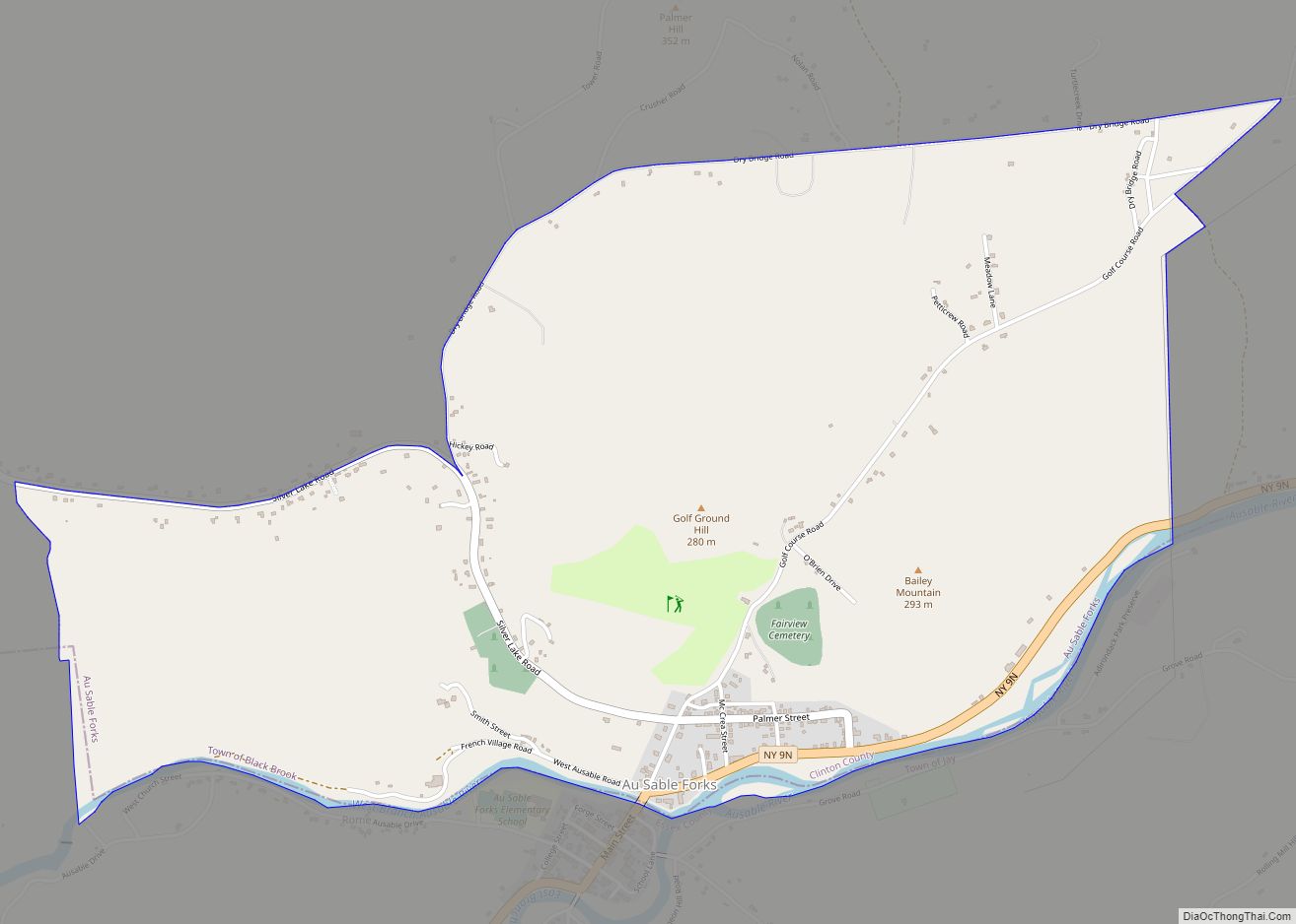
Au Sable Forks is a hamlet in Clinton County and Essex County, New York, United States. The northern half of the community, within Clinton County, is listed as the Au Sable Forks census-designated place (CDP) and had a population of 559 at the 2010 census.
| Name: | Au Sable Forks CDP |
|---|---|
| LSAD Code: | 57 |
| LSAD Description: | CDP (suffix) |
| State: | New York |
| County: | Clinton County |
| Elevation: | 551 ft (168 m) |
| Total Area: | 2.52 sq mi (6.54 km²) |
| Land Area: | 2.48 sq mi (6.42 km²) |
| Water Area: | 0.05 sq mi (0.12 km²) |
| Total Population: | 509 |
| Population Density: | 205.41/sq mi (79.31/km²) |
| ZIP code: | 12912 |
| Area code: | 518 |
| FIPS code: | 3603254 |
| GNISfeature ID: | 0979665 |
Online Interactive Map
Click on ![]() to view map in "full screen" mode.
to view map in "full screen" mode.
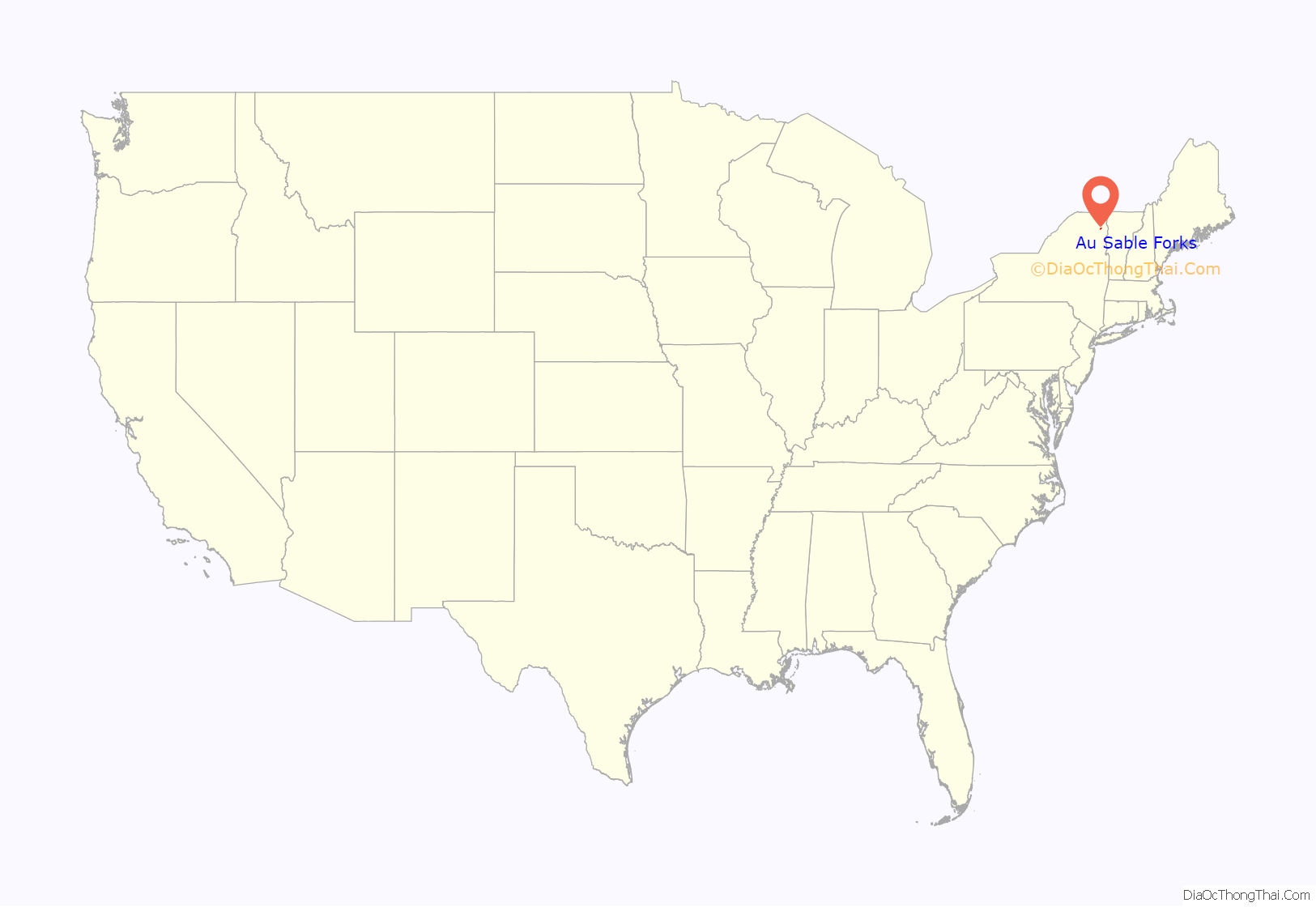
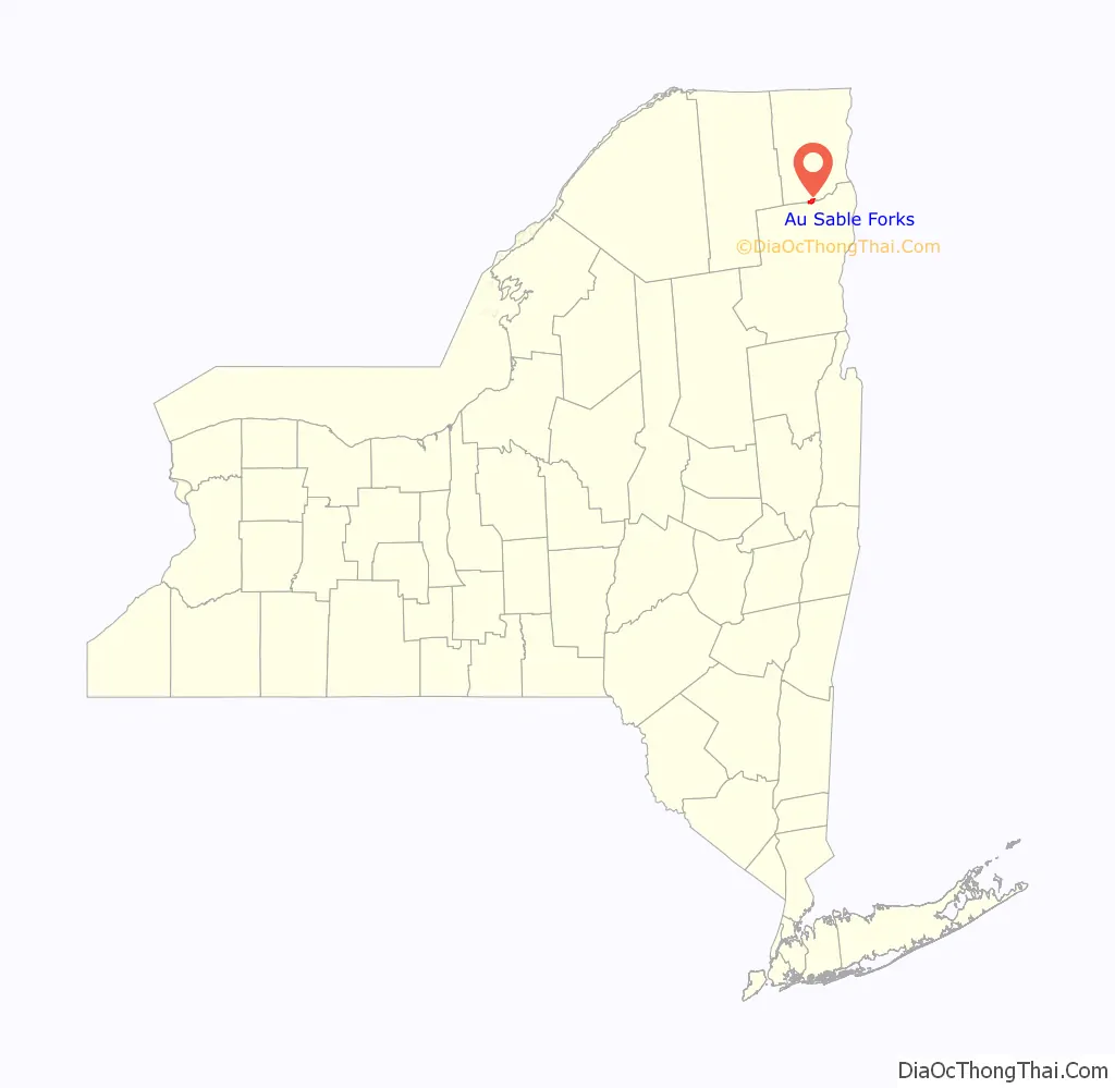
Au Sable Forks location map. Where is Au Sable Forks CDP?
Au Sable Forks Road Map
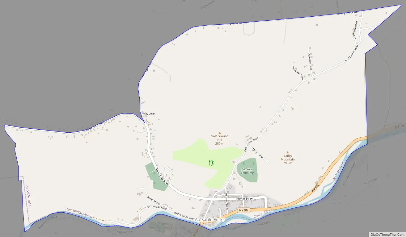
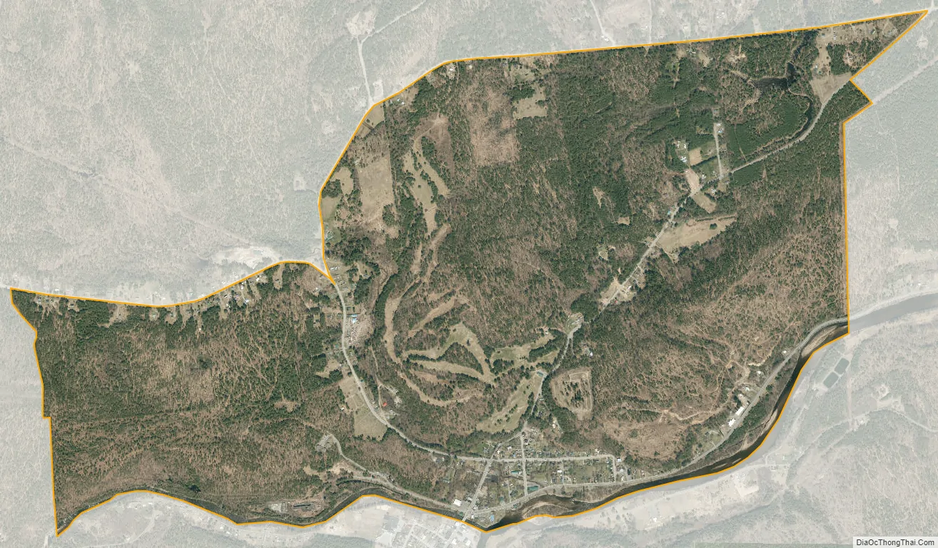
Au Sable Forks city Satellite Map
Geography
Au Sable Forks is located on the border of Clinton and Essex counties at 44°26′39″N 73°40′34″W / 44.44417°N 73.67611°W / 44.44417; -73.67611 (44.444063, −73.676013), centered on the point where the West Branch and the East Branch of the Au Sable River join to form the main confluence which flows into Au Sable Chasm and thence, into Lake Champlain.
According to the United States Census Bureau, the CDP portion of Au Sable Forks has a total area of 2.5 square miles (6.6 km), of which 0.02 square miles (0.06 km), or 0.89%, is water.
New York State Route 9N passes through the center of the community, leading 11 miles (18 km) northeast (downstream) to Keeseville and 6 miles (10 km) southwest (upstream on the East Branch) to Jay. Plattsburgh is 28 miles (45 km) to the northeast via NY-9N and Interstate 87.
The climate of Au Sable Forks is temperate, with it being very cold in winter and fairly hot in summer. Au Sable Forks is known for its repetitive history of floods, with those of 1996 and 2011 causing grievous damage – these were 15 and 18 feet above flood stage respectively. Since the 2011 flood caused by Hurricane Irene, ice jams, once common, have become less frequent because of the alteration in hydrogeology caused by the flood, which was the most massive one recorded.
On April 20, 2002, a 5.0–5.3 Mw earthquake occurred north of the town. The shallow dip-slip shock had a maximum Mercalli intensity of VII (Very strong) and caused damage to roads, bridges, buildings, and chimneys.
See also
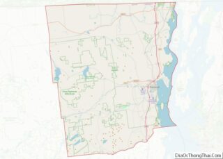
Map of New York State and its subdivision:- Albany
- Allegany
- Bronx
- Broome
- Cattaraugus
- Cayuga
- Chautauqua
- Chemung
- Chenango
- Clinton
- Columbia
- Cortland
- Delaware
- Dutchess
- Erie
- Essex
- Franklin
- Fulton
- Genesee
- Greene
- Hamilton
- Herkimer
- Jefferson
- Kings
- Lake Ontario
- Lewis
- Livingston
- Madison
- Monroe
- Montgomery
- Nassau
- New York
- Niagara
- Oneida
- Onondaga
- Ontario
- Orange
- Orleans
- Oswego
- Otsego
- Putnam
- Queens
- Rensselaer
- Richmond
- Rockland
- Saint Lawrence
- Saratoga
- Schenectady
- Schoharie
- Schuyler
- Seneca
- Steuben
- Suffolk
- Sullivan
- Tioga
- Tompkins
- Ulster
- Warren
- Washington
- Wayne
- Westchester
- Wyoming
- Yates
- Alabama
- Alaska
- Arizona
- Arkansas
- California
- Colorado
- Connecticut
- Delaware
- District of Columbia
- Florida
- Georgia
- Hawaii
- Idaho
- Illinois
- Indiana
- Iowa
- Kansas
- Kentucky
- Louisiana
- Maine
- Maryland
- Massachusetts
- Michigan
- Minnesota
- Mississippi
- Missouri
- Montana
- Nebraska
- Nevada
- New Hampshire
- New Jersey
- New Mexico
- New York
- North Carolina
- North Dakota
- Ohio
- Oklahoma
- Oregon
- Pennsylvania
- Rhode Island
- South Carolina
- South Dakota
- Tennessee
- Texas
- Utah
- Vermont
- Virginia
- Washington
- West Virginia
- Wisconsin
- Wyoming