Champlain is a village in Clinton County, New York, United States. The population was 1,101 at the 2010 census. The village is located in the town of Champlain, approximately 4 miles (6 km) west of Lake Champlain, and is north of Plattsburgh.
| Name: | Champlain village |
|---|---|
| LSAD Code: | 47 |
| LSAD Description: | village (suffix) |
| State: | New York |
| County: | Clinton County |
| Elevation: | 105 ft (32 m) |
| Total Area: | 1.49 sq mi (3.87 km²) |
| Land Area: | 1.46 sq mi (3.77 km²) |
| Water Area: | 0.04 sq mi (0.09 km²) |
| Total Population: | 1,170 |
| Population Density: | 803.02/sq mi (309.98/km²) |
| ZIP code: | 12919 |
| Area code: | 518 |
| FIPS code: | 3613739 |
| GNISfeature ID: | 0946361 |
| Website: | www.vchamplain.com |
Online Interactive Map
Click on ![]() to view map in "full screen" mode.
to view map in "full screen" mode.
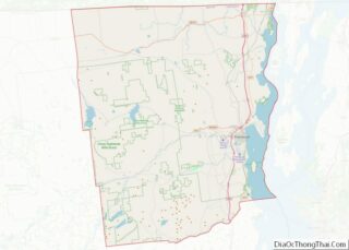
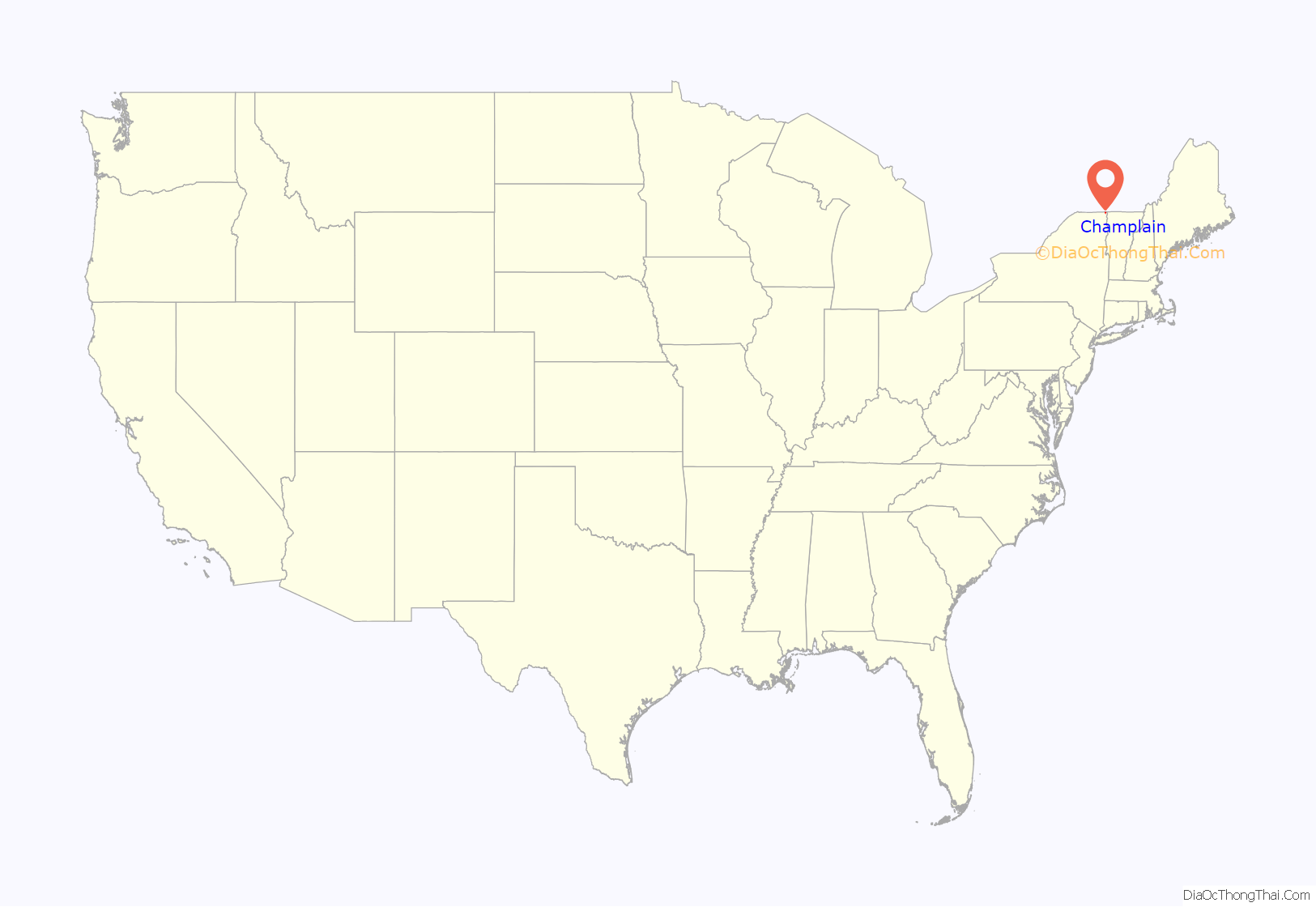
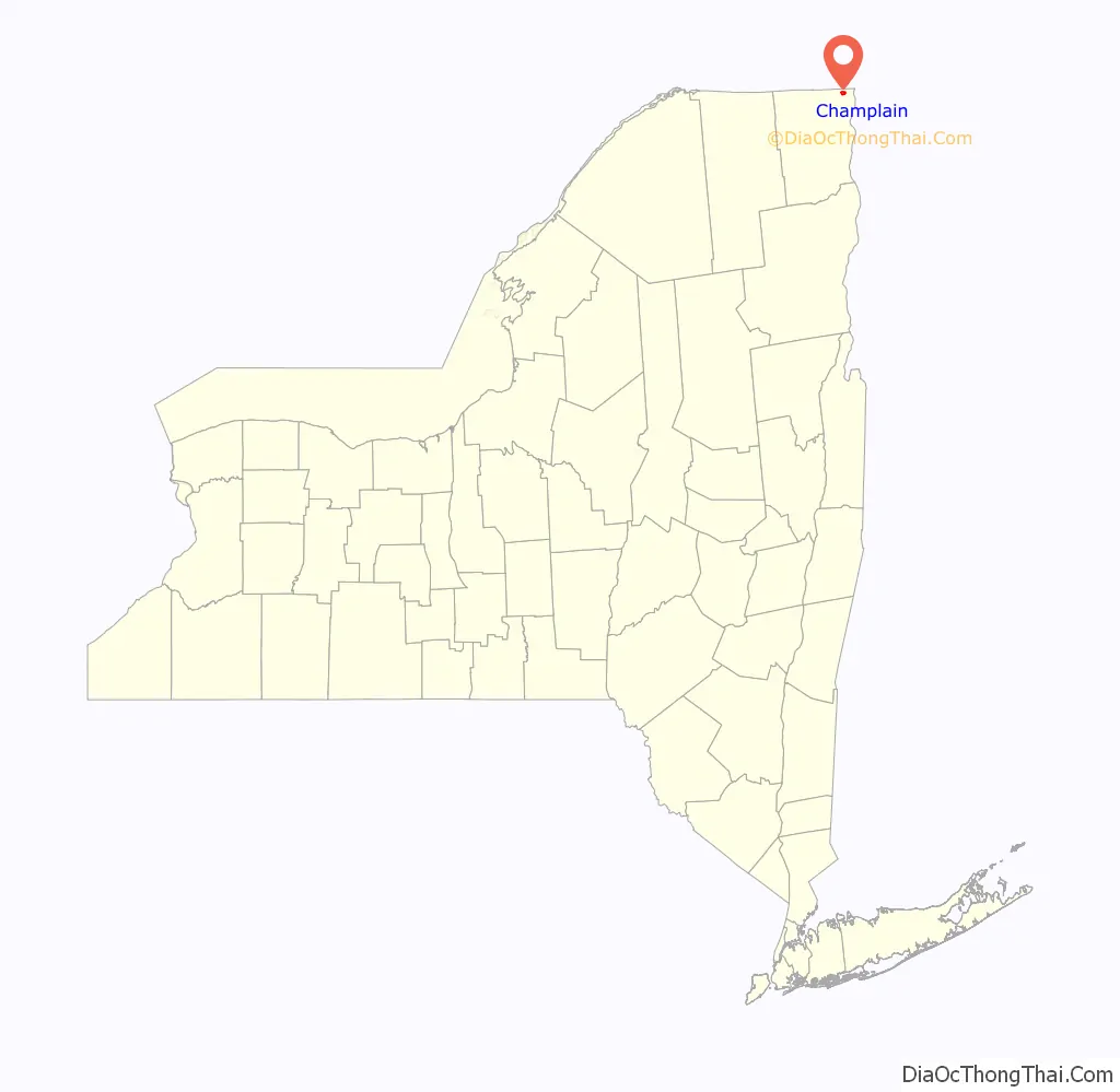
Champlain location map. Where is Champlain village?
History
The lake and the village were named in honor of Samuel de Champlain, who first surveyed the area in 1609. It was part of Canada until 1763, and became part of the United States in 1783.
Champlain was an important staging point in the War of 1812.
The village was incorporated in 1873.
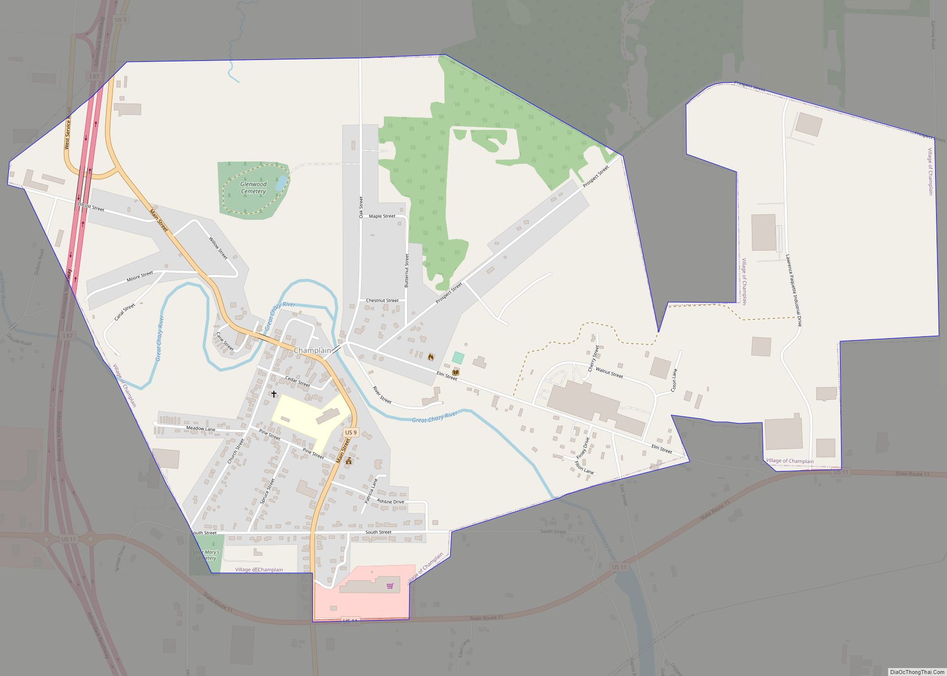
Champlain Road Map
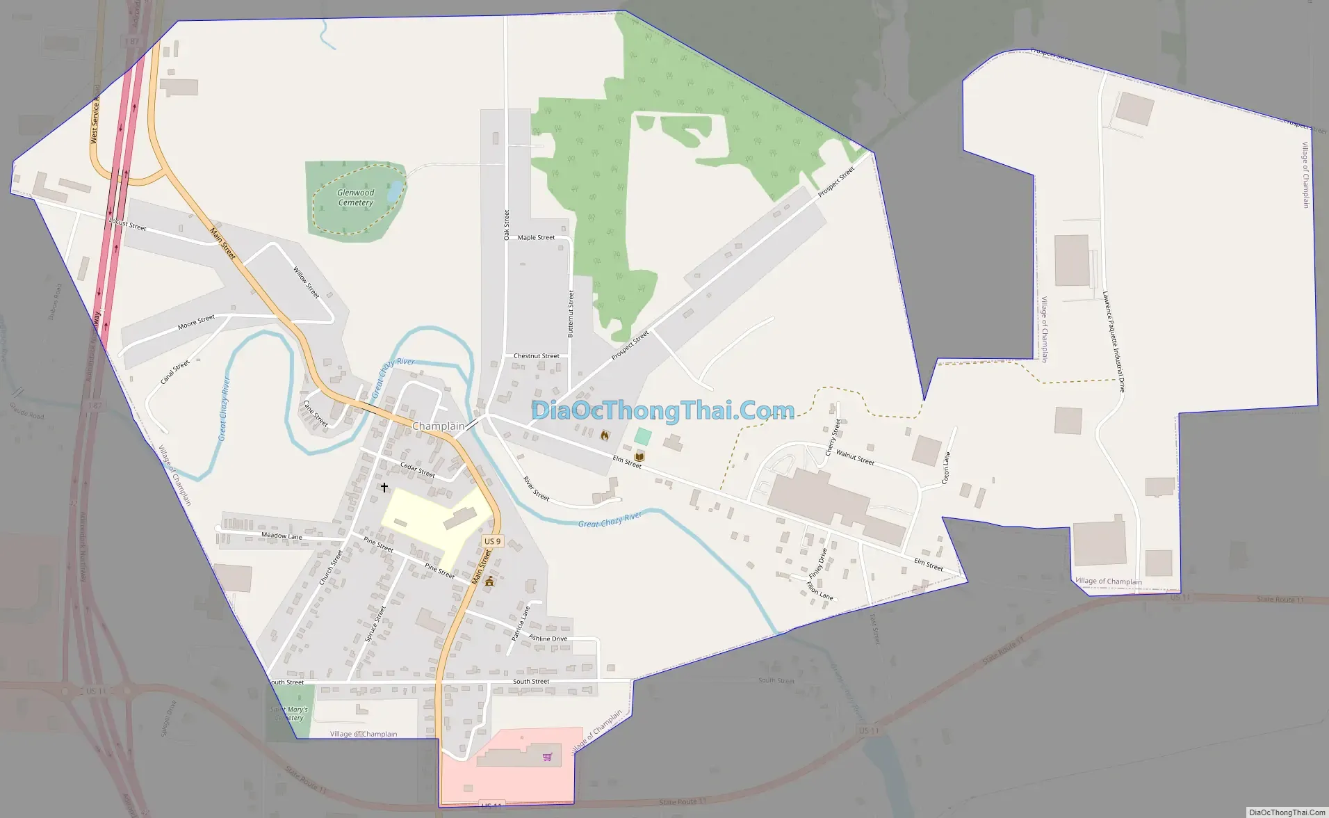
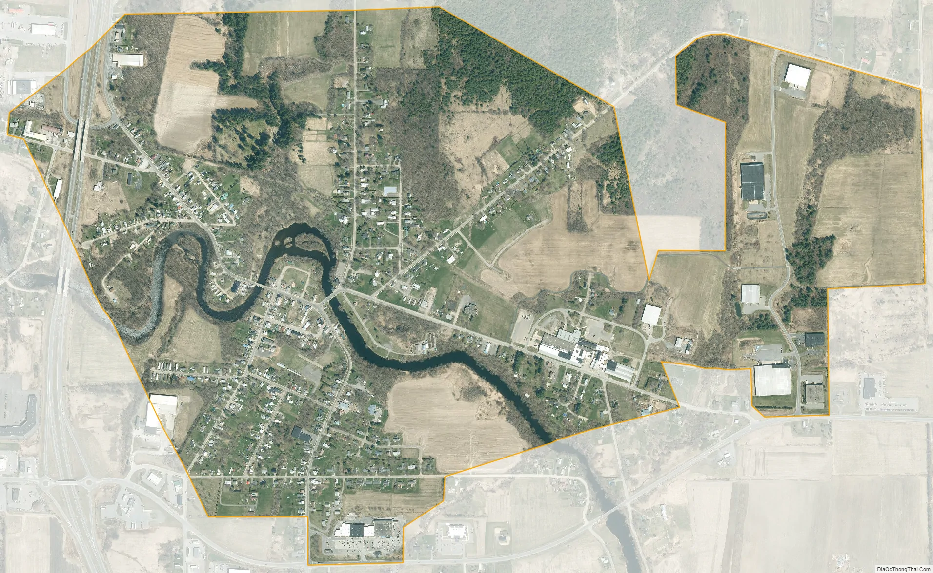
Champlain city Satellite Map
Geography
Champlain village is located in the north-central part of the town of Champlain at 44°59′12″N 73°26′47″W / 44.986678°N 73.446373°W / 44.986678; -73.446373 (44.986678, -73.446373). Interstate 87 (the Adirondack Northway) runs past the western side of the village, with access from exits 42 and 43. Montreal is 41 miles (66 km) to the north, and Plattsburgh is 22 miles (35 km) to the south. US 9 passes through the village and intersects US 11 south of the village. NY 276 intersects US-11 east of Champlain.
According to the United States Census Bureau, the village has a total area of 1.4 square miles (3.7 km), of which 1.4 square miles (3.6 km) is land and 0.04 square miles (0.1 km), or 2.71%, is water. The village is west of Lake Champlain and just south of the international border with Quebec. The Great Chazy River flows through the village to Lake Champlain.
See also
Map of New York State and its subdivision:- Albany
- Allegany
- Bronx
- Broome
- Cattaraugus
- Cayuga
- Chautauqua
- Chemung
- Chenango
- Clinton
- Columbia
- Cortland
- Delaware
- Dutchess
- Erie
- Essex
- Franklin
- Fulton
- Genesee
- Greene
- Hamilton
- Herkimer
- Jefferson
- Kings
- Lake Ontario
- Lewis
- Livingston
- Madison
- Monroe
- Montgomery
- Nassau
- New York
- Niagara
- Oneida
- Onondaga
- Ontario
- Orange
- Orleans
- Oswego
- Otsego
- Putnam
- Queens
- Rensselaer
- Richmond
- Rockland
- Saint Lawrence
- Saratoga
- Schenectady
- Schoharie
- Schuyler
- Seneca
- Steuben
- Suffolk
- Sullivan
- Tioga
- Tompkins
- Ulster
- Warren
- Washington
- Wayne
- Westchester
- Wyoming
- Yates
- Alabama
- Alaska
- Arizona
- Arkansas
- California
- Colorado
- Connecticut
- Delaware
- District of Columbia
- Florida
- Georgia
- Hawaii
- Idaho
- Illinois
- Indiana
- Iowa
- Kansas
- Kentucky
- Louisiana
- Maine
- Maryland
- Massachusetts
- Michigan
- Minnesota
- Mississippi
- Missouri
- Montana
- Nebraska
- Nevada
- New Hampshire
- New Jersey
- New Mexico
- New York
- North Carolina
- North Dakota
- Ohio
- Oklahoma
- Oregon
- Pennsylvania
- Rhode Island
- South Carolina
- South Dakota
- Tennessee
- Texas
- Utah
- Vermont
- Virginia
- Washington
- West Virginia
- Wisconsin
- Wyoming