Baldwinsville is a village in Onondaga County, New York, United States. As of the 2020 census, the population was 7,898. It is part of the Syracuse Metropolitan Statistical Area.
Baldwinsville (the village itself) is located in the towns of Lysander and Van Buren. Baldwinsville mailing addresses also include a small northwestern section of the town of Clay.
| Name: | Baldwinsville village |
|---|---|
| LSAD Code: | 47 |
| LSAD Description: | village (suffix) |
| State: | New York |
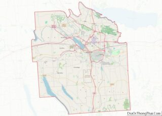
| County: | Onondaga County |
| Elevation: | 381 ft (116 m) |
| Total Area: | 3.36 sq mi (8.71 km²) |
| Land Area: | 3.19 sq mi (8.26 km²) |
| Water Area: | 0.17 sq mi (0.45 km²) |
| Total Population: | 7,898 |
| Population Density: | 2,475.86/sq mi (956.04/km²) |
| ZIP code: | 13027 |
| Area code: | 315 |
| FIPS code: | 3604198 |
| GNISfeature ID: | 0942909 |
| Website: | www.baldwinsville.org |
Online Interactive Map
Click on ![]() to view map in "full screen" mode.
to view map in "full screen" mode.
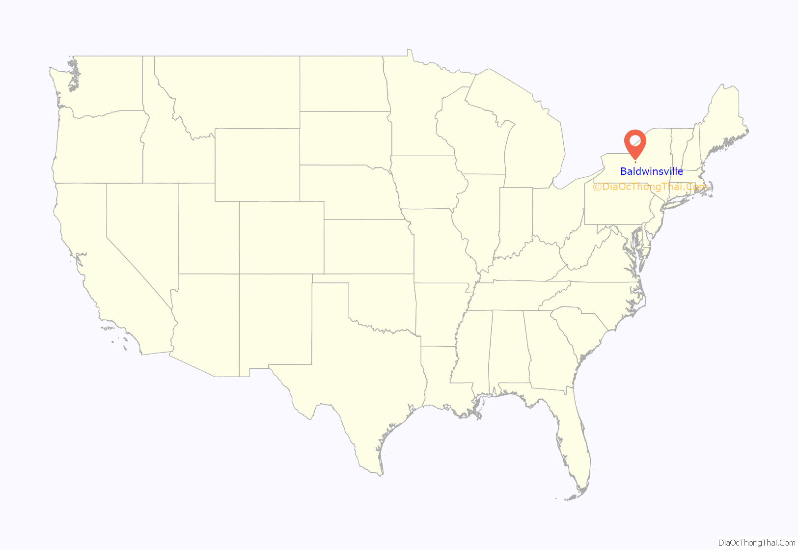
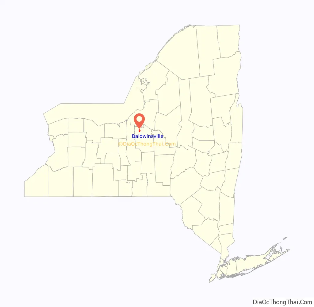
Baldwinsville location map. Where is Baldwinsville village?
History
The village is named after Dr. Jonas Baldwin, who built a dam across the Seneca River to generate energy and a private canal to keep the integrity of the water highway. It incorporated in 1848 as the Village of Baldwinsville. Prior to this, the community was known by a number of other names, including McHarrie’s Rifts.
Baldwinsville initially grew as a local center for a prosperous farming area, with numerous mills along the north and south shores of the Seneca River. A canal on the north shore of the river allowed boats to navigate around the dam. In the early 1900s this canal was superseded with the construction of the New York State Barge Canal on the south shore of the river. In the early 1900s the village was also served by the Erie Lackawanna Railway, connecting Baldwinsville to the cities of Syracuse and Oswego. In addition to agriculture, Baldwinsville had small factories, such as Morris Machine Works, Jardine Bronze Foundry, and others. A large brewery now owned by Anheuser-Busch was constructed immediately east of the village in the mid-1970s to take advantage of ample water supplies from Lake Ontario. As agriculture and industry have receded, Baldwinsville has evolved into an attractive riverside community.
Grace Episcopal Church, formerly of Elizabeth Street, was one of the first churches in the United States to use electric lighting.
Dozens of local farm boys are listed on the Civil War monument in the village cemetery along the Seneca River, having served and died in several units of the Union Army. Those listed on this monument served under General John A. Logan as part of William T. Sherman’s army. Other units included 1st Regiment, Light Artillery, N. Y. S. Volunteers, Battery B (Pettit’s Battery) which fought at many major battles, including:
- Antietam, Md. September 15–17, 1862.
- Battle of Fredericksburg December 12–17, 1862.
- Battle of Chancellorsville May 1–3, 1863.
- Battle of Gettysburg July 2–3, 1863.
- Battle of Spotsylvania May 12, 1864.
- Petersburg, Virginia June 16–20, 1864.
The Baldwinsville Village Hall, Mrs. I. L. Crego House, and Oswego-Oneida Streets Historic District are listed on the National Register of Historic Places.
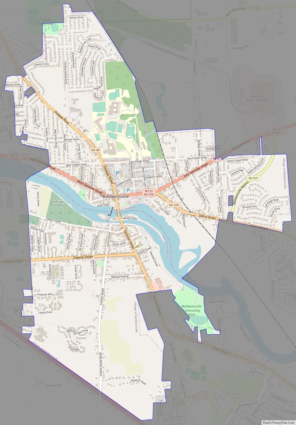
Baldwinsville Road Map
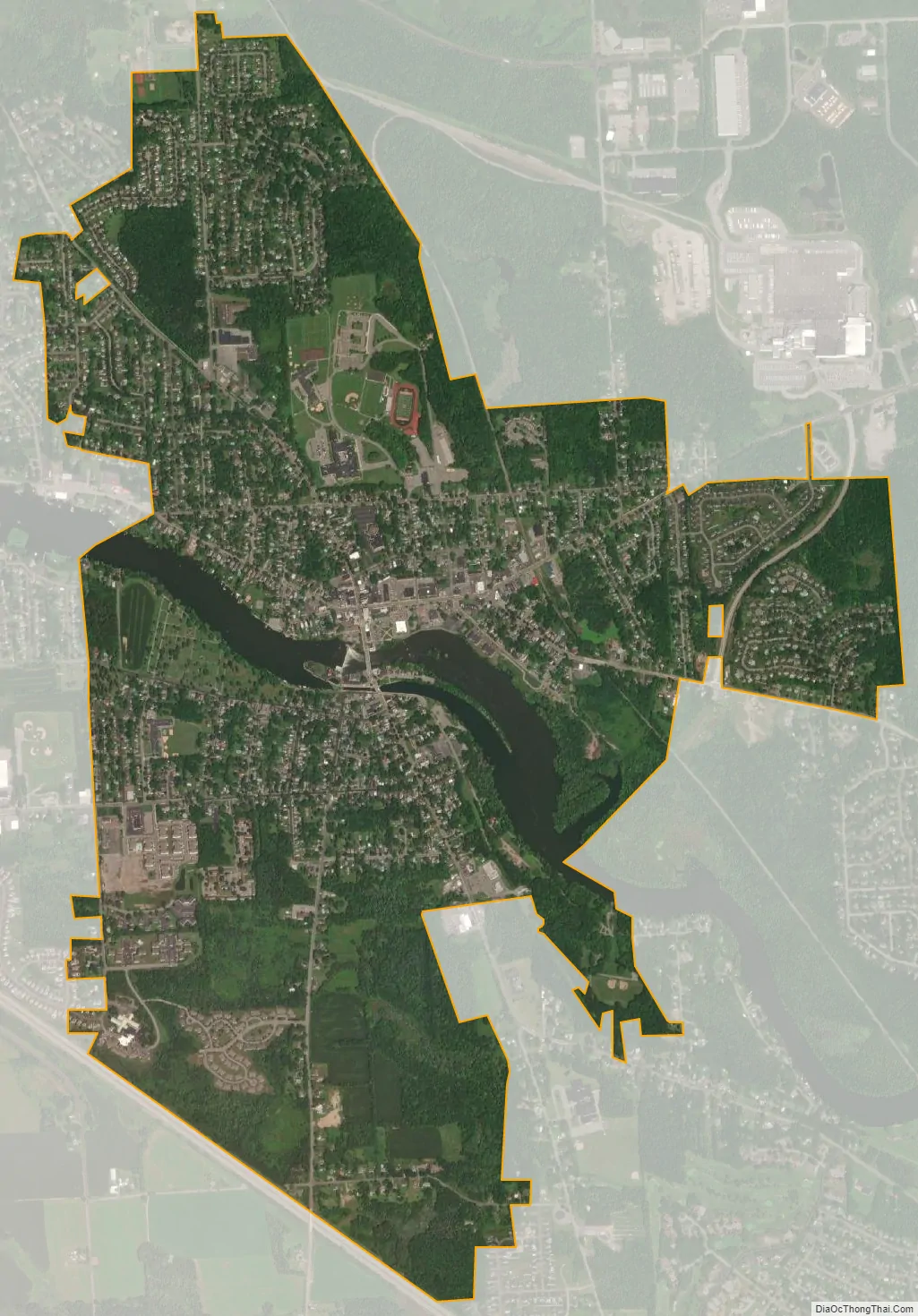
Baldwinsville city Satellite Map
Geography
Baldwinsville is located at 43°10′N 76°20′W / 43.167°N 76.333°W / 43.167; -76.333 (43.1599, -76.3346). The village is located on the Seneca River, which flows through the village, through the historic downtown area and forms a section of the Erie Canal. Its 24th lock sports a local restaurant which is popular for guests.
According to the United States Census Bureau, the village has a total area of 3.2 square miles (8.3 km), of which 3.1 square miles (8.0 km) is land and 0.2 square miles (0.52 km) (5.23%) is water.
Baldwinsville is located on gently rolling hills, nearby Lake Ontario and the Finger Lakes. It lies in a transitional zone between the nearly flat plain immediately adjacent to Lake Ontario, and the hills to the south that form the approaches to the Allegheny Mountains of southern New York and northern Pennsylvania. This rolling glacial terrain is intersected and divided by forests, meadows, farmland, and bodies of water of all types, which is marked by significant seasonal variations. Local soils are a rich and varied blend, with deposits of gravels, sands, and rock flour, ground up and tilled by the glaciers, and left behind as they receded to the north. As is typical of the Great Lakes plains, these varied soils and gentle slopes create ideal conditions for specialty agriculture, orchards, and vegetable farming. The “lake effect” moderates the harsh Arctic winters found on the north side of Lake Ontario, but this comes at a price. Snowfall in the region is the highest for any metropolitan area in the United States. High average rainfall and snowfall result in abundant water resources.
Baldwinsville is in a region of rivers, lakes, streams, swamps, marshes, creeks, and ponds. Local forests, while predominantly hardwoods such as Sugar Maple, are also widely variable due to the variations in soil, drainage, and microclimate. Nearly every tree species found in the northeastern United States can be found in the forests near Baldwinsville. Wildlife is abundant, and many varieties of fish are found in the local waters in the Seneca River. Because the Seneca River flows to Lake Ontario by way of the Oswego River, the introduction of the invasive Zebra Mussel by international shipping in the Great Lakes has had significant ecological effects on the river, for example, a dramatic improvement in clarity and a consequent flourishing of aquatic vegetation along the banks.
See also
Map of New York State and its subdivision:- Albany
- Allegany
- Bronx
- Broome
- Cattaraugus
- Cayuga
- Chautauqua
- Chemung
- Chenango
- Clinton
- Columbia
- Cortland
- Delaware
- Dutchess
- Erie
- Essex
- Franklin
- Fulton
- Genesee
- Greene
- Hamilton
- Herkimer
- Jefferson
- Kings
- Lake Ontario
- Lewis
- Livingston
- Madison
- Monroe
- Montgomery
- Nassau
- New York
- Niagara
- Oneida
- Onondaga
- Ontario
- Orange
- Orleans
- Oswego
- Otsego
- Putnam
- Queens
- Rensselaer
- Richmond
- Rockland
- Saint Lawrence
- Saratoga
- Schenectady
- Schoharie
- Schuyler
- Seneca
- Steuben
- Suffolk
- Sullivan
- Tioga
- Tompkins
- Ulster
- Warren
- Washington
- Wayne
- Westchester
- Wyoming
- Yates
- Alabama
- Alaska
- Arizona
- Arkansas
- California
- Colorado
- Connecticut
- Delaware
- District of Columbia
- Florida
- Georgia
- Hawaii
- Idaho
- Illinois
- Indiana
- Iowa
- Kansas
- Kentucky
- Louisiana
- Maine
- Maryland
- Massachusetts
- Michigan
- Minnesota
- Mississippi
- Missouri
- Montana
- Nebraska
- Nevada
- New Hampshire
- New Jersey
- New Mexico
- New York
- North Carolina
- North Dakota
- Ohio
- Oklahoma
- Oregon
- Pennsylvania
- Rhode Island
- South Carolina
- South Dakota
- Tennessee
- Texas
- Utah
- Vermont
- Virginia
- Washington
- West Virginia
- Wisconsin
- Wyoming