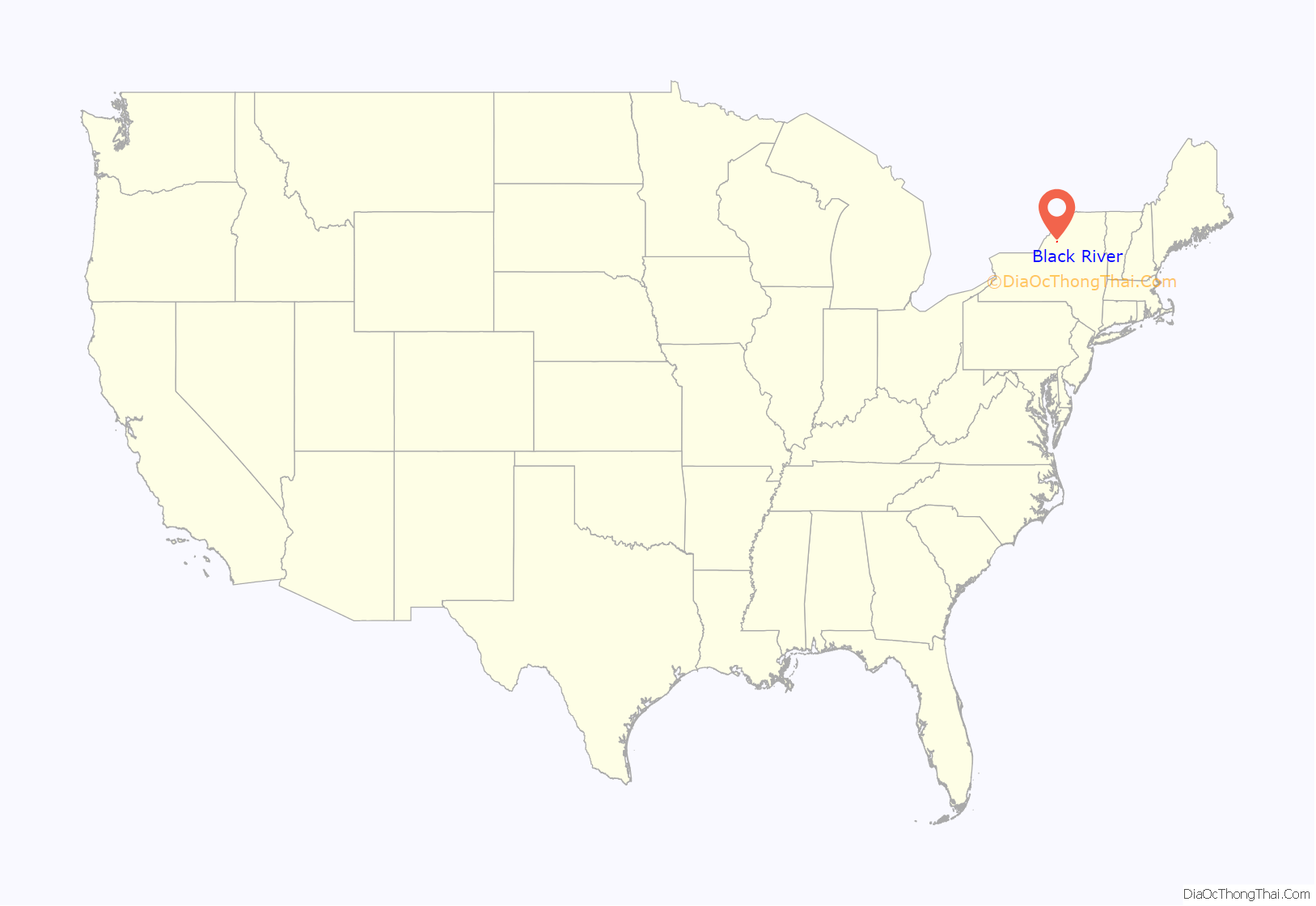
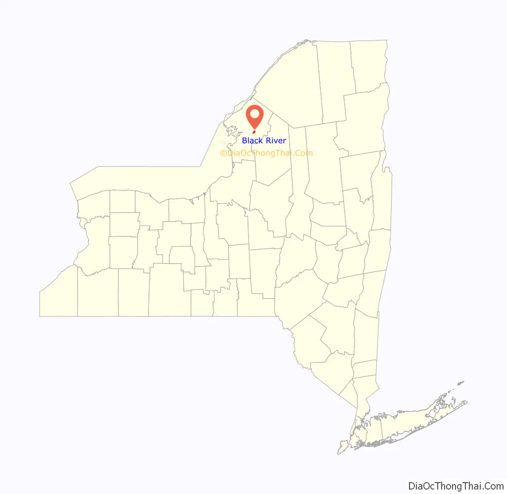
Black River is a village in Jefferson County, New York, United States. The population was 1,348 at the 2010 census. The village is on the border of the towns of Le Ray and Rutland, east of Watertown.
| Name: | Black River village |
|---|---|
| LSAD Code: | 47 |
| LSAD Description: | village (suffix) |
| State: | New York |
| County: | Jefferson County |
| Elevation: | 571 ft (174 m) |
| Total Area: | 1.89 sq mi (4.88 km²) |
| Land Area: | 1.78 sq mi (4.61 km²) |
| Water Area: | 0.10 sq mi (0.27 km²) |
| Total Population: | 1,232 |
| Population Density: | 691.75/sq mi (267.03/km²) |
| ZIP code: | 13612 |
| Area code: | 315 |
| FIPS code: | 3606794 |
| GNISfeature ID: | 0944178 |
| Website: | www.blackriverny.org |
Online Interactive Map
Click on ![]() to view map in "full screen" mode.
to view map in "full screen" mode.
Black River location map. Where is Black River village?
History
The area was first settled around 1806 by the erection of a mill on the south side of the Black River. The village was previously called “Lockport”, and grew to include both sides of the river as well as two small river islands.
On February 20, 1890, a large fire destroyed the business section of the downtown. Buildings destroyed by the fire included the Poor Block (which included a three-story building with an opera house on the third floor); the D.J. Scott and Son Block; the Arthur House (a hotel); Parkinson’s Store (the old 1881 post office); Whipple and Hadsell’s Store; F.H. Dillenbeck’s Tinshop and Hardware Store; A.W. McDowell’s Store; George Graham’s barber shop; the I.O.O.F. Hall and two residential dwellings. The Kennedy Stone house was badly burned, but was later restored. Having no fire department at the time, the residents of Black River immediately made plans to organize a fire department later that year. Black River Fire Company No. 1 was organized September 4, 1890, and incorporated on January 3, 1891. The department was re-incorporated as the Black River Fire Department on February 21, 1940. This department still provides fire protection for the village, and is one of the oldest continually operating fire departments in Jefferson County.
The community incorporated as a village in 1891, taking land in the towns of Rutland and Le Ray.
The LeRay Mansion was listed on the National Register of Historic Places in 1974.
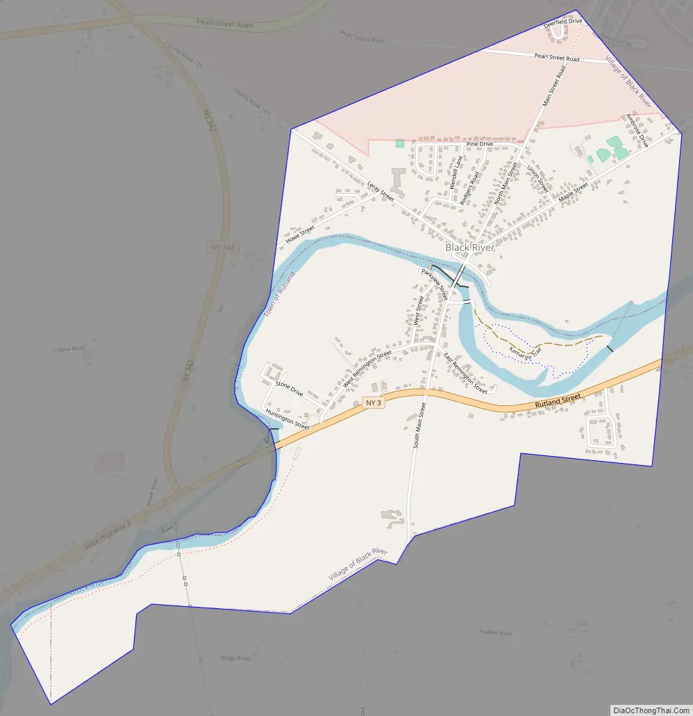
Black River Road Map
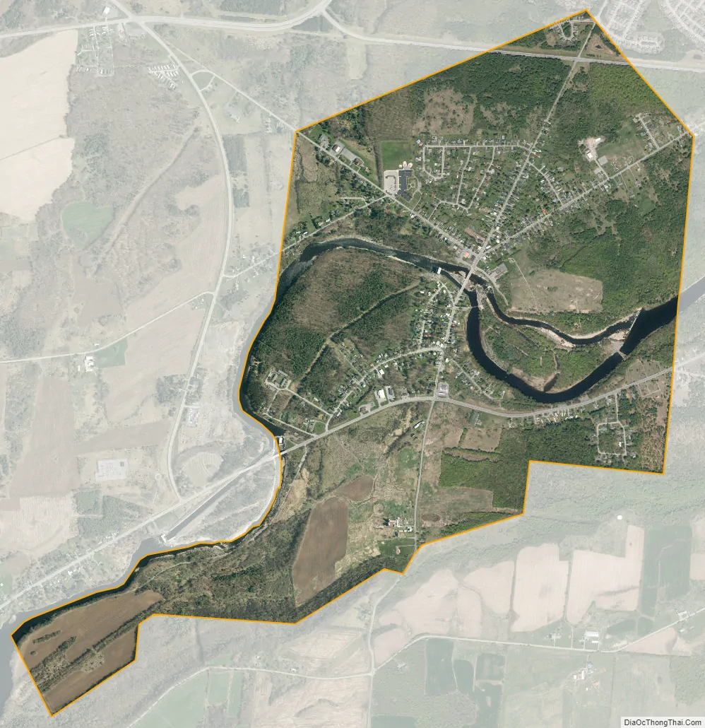
Black River city Satellite Map
Geography
The village of Black River is located in east-central Jefferson County at 44°0′42″N 75°47′41″W / 44.01167°N 75.79472°W / 44.01167; -75.79472 (44.011567, -75.794773). According to the United States Census Bureau, it has a total area of 1.85 square miles (4.78 km), of which 1.79 square miles (4.64 km) are land and 0.054 square miles (0.14 km), or 2.88%, are water.
The Black River flows through the center of the village and forms the border between the towns of Le Ray and Rutland.
New York State Route 3 (Rutland Street) passes through the south side of the village and intersects New York State Route 342 west of the village. NY-3 leads west 6 miles (10 km) (downriver) to the center of Watertown and east 12 miles (19 km) (upriver) to Carthage. NY 342 leads northwest 7 miles (11 km) to Interstate 81 north of Watertown.
See also
Map of New York State and its subdivision:- Albany
- Allegany
- Bronx
- Broome
- Cattaraugus
- Cayuga
- Chautauqua
- Chemung
- Chenango
- Clinton
- Columbia
- Cortland
- Delaware
- Dutchess
- Erie
- Essex
- Franklin
- Fulton
- Genesee
- Greene
- Hamilton
- Herkimer
- Jefferson
- Kings
- Lake Ontario
- Lewis
- Livingston
- Madison
- Monroe
- Montgomery
- Nassau
- New York
- Niagara
- Oneida
- Onondaga
- Ontario
- Orange
- Orleans
- Oswego
- Otsego
- Putnam
- Queens
- Rensselaer
- Richmond
- Rockland
- Saint Lawrence
- Saratoga
- Schenectady
- Schoharie
- Schuyler
- Seneca
- Steuben
- Suffolk
- Sullivan
- Tioga
- Tompkins
- Ulster
- Warren
- Washington
- Wayne
- Westchester
- Wyoming
- Yates
- Alabama
- Alaska
- Arizona
- Arkansas
- California
- Colorado
- Connecticut
- Delaware
- District of Columbia
- Florida
- Georgia
- Hawaii
- Idaho
- Illinois
- Indiana
- Iowa
- Kansas
- Kentucky
- Louisiana
- Maine
- Maryland
- Massachusetts
- Michigan
- Minnesota
- Mississippi
- Missouri
- Montana
- Nebraska
- Nevada
- New Hampshire
- New Jersey
- New Mexico
- New York
- North Carolina
- North Dakota
- Ohio
- Oklahoma
- Oregon
- Pennsylvania
- Rhode Island
- South Carolina
- South Dakota
- Tennessee
- Texas
- Utah
- Vermont
- Virginia
- Washington
- West Virginia
- Wisconsin
- Wyoming


