Blodgett Mills is a hamlet and census-designated place (CDP) in Cortland County, New York, United States. The population was 303 at the 2010 census. It is in the town of Cortlandville, southeast of the city of Cortland.
| Name: | Blodgett Mills CDP |
|---|---|
| LSAD Code: | 57 |
| LSAD Description: | CDP (suffix) |
| State: | New York |
| County: | Cortland County |
| Elevation: | 1,085 ft (331 m) |
| Total Area: | 2.17 sq mi (5.63 km²) |
| Land Area: | 2.17 sq mi (5.63 km²) |
| Water Area: | 0.00 sq mi (0.00 km²) |
| Total Population: | 274 |
| Population Density: | 126.03/sq mi (48.66/km²) |
| ZIP code: | 13738 |
| FIPS code: | 3606937 |
Online Interactive Map
Click on ![]() to view map in "full screen" mode.
to view map in "full screen" mode.
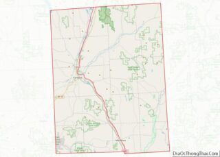
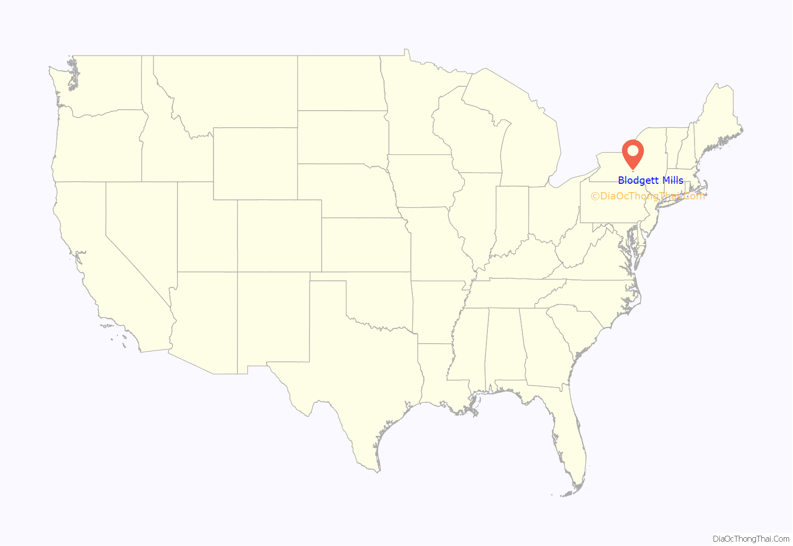
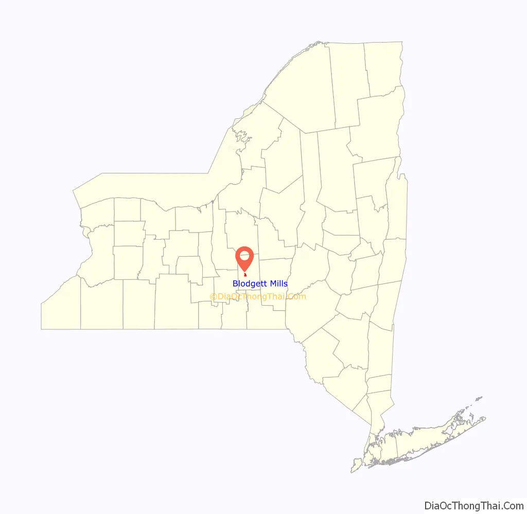
Blodgett Mills location map. Where is Blodgett Mills CDP?
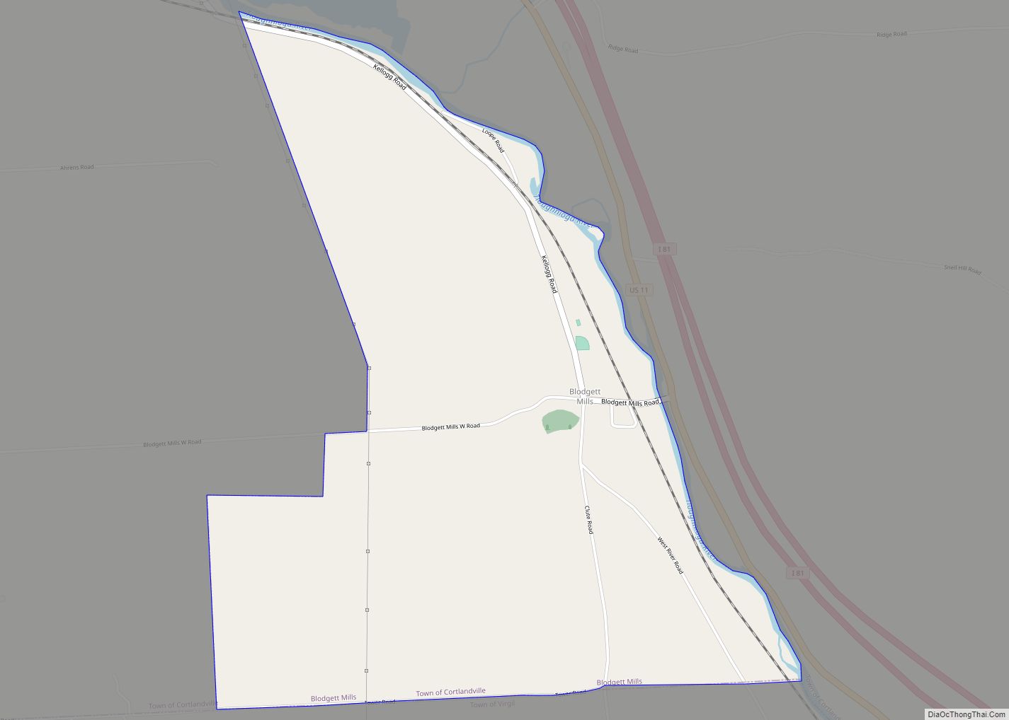
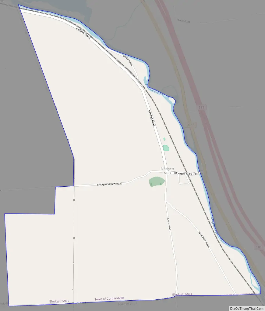
Blodgett Mills Road Map
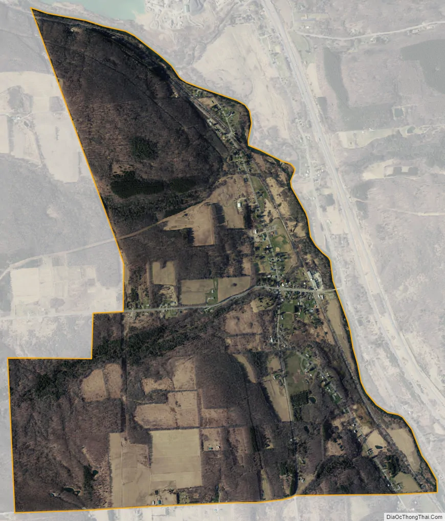
Blodgett Mills city Satellite Map
Geography
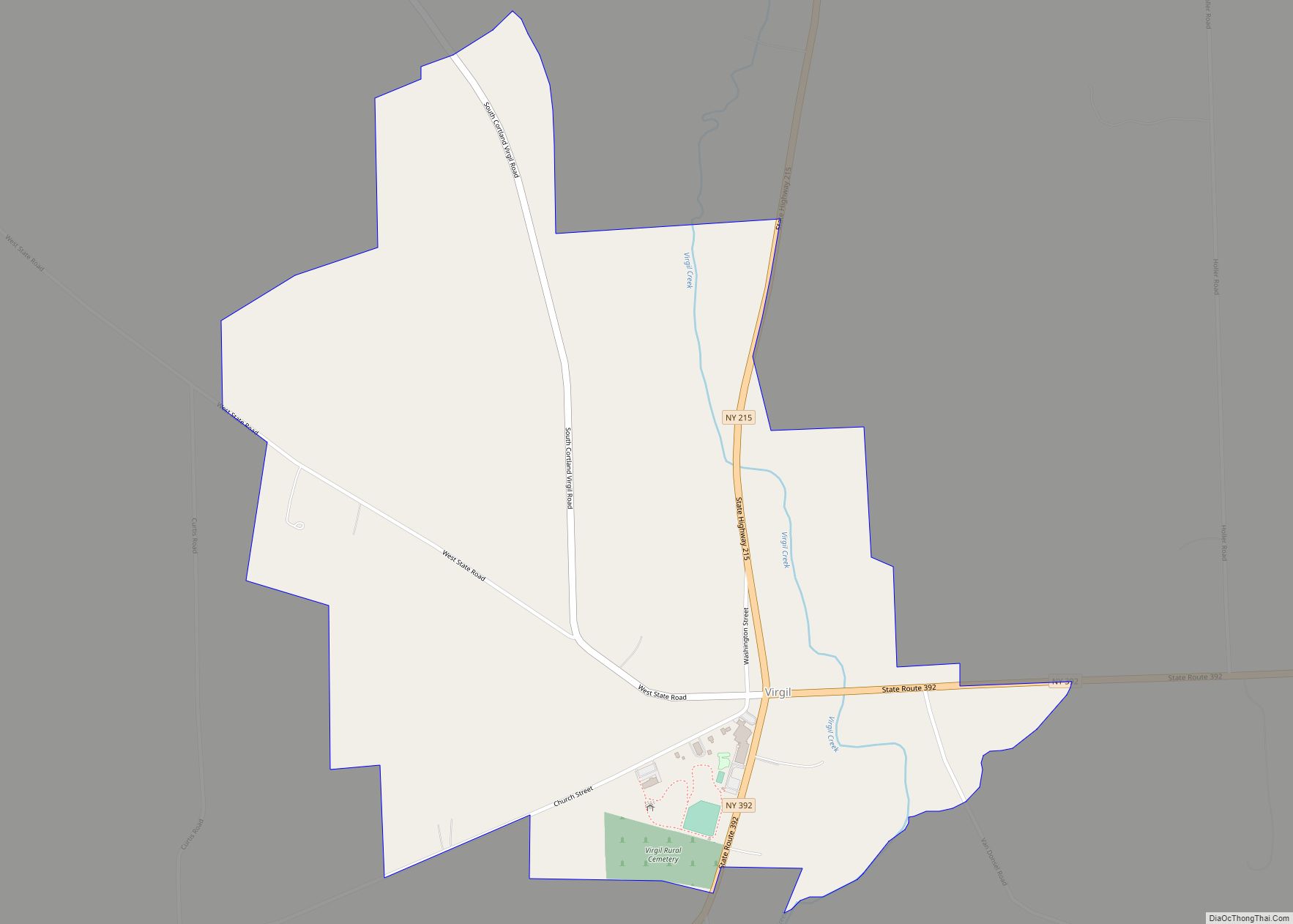
Blodgett Mills is located in the southeastern part of Cortlandville and is bordered to the south by the town of Virgil. The Tioughnioga River forms the eastern edge of the CDP and flows south to the Chenango River and ultimately to the Susquehanna River.
U.S. Route 11 passes just east of the community and is accessed by a bridge over the Tioughnioga. US-11 leads northwest 4 miles (6 km) to the center of Cortland and south 10 miles (16 km) to Marathon. Interstate 81 runs just east of US-11 but is not directly accessible from Blodgett Mills.
According to the United States Census Bureau, the Blodgett Mills CDP has a total area of 2.2 square miles (5.6 km), all land.
See also
Map of New York State and its subdivision:- Albany
- Allegany
- Bronx
- Broome
- Cattaraugus
- Cayuga
- Chautauqua
- Chemung
- Chenango
- Clinton
- Columbia
- Cortland
- Delaware
- Dutchess
- Erie
- Essex
- Franklin
- Fulton
- Genesee
- Greene
- Hamilton
- Herkimer
- Jefferson
- Kings
- Lake Ontario
- Lewis
- Livingston
- Madison
- Monroe
- Montgomery
- Nassau
- New York
- Niagara
- Oneida
- Onondaga
- Ontario
- Orange
- Orleans
- Oswego
- Otsego
- Putnam
- Queens
- Rensselaer
- Richmond
- Rockland
- Saint Lawrence
- Saratoga
- Schenectady
- Schoharie
- Schuyler
- Seneca
- Steuben
- Suffolk
- Sullivan
- Tioga
- Tompkins
- Ulster
- Warren
- Washington
- Wayne
- Westchester
- Wyoming
- Yates
- Alabama
- Alaska
- Arizona
- Arkansas
- California
- Colorado
- Connecticut
- Delaware
- District of Columbia
- Florida
- Georgia
- Hawaii
- Idaho
- Illinois
- Indiana
- Iowa
- Kansas
- Kentucky
- Louisiana
- Maine
- Maryland
- Massachusetts
- Michigan
- Minnesota
- Mississippi
- Missouri
- Montana
- Nebraska
- Nevada
- New Hampshire
- New Jersey
- New Mexico
- New York
- North Carolina
- North Dakota
- Ohio
- Oklahoma
- Oregon
- Pennsylvania
- Rhode Island
- South Carolina
- South Dakota
- Tennessee
- Texas
- Utah
- Vermont
- Virginia
- Washington
- West Virginia
- Wisconsin
- Wyoming