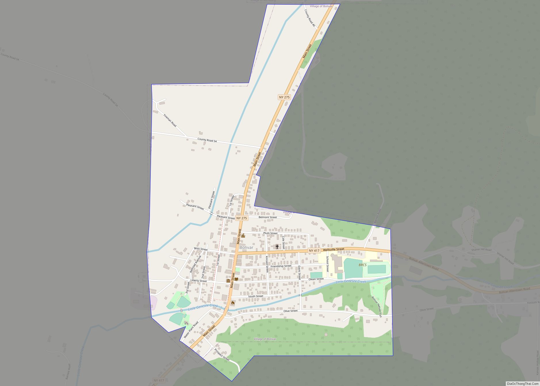
Bolivar is a village in Allegany County, New York, United States. The village is in the northwest part of the town of Bolivar and is east of Olean. The population of the village was 1,047 at the 2010 census. It is named after Simón Bolívar.
| Name: | Bolivar village |
|---|---|
| LSAD Code: | 47 |
| LSAD Description: | village (suffix) |
| State: | New York |
| County: | Allegany County |
| Elevation: | 1,594 ft (486 m) |
| Total Area: | 0.80 sq mi (2.06 km²) |
| Land Area: | 0.80 sq mi (2.06 km²) |
| Water Area: | 0.00 sq mi (0.00 km²) |
| Total Population: | 1,010 |
| Population Density: | 1,267.25/sq mi (489.45/km²) |
| ZIP code: | 14715 |
| Area code: | 585 |
| FIPS code: | 3607190 |
| GNISfeature ID: | 0944401 |
Online Interactive Map
Click on ![]() to view map in "full screen" mode.
to view map in "full screen" mode.
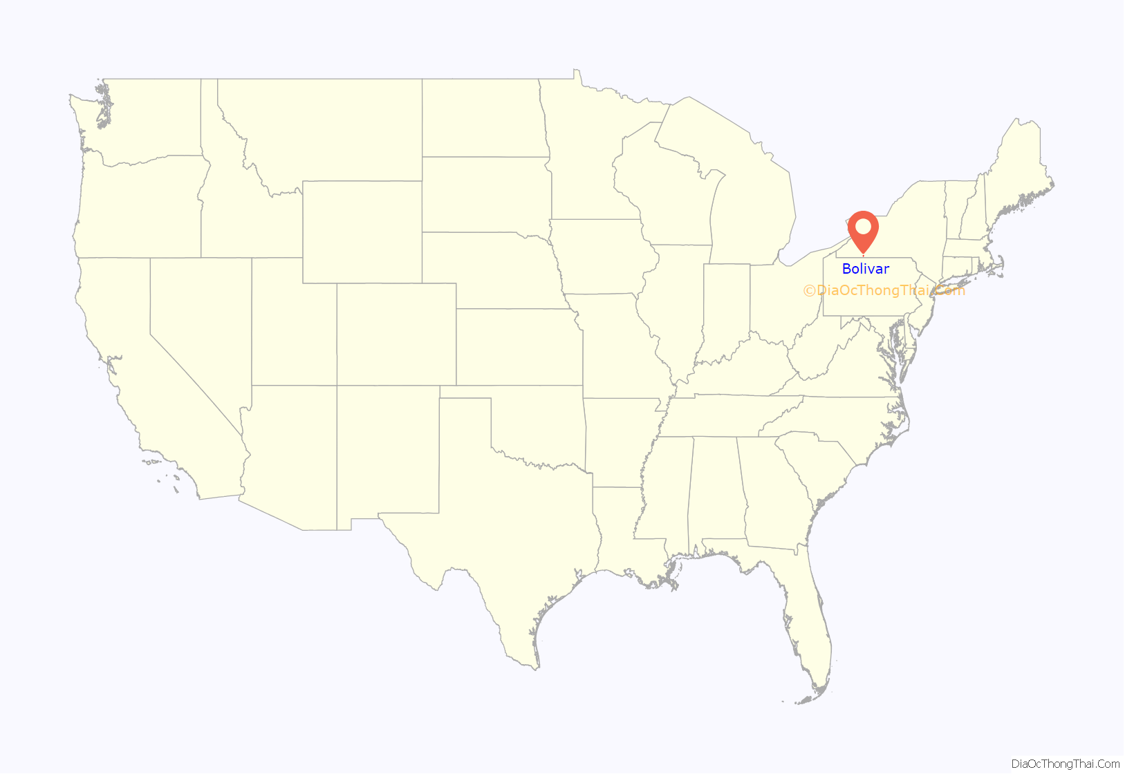
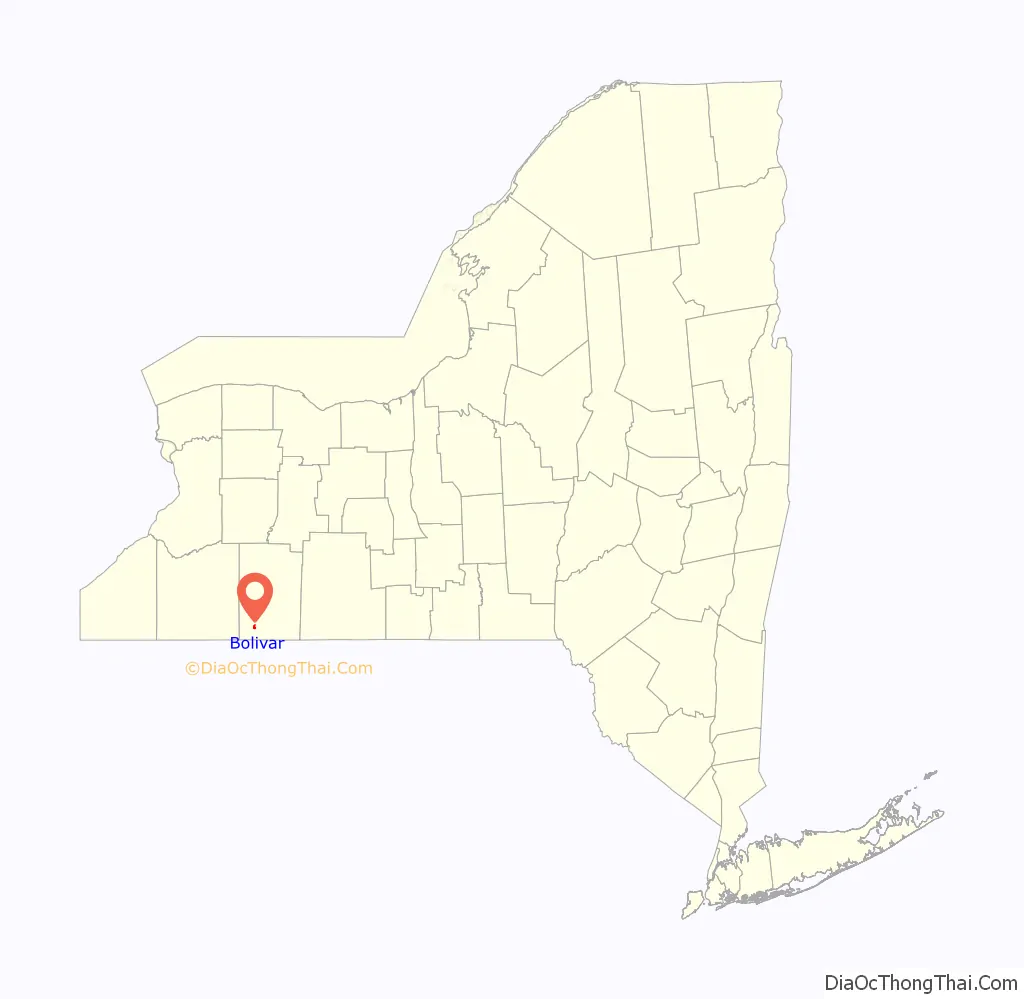
Bolivar location map. Where is Bolivar village?
History
The first building on the future site of the village, a log cabin, was erected around 1820. The village of Bolivar was incorporated in 1882.
As “the heart of the Allegany Oil Field”, the Bolivar-Richburg area rose to significance during the oil boom era of the late 1800s. During the brief initial oil boom of the 1880s it was purportedly the wealthiest locale, per capita, in the United States. By the early 1900s the initial boom, with its economic and population impacts, had significantly faded, but secondary oil recovery techniques applied to the oil fields (starting around 1920) drastically rejuvenated the industry in the area. By the early 1930s Bolivar village boasted an imposing new school, well-paved streets, a modern sewage treatment facility, and a thriving Main Street economy.
The village and town of Bolivar adopted the description “Land of the Deer and the Derrick” in the mid-1900s.
The village is home to the high school of the Bolivar-Richburg Central School District, which merged in the fall of 1994.
The Bolivar Free Library was listed on the National Register of Historic Places in 2003.
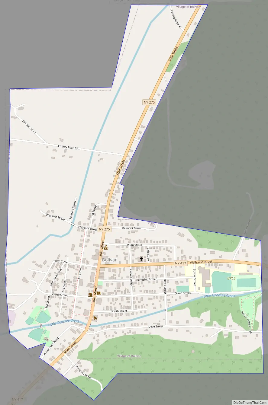
Bolivar Road Map
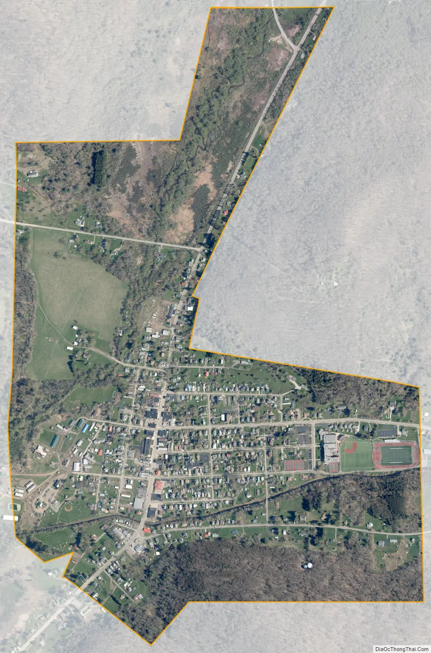
Bolivar city Satellite Map
Geography
Bolivar is located at 42°4′2″N 78°9′59″W / 42.06722°N 78.16639°W / 42.06722; -78.16639 (42.067324, -78.166622).
According to the United States Census Bureau, the village has a total area of 0.81 square miles (2.1 km), all land. Root Hollow Creek enters the village from the east, joining with Little Genesee Creek flowing north-south through the west edge of the village, leading to the Allegheny River.
Bolivar is at the junction of state routes 275 and 417.
Bolivar was served (1881–1947) by the Pittsburg, Shawmut & Northern Railroad (PS&N) and predecessors (1881–1893), by the Bradford, Eldred & Cuba Railroad System (BE&C), and (1903–1926) by the Olean, Bradford & Salamanca Railway (OB&S) and predecessors. The early PS&N predecessors and the BE&C were 36″ narrow-gauge railroads while the PS&N and OB&S were standard-gauge railroads, the latter being electric-powered.
Notable People:
Frank Gannett, founder of the Gannett News Service, and presidential hopeful, graduated from Bolivar High School in 1893.
Bob Torrey, an NFL running back who played college football for Penn State, and for the Giants, Dolphins and Eagles, graduated from Bolivar High School in 1974.
Richard Dougherty, Bolivar Class of 1938, served as press secretary for Democratic presidential nominee George McGovern during his 1972 campaign. Dougherty went on to serve as the public relations director for the Metropolitan Museum of Art in New York.
Patsy Dougherty, Patrick Henry “Patsy” Dougherty, Bolivar High School Class of 1893, was a professional baseball player from 1902 to 1911. Playing first for the Boston Americans (now Red Sox), in the first modern World Series (1903), Patsy was the first member of the team to hit a World Series home run, the first player ever to hit two home runs in one World Series game, and was the only person to hit a lead-off inside-the-park home run in a World Series game until that feat was finally duplicated 112 years later, in 2015. He was also the first player to play for two different teams when they won the World Series, playing in 1906 for the Chicago White Sox.
William Blowers, Bolivar Class of 1959, won an Oscar for technical achievement.
See also
Map of New York State and its subdivision:- Albany
- Allegany
- Bronx
- Broome
- Cattaraugus
- Cayuga
- Chautauqua
- Chemung
- Chenango
- Clinton
- Columbia
- Cortland
- Delaware
- Dutchess
- Erie
- Essex
- Franklin
- Fulton
- Genesee
- Greene
- Hamilton
- Herkimer
- Jefferson
- Kings
- Lake Ontario
- Lewis
- Livingston
- Madison
- Monroe
- Montgomery
- Nassau
- New York
- Niagara
- Oneida
- Onondaga
- Ontario
- Orange
- Orleans
- Oswego
- Otsego
- Putnam
- Queens
- Rensselaer
- Richmond
- Rockland
- Saint Lawrence
- Saratoga
- Schenectady
- Schoharie
- Schuyler
- Seneca
- Steuben
- Suffolk
- Sullivan
- Tioga
- Tompkins
- Ulster
- Warren
- Washington
- Wayne
- Westchester
- Wyoming
- Yates
- Alabama
- Alaska
- Arizona
- Arkansas
- California
- Colorado
- Connecticut
- Delaware
- District of Columbia
- Florida
- Georgia
- Hawaii
- Idaho
- Illinois
- Indiana
- Iowa
- Kansas
- Kentucky
- Louisiana
- Maine
- Maryland
- Massachusetts
- Michigan
- Minnesota
- Mississippi
- Missouri
- Montana
- Nebraska
- Nevada
- New Hampshire
- New Jersey
- New Mexico
- New York
- North Carolina
- North Dakota
- Ohio
- Oklahoma
- Oregon
- Pennsylvania
- Rhode Island
- South Carolina
- South Dakota
- Tennessee
- Texas
- Utah
- Vermont
- Virginia
- Washington
- West Virginia
- Wisconsin
- Wyoming