Brentwood is a hamlet in the Town of Islip in Suffolk County, on Long Island, in New York, United States. The population was 62,387 at the 2020 Census, making it the most populous in Suffolk County and on all of Long Island outside of New York City.
| Name: | Brentwood CDP |
|---|---|
| LSAD Code: | 57 |
| LSAD Description: | CDP (suffix) |
| State: | New York |
| County: | Suffolk County |
| Elevation: | 79 ft (24 m) |
| Total Area: | 10.95 sq mi (28.36 km²) |
| Land Area: | 10.95 sq mi (28.36 km²) |
| Water Area: | 0.00 sq mi (0.00 km²) |
| Total Population: | 62,387 |
| Population Density: | 5,697.44/sq mi (2,199.77/km²) |
| ZIP code: | 11717 |
| Area code: | 631, 934 |
| FIPS code: | 3608026 |
| GNISfeature ID: | 0944688 |
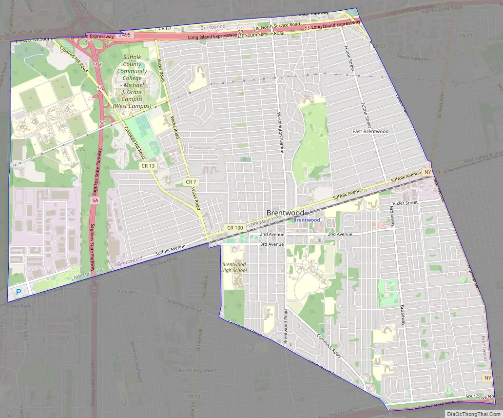
Online Interactive Map
Click on ![]() to view map in "full screen" mode.
to view map in "full screen" mode.
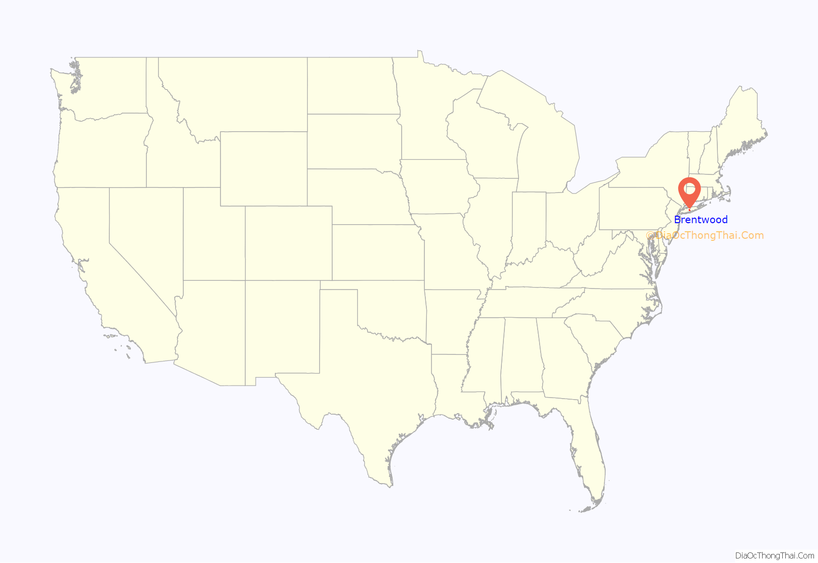
Brentwood location map. Where is Brentwood CDP?

History
Early history
In 1844, the area was established as Thompson Station and Suffolk Station, two new stations on the expansion of the Main Line of the Long Island Rail Road.
On March 21, 1851, it became the utopian community named Modern Times. The colony was established on 750 acres (3.0 km) of land by Josiah Warren and Stephen Pearl Andrews. In 1864, it was renamed Brentwood after the town of Brentwood, Essex, in England.
By contract, all the land in the colony was bought and sold at cost, with 3 acres (12,000 m) being the maximum allowable lot size. The community was said to be based on the idea of individual sovereignty and individual responsibility. Individuals were encouraged to pursue their self-interest as they saw fit. All products of labor were considered private property. The community had a local private currency based upon labor exchange in order to trade goods and services (see Mutualism (economic theory)). All land was private property, with the exception of alleys which were initially considered common property but later converted to private property. Initially, no system of authority existed in the colony; there were no courts, jails or police. This appears to have given some credence to Warren’s theories that the most significant cause of violence in society was most attributable to policies and law which did not allow complete individuality in person and property. However, the modest population of the colony might be considered a factor in this characteristic. The Civil War, as well as new residents that did not share the colony’s philosophy, are said to have contributed to its eventual dissolution. Almost all of the original buildings that existed in Modern Times have been destroyed, aside from two Octagon houses, the original schoolhouse and a residence.
Modern-day Brentwood
During the first half of the 20th century, Brentwood was home to the Ross Health Resort Onehtah, managed by Dr. William H. Ross. Onehtah was a place where a person could escape the pollution of the city. It was thought that the smell of pine needles brought a person good health.
Brentwood is the site of Pilgrim State Hospital (once one of the world’s largest hospitals and psychiatric institutions), now known as Pilgrim Psychiatric Center. A 52-acre (0.21 km) portion of the psychiatric center was converted into the Brentwood State Park athletic field complex, which officially opened in 2009.
Brentwood’s Centennial Celebration was on June 16–17, 1950. The 150th anniversary of the community was commemorated on May 9–11, 2007.
Brentwood High School has a nationally-recognized boys soccer team that won national championship in 2019.
Brentwood Road Map
Brentwood city Satellite Map

Geography
According to the United States Census Bureau, the CDP has a total area of 11.0 square miles (28 km), all land.
See also
Map of New York State and its subdivision:- Albany
- Allegany
- Bronx
- Broome
- Cattaraugus
- Cayuga
- Chautauqua
- Chemung
- Chenango
- Clinton
- Columbia
- Cortland
- Delaware
- Dutchess
- Erie
- Essex
- Franklin
- Fulton
- Genesee
- Greene
- Hamilton
- Herkimer
- Jefferson
- Kings
- Lake Ontario
- Lewis
- Livingston
- Madison
- Monroe
- Montgomery
- Nassau
- New York
- Niagara
- Oneida
- Onondaga
- Ontario
- Orange
- Orleans
- Oswego
- Otsego
- Putnam
- Queens
- Rensselaer
- Richmond
- Rockland
- Saint Lawrence
- Saratoga
- Schenectady
- Schoharie
- Schuyler
- Seneca
- Steuben
- Suffolk
- Sullivan
- Tioga
- Tompkins
- Ulster
- Warren
- Washington
- Wayne
- Westchester
- Wyoming
- Yates
- Alabama
- Alaska
- Arizona
- Arkansas
- California
- Colorado
- Connecticut
- Delaware
- District of Columbia
- Florida
- Georgia
- Hawaii
- Idaho
- Illinois
- Indiana
- Iowa
- Kansas
- Kentucky
- Louisiana
- Maine
- Maryland
- Massachusetts
- Michigan
- Minnesota
- Mississippi
- Missouri
- Montana
- Nebraska
- Nevada
- New Hampshire
- New Jersey
- New Mexico
- New York
- North Carolina
- North Dakota
- Ohio
- Oklahoma
- Oregon
- Pennsylvania
- Rhode Island
- South Carolina
- South Dakota
- Tennessee
- Texas
- Utah
- Vermont
- Virginia
- Washington
- West Virginia
- Wisconsin
- Wyoming


