Brookville is a village located within the Town of Oyster Bay in Nassau County, on the North Shore of Long Island, in New York, United States. The population was 3,465 at the time of the 2010 census. It is considered part of the greater Glen Cove area, which is anchored by the City of Glen Cove.
| Name: | Brookville village |
|---|---|
| LSAD Code: | 47 |
| LSAD Description: | village (suffix) |
| State: | New York |
| County: | Nassau County |
| Incorporated: | 1931 |
| Elevation: | 236 ft (72 m) |
| Total Area: | 3.96 sq mi (10.25 km²) |
| Land Area: | 3.95 sq mi (10.22 km²) |
| Water Area: | 0.01 sq mi (0.03 km²) |
| Total Population: | 2,939 |
| Population Density: | 744.62/sq mi (287.46/km²) |
| Area code: | 516 |
| FIPS code: | 3610132 |
| GNISfeature ID: | 0944887 |
| Website: | www.villageofbrookville.com |
Online Interactive Map
Click on ![]() to view map in "full screen" mode.
to view map in "full screen" mode.
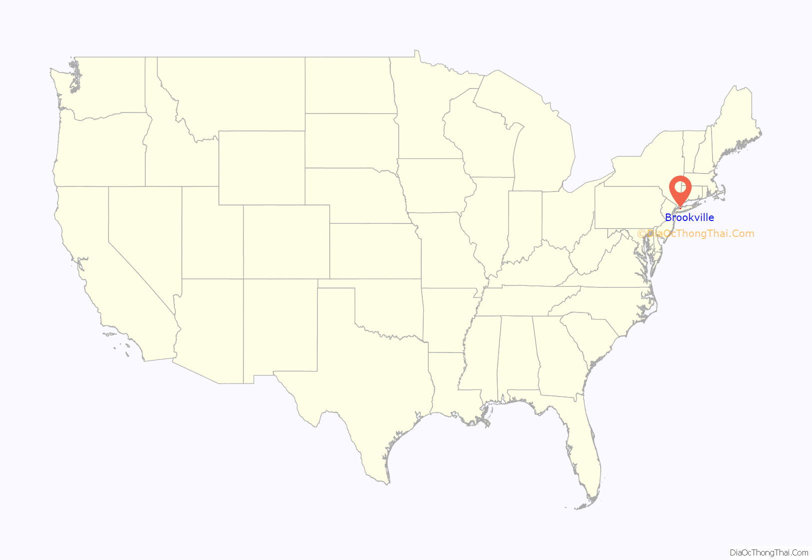
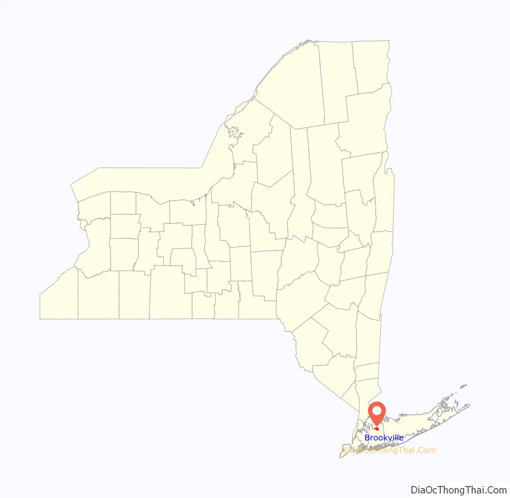
Brookville location map. Where is Brookville village?
History
The geographic Village of Brookville was formed in two stages. When the village was incorporated in 1931, it consisted of a long, narrow tract of land that was centered along Cedar Swamp Road (Route 107). In the 1950s, the northern portion of the unincorporated area then known as Wheatley Hills was annexed and incorporated into the village, approximately doubling the village’s area to its present 2,650 acres (1,070 ha).
When the town of Oyster Bay purchased what is now Brookville from the Matinecocks in the mid-17th century, the area was known as Suco’s Wigwam. Most pioneers were English, many of them Quakers. They were soon joined by Dutch settlers from western Long Island, who called the surrounding area Wolver Hollow, apparently because wolves gathered at spring-fed Shoo Brook to drink. For most of the 19th century, the village was called Tappentown after a prominent family. Brookville became the preferred name after the Civil War and was used on 1873 maps.
Brookville’s two centuries as a farm and woodland backwater changed quickly in the early 20th century as wealthy New Yorkers built lavish mansions. By the mid-1920s, there were 22 estates, part of the emergence of Nassau’s North Shore Gold Coast. One was Broadhollow, the 108-acre (0.44 km) spread of attorney-banker-diplomat Winthrop W. Aldrich, which had a 40-room manor house. The second owner of Broadhollow was Alfred Gwynne Vanderbilt Jr., who was owner of the Belmont and Pimlico racetracks. Marjorie Merriweather Post, daughter of cereal creator Charles William Post, and her husband Edward Francis Hutton, the famous financier, built a lavish 70-room mansion on 178 acres (0.72 km) called Hillwood.
In 1931, estate owners banded together to win village incorporation to head off what they saw as undesirable residential and commercial development in other parts of Nassau County. In 1947, the Post estate was sold to Long Island University for its C. W. Post campus. The campus is noted as the home of the Tilles Center for the Performing Arts. Also in Brookville is the DeSeversky Conference Center of the New York Institute of Technology. The center was formerly Templeton, mansion of socialite and businessman Winston Guest. Templeton was later used as one of the settings for the Dudley Moore film Arthur.
The Chapelle de St. Martin de Sayssuel, also known as the St. Joan of Arc Chapel where Joan of Arc prayed prior to engaging the English, was moved from France to Brookville in the early 20th century. It was acquired by Gertrude Hill Gavin, daughter of James J. Hill, the American railroad magnate. The chapel was dismantled stone by stone and imported from France to her Brookville estate in 1926. The chapel is now located at Marquette University in Wisconsin.
The Brookville Reformed Church, one of the oldest existing church congregations in the country, calls Brookville its home. The Brookville Church was founded by 17th century Dutch settlers.
The James Preserve is a nature preserve in Old Brookville and is the only tract of land showing the natural appearance of the village before development. Although it is in Old Brookville, it is connected to Greenvale.
In 2009, BusinessWeek dubbed Brookville the wealthiest town in America.
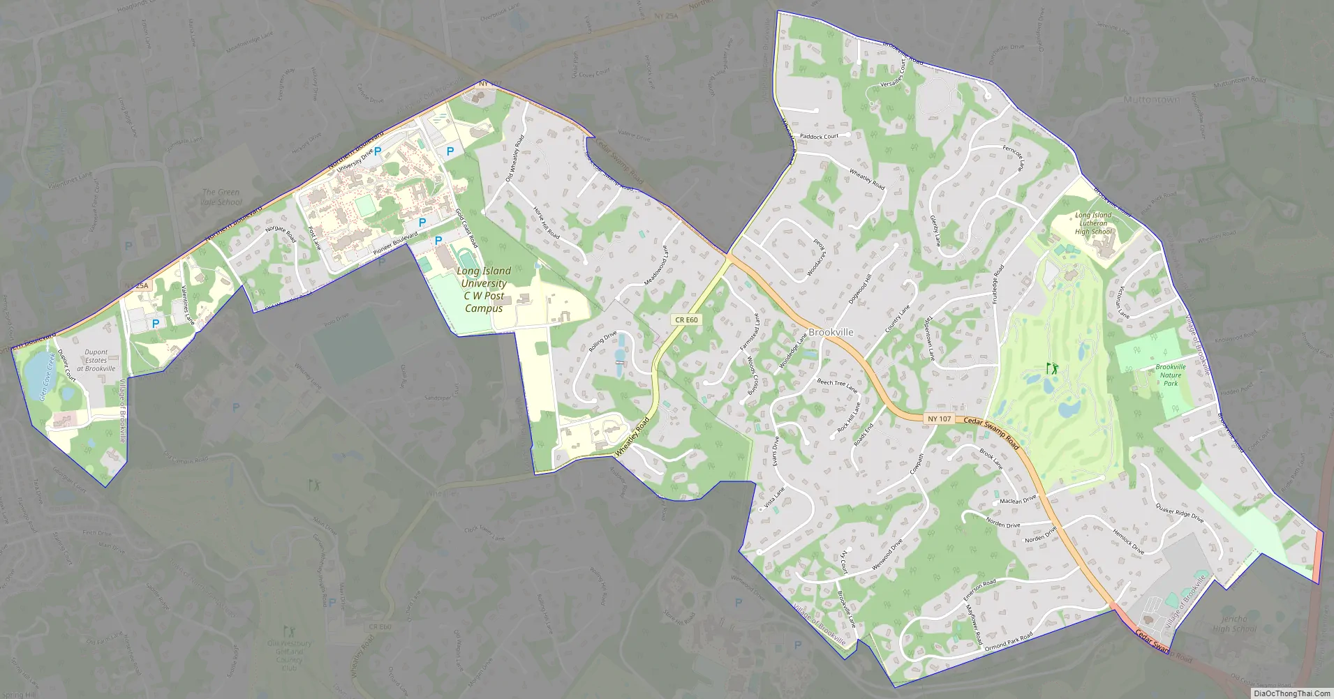
Brookville Road Map
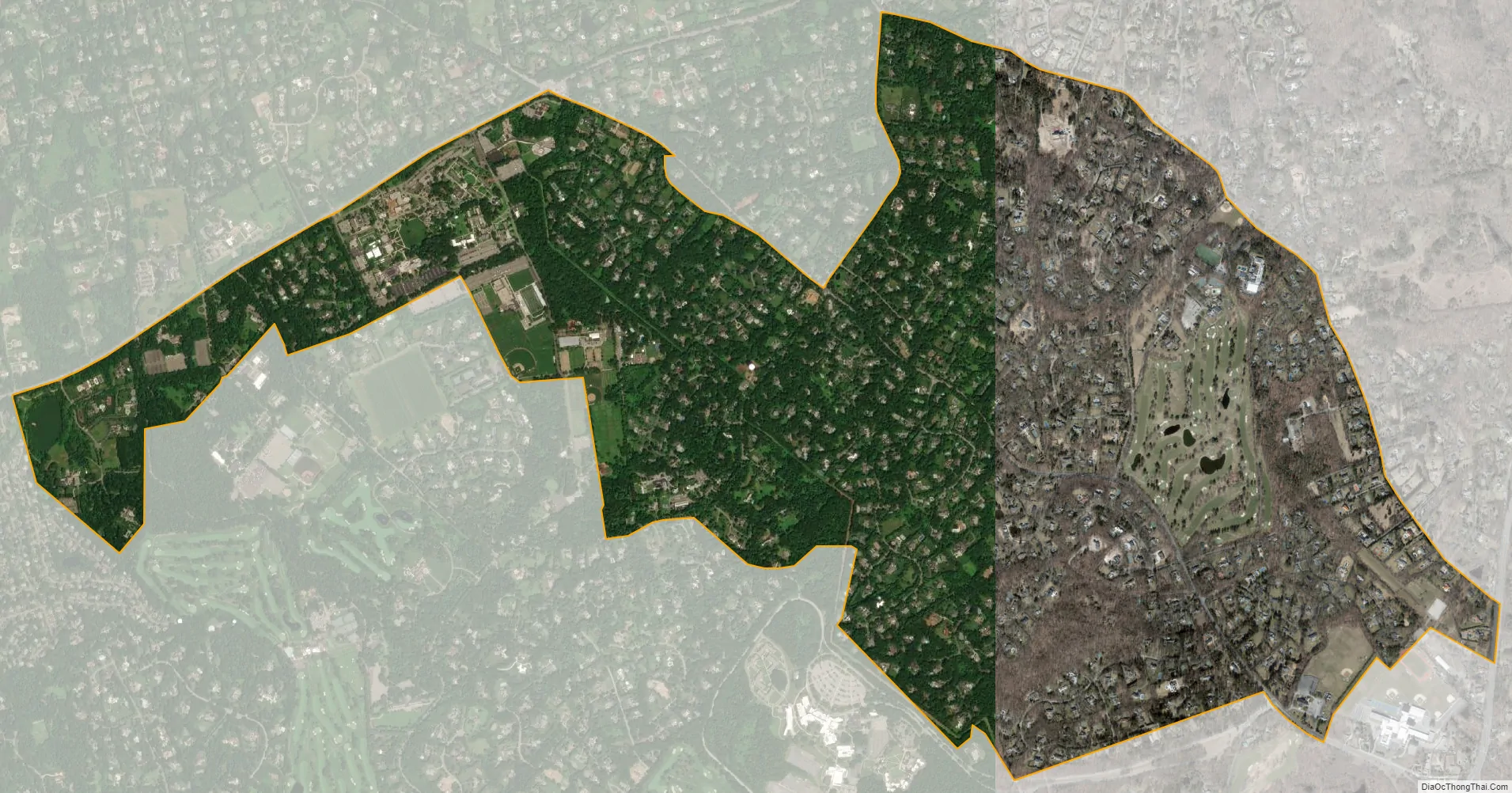
Brookville city Satellite Map
Geography
According to the U.S. Census Bureau, the village has a total area of 4.0 square miles (10 km), all land.
The village lost territory to the adjacent Incorporated Village of East Hills between the 1960 census and the 1970 census.
See also
Map of New York State and its subdivision:- Albany
- Allegany
- Bronx
- Broome
- Cattaraugus
- Cayuga
- Chautauqua
- Chemung
- Chenango
- Clinton
- Columbia
- Cortland
- Delaware
- Dutchess
- Erie
- Essex
- Franklin
- Fulton
- Genesee
- Greene
- Hamilton
- Herkimer
- Jefferson
- Kings
- Lake Ontario
- Lewis
- Livingston
- Madison
- Monroe
- Montgomery
- Nassau
- New York
- Niagara
- Oneida
- Onondaga
- Ontario
- Orange
- Orleans
- Oswego
- Otsego
- Putnam
- Queens
- Rensselaer
- Richmond
- Rockland
- Saint Lawrence
- Saratoga
- Schenectady
- Schoharie
- Schuyler
- Seneca
- Steuben
- Suffolk
- Sullivan
- Tioga
- Tompkins
- Ulster
- Warren
- Washington
- Wayne
- Westchester
- Wyoming
- Yates
- Alabama
- Alaska
- Arizona
- Arkansas
- California
- Colorado
- Connecticut
- Delaware
- District of Columbia
- Florida
- Georgia
- Hawaii
- Idaho
- Illinois
- Indiana
- Iowa
- Kansas
- Kentucky
- Louisiana
- Maine
- Maryland
- Massachusetts
- Michigan
- Minnesota
- Mississippi
- Missouri
- Montana
- Nebraska
- Nevada
- New Hampshire
- New Jersey
- New Mexico
- New York
- North Carolina
- North Dakota
- Ohio
- Oklahoma
- Oregon
- Pennsylvania
- Rhode Island
- South Carolina
- South Dakota
- Tennessee
- Texas
- Utah
- Vermont
- Virginia
- Washington
- West Virginia
- Wisconsin
- Wyoming


