Cape Vincent is a village in Jefferson County, New York, United States. The population was 726 at the 2010 census. The village is in the west-central part of the town of Cape Vincent and is northwest of Watertown.
| Name: | Cape Vincent village |
|---|---|
| LSAD Code: | 47 |
| LSAD Description: | village (suffix) |
| State: | New York |
| County: | Jefferson County |
| Elevation: | 262 ft (80 m) |
| Total Area: | 0.73 sq mi (1.89 km²) |
| Land Area: | 0.70 sq mi (1.82 km²) |
| Water Area: | 0.03 sq mi (0.07 km²) |
| Total Population: | 699 |
| Population Density: | 994.31/sq mi (383.78/km²) |
| ZIP code: | 13618 |
| Area code: | 315 |
| FIPS code: | 3612353 |
| GNISfeature ID: | 0945801 |
| Website: | www.villageofcapevincent.org |
Online Interactive Map
Click on ![]() to view map in "full screen" mode.
to view map in "full screen" mode.
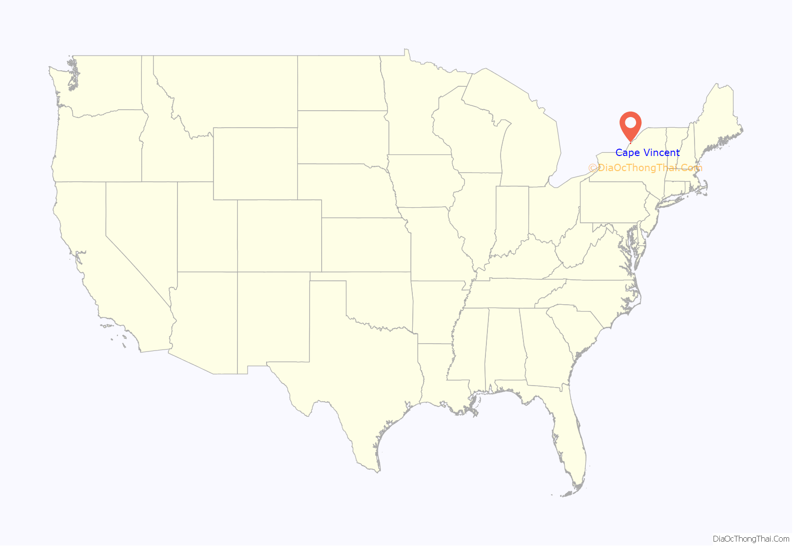
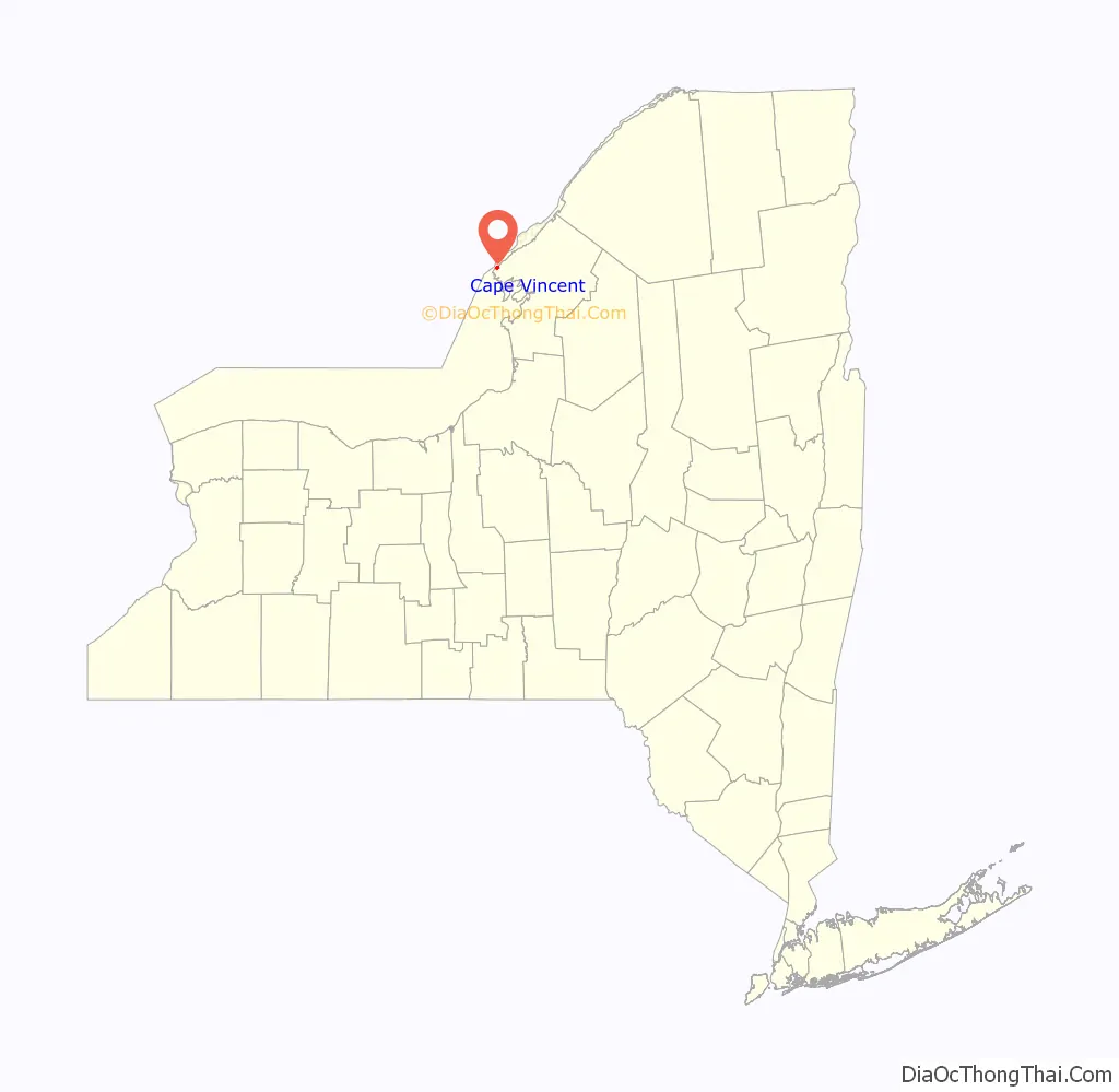
Cape Vincent location map. Where is Cape Vincent village?
History
The area was formerly controlled by the Onondaga people. French missionaries and explorers passed through the area in the middle of the 17th century.
The town of Cape Vincent was originally part of the town of Lyme. In 1849 the town of Cape Vincent separated from Lyme. The village of Cape Vincent was incorporated in 1853. At the time of its incorporation the village had a population of 1,218.
By the end of the 19th century, the area was becoming a vacation land due to the nearby Thousand Islands.
The Levi Anthony Building, Aubertine Building, John Borland House, Broadway Historic District, James Buckley House, E. K. Burnham House, Duvillard Mill, First Presbyterian Society of Cape Vincent, Fort Haldimand Site, Jean Philippe Galband du Fort House, Glen Building, Vincent LeRay House, Lewis House, Roxy Hotel, Cornelius Sacket House, General Sacket House, St. John’s Episcopal Church, St. Vincent of Paul Catholic Church, and Otis Starkey House are listed on the National Register of Historic Places.
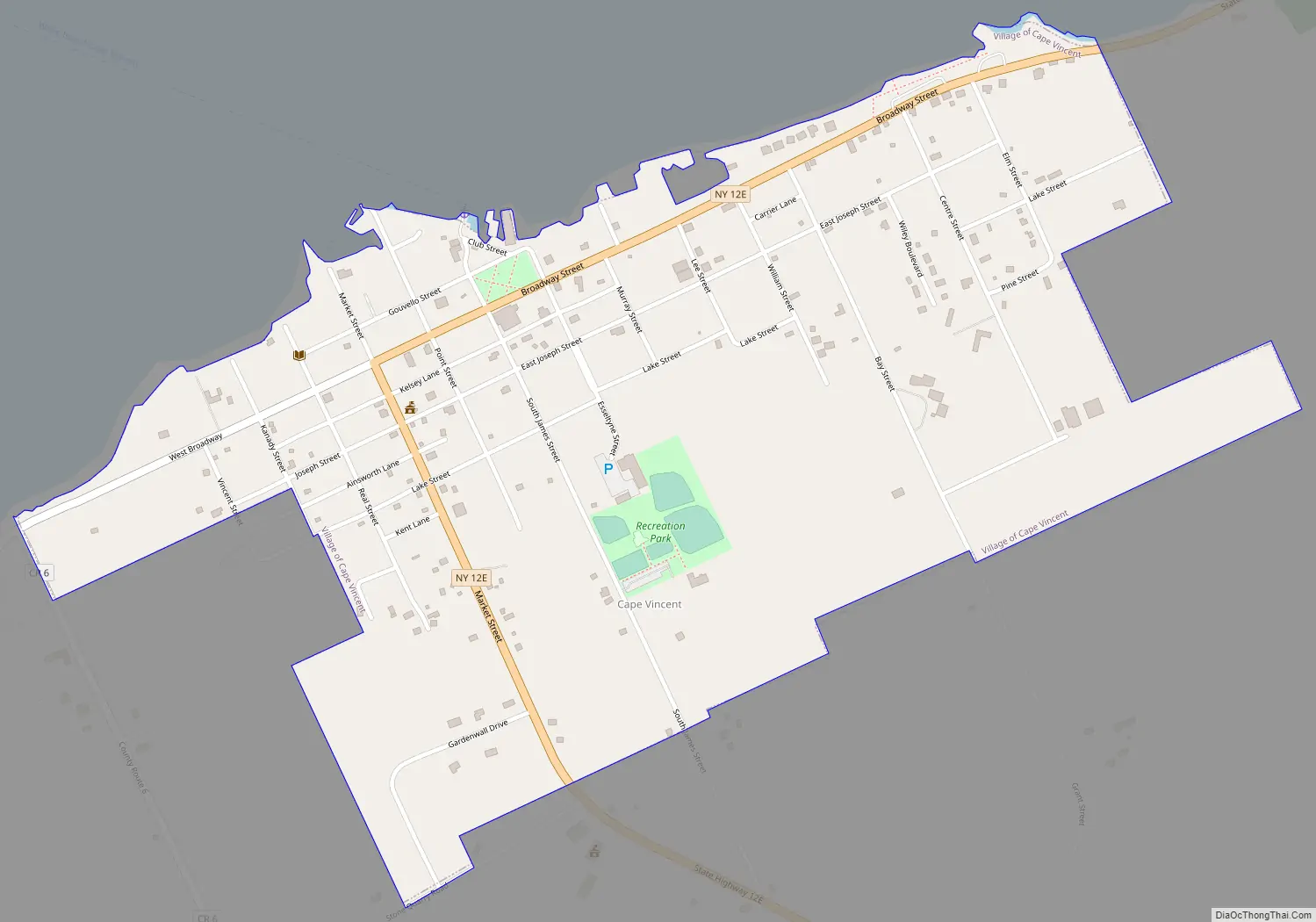
Cape Vincent Road Map
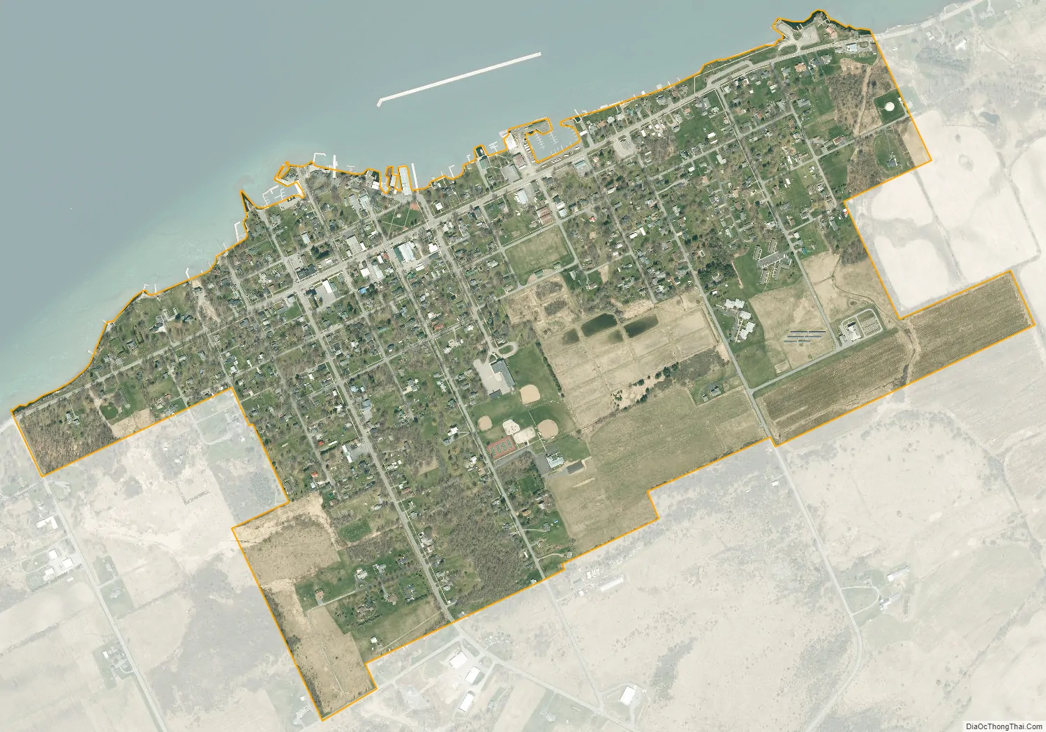
Cape Vincent city Satellite Map
Geography
According to the United States Census Bureau, Cape Vincent has a total area of 0.73 square miles (1.9 km), of which 0.02 square miles (0.06 km), or 3.31%, are water. The village is on the south bank of the St. Lawrence River. A seasonal ferry connects the village to Point Alexandria on Wolfe Island in Ontario, Canada, 1 mile (1.6 km) from Cape Vincent across the southern channel of the St. Lawrence.
New York State Route 12E passes through the village center, leading northeast (downstream) along the St. Lawrence 15 miles (24 km) to Clayton and southeast 25 miles (40 km) to Watertown, the Jefferson county seat.
See also
Map of New York State and its subdivision:- Albany
- Allegany
- Bronx
- Broome
- Cattaraugus
- Cayuga
- Chautauqua
- Chemung
- Chenango
- Clinton
- Columbia
- Cortland
- Delaware
- Dutchess
- Erie
- Essex
- Franklin
- Fulton
- Genesee
- Greene
- Hamilton
- Herkimer
- Jefferson
- Kings
- Lake Ontario
- Lewis
- Livingston
- Madison
- Monroe
- Montgomery
- Nassau
- New York
- Niagara
- Oneida
- Onondaga
- Ontario
- Orange
- Orleans
- Oswego
- Otsego
- Putnam
- Queens
- Rensselaer
- Richmond
- Rockland
- Saint Lawrence
- Saratoga
- Schenectady
- Schoharie
- Schuyler
- Seneca
- Steuben
- Suffolk
- Sullivan
- Tioga
- Tompkins
- Ulster
- Warren
- Washington
- Wayne
- Westchester
- Wyoming
- Yates
- Alabama
- Alaska
- Arizona
- Arkansas
- California
- Colorado
- Connecticut
- Delaware
- District of Columbia
- Florida
- Georgia
- Hawaii
- Idaho
- Illinois
- Indiana
- Iowa
- Kansas
- Kentucky
- Louisiana
- Maine
- Maryland
- Massachusetts
- Michigan
- Minnesota
- Mississippi
- Missouri
- Montana
- Nebraska
- Nevada
- New Hampshire
- New Jersey
- New Mexico
- New York
- North Carolina
- North Dakota
- Ohio
- Oklahoma
- Oregon
- Pennsylvania
- Rhode Island
- South Carolina
- South Dakota
- Tennessee
- Texas
- Utah
- Vermont
- Virginia
- Washington
- West Virginia
- Wisconsin
- Wyoming


