Clarence is a hamlet and census-designated place (CDP) within the town of Clarence in Erie County, New York, United States. The population was 2,646 at the 2010 census.
Clarence is part of the Buffalo–Niagara Falls Metropolitan Statistical Area.
| Name: | Clarence CDP |
|---|---|
| LSAD Code: | 57 |
| LSAD Description: | CDP (suffix) |
| State: | New York |
| County: | Erie County |
| Elevation: | 705 ft (215 m) |
| Total Area: | 2.91 sq mi (7.53 km²) |
| Land Area: | 2.84 sq mi (7.37 km²) |
| Water Area: | 0.07 sq mi (0.17 km²) |
| Total Population: | 2,733 |
| Population Density: | 960.97/sq mi (371.04/km²) |
| Area code: | 716 |
| FIPS code: | 3615814 |
| GNISfeature ID: | 0946735 |
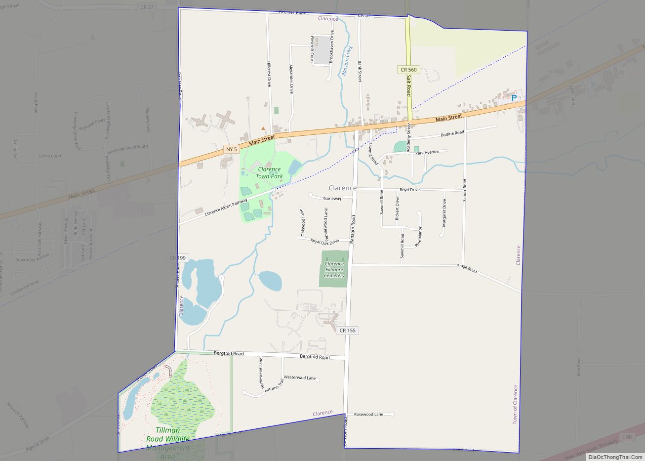
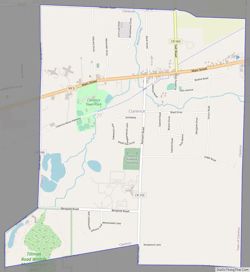
Online Interactive Map
Click on ![]() to view map in "full screen" mode.
to view map in "full screen" mode.
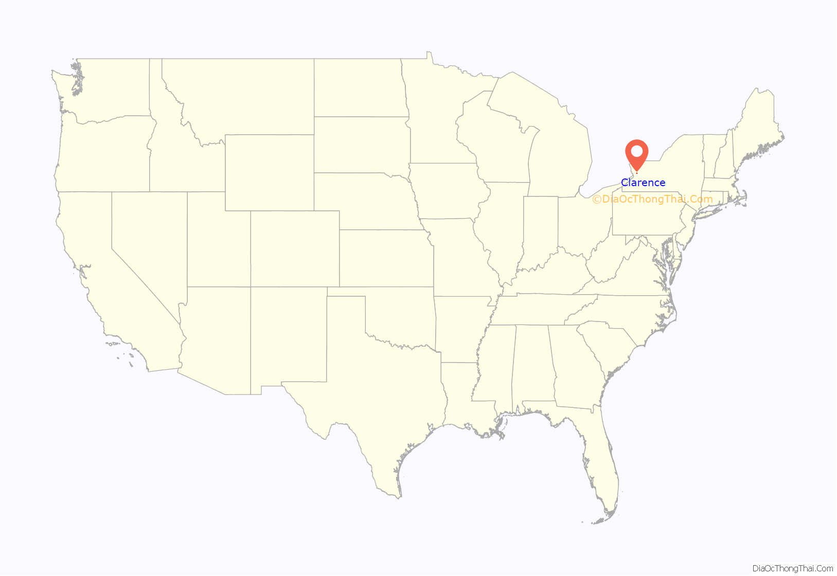
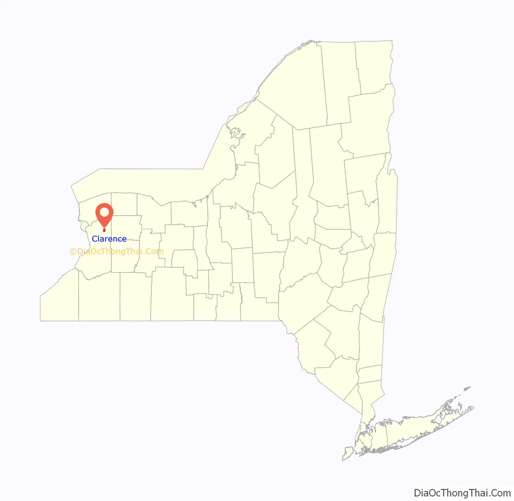
Clarence location map. Where is Clarence CDP?
Clarence Road Map
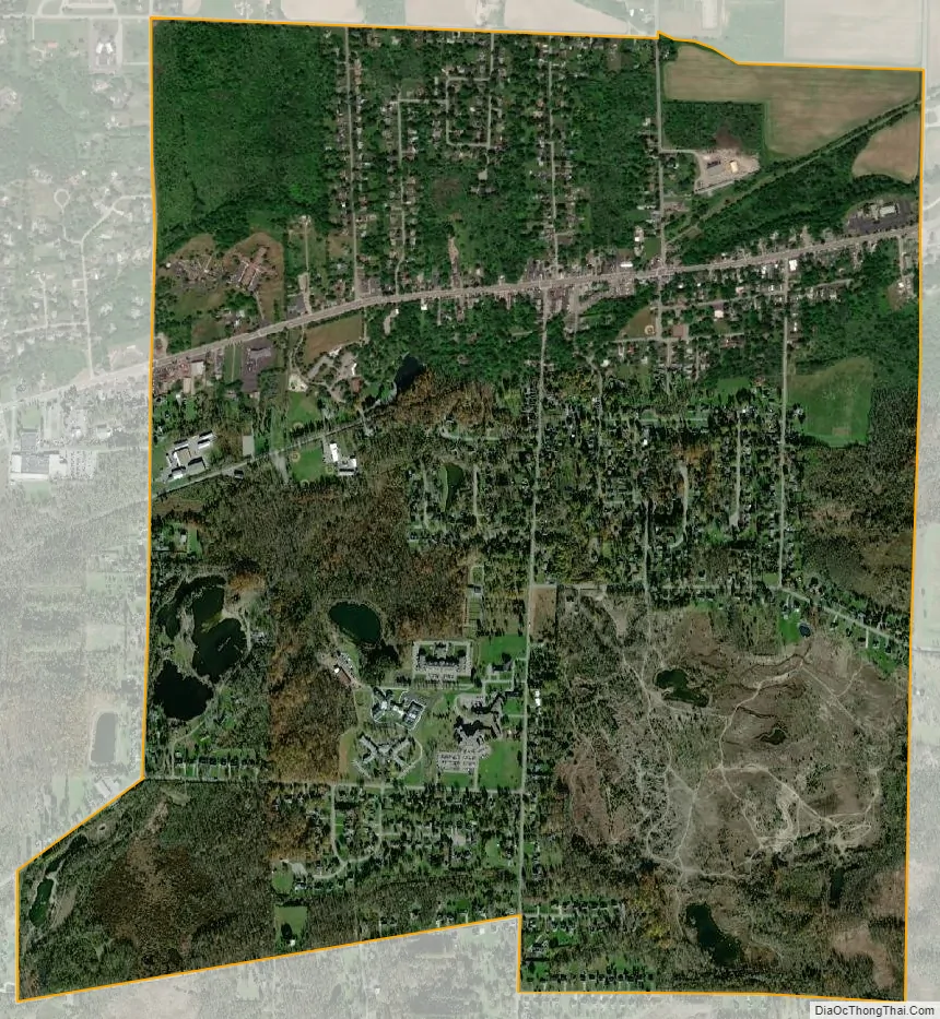
Clarence city Satellite Map
Geography
The Clarence CDP is located at 42°58′49″N 78°35′30″W / 42.98028°N 78.59167°W / 42.98028; -78.59167 (42.98054, -78.59177), in the southeastern part of the town of Clarence. New York State Route 5, Main Street, passes east–west through the center of the CDP.
The hamlet is also called “Clarence Hollow”, or just “The Hollow”, due its location centered at the base of an indentation in the Onondaga Escarpment formed by Ransom Creek. The Clarence Historical Society is located on Main Street. During the time of its founding, Clarence village was called “Pine Grove” and later “Ransomville”.
According to the United States Census Bureau, the CDP has a total area of 2.91 square miles (7.54 km), of which 2.85 square miles (7.37 km) is land and 0.066 square miles (0.17 km), or 2.23%, is water.
See also
Map of New York State and its subdivision:- Albany
- Allegany
- Bronx
- Broome
- Cattaraugus
- Cayuga
- Chautauqua
- Chemung
- Chenango
- Clinton
- Columbia
- Cortland
- Delaware
- Dutchess
- Erie
- Essex
- Franklin
- Fulton
- Genesee
- Greene
- Hamilton
- Herkimer
- Jefferson
- Kings
- Lake Ontario
- Lewis
- Livingston
- Madison
- Monroe
- Montgomery
- Nassau
- New York
- Niagara
- Oneida
- Onondaga
- Ontario
- Orange
- Orleans
- Oswego
- Otsego
- Putnam
- Queens
- Rensselaer
- Richmond
- Rockland
- Saint Lawrence
- Saratoga
- Schenectady
- Schoharie
- Schuyler
- Seneca
- Steuben
- Suffolk
- Sullivan
- Tioga
- Tompkins
- Ulster
- Warren
- Washington
- Wayne
- Westchester
- Wyoming
- Yates
- Alabama
- Alaska
- Arizona
- Arkansas
- California
- Colorado
- Connecticut
- Delaware
- District of Columbia
- Florida
- Georgia
- Hawaii
- Idaho
- Illinois
- Indiana
- Iowa
- Kansas
- Kentucky
- Louisiana
- Maine
- Maryland
- Massachusetts
- Michigan
- Minnesota
- Mississippi
- Missouri
- Montana
- Nebraska
- Nevada
- New Hampshire
- New Jersey
- New Mexico
- New York
- North Carolina
- North Dakota
- Ohio
- Oklahoma
- Oregon
- Pennsylvania
- Rhode Island
- South Carolina
- South Dakota
- Tennessee
- Texas
- Utah
- Vermont
- Virginia
- Washington
- West Virginia
- Wisconsin
- Wyoming