Clarence Center is a affluent hamlet and census-designated place (CDP) in the town of Clarence in Erie County, New York, United States. The population was 2,257 at the 2010 census. It is part of the Buffalo–Niagara Falls Metropolitan Statistical Area.
Clarence Center, within the south-central part of the town, is the location of most of the town government facilities, although the actual town hall is within the Clarence postal zone.
Clarence Center is also one of the postal zones in the town with a ZIP code of 14032. This area comprises most of the northern part of the town.
| Name: | Clarence Center CDP |
|---|---|
| LSAD Code: | 57 |
| LSAD Description: | CDP (suffix) |
| State: | New York |
| County: | Erie County |
| Elevation: | 633 ft (193 m) |
| Total Area: | 2.26 sq mi (5.85 km²) |
| Land Area: | 2.26 sq mi (5.85 km²) |
| Water Area: | 0.00 sq mi (0.00 km²) |
| Total Population: | 2,605 |
| Population Density: | 1,153.68/sq mi (445.44/km²) |
| ZIP code: | 14032 |
| Area code: | 716 |
| FIPS code: | 3615836 |
| GNISfeature ID: | 0946736 |
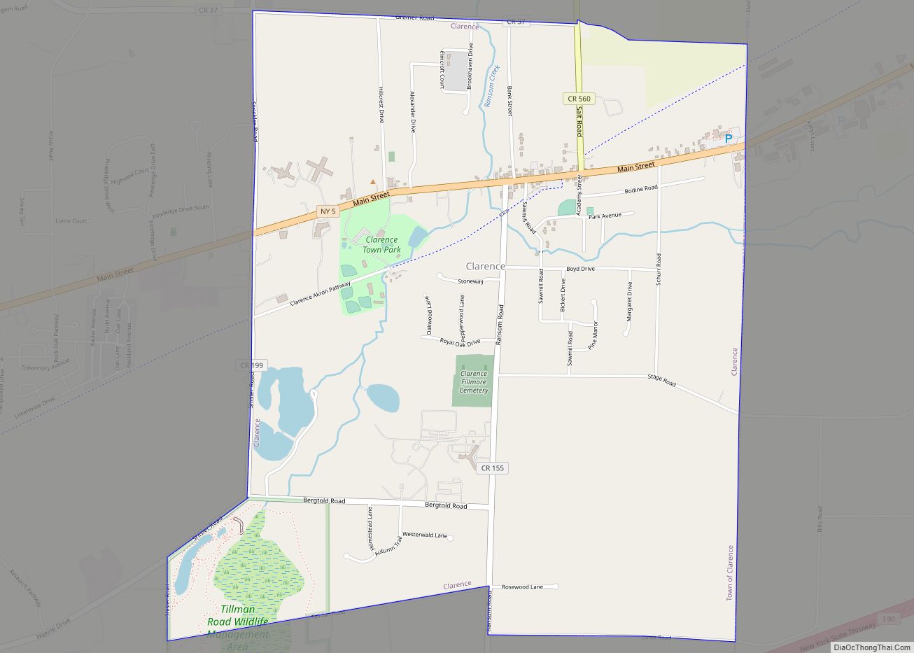
Online Interactive Map
Click on ![]() to view map in "full screen" mode.
to view map in "full screen" mode.
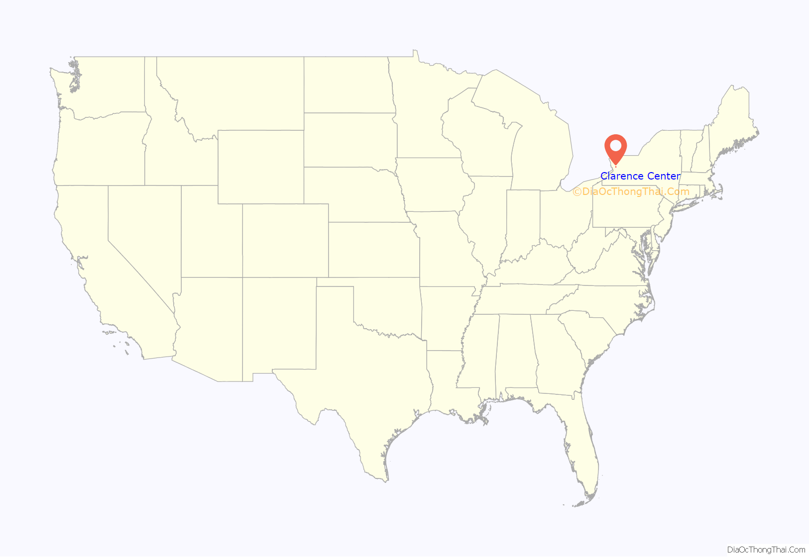
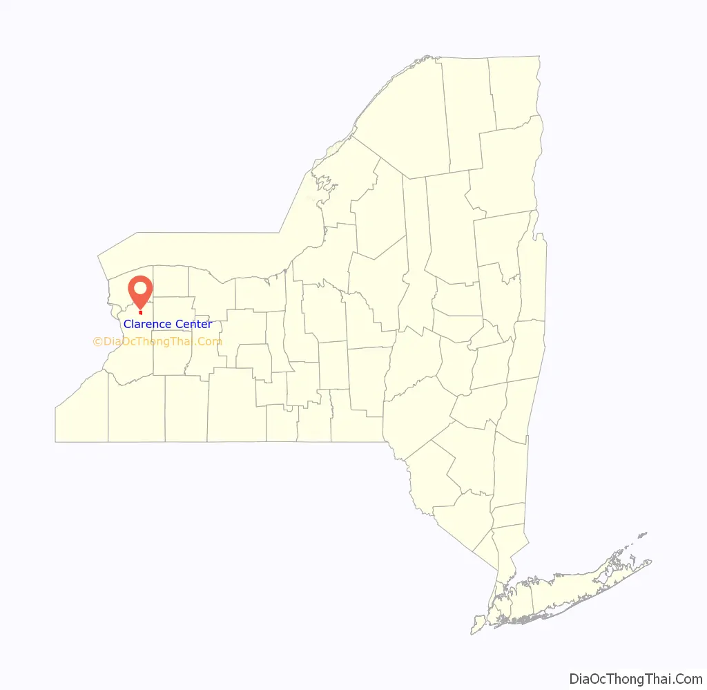
Clarence Center location map. Where is Clarence Center CDP?
History
The community was founded in 1823 as Van Tines Corners. The community was the first in the town of Clarence to have access to a rail line, with the “Peanut” line being pulled through the community in 1853, the station was named “Clarence Center,” Railroad service was cut off on December 31, 1977, and today the line has been mostly ripped up, replaced by a cycling trail, referred to as the “Peanut” line, an homage to the original “Peanut” line, on which rail came to the community.
Colgan Air Flight 3407 crash
On February 12, 2009 at 10:20 pm, a Continental Connection flight operated by Colgan Air went down in Clarence Center, killing all 44 passengers and five crew members, along with one resident on the ground whose house the plane impacted. The plane, a Bombardier Dash 8 Q400 74-seat turboprop, had logged only 1819 hours, having been delivered in 2008. Up to a week after the crash, the entire neighborhood was closed off because of the numerous residents wanting to see the crash site.
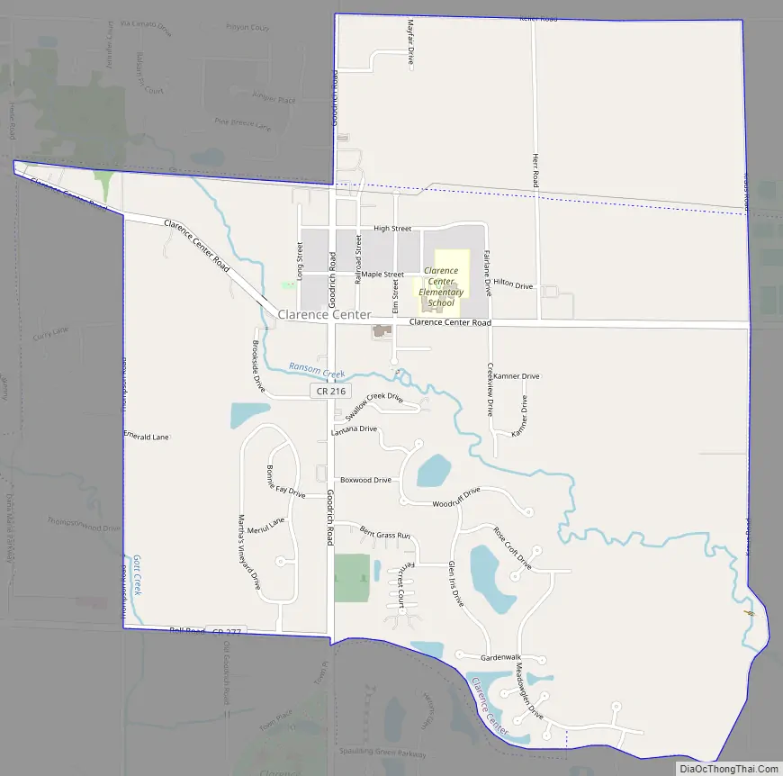
Clarence Center Road Map
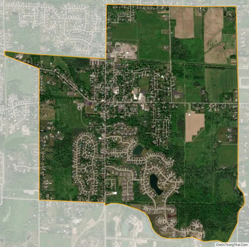
Clarence Center city Satellite Map
Geography
Clarence Center is located at 43°0′40″N 78°38′5″W / 43.01111°N 78.63472°W / 43.01111; -78.63472 (43.011158, -78.634749). According to the United States Census Bureau, the CDP has a total area of 2.1 square miles (5.4 km), all land.
As suggested by its name, Clarence Center lies near the middle of the town.
See also
Map of New York State and its subdivision:- Albany
- Allegany
- Bronx
- Broome
- Cattaraugus
- Cayuga
- Chautauqua
- Chemung
- Chenango
- Clinton
- Columbia
- Cortland
- Delaware
- Dutchess
- Erie
- Essex
- Franklin
- Fulton
- Genesee
- Greene
- Hamilton
- Herkimer
- Jefferson
- Kings
- Lake Ontario
- Lewis
- Livingston
- Madison
- Monroe
- Montgomery
- Nassau
- New York
- Niagara
- Oneida
- Onondaga
- Ontario
- Orange
- Orleans
- Oswego
- Otsego
- Putnam
- Queens
- Rensselaer
- Richmond
- Rockland
- Saint Lawrence
- Saratoga
- Schenectady
- Schoharie
- Schuyler
- Seneca
- Steuben
- Suffolk
- Sullivan
- Tioga
- Tompkins
- Ulster
- Warren
- Washington
- Wayne
- Westchester
- Wyoming
- Yates
- Alabama
- Alaska
- Arizona
- Arkansas
- California
- Colorado
- Connecticut
- Delaware
- District of Columbia
- Florida
- Georgia
- Hawaii
- Idaho
- Illinois
- Indiana
- Iowa
- Kansas
- Kentucky
- Louisiana
- Maine
- Maryland
- Massachusetts
- Michigan
- Minnesota
- Mississippi
- Missouri
- Montana
- Nebraska
- Nevada
- New Hampshire
- New Jersey
- New Mexico
- New York
- North Carolina
- North Dakota
- Ohio
- Oklahoma
- Oregon
- Pennsylvania
- Rhode Island
- South Carolina
- South Dakota
- Tennessee
- Texas
- Utah
- Vermont
- Virginia
- Washington
- West Virginia
- Wisconsin
- Wyoming