Conesus Lake is a hamlet and census-designated place (CDP) in Livingston County, New York, United States. Its population was 2,584 as of the 2010 census. The community is located in the towns of Geneseo, Livonia, Groveland, and Conesus and covers Conesus Lake, the westernmost of New York’s Finger Lakes, and nearly all of the lake’s shoreline communities.
| Name: | Conesus Lake CDP |
|---|---|
| LSAD Code: | 57 |
| LSAD Description: | CDP (suffix) |
| State: | New York |
| County: | Livingston County |
| Elevation: | 817 ft (249 m) |
| Total Area: | 9.41 sq mi (24.38 km²) |
| Land Area: | 4.36 sq mi (11.30 km²) |
| Water Area: | 5.05 sq mi (13.08 km²) |
| Total Population: | 2,270 |
| Population Density: | 520.52/sq mi (200.95/km²) |
| Area code: | 585 |
| FIPS code: | 3617622 |
| GNISfeature ID: | 2584248 |
Online Interactive Map
Click on ![]() to view map in "full screen" mode.
to view map in "full screen" mode.
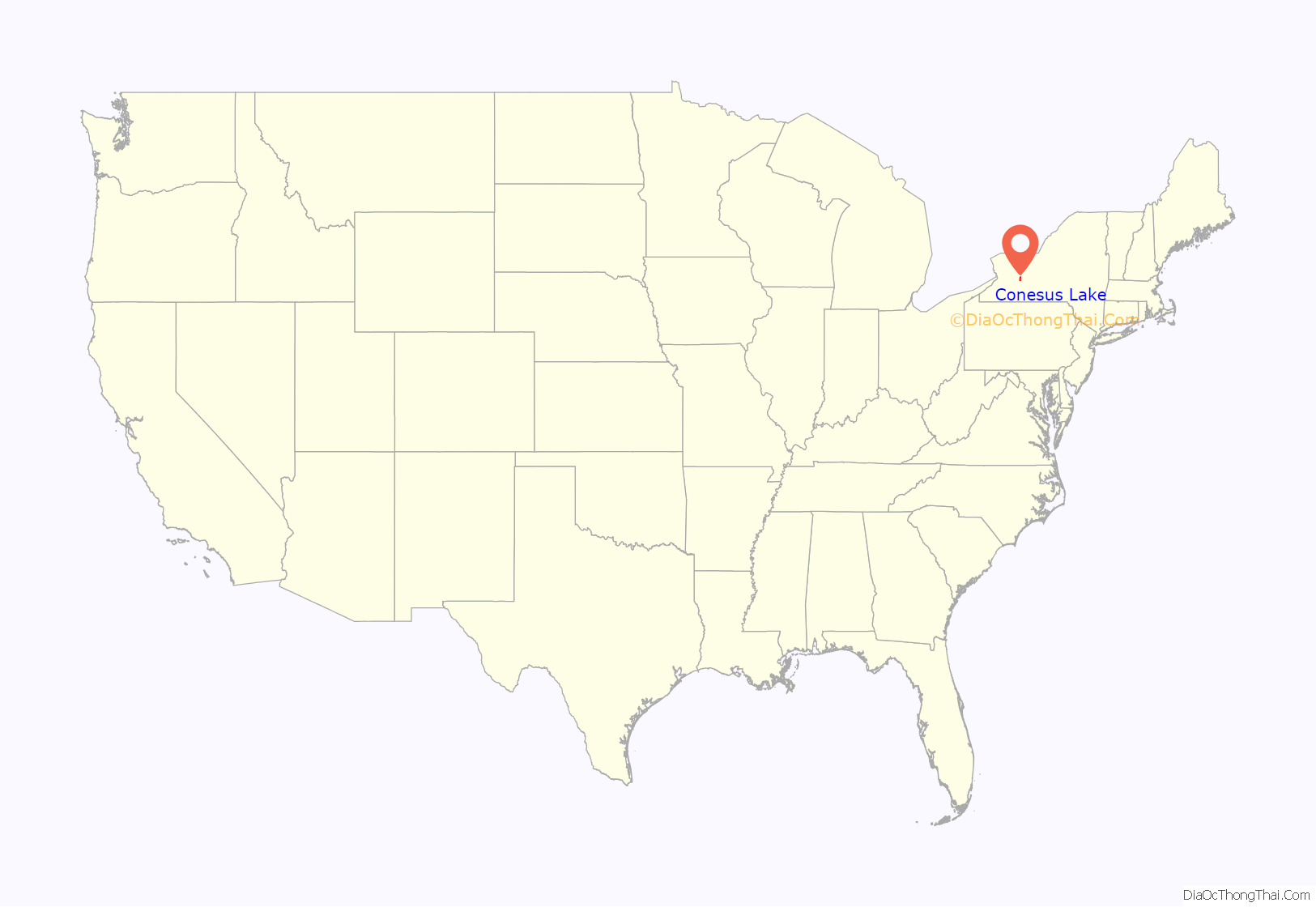
Conesus Lake location map. Where is Conesus Lake CDP?

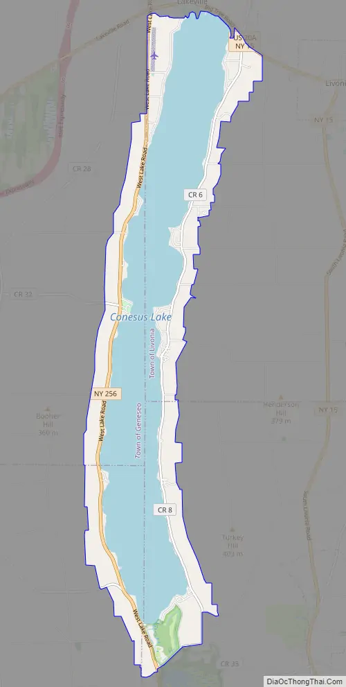
Conesus Lake Road Map
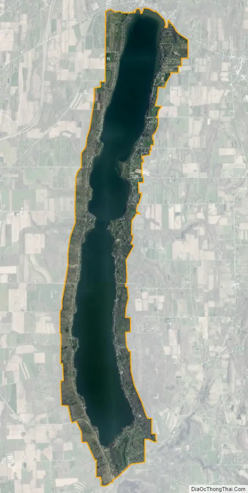
Conesus Lake city Satellite Map
Geography
According to the U.S. Census Bureau, the community has an area of 9.4 square miles (24 km); 4.4 square miles (11 km) of its area are land, and 5.1 square miles (13 km) are water. It is bordered to the north by the hamlet of Lakeville at the lake’s outlet in the town of Livonia.
New York State Route 256 (West Lake Road) follows the western shore of the lake, and East Lake Road runs along the eastern side. The lake is 7.6 miles (12.2 km) long from north to south, with an east-west width of about 0.6 miles (1.0 km), while the CDP measures slightly over 8 miles (13 km) from north to south and about 1 mile (1.6 km) from east to west.
Geneseo, the Livingston county seat, is 5 miles (8 km) west of the center of the CDP.
See also
Map of New York State and its subdivision:- Albany
- Allegany
- Bronx
- Broome
- Cattaraugus
- Cayuga
- Chautauqua
- Chemung
- Chenango
- Clinton
- Columbia
- Cortland
- Delaware
- Dutchess
- Erie
- Essex
- Franklin
- Fulton
- Genesee
- Greene
- Hamilton
- Herkimer
- Jefferson
- Kings
- Lake Ontario
- Lewis
- Livingston
- Madison
- Monroe
- Montgomery
- Nassau
- New York
- Niagara
- Oneida
- Onondaga
- Ontario
- Orange
- Orleans
- Oswego
- Otsego
- Putnam
- Queens
- Rensselaer
- Richmond
- Rockland
- Saint Lawrence
- Saratoga
- Schenectady
- Schoharie
- Schuyler
- Seneca
- Steuben
- Suffolk
- Sullivan
- Tioga
- Tompkins
- Ulster
- Warren
- Washington
- Wayne
- Westchester
- Wyoming
- Yates
- Alabama
- Alaska
- Arizona
- Arkansas
- California
- Colorado
- Connecticut
- Delaware
- District of Columbia
- Florida
- Georgia
- Hawaii
- Idaho
- Illinois
- Indiana
- Iowa
- Kansas
- Kentucky
- Louisiana
- Maine
- Maryland
- Massachusetts
- Michigan
- Minnesota
- Mississippi
- Missouri
- Montana
- Nebraska
- Nevada
- New Hampshire
- New Jersey
- New Mexico
- New York
- North Carolina
- North Dakota
- Ohio
- Oklahoma
- Oregon
- Pennsylvania
- Rhode Island
- South Carolina
- South Dakota
- Tennessee
- Texas
- Utah
- Vermont
- Virginia
- Washington
- West Virginia
- Wisconsin
- Wyoming


