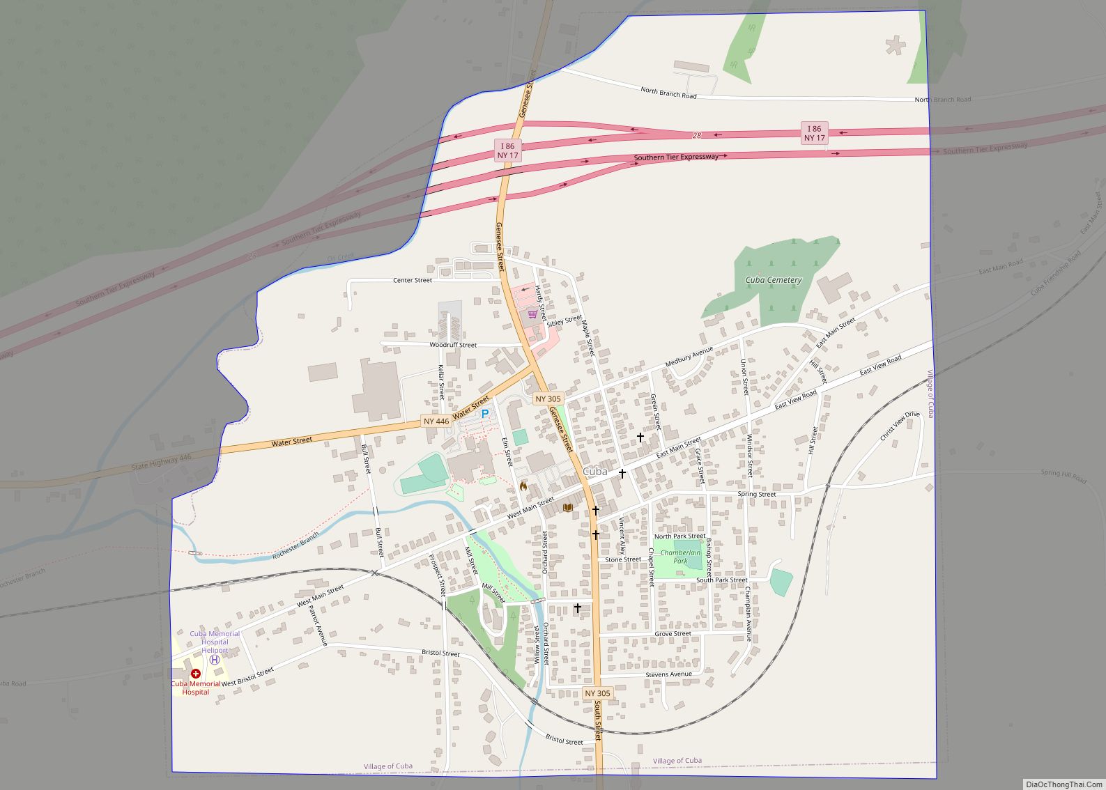
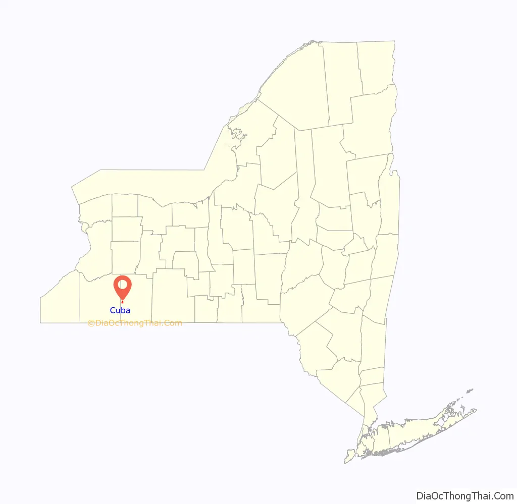
Cuba is a village in Allegany County, New York, United States. The population was 1,575 at the 2010 census. The village is in the western part of the town of Cuba at the junction of Routes 305 and 446 on Oil Creek.
| Name: | Cuba village |
|---|---|
| LSAD Code: | 47 |
| LSAD Description: | village (suffix) |
| State: | New York |
| County: | Allegany County |
| Elevation: | 1,496 ft (456 m) |
| Total Area: | 1.22 sq mi (3.15 km²) |
| Land Area: | 1.22 sq mi (3.15 km²) |
| Water Area: | 0.00 sq mi (0.00 km²) |
| Total Population: | 1,517 |
| Population Density: | 1,247.53/sq mi (481.49/km²) |
| ZIP code: | 14727 |
| Area code: | 585 |
| FIPS code: | 3619356 |
| GNISfeature ID: | 0947911 |
| Website: | www.cubany.org |
Online Interactive Map
Click on ![]() to view map in "full screen" mode.
to view map in "full screen" mode.
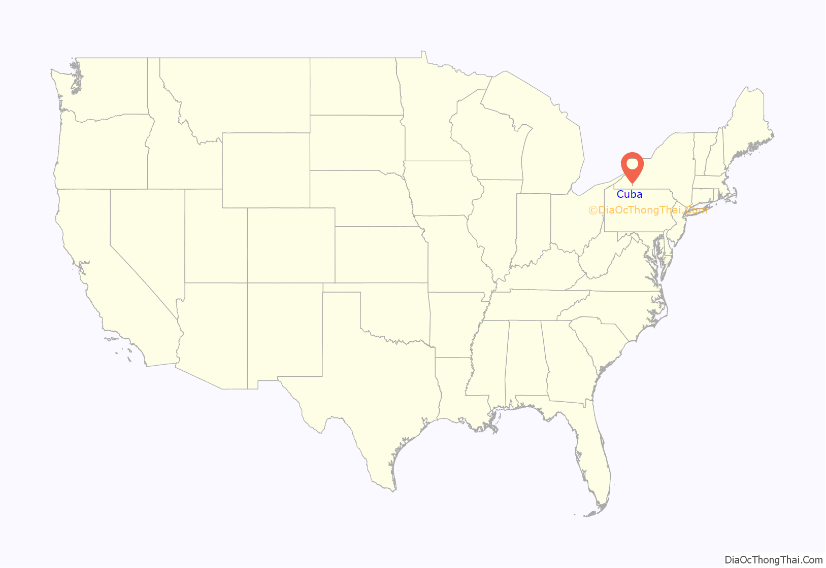
Cuba location map. Where is Cuba village?
History
An early missionary mentioned a native oil spring at this location. The village of Cuba was incorporated in 1850.
The Cuba Cemetery, Main Street Historic District, and South Street Historic District are listed on the National Register of Historic Places.
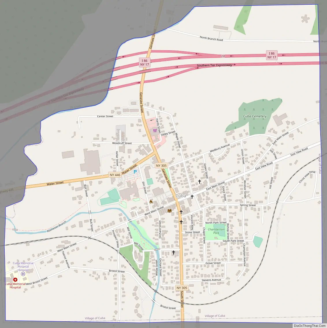
Cuba Road Map
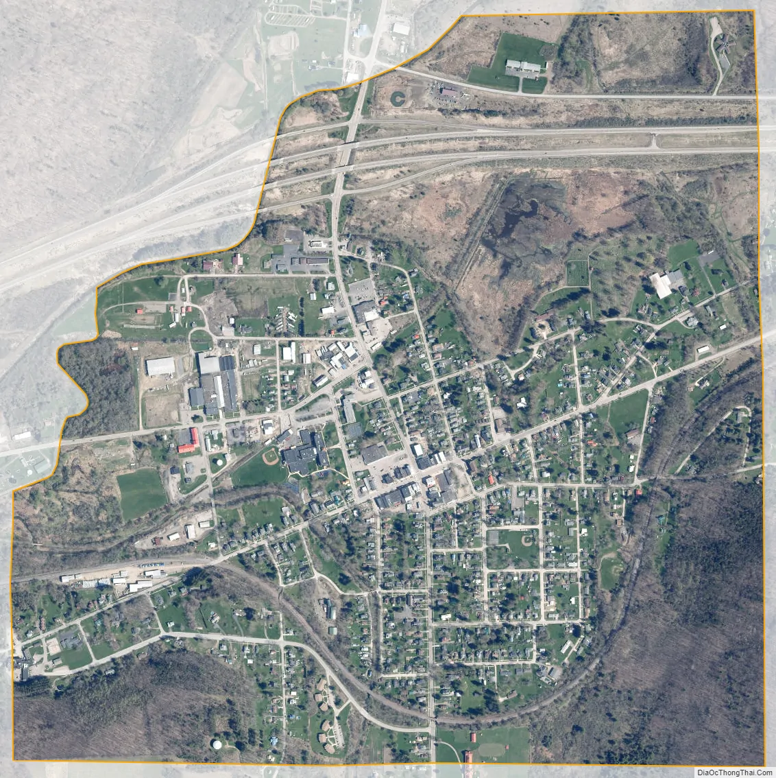
Cuba city Satellite Map
Geography
Cuba is located at 42°13′06″N 78°16′31″W / 42.21833°N 78.27528°W / 42.21833; -78.27528. The village is entirely within Allegany County, just east of the border with Cattaraugus County.
According to the United States Census Bureau, the village has a total area of 1.22 square miles (3.15 km). None of the area is covered with water, except for several narrow streams which pass through the village. Cuba Lake, a large water body, is two miles (3 km) north of the village.
The Southern Tier Expressway (Interstate 86 and New York State Highway 17) passes through the north side of the village, with access from Exit 28. NY Route 446 runs parallel to the Southern Tier Expressway. NY Route 305 is an important north-south trunk road passing through the village. Cuba is located on the Main Line of the Western New York and Pennsylvania Railroad.
North Cuba and South Cuba are small communities respectively north and south of the village on Route 305.
See also
Map of New York State and its subdivision:- Albany
- Allegany
- Bronx
- Broome
- Cattaraugus
- Cayuga
- Chautauqua
- Chemung
- Chenango
- Clinton
- Columbia
- Cortland
- Delaware
- Dutchess
- Erie
- Essex
- Franklin
- Fulton
- Genesee
- Greene
- Hamilton
- Herkimer
- Jefferson
- Kings
- Lake Ontario
- Lewis
- Livingston
- Madison
- Monroe
- Montgomery
- Nassau
- New York
- Niagara
- Oneida
- Onondaga
- Ontario
- Orange
- Orleans
- Oswego
- Otsego
- Putnam
- Queens
- Rensselaer
- Richmond
- Rockland
- Saint Lawrence
- Saratoga
- Schenectady
- Schoharie
- Schuyler
- Seneca
- Steuben
- Suffolk
- Sullivan
- Tioga
- Tompkins
- Ulster
- Warren
- Washington
- Wayne
- Westchester
- Wyoming
- Yates
- Alabama
- Alaska
- Arizona
- Arkansas
- California
- Colorado
- Connecticut
- Delaware
- District of Columbia
- Florida
- Georgia
- Hawaii
- Idaho
- Illinois
- Indiana
- Iowa
- Kansas
- Kentucky
- Louisiana
- Maine
- Maryland
- Massachusetts
- Michigan
- Minnesota
- Mississippi
- Missouri
- Montana
- Nebraska
- Nevada
- New Hampshire
- New Jersey
- New Mexico
- New York
- North Carolina
- North Dakota
- Ohio
- Oklahoma
- Oregon
- Pennsylvania
- Rhode Island
- South Carolina
- South Dakota
- Tennessee
- Texas
- Utah
- Vermont
- Virginia
- Washington
- West Virginia
- Wisconsin
- Wyoming