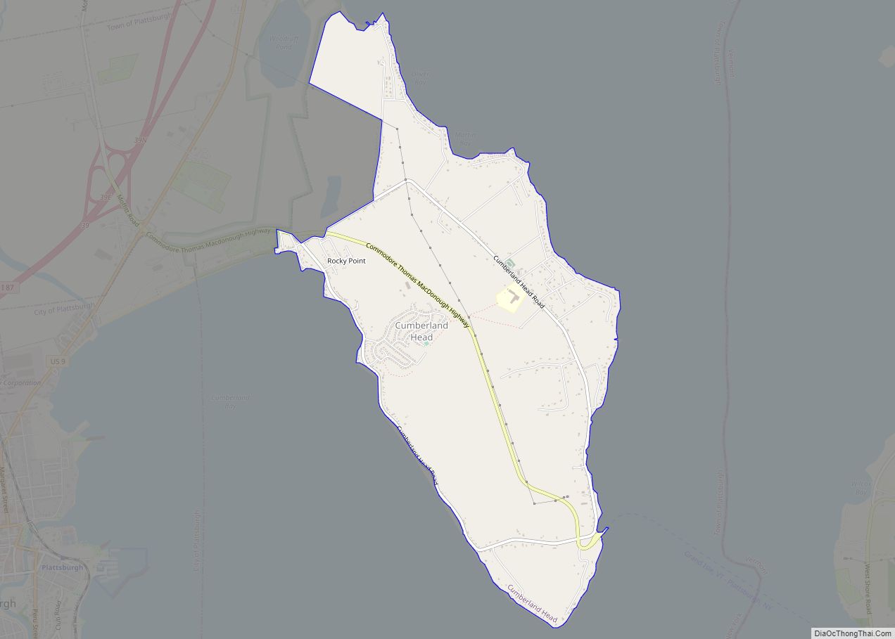
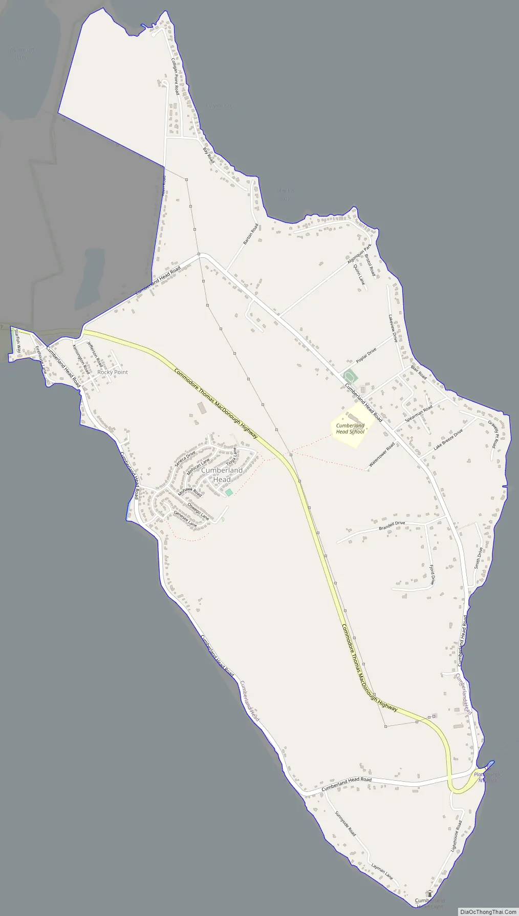
Cumberland Head is a census-designated place and region of the town of Plattsburgh in Clinton County, New York, United States. The population was 1,627 at the 2010 census.
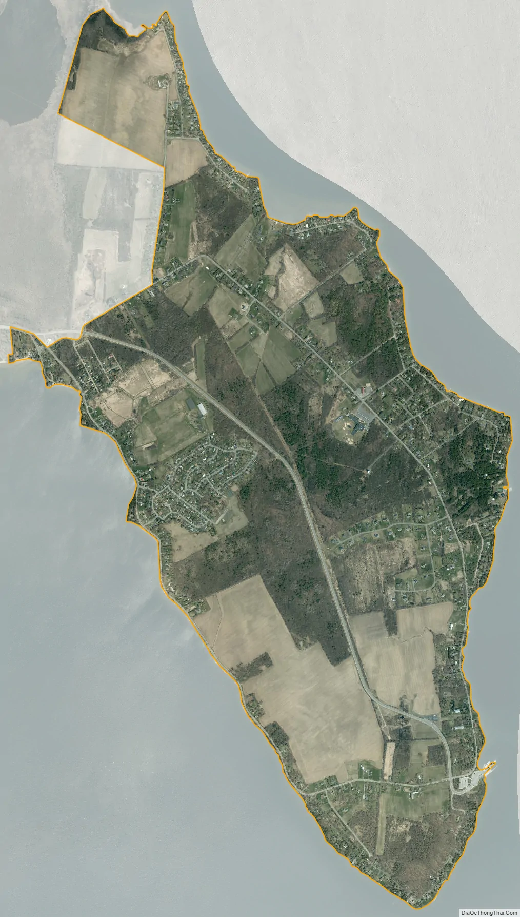
Cumberland Head is a peninsula projecting into Lake Champlain, and includes the communities of Rocky Point and Champlain Park.
A landing for the Lake Champlain Transportation Company’s ferry to Gordon Landing on Grand Isle, Vermont, is near the southern end of Cumberland Head. Cumberland Bay State Park is located at the northern end of the peninsula.
There is a historic lighthouse on the end of Cumberland Head.
| Name: | Cumberland Head CDP |
|---|---|
| LSAD Code: | 57 |
| LSAD Description: | CDP (suffix) |
| State: | New York |
| County: | Clinton County |
| Elevation: | 144 ft (44 m) |
| Total Area: | 3.86 sq mi (10.00 km²) |
| Land Area: | 3.86 sq mi (10.00 km²) |
| Water Area: | 0.00 sq mi (0.00 km²) |
| Total Population: | 1,735 |
| Population Density: | 449.48/sq mi (173.56/km²) |
| FIPS code: | 3619408 |
| GNISfeature ID: | 1867398 |
Online Interactive Map
Click on ![]() to view map in "full screen" mode.
to view map in "full screen" mode.
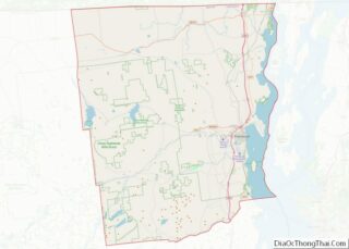
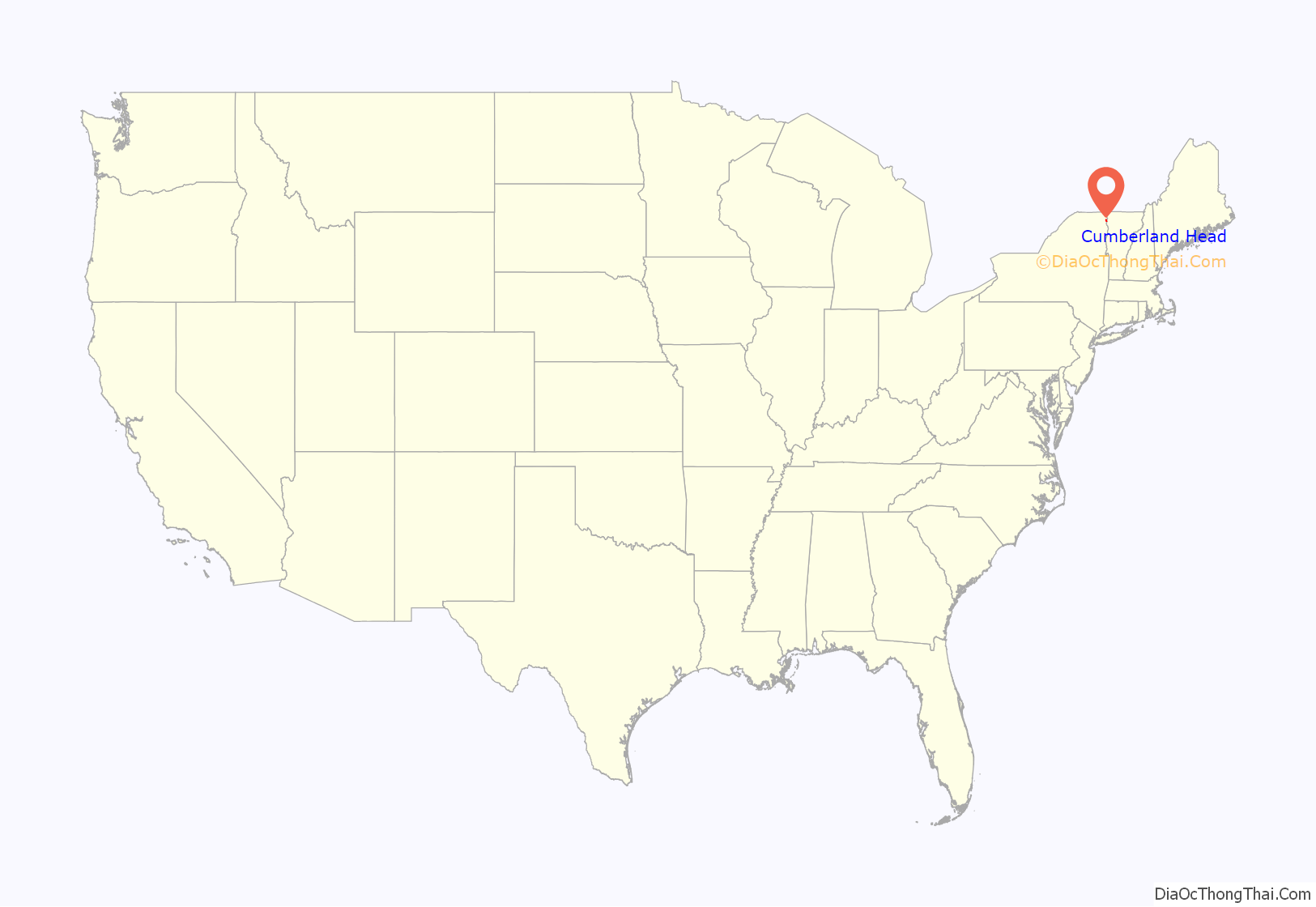
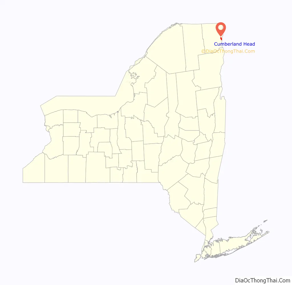
Cumberland Head location map. Where is Cumberland Head CDP?
Cumberland Head Road Map
Cumberland Head city Satellite Map
Geography
Cumberland Head is located in the northeastern part of the town of Plattsburgh at 44°42′59″N 73°24′9″W / 44.71639°N 73.40250°W / 44.71639; -73.40250 (44.716345, -73.402603).
According to the United States Census Bureau, the CDP has a total area of 3.6 square miles (9.3 km), all land.
See also
Map of New York State and its subdivision:- Albany
- Allegany
- Bronx
- Broome
- Cattaraugus
- Cayuga
- Chautauqua
- Chemung
- Chenango
- Clinton
- Columbia
- Cortland
- Delaware
- Dutchess
- Erie
- Essex
- Franklin
- Fulton
- Genesee
- Greene
- Hamilton
- Herkimer
- Jefferson
- Kings
- Lake Ontario
- Lewis
- Livingston
- Madison
- Monroe
- Montgomery
- Nassau
- New York
- Niagara
- Oneida
- Onondaga
- Ontario
- Orange
- Orleans
- Oswego
- Otsego
- Putnam
- Queens
- Rensselaer
- Richmond
- Rockland
- Saint Lawrence
- Saratoga
- Schenectady
- Schoharie
- Schuyler
- Seneca
- Steuben
- Suffolk
- Sullivan
- Tioga
- Tompkins
- Ulster
- Warren
- Washington
- Wayne
- Westchester
- Wyoming
- Yates
- Alabama
- Alaska
- Arizona
- Arkansas
- California
- Colorado
- Connecticut
- Delaware
- District of Columbia
- Florida
- Georgia
- Hawaii
- Idaho
- Illinois
- Indiana
- Iowa
- Kansas
- Kentucky
- Louisiana
- Maine
- Maryland
- Massachusetts
- Michigan
- Minnesota
- Mississippi
- Missouri
- Montana
- Nebraska
- Nevada
- New Hampshire
- New Jersey
- New Mexico
- New York
- North Carolina
- North Dakota
- Ohio
- Oklahoma
- Oregon
- Pennsylvania
- Rhode Island
- South Carolina
- South Dakota
- Tennessee
- Texas
- Utah
- Vermont
- Virginia
- Washington
- West Virginia
- Wisconsin
- Wyoming