Earlville is a village in New York state bisected by two counties: Madison County and Chenango County, United States. The population was 774 as per the 2020 Decennial census, a decrease from the 872 reported in the 2010 census. The village is named after Jonas Earl, a canal commissioner.
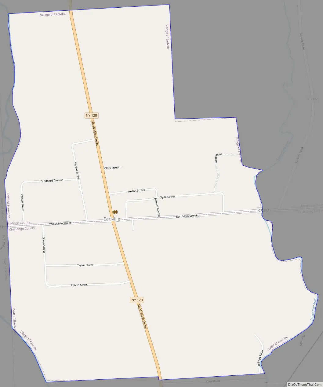
The village of Earlville is at the intersection of four towns: Sherburne, Hamilton, Lebanon, and Smyrna. The east–west thoroughfare, East and West Main streets, runs along the county line. The Madison County part of Earlville is part of the Syracuse Metropolitan Statistical Area.
| Name: | Earlville village |
|---|---|
| LSAD Code: | 47 |
| LSAD Description: | village (suffix) |
| State: | New York |
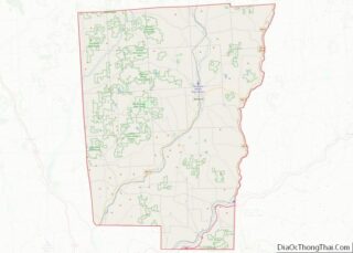
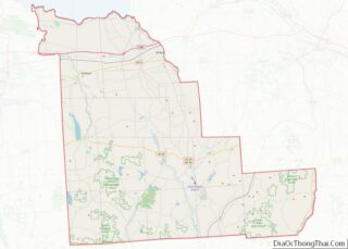
| County: | Chenango County, Madison County |
| Elevation: | 1,099 ft (335 m) |
| Total Area: | 1.08 sq mi (2.80 km²) |
| Land Area: | 1.08 sq mi (2.80 km²) |
| Water Area: | 0.00 sq mi (0.00 km²) |
| Total Population: | 774 |
| Population Density: | 716.00/sq mi (276.49/km²) |
| ZIP code: | 13332 |
| Area code: | 315 |
| FIPS code: | 3621523 |
| GNISfeature ID: | 0948958 |
| Website: | www.villageofearlville.com |
Online Interactive Map
Click on ![]() to view map in "full screen" mode.
to view map in "full screen" mode.
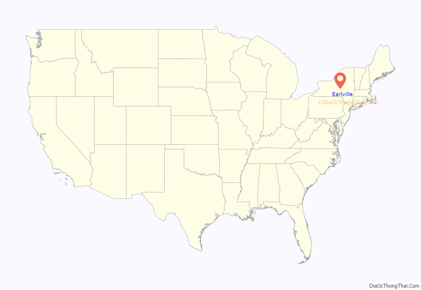
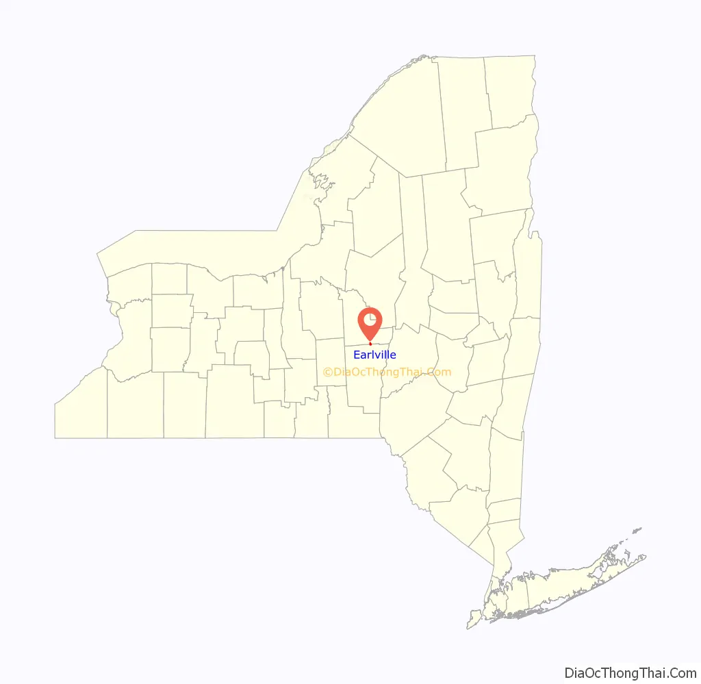
Earlville location map. Where is Earlville village?
History
The area was first settled around 1792 and was originally called “Forks” or “Madison Forks” until the current name was adopted around 1835, after development of the Chenango Canal. It was named for the builder of the Chenango Canal. After canal transportation waned, railroad service helped community commerce.
Earlville became an incorporated village in 1887. The Earlville Historic District was added to the National Register of Historic Places in 1982. The Earlville Opera House was listed in 1973 and houses a theater, two art galleries, an arts cafe, and an artisan gift shop.
Earlville Road Map
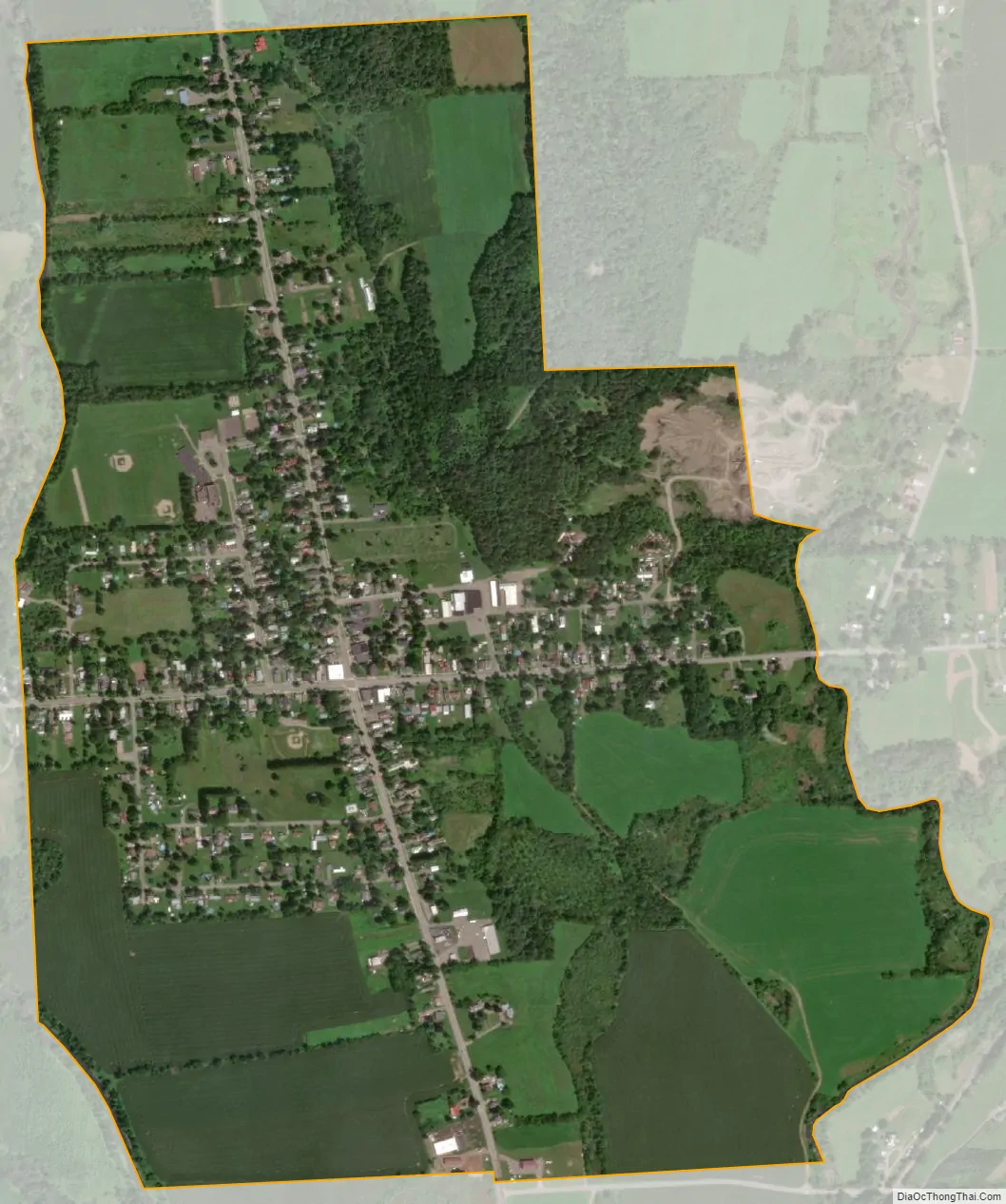
Earlville city Satellite Map
Geography
Earlville is located at 42°44′28″N 75°32′38″W / 42.74111°N 75.54389°W / 42.74111; -75.54389 (42.741079, -75.543827), positioned between the Chenango River to the west and the Sangerfield River, a tributary of the Chenango River, to the east. The Chenango River is a southward-flowing tributary of the Susquehanna River.
According to the United States Census Bureau, the village has a total area of 1.1 square miles (2.8 km), all land.
New York State Route 12B, a north–south highway, passes through the center of the village as North and South Main streets. East and West Main streets cross NY 12B, dividing the village between the two counties (Madison and Chenango).
See also
Map of New York State and its subdivision:- Albany
- Allegany
- Bronx
- Broome
- Cattaraugus
- Cayuga
- Chautauqua
- Chemung
- Chenango
- Clinton
- Columbia
- Cortland
- Delaware
- Dutchess
- Erie
- Essex
- Franklin
- Fulton
- Genesee
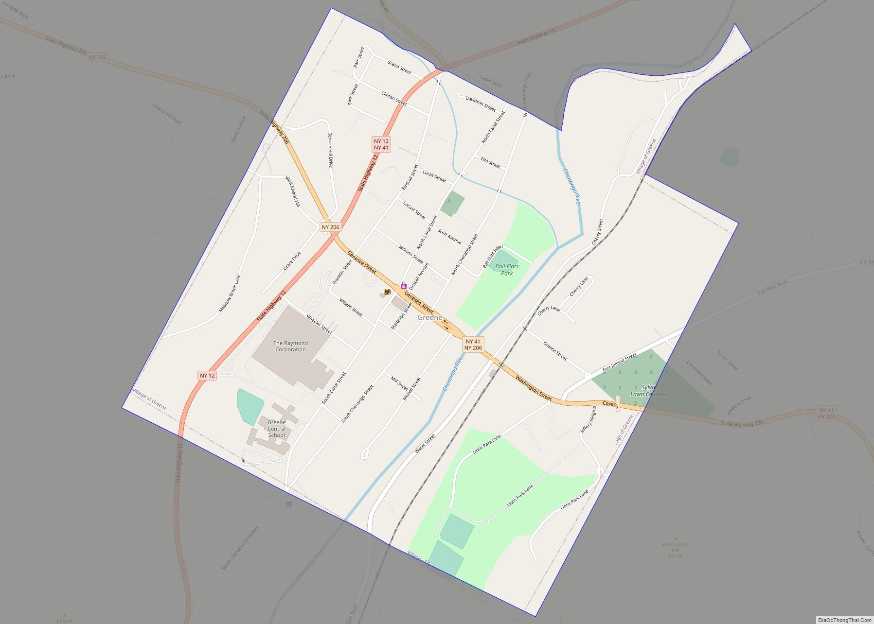
- Greene
- Hamilton
- Herkimer
- Jefferson
- Kings
- Lake Ontario
- Lewis
- Livingston
- Madison
- Monroe
- Montgomery
- Nassau
- New York
- Niagara
- Oneida
- Onondaga
- Ontario
- Orange
- Orleans
- Oswego
- Otsego
- Putnam
- Queens
- Rensselaer
- Richmond
- Rockland
- Saint Lawrence
- Saratoga
- Schenectady
- Schoharie
- Schuyler
- Seneca
- Steuben
- Suffolk
- Sullivan
- Tioga
- Tompkins
- Ulster
- Warren
- Washington
- Wayne
- Westchester
- Wyoming
- Yates
- Alabama
- Alaska
- Arizona
- Arkansas
- California
- Colorado
- Connecticut
- Delaware
- District of Columbia
- Florida
- Georgia
- Hawaii
- Idaho
- Illinois
- Indiana
- Iowa
- Kansas
- Kentucky
- Louisiana
- Maine
- Maryland
- Massachusetts
- Michigan
- Minnesota
- Mississippi
- Missouri
- Montana
- Nebraska
- Nevada
- New Hampshire
- New Jersey
- New Mexico
- New York
- North Carolina
- North Dakota
- Ohio
- Oklahoma
- Oregon
- Pennsylvania
- Rhode Island
- South Carolina
- South Dakota
- Tennessee
- Texas
- Utah
- Vermont
- Virginia
- Washington
- West Virginia
- Wisconsin
- Wyoming