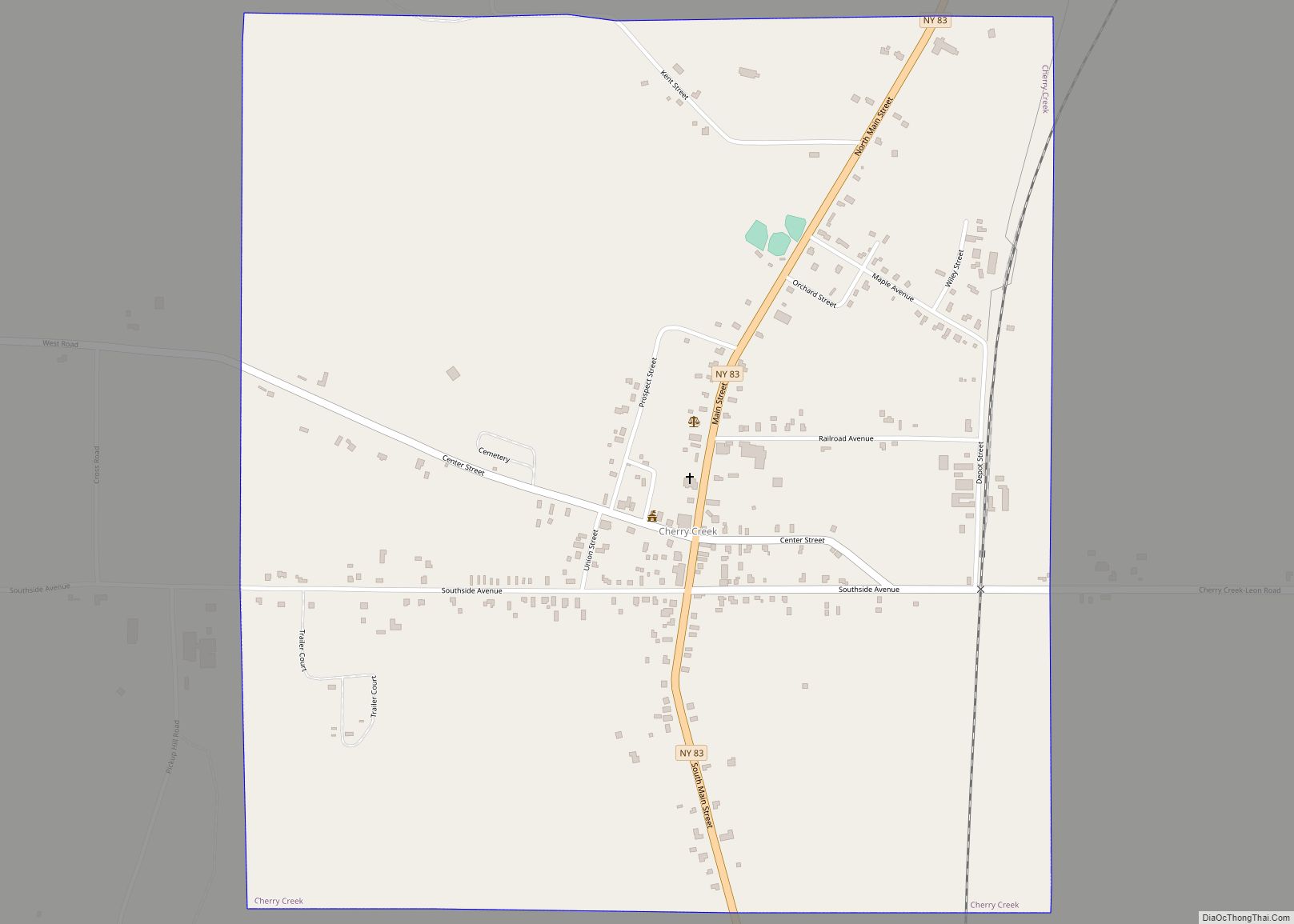
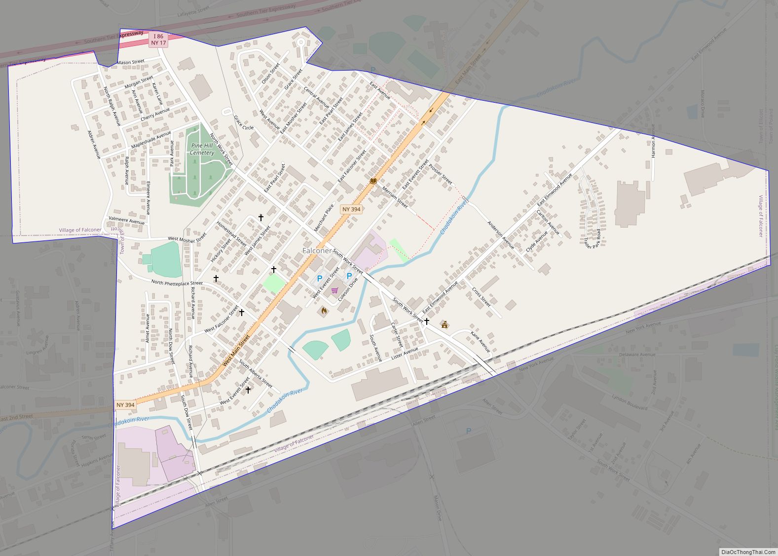
Falconer is a village in Chautauqua County, New York, United States. The population was 2,284 at the 2020 census. Falconer is within the town of Ellicott and is on the eastern edge of the city of Jamestown.
| Name: | Falconer village |
|---|---|
| LSAD Code: | 47 |
| LSAD Description: | village (suffix) |
| State: | New York |
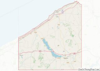
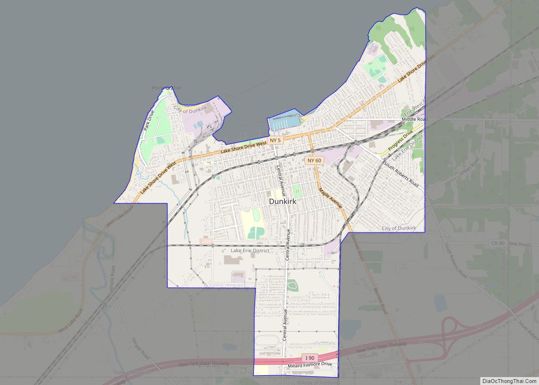
| County: | Chautauqua County |
| Elevation: | 1,263 ft (385 m) |
| Total Area: | 1.08 sq mi (2.79 km²) |
| Land Area: | 1.08 sq mi (2.79 km²) |
| Water Area: | 0.00 sq mi (0.00 km²) |
| Total Population: | 2,269 |
| Population Density: | 2,102.87/sq mi (811.97/km²) |
| ZIP code: | 14733 |
| Area code: | 716 |
| FIPS code: | 3625164 |
| GNISfeature ID: | 0949863 |
| Website: | falconerny.org |
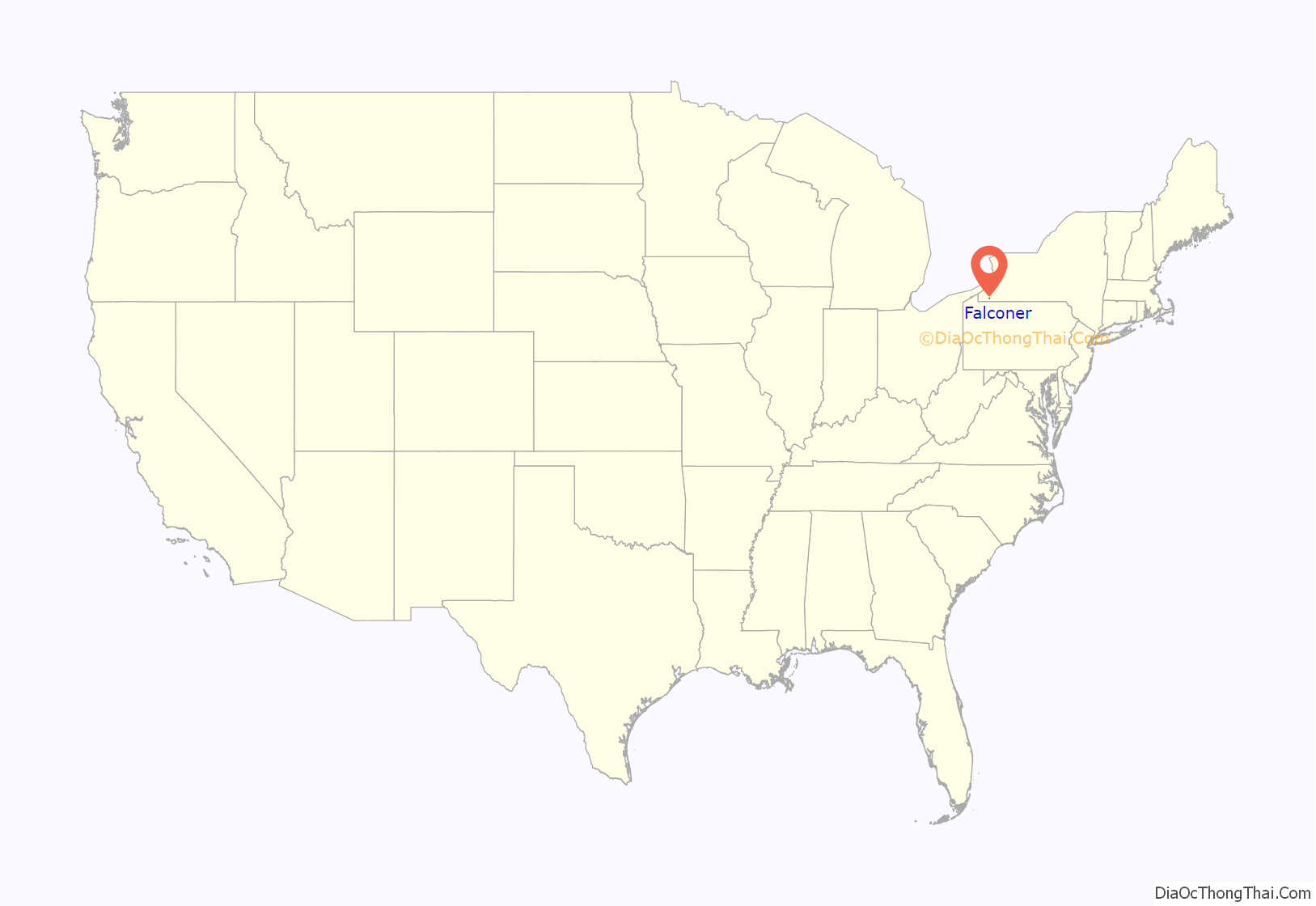
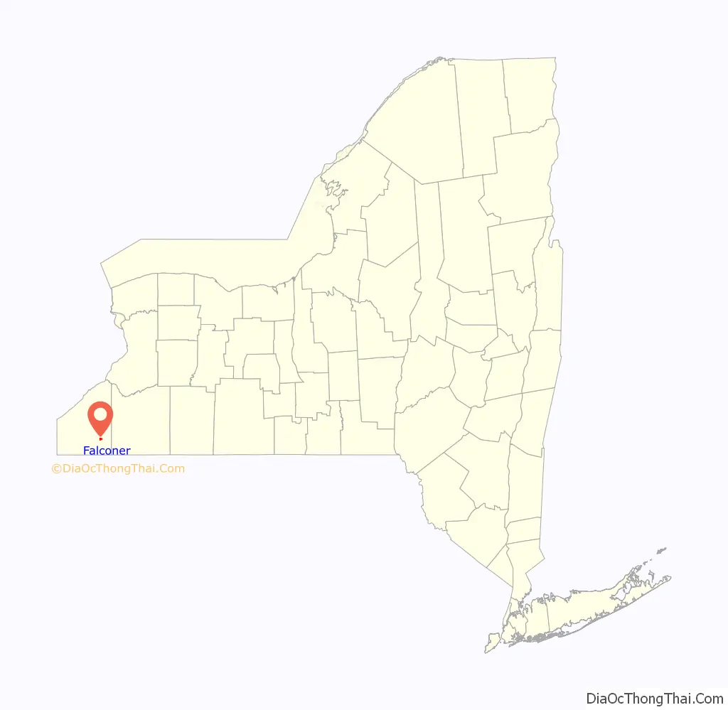
Online Interactive Map
Click on ![]() to view map in "full screen" mode.
to view map in "full screen" mode.
Falconer location map. Where is Falconer village?
History
The area now known as Falconer was inhabited by the Erie People until the mid-1600s. Five years of war with the Seneca Nation led to the Erie Nation’s decimation; their people migrated and were absorbed into the Seneca community, who then inhabited this land. During the Revolutionary War, the thriving Seneca Nation sided with the losing British. In 1779, George Washington organized the Sullivan Expedition, a military campaign intended to weaken Loyalist and Haudenosaunee (Iroquois) communities. The Seneca signed the Treaty at Big Tree in 1797, surrendering most of their lands to the United States government.
By White settlers, Falconer was originally called Worksburg, after Edward Work, who purchased the land from the Holland Land Company in August 1807. The first Falconer to own the land was Robert Falconer, who bought it from Edward Work in 1836. His son, Patrick, later consolidated his land holdings in the future village. In 1874 the community received its present name, after either William T. Falconer (1850–1915) or his father Patrick, who was on the board of directors of the Allegheny & Pittsburg Railroad and donated a large tract of land through town to the railroad concern. This resulted in the railroad line being routed through the middle of the community. Route 380 in the village retains the name “Work Street” after the town’s founder (it also now serves as a double entendre as the village’s various industrial sites are on the same road and thus many people “work” there).
The village of Falconer was incorporated in 1891.
John Cheever selected the village as the location for the fictional Falconer State Prison in his novel Falconer.
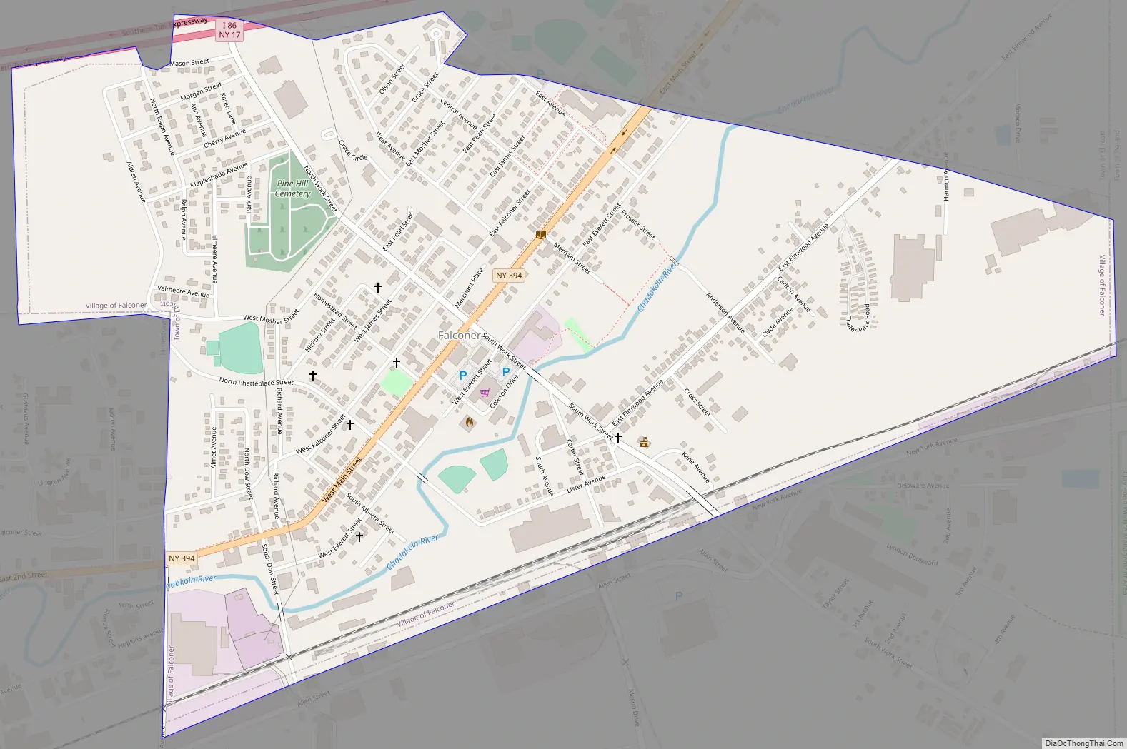
Falconer Road Map
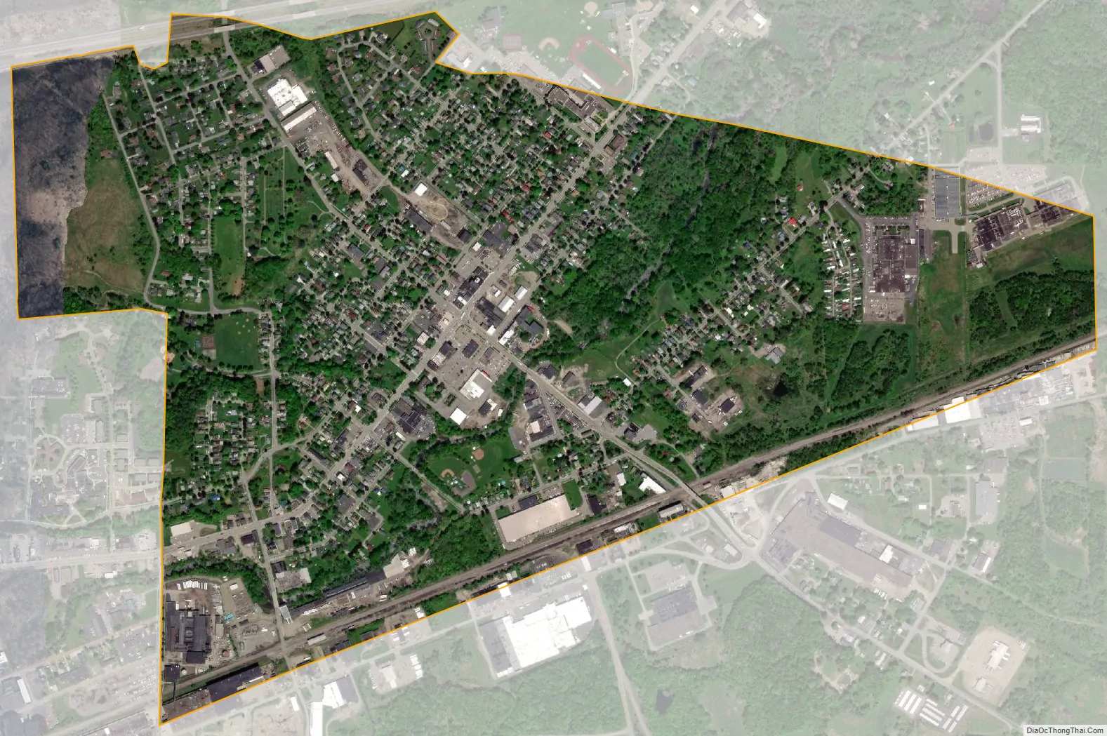
Falconer city Satellite Map
Geography
Falconer is located in the eastern part of the town of Ellicott at 42°7′8″N 79°12′1″W / 42.11889°N 79.20028°W / 42.11889; -79.20028 (42.118908, -79.200207). It is bordered to the west by the city of Jamestown, while its eastern tip touches the border of the town of Poland.
The Chadakoin River, the outlet of Chautauqua Lake, flows from Jamestown and passes through the village, meeting Cassadaga Creek to the northeast at Levant. The river system is part of the Mississippi River basin via Conewango Creek and the Allegheny River.
According to the United States Census Bureau, the village has a total area of 2.8 square kilometres (1.1 sq mi), all land.
New York State Route 394 (east-to-west) and Chautauqua County Route 380 (north-to-south) are the primary routes through Falconer. Access to and from Interstate 86 is available via exit 13, just east of the village. County Route 65 enters the village from the southeast. Falconer is unusual among villages in the area in that its speed limit is 25 miles per hour, the lowest of any village or town in Chautauqua County; Route 394 has a 35 mile-per-hour posted speed limit.
See also
Map of New York State and its subdivision:- Albany
- Allegany
- Bronx
- Broome
- Cattaraugus
- Cayuga
- Chautauqua
- Chemung
- Chenango
- Clinton
- Columbia
- Cortland
- Delaware
- Dutchess
- Erie
- Essex
- Franklin
- Fulton
- Genesee
- Greene
- Hamilton
- Herkimer
- Jefferson
- Kings
- Lake Ontario
- Lewis
- Livingston
- Madison
- Monroe
- Montgomery
- Nassau
- New York
- Niagara
- Oneida
- Onondaga
- Ontario
- Orange
- Orleans
- Oswego
- Otsego
- Putnam
- Queens
- Rensselaer
- Richmond
- Rockland
- Saint Lawrence
- Saratoga
- Schenectady
- Schoharie
- Schuyler
- Seneca
- Steuben
- Suffolk
- Sullivan
- Tioga
- Tompkins
- Ulster
- Warren
- Washington
- Wayne
- Westchester
- Wyoming
- Yates
- Alabama
- Alaska
- Arizona
- Arkansas
- California
- Colorado
- Connecticut
- Delaware
- District of Columbia
- Florida
- Georgia
- Hawaii
- Idaho
- Illinois
- Indiana
- Iowa
- Kansas
- Kentucky
- Louisiana
- Maine
- Maryland
- Massachusetts
- Michigan
- Minnesota
- Mississippi
- Missouri
- Montana
- Nebraska
- Nevada
- New Hampshire
- New Jersey
- New Mexico
- New York
- North Carolina
- North Dakota
- Ohio
- Oklahoma
- Oregon
- Pennsylvania
- Rhode Island
- South Carolina
- South Dakota
- Tennessee
- Texas
- Utah
- Vermont
- Virginia
- Washington
- West Virginia
- Wisconsin
- Wyoming