Felts Mills is a hamlet and census-designated place (CDP) in the town of Rutland of Jefferson County, New York, United States. The population was 372 at the 2010 census. Felts Mills’ original name was “Mid Road” because it is close to the halfway point between Watertown and Carthage.
| Name: | Felts Mills CDP |
|---|---|
| LSAD Code: | 57 |
| LSAD Description: | CDP (suffix) |
| State: | New York |
| County: | Jefferson County |
| Elevation: | 580 ft (180 m) |
| Total Area: | 0.60 sq mi (1.55 km²) |
| Land Area: | 0.59 sq mi (1.52 km²) |
| Water Area: | 0.01 sq mi (0.04 km²) |
| Total Population: | 473 |
| Population Density: | 807.17/sq mi (311.86/km²) |
| ZIP code: | 13638 |
| Area code: | 315 |
| FIPS code: | 3625571 |
| GNISfeature ID: | 0949970 |
Online Interactive Map
Click on ![]() to view map in "full screen" mode.
to view map in "full screen" mode.
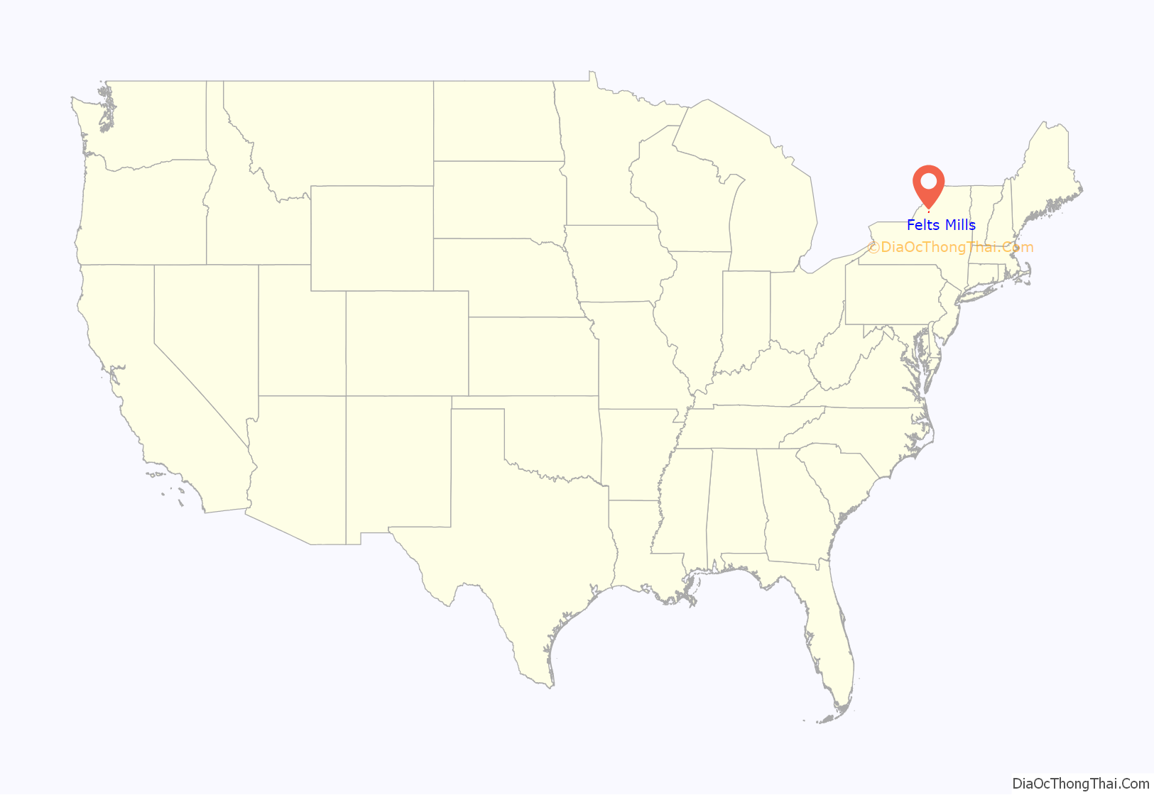
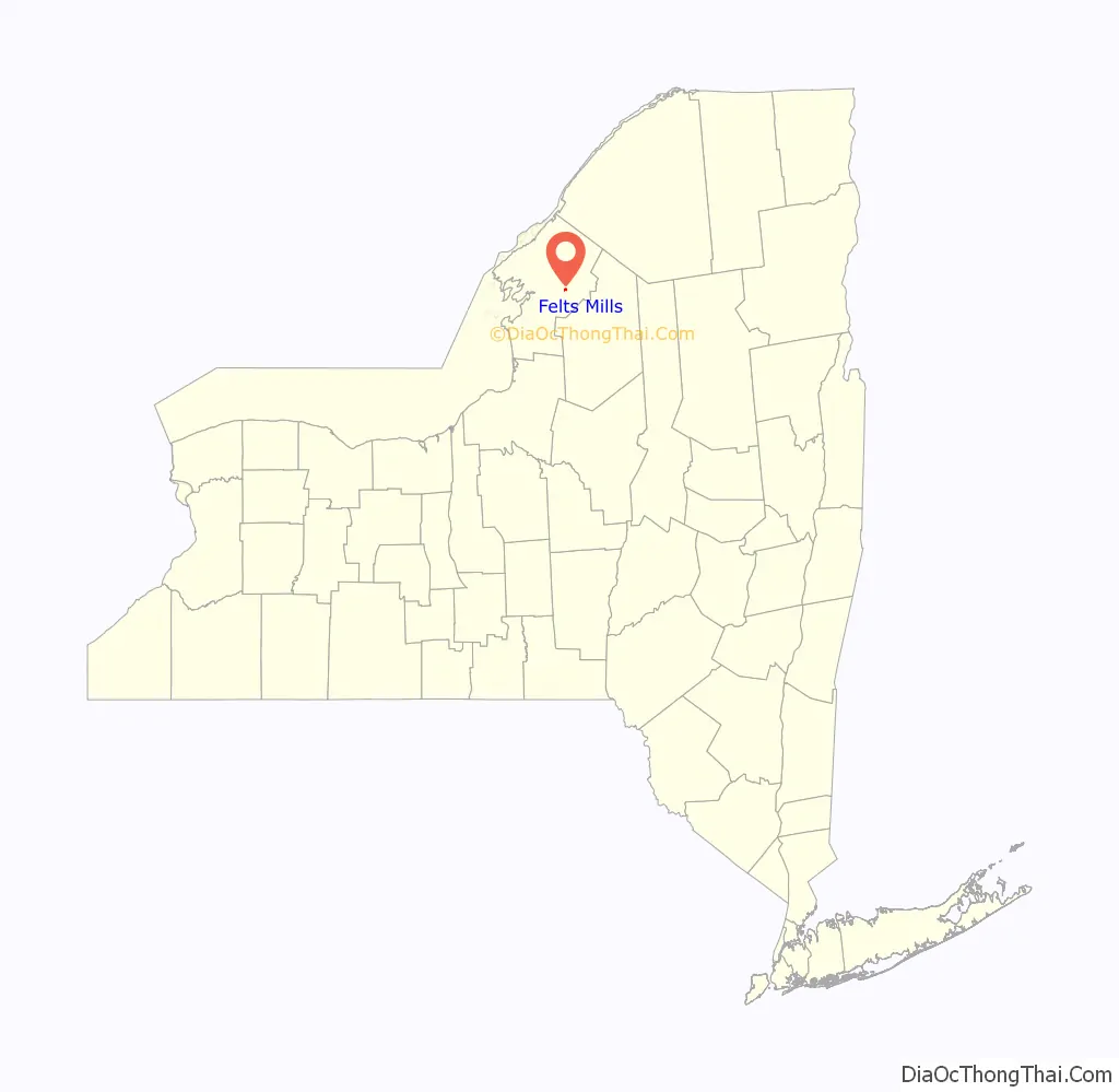
Felts Mills location map. Where is Felts Mills CDP?
History
Felts Mills was sited on one of several natural falls on the Black River and first settled with the construction of a gristmill in about 1800. An improved dam was erected in 1821, and a stone mill in the following year. In 1824, John Felts constructed the large sawmills that gave the town its name. In 1889, the Taggart Paper Company built a large paper mill on an island across the river, ruins of which are still visible today.
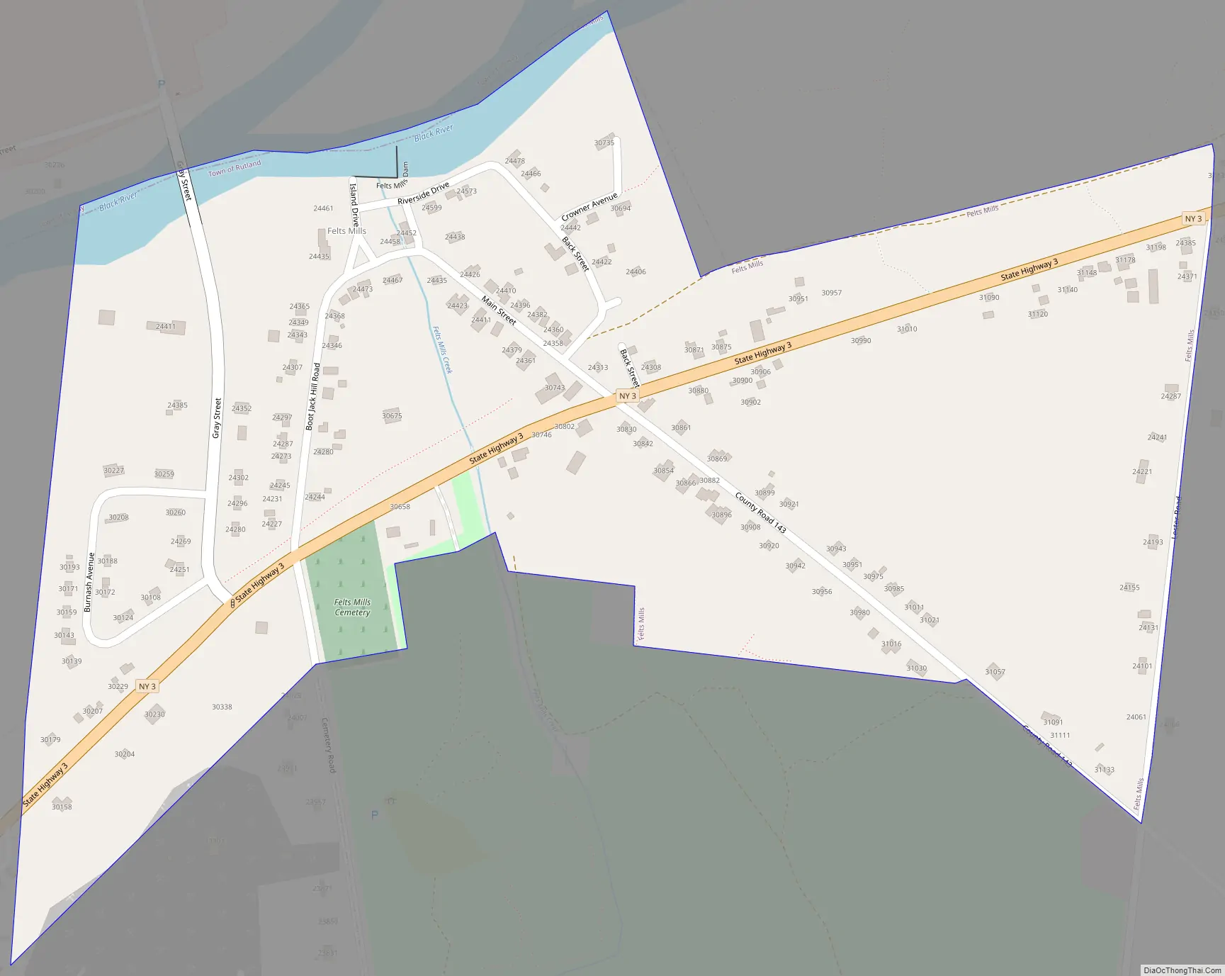
Felts Mills Road Map
Felts Mills city Satellite Map
Geography
The community is in the northeast corner of the town of Rutland, east of the center of Jefferson County. New York State Route 3 passes through the CDP, leading west 8 miles (13 km) to Watertown, the county seat, and east 10 miles (16 km) to Carthage.
According to the U.S. Census Bureau, the Felts Mills CDP has an area of 0.33 square miles (0.85 km), all land.
See also
Map of New York State and its subdivision:- Albany
- Allegany
- Bronx
- Broome
- Cattaraugus
- Cayuga
- Chautauqua
- Chemung
- Chenango
- Clinton
- Columbia
- Cortland
- Delaware
- Dutchess
- Erie
- Essex
- Franklin
- Fulton
- Genesee
- Greene
- Hamilton
- Herkimer
- Jefferson
- Kings
- Lake Ontario
- Lewis
- Livingston
- Madison
- Monroe
- Montgomery
- Nassau
- New York
- Niagara
- Oneida
- Onondaga
- Ontario
- Orange
- Orleans
- Oswego
- Otsego
- Putnam
- Queens
- Rensselaer
- Richmond
- Rockland
- Saint Lawrence
- Saratoga
- Schenectady
- Schoharie
- Schuyler
- Seneca
- Steuben
- Suffolk
- Sullivan
- Tioga
- Tompkins
- Ulster
- Warren
- Washington
- Wayne
- Westchester
- Wyoming
- Yates
- Alabama
- Alaska
- Arizona
- Arkansas
- California
- Colorado
- Connecticut
- Delaware
- District of Columbia
- Florida
- Georgia
- Hawaii
- Idaho
- Illinois
- Indiana
- Iowa
- Kansas
- Kentucky
- Louisiana
- Maine
- Maryland
- Massachusetts
- Michigan
- Minnesota
- Mississippi
- Missouri
- Montana
- Nebraska
- Nevada
- New Hampshire
- New Jersey
- New Mexico
- New York
- North Carolina
- North Dakota
- Ohio
- Oklahoma
- Oregon
- Pennsylvania
- Rhode Island
- South Carolina
- South Dakota
- Tennessee
- Texas
- Utah
- Vermont
- Virginia
- Washington
- West Virginia
- Wisconsin
- Wyoming


