Franklinville is a village in Cattaraugus County, New York, United States. The population was 1,740 at the 2010 census. The community was named after William Temple Franklin, an agent with the Holland Land Company and the grandson of Founding Father Benjamin Franklin. The village is in the northeast part of the town of Franklinville.
| Name: | Franklinville village |
|---|---|
| LSAD Code: | 47 |
| LSAD Description: | village (suffix) |
| State: | New York |
| County: | Cattaraugus County |
| Elevation: | 1,591 ft (485 m) |
| Total Area: | 1.10 sq mi (2.85 km²) |
| Land Area: | 1.10 sq mi (2.85 km²) |
| Water Area: | 0.00 sq mi (0.00 km²) |
| Total Population: | 1,652 |
| Population Density: | 1,501.82/sq mi (579.85/km²) |
| ZIP code: | 14737 |
| Area code: | 716 |
| FIPS code: | 3627331 |
| Website: | www.franklinvilleny.org |
Online Interactive Map
Click on ![]() to view map in "full screen" mode.
to view map in "full screen" mode.
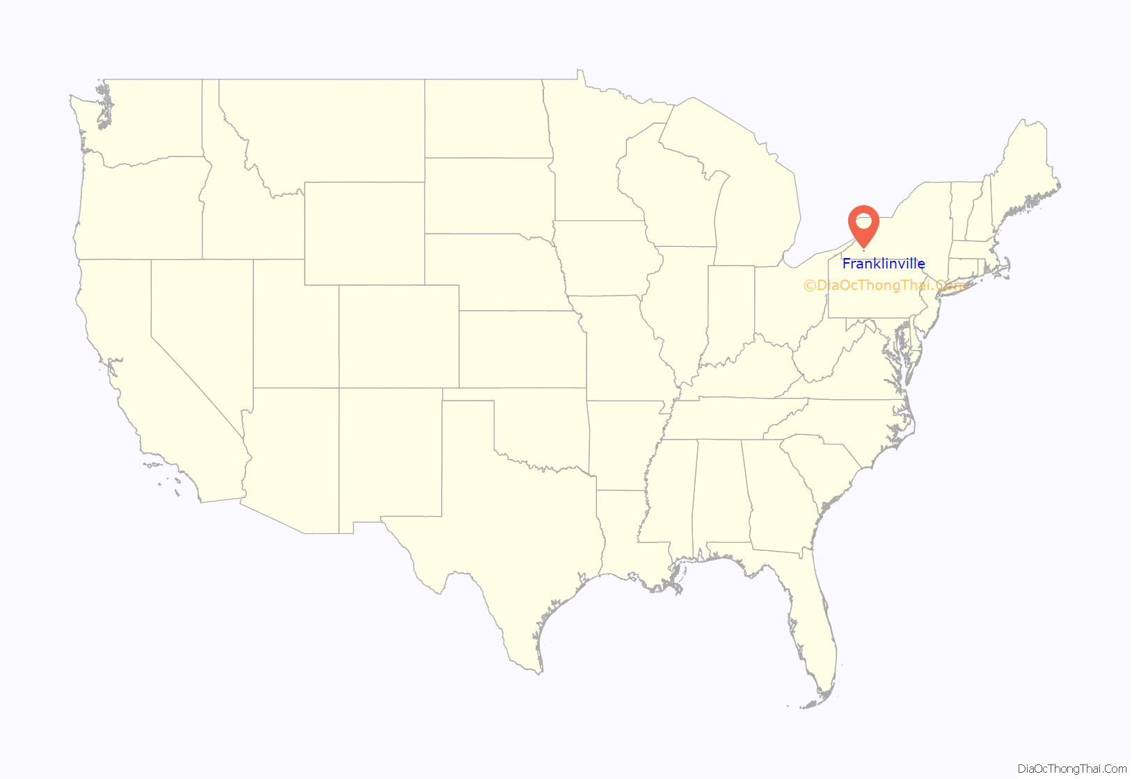
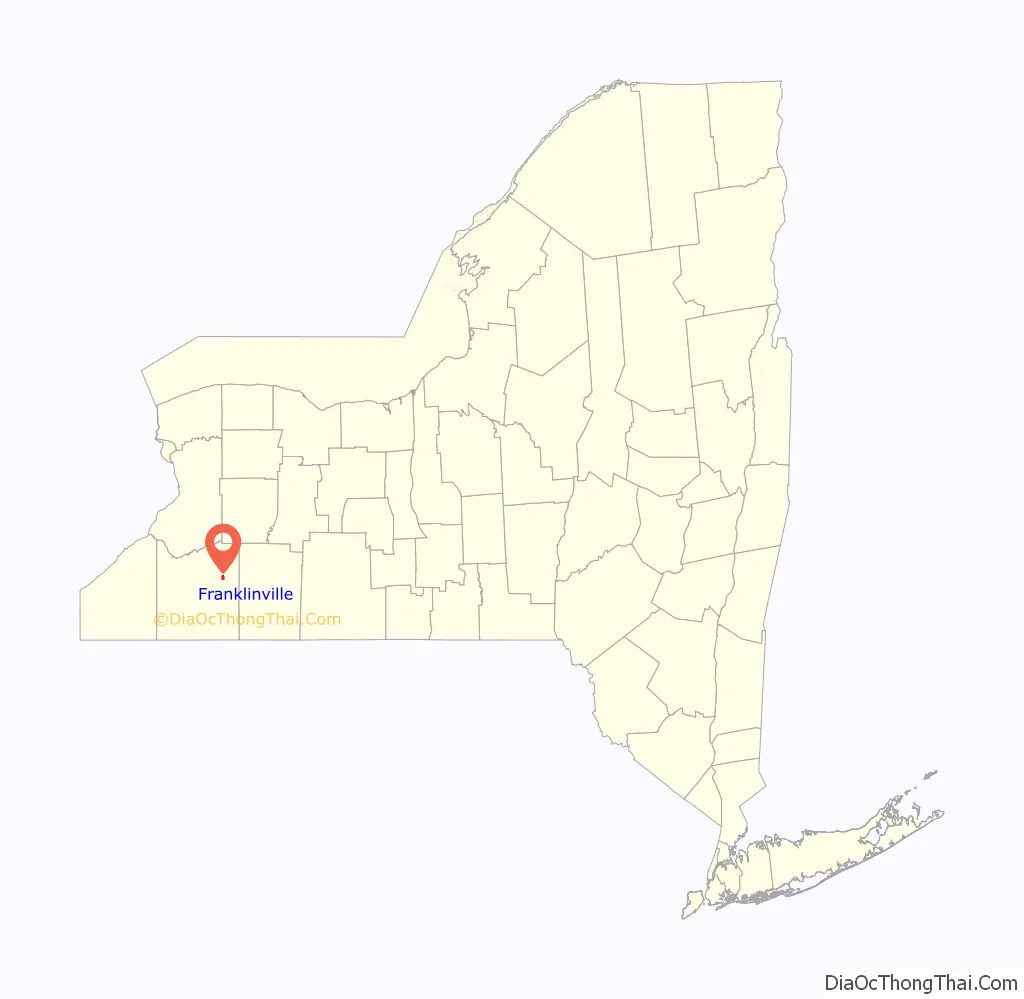
Franklinville location map. Where is Franklinville village?
History
The community was founded circa 1806, while still in an area named “Ischua”. The village of Franklinville was incorporated in 1874. The central core of the village is on the National Register of Historic Places as the Park Square Historic District. Also listed on the National Register of Historic Places is the Simeon B. Robbins House.
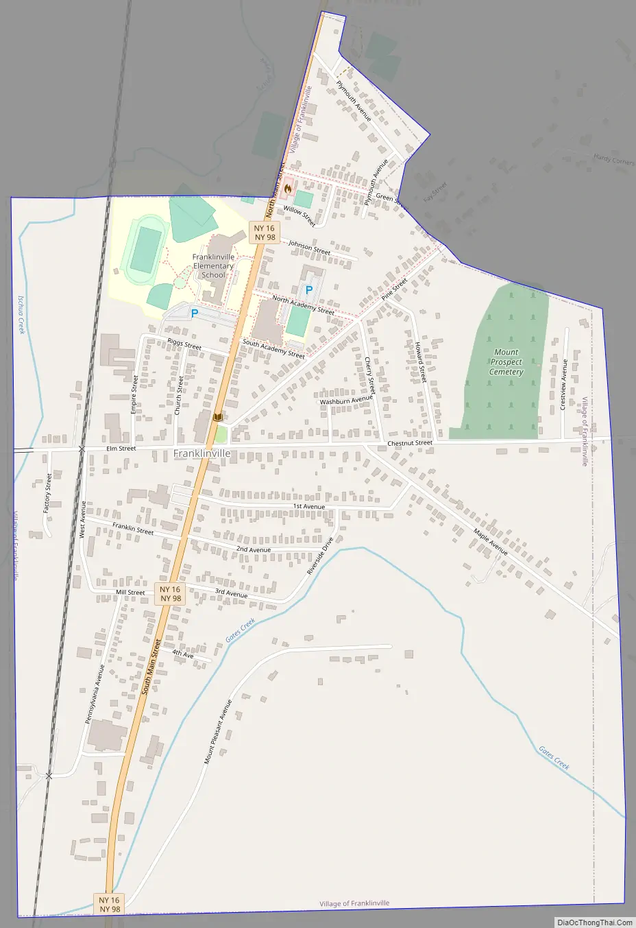
Franklinville Road Map
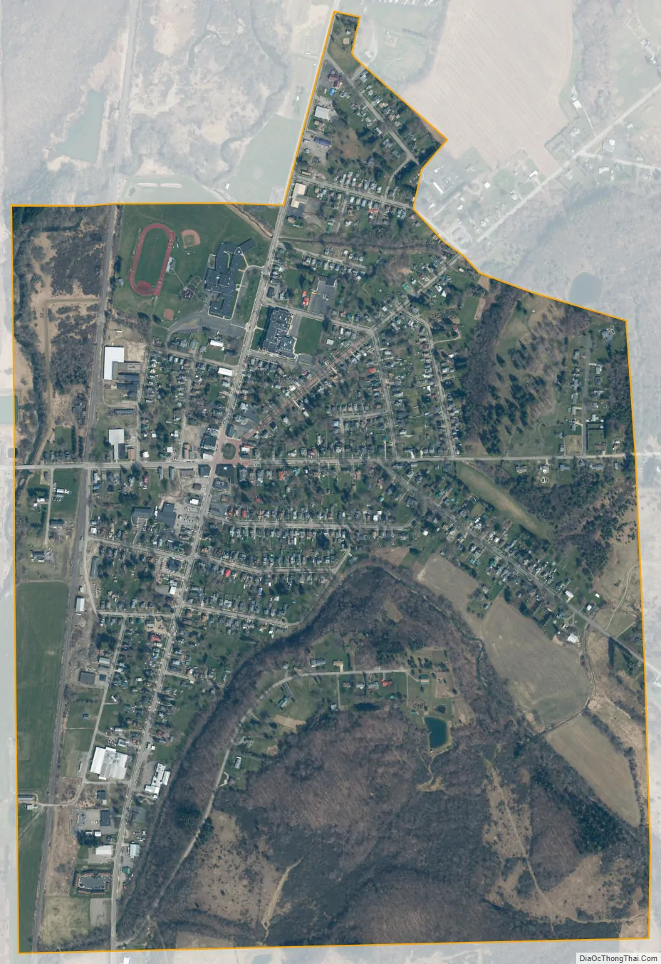
Franklinville city Satellite Map
Geography
Franklinville is located at 42°20′13″N 078°27′29″W / 42.33694°N 78.45806°W / 42.33694; -78.45806 (42.3370091, -78.4580762) and its elevation is 1,591 feet (485 m).
According to the 2010 United States Census, the village has a total area of 1.10 square miles (2.85 km), all land.
The village is located in the Ischua Valley, and Ischua Creek, a tributary of Olean Creek and part of the Allegheny River watershed, flows past the west side of the community. Gates Creek joins Ischua Creek south of the village, and Saunders Creek joins it north of the village. A wide part of Gates Creek, formed by a dam, creates a small lake southeast of the village.
The village is on conjoined NY-16 and NY-98. County Roads 17, 24, 46, and 69 also converge on the village.
See also
Map of New York State and its subdivision:- Albany
- Allegany
- Bronx
- Broome
- Cattaraugus
- Cayuga
- Chautauqua
- Chemung
- Chenango
- Clinton
- Columbia
- Cortland
- Delaware
- Dutchess
- Erie
- Essex
- Franklin
- Fulton
- Genesee
- Greene
- Hamilton
- Herkimer
- Jefferson
- Kings
- Lake Ontario
- Lewis
- Livingston
- Madison
- Monroe
- Montgomery
- Nassau
- New York
- Niagara
- Oneida
- Onondaga
- Ontario
- Orange
- Orleans
- Oswego
- Otsego
- Putnam
- Queens
- Rensselaer
- Richmond
- Rockland
- Saint Lawrence
- Saratoga
- Schenectady
- Schoharie
- Schuyler
- Seneca
- Steuben
- Suffolk
- Sullivan
- Tioga
- Tompkins
- Ulster
- Warren
- Washington
- Wayne
- Westchester
- Wyoming
- Yates
- Alabama
- Alaska
- Arizona
- Arkansas
- California
- Colorado
- Connecticut
- Delaware
- District of Columbia
- Florida
- Georgia
- Hawaii
- Idaho
- Illinois
- Indiana
- Iowa
- Kansas
- Kentucky
- Louisiana
- Maine
- Maryland
- Massachusetts
- Michigan
- Minnesota
- Mississippi
- Missouri
- Montana
- Nebraska
- Nevada
- New Hampshire
- New Jersey
- New Mexico
- New York
- North Carolina
- North Dakota
- Ohio
- Oklahoma
- Oregon
- Pennsylvania
- Rhode Island
- South Carolina
- South Dakota
- Tennessee
- Texas
- Utah
- Vermont
- Virginia
- Washington
- West Virginia
- Wisconsin
- Wyoming