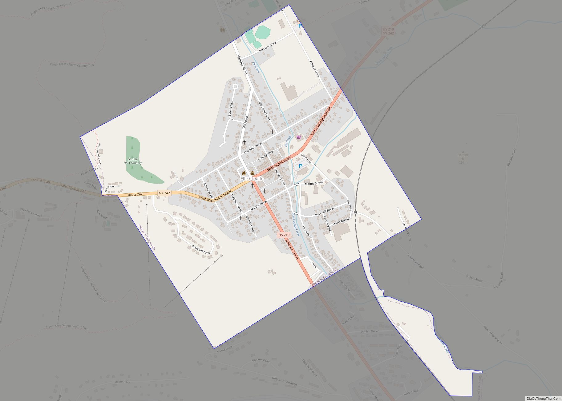
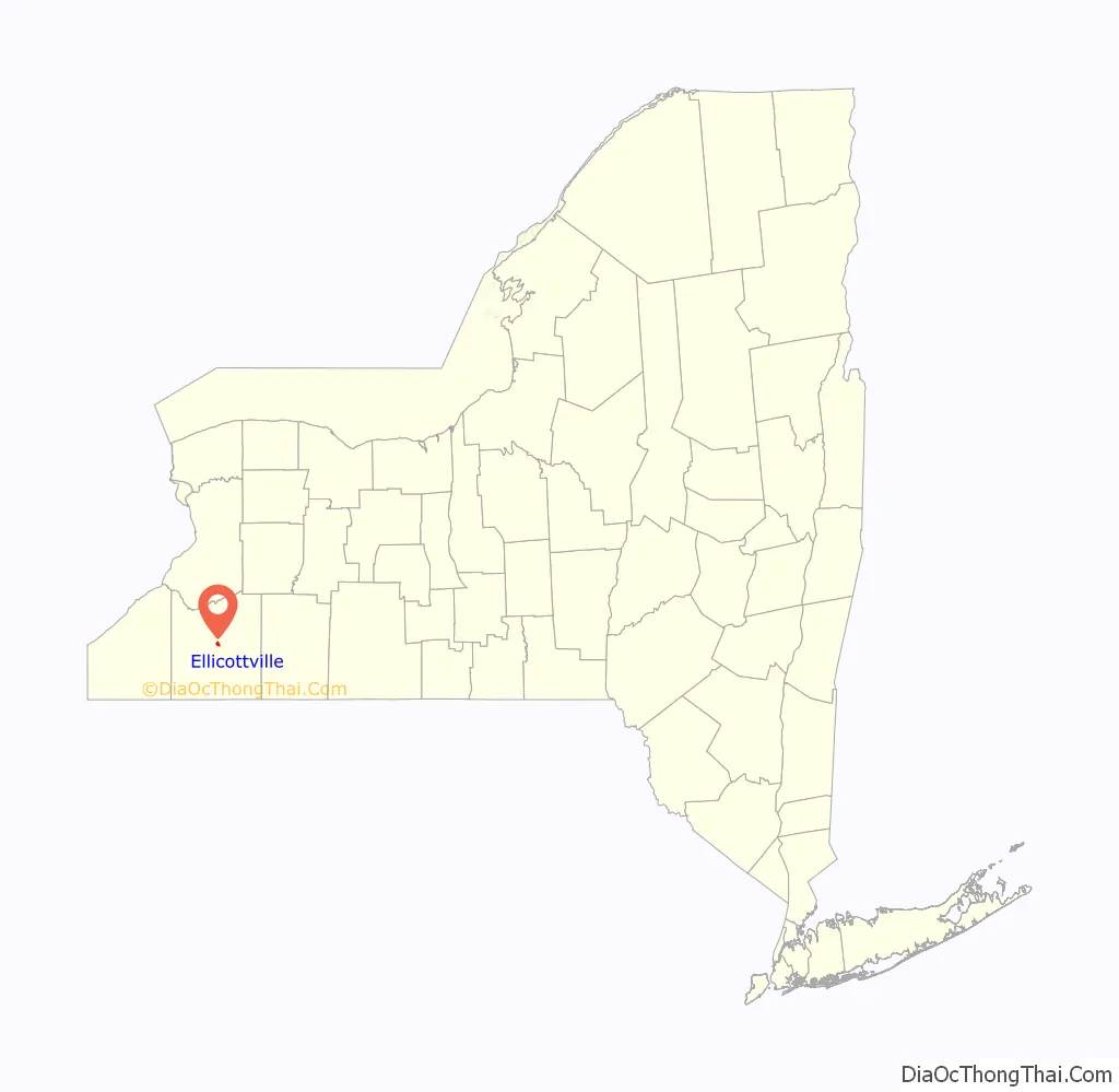
Ellicottville is a village in Cattaraugus County, New York, United States. The population was 284 at the 2020 census. The village is named after Joseph Ellicott, principal land agent of the Holland Land Company. It lies in the southwest part of the town of Ellicottville and is north of the city of Salamanca.
Ellicottville’s current mayor is John Burrell.
| Name: | Ellicottville village |
|---|---|
| LSAD Code: | 47 |
| LSAD Description: | village (suffix) |
| State: | New York |
| County: | Cattaraugus County |
| Elevation: | 1,549 ft (472 m) |
| Total Area: | 0.83 sq mi (2.16 km²) |
| Land Area: | 0.82 sq mi (2.12 km²) |
| Water Area: | 0.01 sq mi (0.04 km²) |
| Total Population: | 256 |
| Population Density: | 312.20/sq mi (120.50/km²) |
| ZIP code: | 14731 |
| Area code: | 716 |
| FIPS code: | 3624020 |
| GNISfeature ID: | 0949515 |
| Website: | www.ellicottvillegov.com |
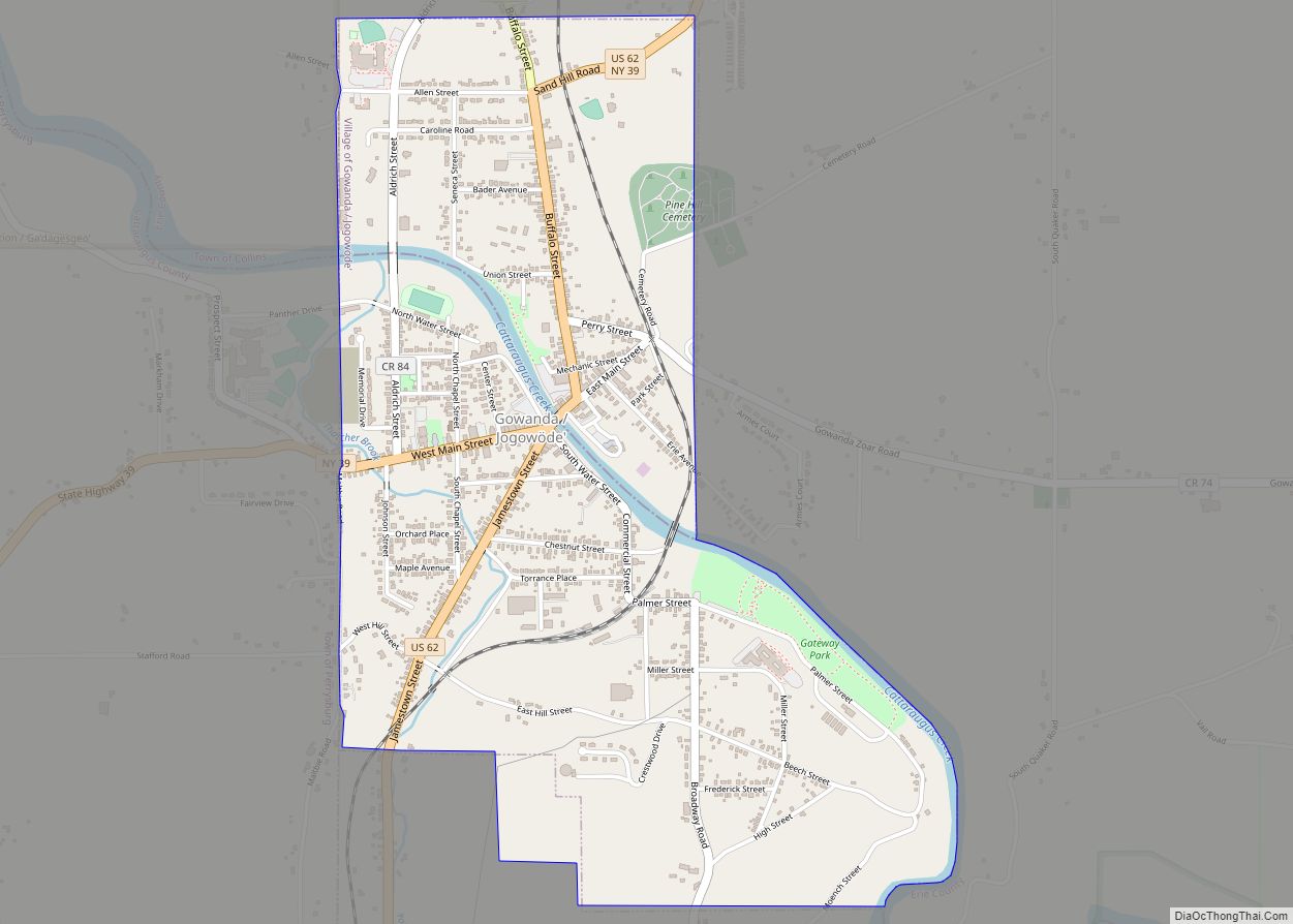
Online Interactive Map
Click on ![]() to view map in "full screen" mode.
to view map in "full screen" mode.
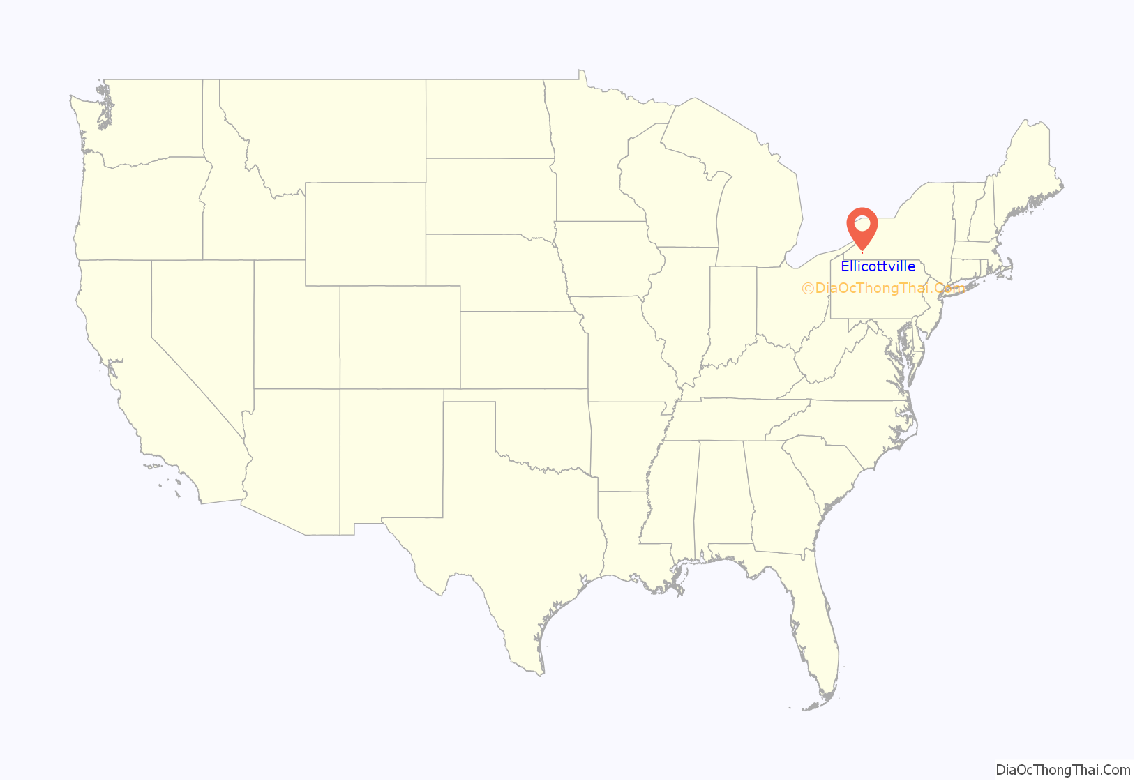
Ellicottville location map. Where is Ellicottville village?
History
The native name for this location was De-as-hen-da-qua, or “place for holding court”.
The Holland Land Company opened an office in 1818. The community was the original county seat of Cattaraugus County in 1808, and public buildings were subsequently constructed.
The village of Ellicottville was incorporated in 1837. In 1868, the county seat was moved to the village of Little Valley.
The Ellicottville Historic District, Ellicottville Town Hall, and Jefferson Street Cemetery are listed on the National Register of Historic Places.
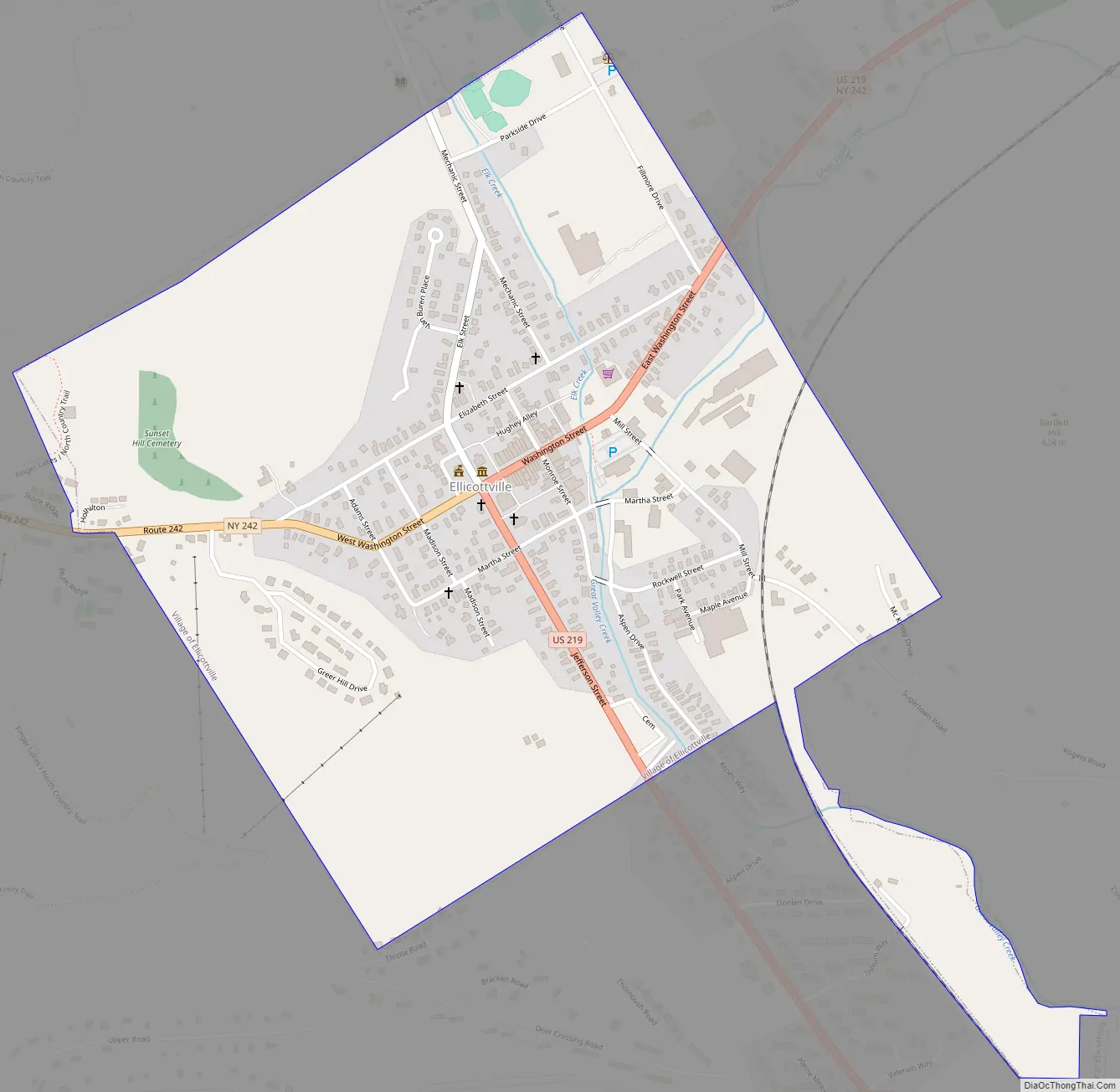
Ellicottville Road Map
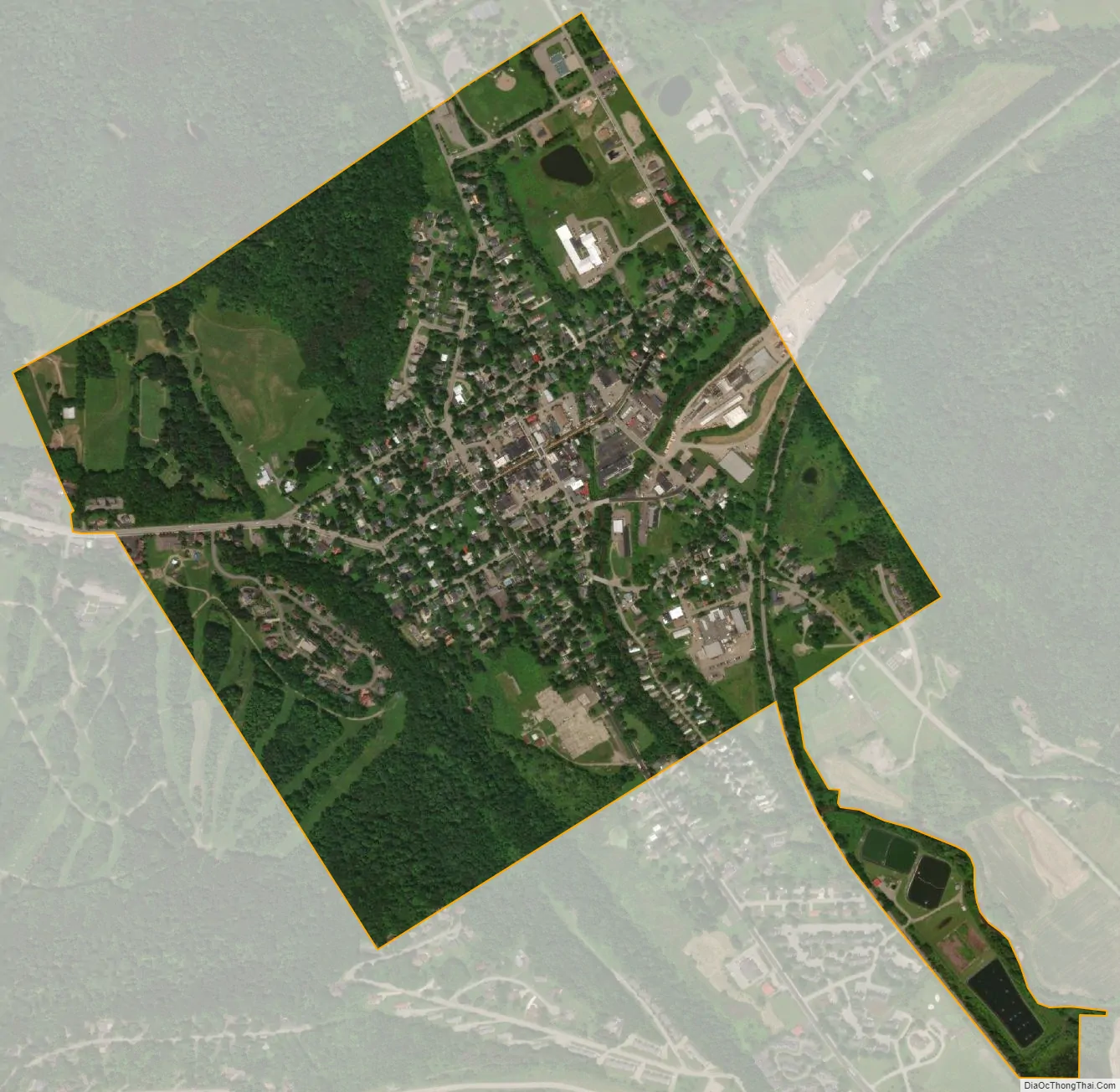
Ellicottville city Satellite Map
Geography
Ellicottville is located in the southwest corner of the town of Ellicottville at 42°16′N 78°40′W / 42.267°N 78.667°W / 42.267; -78.667 (42.2752, -78.6716).
According to the United States Census Bureau, the village has a total area of 0.85 square miles (2.2 km), of which 0.02 square miles (0.04 km), or 1.65%, is water.
Great Valley Creek, a tributary of the Allegheny River, flows through the village along the eastern edges; a smaller creek, Elk Creek, flows through the middle of the village.
Ellicottville is at the convergence of County Roads 13 and 71, along with NY-242 and U.S. Route 219. In lieu of numbered or standard street names, most of the village’s streets are named after presidents and first ladies of the United States from prior to 1828: (George) Washington Street, (Thomas) Jefferson Street, (John) Adams Street, (James) Madison Street, (James) Monroe Street, Martha Street (alluding to Martha Washington and/or Martha Jefferson Randolph), and Elizabeth (Monroe) Street. (Martin) Van Buren Street and (Millard) Fillmore Avenue were later additions to the grid.
See also
Map of New York State and its subdivision:- Albany
- Allegany
- Bronx
- Broome
- Cattaraugus
- Cayuga
- Chautauqua
- Chemung
- Chenango
- Clinton
- Columbia
- Cortland
- Delaware
- Dutchess
- Erie
- Essex
- Franklin
- Fulton
- Genesee
- Greene
- Hamilton
- Herkimer
- Jefferson
- Kings
- Lake Ontario
- Lewis
- Livingston
- Madison
- Monroe
- Montgomery
- Nassau
- New York
- Niagara
- Oneida
- Onondaga
- Ontario
- Orange
- Orleans
- Oswego
- Otsego
- Putnam
- Queens
- Rensselaer
- Richmond
- Rockland
- Saint Lawrence
- Saratoga
- Schenectady
- Schoharie
- Schuyler
- Seneca
- Steuben
- Suffolk
- Sullivan
- Tioga
- Tompkins
- Ulster
- Warren
- Washington
- Wayne
- Westchester
- Wyoming
- Yates
- Alabama
- Alaska
- Arizona
- Arkansas
- California
- Colorado
- Connecticut
- Delaware
- District of Columbia
- Florida
- Georgia
- Hawaii
- Idaho
- Illinois
- Indiana
- Iowa
- Kansas
- Kentucky
- Louisiana
- Maine
- Maryland
- Massachusetts
- Michigan
- Minnesota
- Mississippi
- Missouri
- Montana
- Nebraska
- Nevada
- New Hampshire
- New Jersey
- New Mexico
- New York
- North Carolina
- North Dakota
- Ohio
- Oklahoma
- Oregon
- Pennsylvania
- Rhode Island
- South Carolina
- South Dakota
- Tennessee
- Texas
- Utah
- Vermont
- Virginia
- Washington
- West Virginia
- Wisconsin
- Wyoming