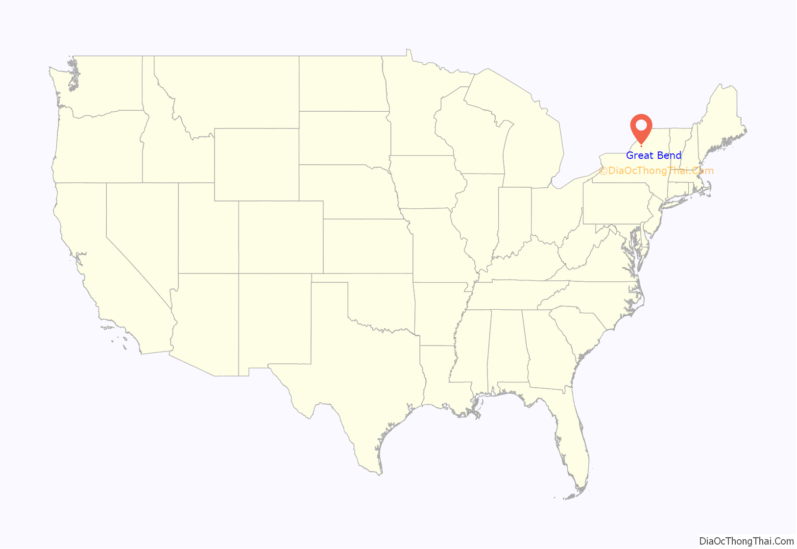
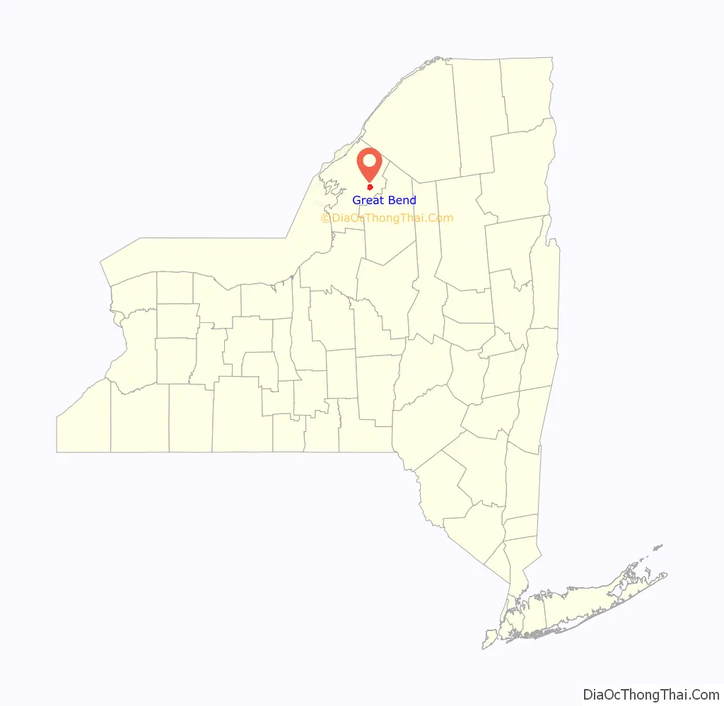
Great Bend is a hamlet and census-designated place (CDP) in Jefferson County, New York, United States. The population was 843 at the 2010 census.
Great Bend is in the northern part of the town of Champion. It is adjacent to the southern section of the Fort Drum military reservation.
| Name: | Great Bend CDP |
|---|---|
| LSAD Code: | 57 |
| LSAD Description: | CDP (suffix) |
| State: | New York |
| County: | Jefferson County |
| Elevation: | 663 ft (202 m) |
| Total Area: | 5.88 sq mi (15.24 km²) |
| Land Area: | 5.79 sq mi (15.00 km²) |
| Water Area: | 0.09 sq mi (0.24 km²) |
| Total Population: | 807 |
| Population Density: | 139.35/sq mi (53.80/km²) |
| ZIP code: | 13643 |
| Area code: | 315 |
| FIPS code: | 3630136 |
| GNISfeature ID: | 0951618 |
Online Interactive Map
Click on ![]() to view map in "full screen" mode.
to view map in "full screen" mode.
Great Bend location map. Where is Great Bend CDP?
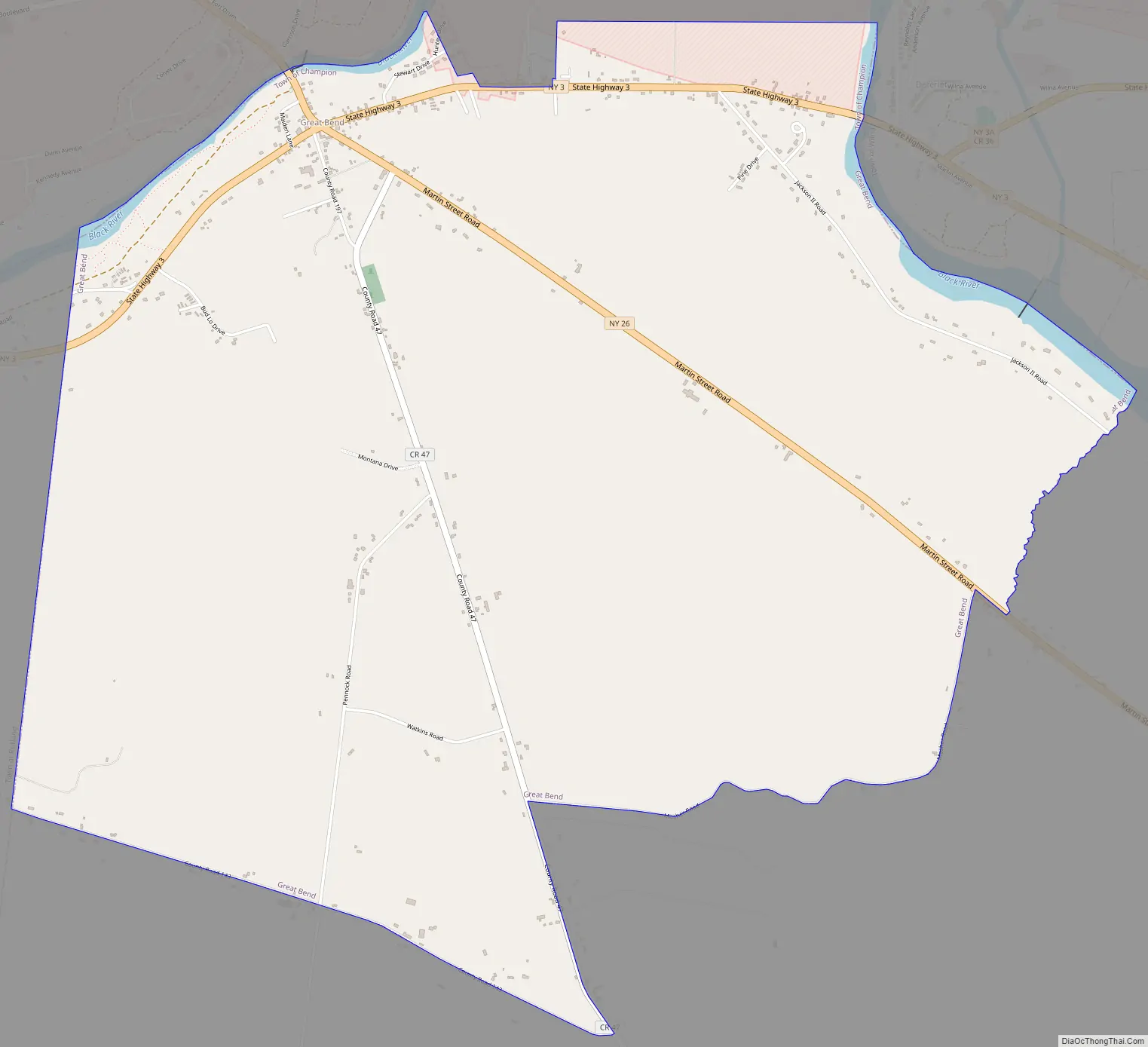
Great Bend Road Map
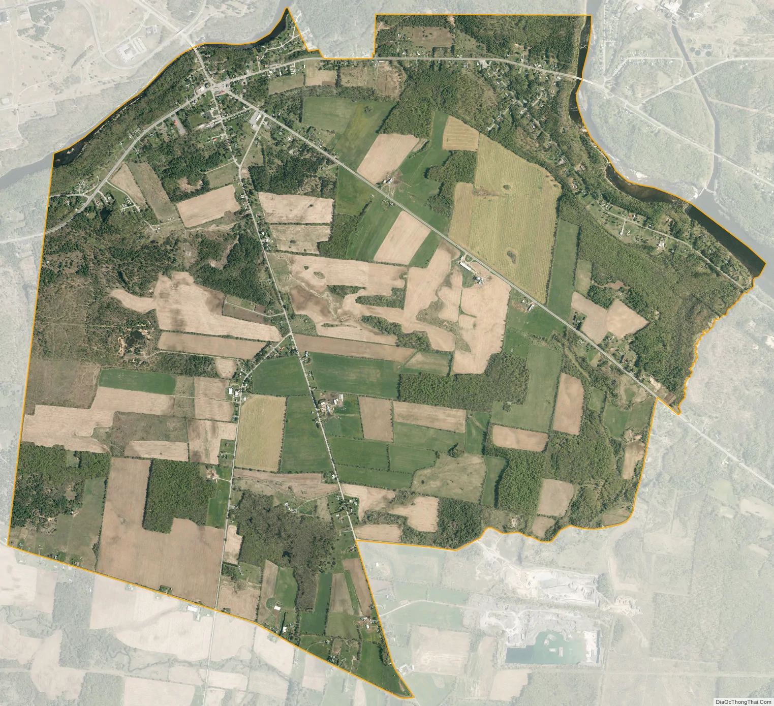
Great Bend city Satellite Map
Geography
Great Bend is located in eastern Jefferson County at 44°2′11″N 75°42′30″W / 44.03639°N 75.70833°W / 44.03639; -75.70833 (44.036396, -75.708376). It is bordered to the northeast and northwest (but not the north) by the Black River, which makes the bend referred to in the community’s name. Across the river to the northwest is Fort Drum in the town of Le Ray, and across it to the northeast is the village of Deferiet in the town of Wilna.
According to the United States Census Bureau, the Great Bend CDP has a total area of 5.8 square miles (15.1 km), of which 5.8 square miles (15.0 km) are land and 0.04 square miles (0.1 km), or 0.97%, are water.
Great Bend is at the junction of New York State Route 3, New York State Route 26, and County Road 47. Route 3 leads east and southeast 7 miles (11 km) to Carthage, passing first through Deferiet, and west 10 miles (16 km) to Watertown, the Jefferson county seat. Route 26 leads northwest across Fort Drum 6 miles (10 km) to Evans Mills and southeast 7 miles (11 km) to West Carthage.
See also
Map of New York State and its subdivision:- Albany
- Allegany
- Bronx
- Broome
- Cattaraugus
- Cayuga
- Chautauqua
- Chemung
- Chenango
- Clinton
- Columbia
- Cortland
- Delaware
- Dutchess
- Erie
- Essex
- Franklin
- Fulton
- Genesee
- Greene
- Hamilton
- Herkimer
- Jefferson
- Kings
- Lake Ontario
- Lewis
- Livingston
- Madison
- Monroe
- Montgomery
- Nassau
- New York
- Niagara
- Oneida
- Onondaga
- Ontario
- Orange
- Orleans
- Oswego
- Otsego
- Putnam
- Queens
- Rensselaer
- Richmond
- Rockland
- Saint Lawrence
- Saratoga
- Schenectady
- Schoharie
- Schuyler
- Seneca
- Steuben
- Suffolk
- Sullivan
- Tioga
- Tompkins
- Ulster
- Warren
- Washington
- Wayne
- Westchester
- Wyoming
- Yates
- Alabama
- Alaska
- Arizona
- Arkansas
- California
- Colorado
- Connecticut
- Delaware
- District of Columbia
- Florida
- Georgia
- Hawaii
- Idaho
- Illinois
- Indiana
- Iowa
- Kansas
- Kentucky
- Louisiana
- Maine
- Maryland
- Massachusetts
- Michigan
- Minnesota
- Mississippi
- Missouri
- Montana
- Nebraska
- Nevada
- New Hampshire
- New Jersey
- New Mexico
- New York
- North Carolina
- North Dakota
- Ohio
- Oklahoma
- Oregon
- Pennsylvania
- Rhode Island
- South Carolina
- South Dakota
- Tennessee
- Texas
- Utah
- Vermont
- Virginia
- Washington
- West Virginia
- Wisconsin
- Wyoming


