Great River is a suburban hamlet and CDP in the Town of Islip in Suffolk County, New York, United States. It is situated approximately 50 miles (80 km) (55 mi driving) east of New York City on the South Shore of Long Island, adjoining the Great South Bay, protected from the Atlantic Ocean by Fire Island.
Great River’s name derives from “Connetquot,” an Algonquian word for “Great River.” Prior to the 1900s Great River was primarily home to wealthy families on mansion estates. As of the 2010 census, the population of Great River was 1,489.
Great River’s buildings include a New York City-style steak house in a turn of the century (20th) Public house, a delicatessen, a rural delivery post office and the Great River Fire Department.
| Name: | Great River CDP |
|---|---|
| LSAD Code: | 57 |
| LSAD Description: | CDP (suffix) |
| State: | New York |
| County: | Suffolk County |
| Elevation: | 13 ft (4 m) |
| Total Area: | 5.79 sq mi (15.01 km²) |
| Land Area: | 4.18 sq mi (10.84 km²) |
| Water Area: | 1.61 sq mi (4.17 km²) |
| Total Population: | 2,005 |
| Population Density: | 479.09/sq mi (184.96/km²) |
| ZIP code: | 11739 |
| Area code: | 631 |
| FIPS code: | 3630235 |
| GNISfeature ID: | 0951648 |
Online Interactive Map
Click on ![]() to view map in "full screen" mode.
to view map in "full screen" mode.
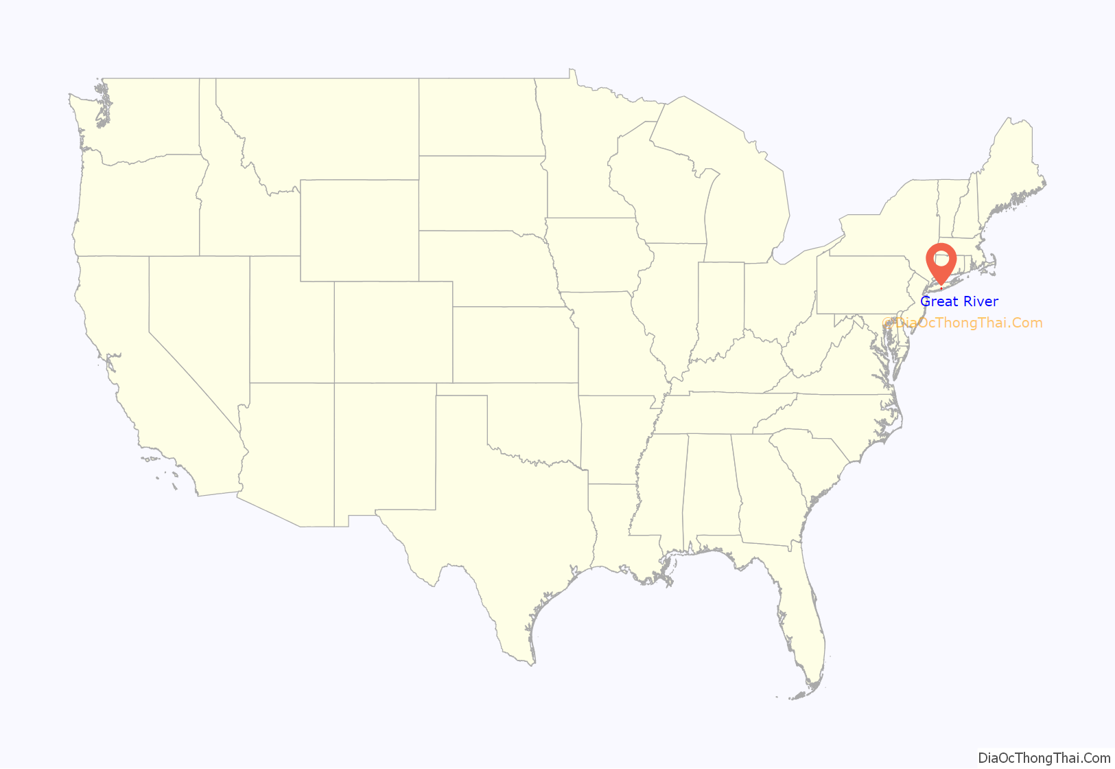
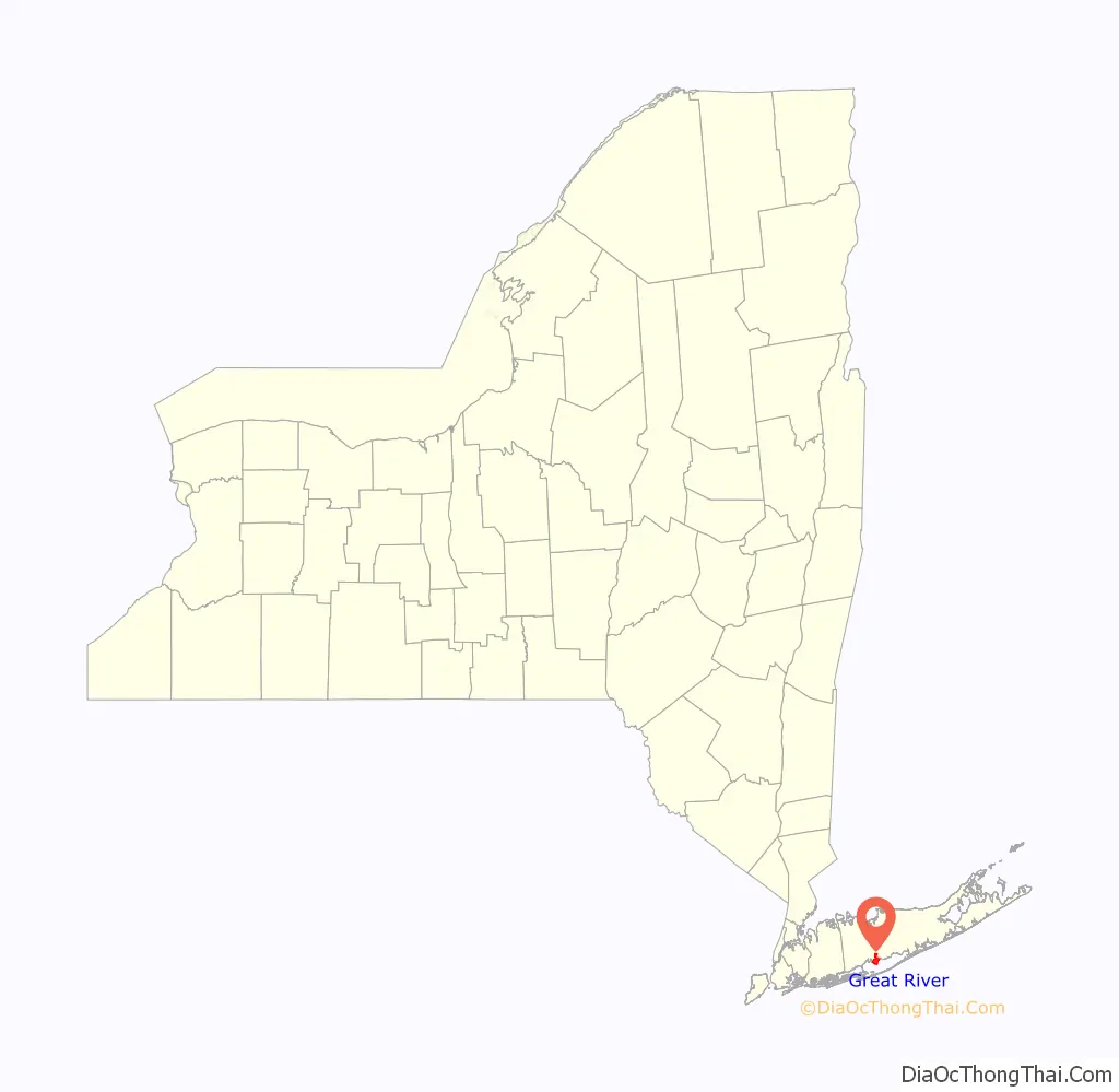
Great River location map. Where is Great River CDP?
History
For centuries, cluster of the Algonquin people known as the Montaukett Indian Nation occupied the territory known as Secatogue, now the town of Islip. They lived in clusters located at West Islip (Secatogue), Bay Shore (Penataquit), Great River, and Oakdale (Connetquot).
On November 29, 1683, William Nicoll (Nicolls), founder of the Town of Islip and son of New York City Mayor Matthias Nicoll, was awarded the first royal patent to the east end of what is now the Town of Islip. Nicoll purchased land from Sachem (Paramount chief) Winnequaheagh of Connetquot. He named his 50,000-acre (20,000 ha) plantation (an 8-by-10-mile (13 by 16 km) tract of land) “Islip Grange”, in honor of his ancestral home of Islip (UK) in East Northamptonshire, England, from which Matthias emigrated in 1664. Nicoll’s domain extended from East Islip to Bayport and embraced the present-day communities of Sayville, West Sayville, Oakdale, Great River, Islip Terrace, Central Islip, Hauppauge, Holbrook, Bohemia, Brentwood, Holtsville, and a portion of Ronkonkoma. Nicoll paid an annual quit-rent (tax) to Thomas Dongan, 2nd Earl of Limerick and Governor of the Province of New York, of five bushels of good winter wheat or twenty-five (25) shillings payable annually on March 25.
Other early land patentees were Andrew Gibb (Islip hamlet), John Mowbray (Bay Shore, originally Awixa), Stephan Van Cortlandt (Sagtikos Manor), and Thomas Willets (West Islip).
William Nicholl also purchased five islands from Winnequaheagh on November 19, 1687, including Hollins Island (a.k.a. East Fire Island.) The purchase was confirmed on a patent by Governor Dongan on June 4, 1688. Altogether William Nicoll acquired four patents for land – the final purchase was on September 20, 1697, issued by Governor Benjamin Fletcher. Under Col. Fletcher, piracy was a leading economic development tool in New York City’s competition with the ports of Boston and Philadelphia. New York City had become a safe place for pirates (freebooters) who carried “real money” into the impoverished colony.
Nicoll’s estate eventually became the largest manor on Long Island.
By 1710, the colonial government passed an act to enable the precinct of Islip in the County of Suffolk to elect two assessors, a collector, a constable and a supervisor. The people finally had a voice. Growth, however, remained at a standstill until the American Revolutionary War ended, when in the seventeen (17) years that followed there was more progress than in the fifty (50) years preceding. This activity was partly due to the impact of American shipping.
Great River hamlet was formerly known as Youngsport. In the 1840s the Youngs family lived about one and a half miles south of Montauk Highway on Great River Road. Erastus Youngs and his family began building and repairing boats on the west shore of the Connetquot River near Great South Bay. With hardly anyone else around (21 houses), the place was called Youngsport for thirty years. Youngsport had one store and a freight station on the South Side Railroad of Long Island two miles north of it. The inhabitants were principally known as bay men. Alva Vanderbilt (later Alva Belmont), the Oakdale socialite suffragette, bought the Youngs’ home and gave it to Trinity Lutheran Parish of Brooklyn, which used it as a summer camp called “Seaside Camp” for city children. Youngsport Village’s name was changed to Great River in either 1870 or 1881.
William Lawrence Breeze purchased 290-acre (120 ha) “Timber Point Farm” from William Nicoll in 1883.
The Great River freight station was enhanced to a passenger station in the summer of 1897.
William Nicoll 7th (great-great-great grandson of the original William) served as School Commissioner of East Islip. He was the last owner of Islip Grange. He served as Warden of Emmanuel Church in Great River for 22 years, and ministered to the small cemetery there in which he is now buried. William 7th donated part of the land on which the present East Islip Junior High School now stands.
Heckscher State Park (1,600 acres (650 ha)), named for the industrialist August Heckscher, was part of Nicoll’s original estate and the location of the Nicoll Manor house. Heckscher Park’s land (Nicholls Neck) was once the location of the 19th-century estates of J. Neal Plumb (original location) and in 1886 George Campbell Taylor (1,500 acres (610 ha)). This should not be mistaken for the similarly named, fairly close but much smaller (18.5 acres (7.5 ha)) national historic district of Heckscher Park in Huntington on the North Shore of Long Island.
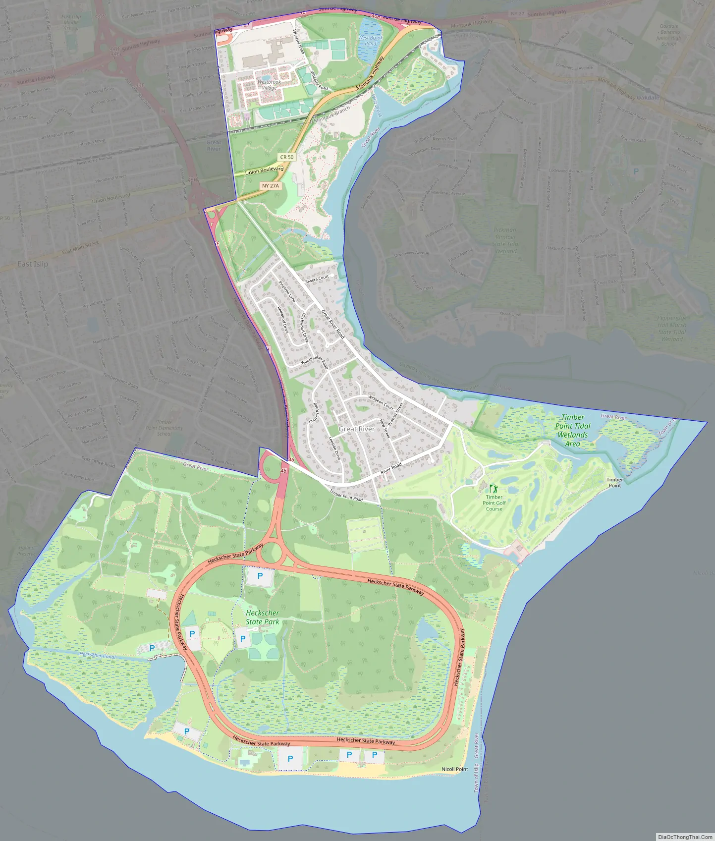
Great River Road Map
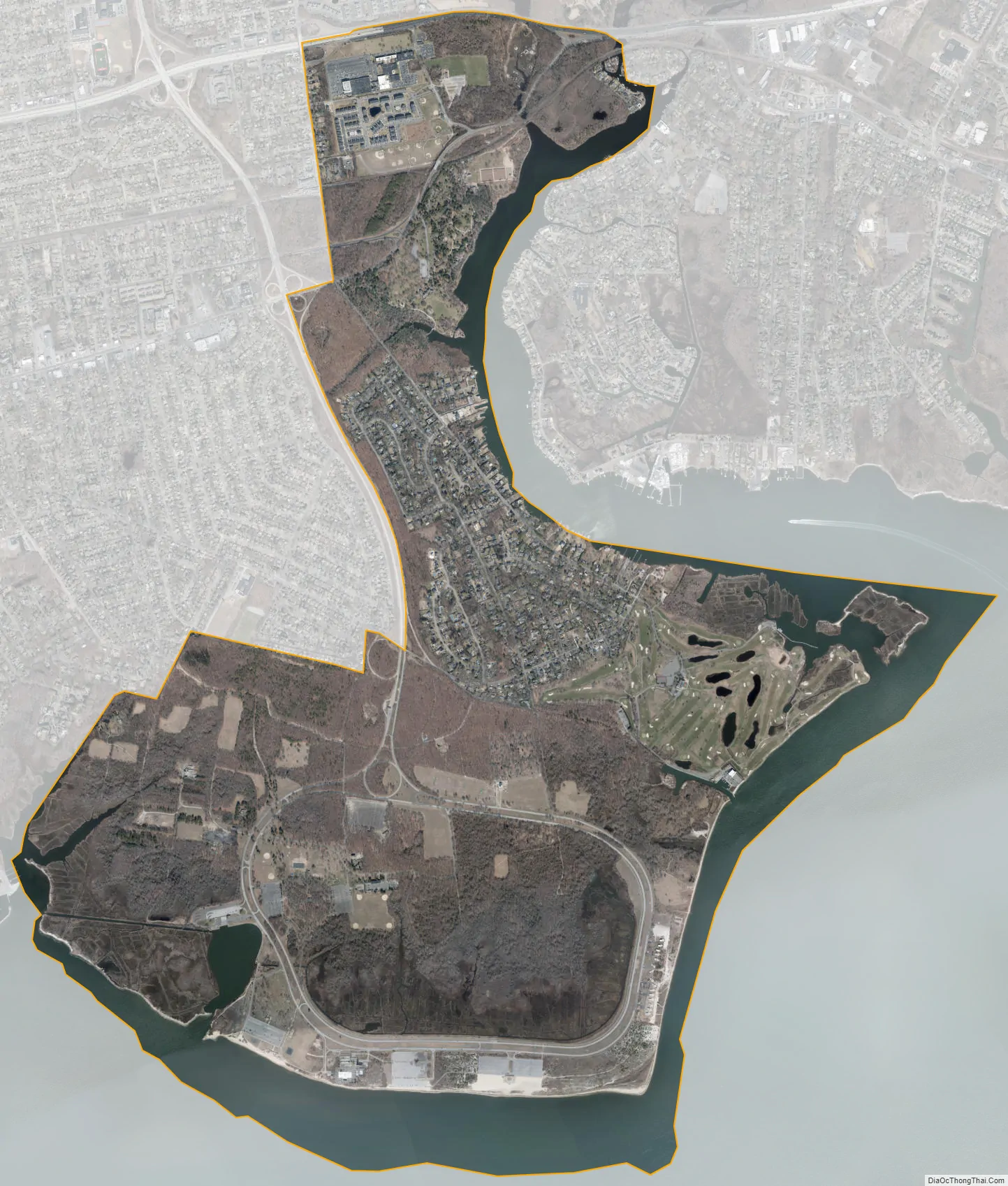
Great River city Satellite Map
Geography
Great River is located at 40°43′29″N 73°9′36″W / 40.72472°N 73.16000°W / 40.72472; -73.16000 (40.724626, −73.159916).
According to the United States Census Bureau, the CDP has a total area of 5.2 square miles (13.4 km), of which 4.6 square miles (11.9 km) is land and 0.58 square miles (1.5 km), or 11.46%, is water. The Hamlet of Great River comprises 465 land parcels. Great River CDP and the GRFD responsibilities include Heckscher State Park although most references by NY State for mailing addresses are listed as East Islip.
See also
Map of New York State and its subdivision:- Albany
- Allegany
- Bronx
- Broome
- Cattaraugus
- Cayuga
- Chautauqua
- Chemung
- Chenango
- Clinton
- Columbia
- Cortland
- Delaware
- Dutchess
- Erie
- Essex
- Franklin
- Fulton
- Genesee
- Greene
- Hamilton
- Herkimer
- Jefferson
- Kings
- Lake Ontario
- Lewis
- Livingston
- Madison
- Monroe
- Montgomery
- Nassau
- New York
- Niagara
- Oneida
- Onondaga
- Ontario
- Orange
- Orleans
- Oswego
- Otsego
- Putnam
- Queens
- Rensselaer
- Richmond
- Rockland
- Saint Lawrence
- Saratoga
- Schenectady
- Schoharie
- Schuyler
- Seneca
- Steuben
- Suffolk
- Sullivan
- Tioga
- Tompkins
- Ulster
- Warren
- Washington
- Wayne
- Westchester
- Wyoming
- Yates
- Alabama
- Alaska
- Arizona
- Arkansas
- California
- Colorado
- Connecticut
- Delaware
- District of Columbia
- Florida
- Georgia
- Hawaii
- Idaho
- Illinois
- Indiana
- Iowa
- Kansas
- Kentucky
- Louisiana
- Maine
- Maryland
- Massachusetts
- Michigan
- Minnesota
- Mississippi
- Missouri
- Montana
- Nebraska
- Nevada
- New Hampshire
- New Jersey
- New Mexico
- New York
- North Carolina
- North Dakota
- Ohio
- Oklahoma
- Oregon
- Pennsylvania
- Rhode Island
- South Carolina
- South Dakota
- Tennessee
- Texas
- Utah
- Vermont
- Virginia
- Washington
- West Virginia
- Wisconsin
- Wyoming


