Greenvale is a hamlet and census-designated place (CDP) in the towns of North Hempstead and Oyster Bay in Nassau County, on the North Shore of Long Island, in New York, United States. It is considered part of the Greater Roslyn area, which is anchored by the Incorporated Village of Roslyn. The population was 1,904 at the 2010 census.
| Name: | Greenvale CDP |
|---|---|
| LSAD Code: | 57 |
| LSAD Description: | CDP (suffix) |
| State: | New York |
| County: | Nassau County |
| Elevation: | 187 ft (57 m) |
| Total Area: | 0.25 sq mi (0.65 km²) |
| Land Area: | 0.25 sq mi (0.65 km²) |
| Water Area: | 0.00 sq mi (0.00 km²) |
| Total Population: | 1,069 |
| Population Density: | 4,276.00/sq mi (1,653.15/km²) |
| ZIP code: | 11548 |
| FIPS code: | 3630598 |
| GNISfeature ID: | 0951769 |
Online Interactive Map
Click on ![]() to view map in "full screen" mode.
to view map in "full screen" mode.
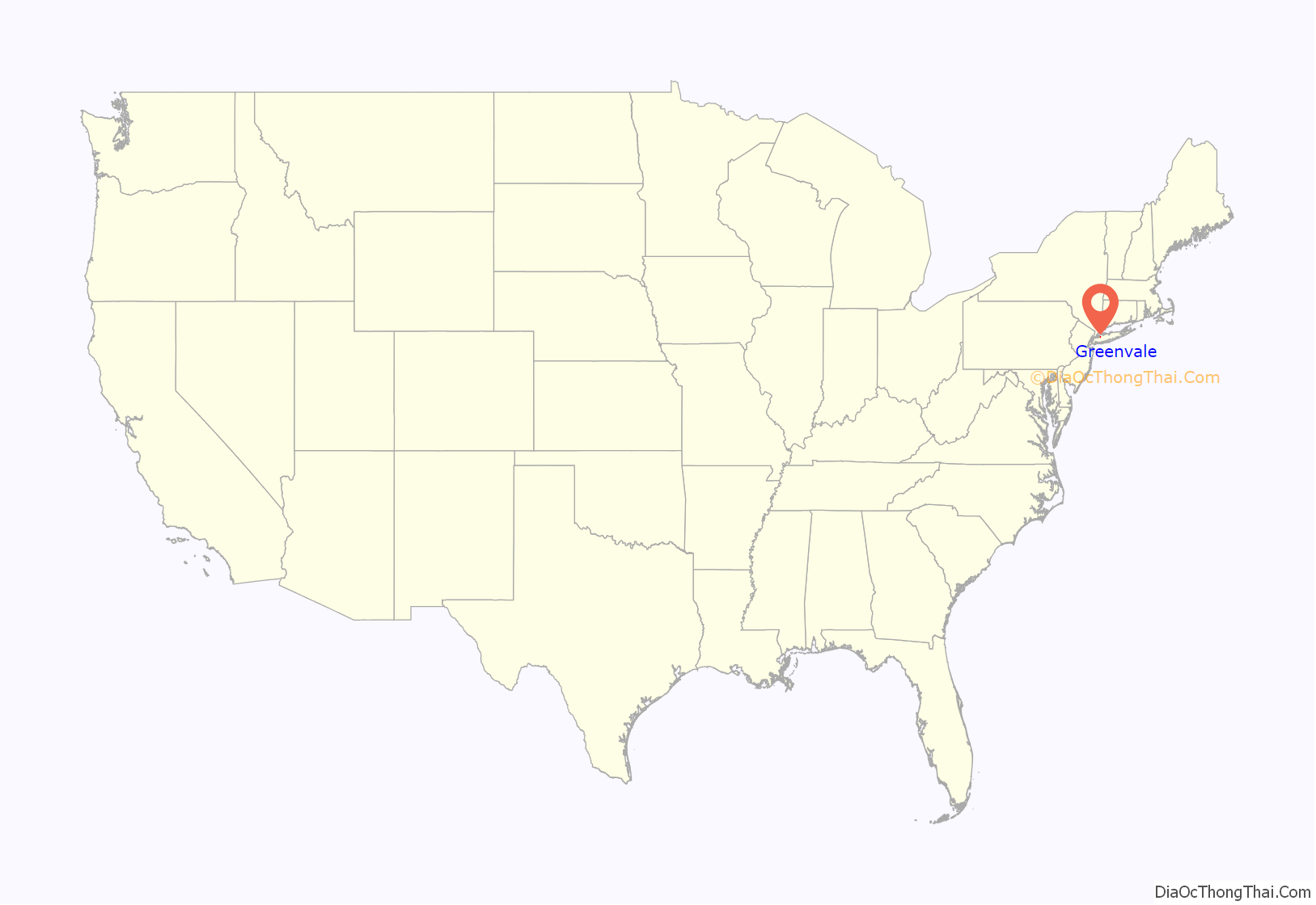
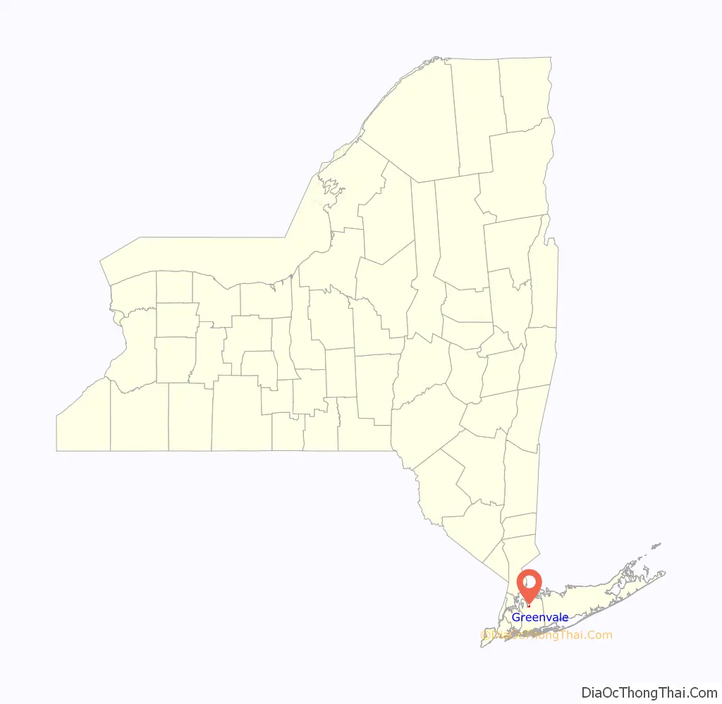
Greenvale location map. Where is Greenvale CDP?
History
Located between Roslyn and Brookville, the Greenvale LIRR station is known as the Long Island Rail Road stop for the C.W. Post Campus of Long Island University and the New York Institute of Technology. While LIU Post is located to the east in Brookville, it uses the Greenvale postal code (11548). Until 1866, the community was originally known as “Cedar Swamp”, and later known as “Bull’s Head”, until some point in the early 20th century.
While many residential areas in the hamlet were developed prior to the Second World War, the 1940s and 1950s saw the development of the area adjacent to the Roslyn Cemetery and the Long Island Rail Road tracks (including Park Avenue and Wellington Road).
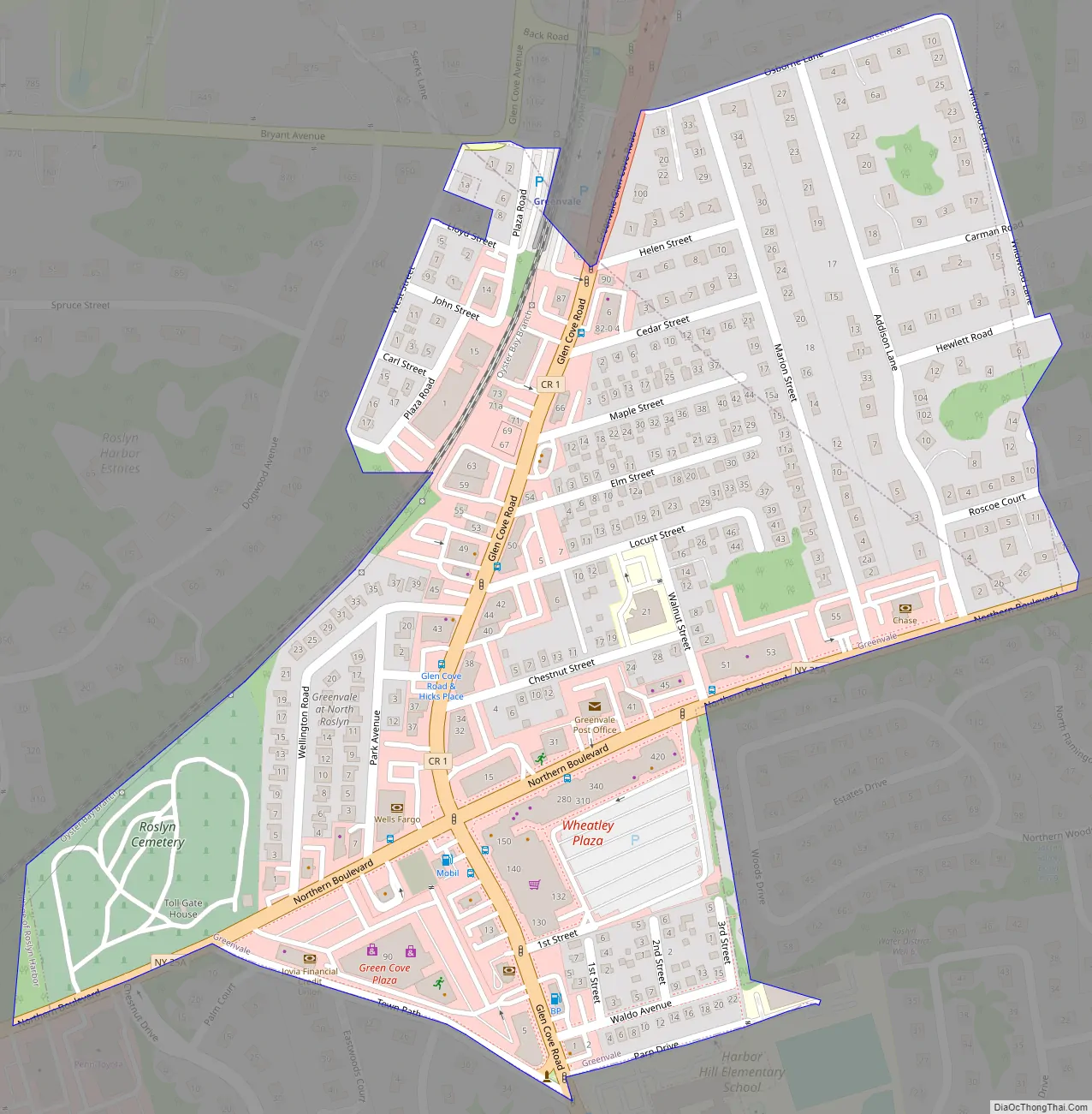
Greenvale Road Map
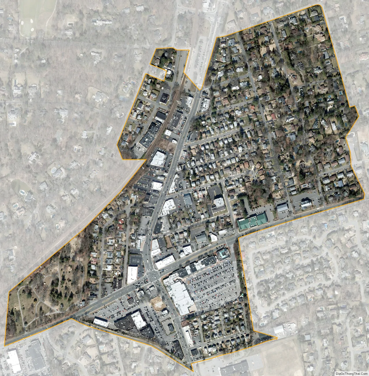
Greenvale city Satellite Map
Geography
According to the United States Census Bureau, the CDP has a total area of 0.3 square miles (0.78 km), all land.
Greenvale is located within the Hempstead Harbor Watershed, which itself is located within the larger Long Island Sound/Atlantic Ocean Watershed.
Greenvale is located mainly within the Town of North Hempstead, while a small portion is located in the Town of Oyster Bay.
See also
Map of New York State and its subdivision:- Albany
- Allegany
- Bronx
- Broome
- Cattaraugus
- Cayuga
- Chautauqua
- Chemung
- Chenango
- Clinton
- Columbia
- Cortland
- Delaware
- Dutchess
- Erie
- Essex
- Franklin
- Fulton
- Genesee
- Greene
- Hamilton
- Herkimer
- Jefferson
- Kings
- Lake Ontario
- Lewis
- Livingston
- Madison
- Monroe
- Montgomery
- Nassau
- New York
- Niagara
- Oneida
- Onondaga
- Ontario
- Orange
- Orleans
- Oswego
- Otsego
- Putnam
- Queens
- Rensselaer
- Richmond
- Rockland
- Saint Lawrence
- Saratoga
- Schenectady
- Schoharie
- Schuyler
- Seneca
- Steuben
- Suffolk
- Sullivan
- Tioga
- Tompkins
- Ulster
- Warren
- Washington
- Wayne
- Westchester
- Wyoming
- Yates
- Alabama
- Alaska
- Arizona
- Arkansas
- California
- Colorado
- Connecticut
- Delaware
- District of Columbia
- Florida
- Georgia
- Hawaii
- Idaho
- Illinois
- Indiana
- Iowa
- Kansas
- Kentucky
- Louisiana
- Maine
- Maryland
- Massachusetts
- Michigan
- Minnesota
- Mississippi
- Missouri
- Montana
- Nebraska
- Nevada
- New Hampshire
- New Jersey
- New Mexico
- New York
- North Carolina
- North Dakota
- Ohio
- Oklahoma
- Oregon
- Pennsylvania
- Rhode Island
- South Carolina
- South Dakota
- Tennessee
- Texas
- Utah
- Vermont
- Virginia
- Washington
- West Virginia
- Wisconsin
- Wyoming


