Hamburg is a village in Erie County, New York, United States. The population was 9,409 at the 2010 census. The village is named after Hamburg, a city in Germany. It is part of the Buffalo–Niagara Falls Metropolitan Statistical Area.
The village of Hamburg lies in the southeast part of the town of Hamburg and is south of Buffalo.
| Name: | Hamburg village |
|---|---|
| LSAD Code: | 47 |
| LSAD Description: | village (suffix) |
| State: | New York |
| County: | Erie County |
| Elevation: | 820 ft (250 m) |
| Total Area: | 2.48 sq mi (6.42 km²) |
| Land Area: | 2.48 sq mi (6.42 km²) |
| Water Area: | 0.00 sq mi (0.00 km²) |
| Total Population: | 9,696 |
| Population Density: | 3,911.25/sq mi (1,509.94/km²) |
| ZIP code: | 14075, 14219 |
| Area code: | 716 |
| FIPS code: | 3631643 |
| GNISfeature ID: | 0952086 |
| Website: | www.villagehamburg.com |
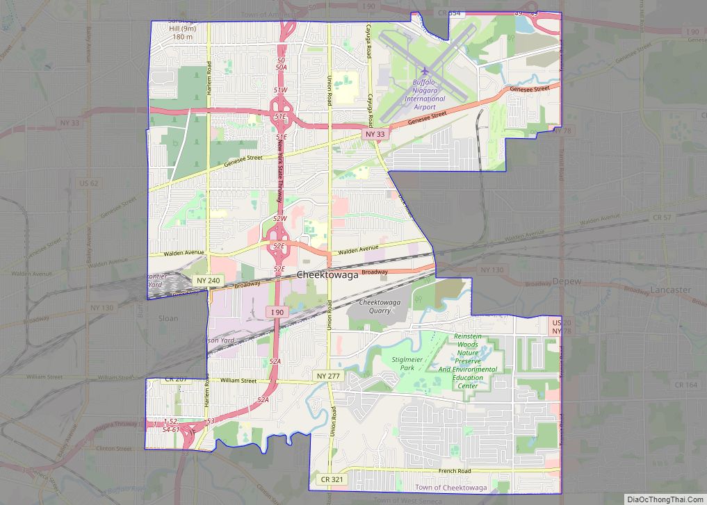
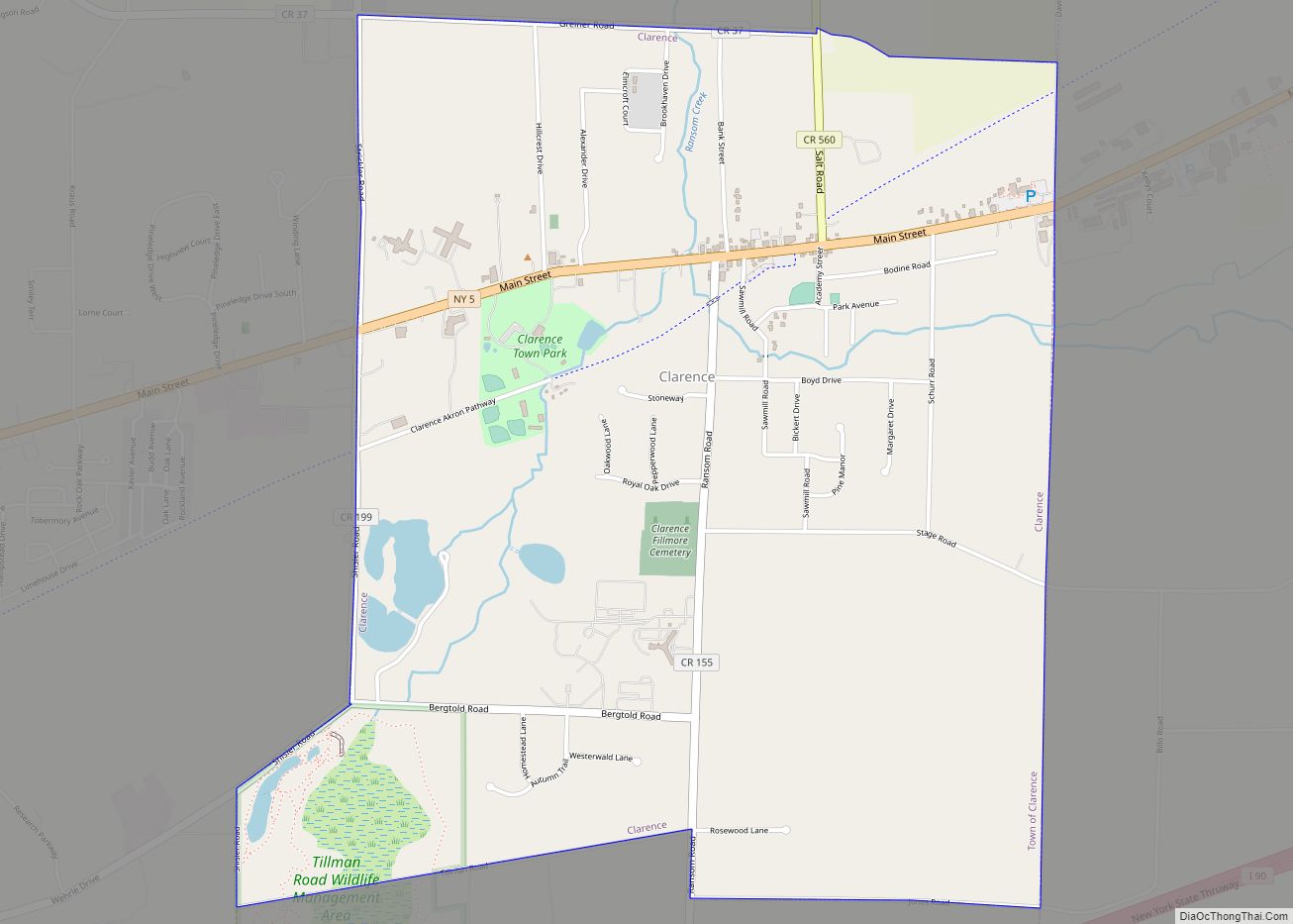
Online Interactive Map
Click on ![]() to view map in "full screen" mode.
to view map in "full screen" mode.
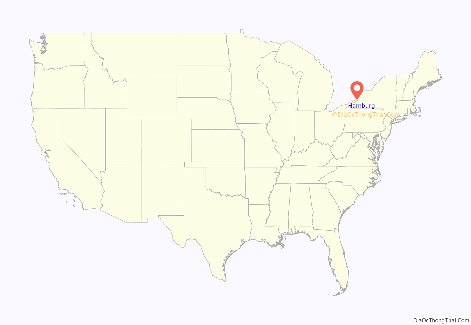
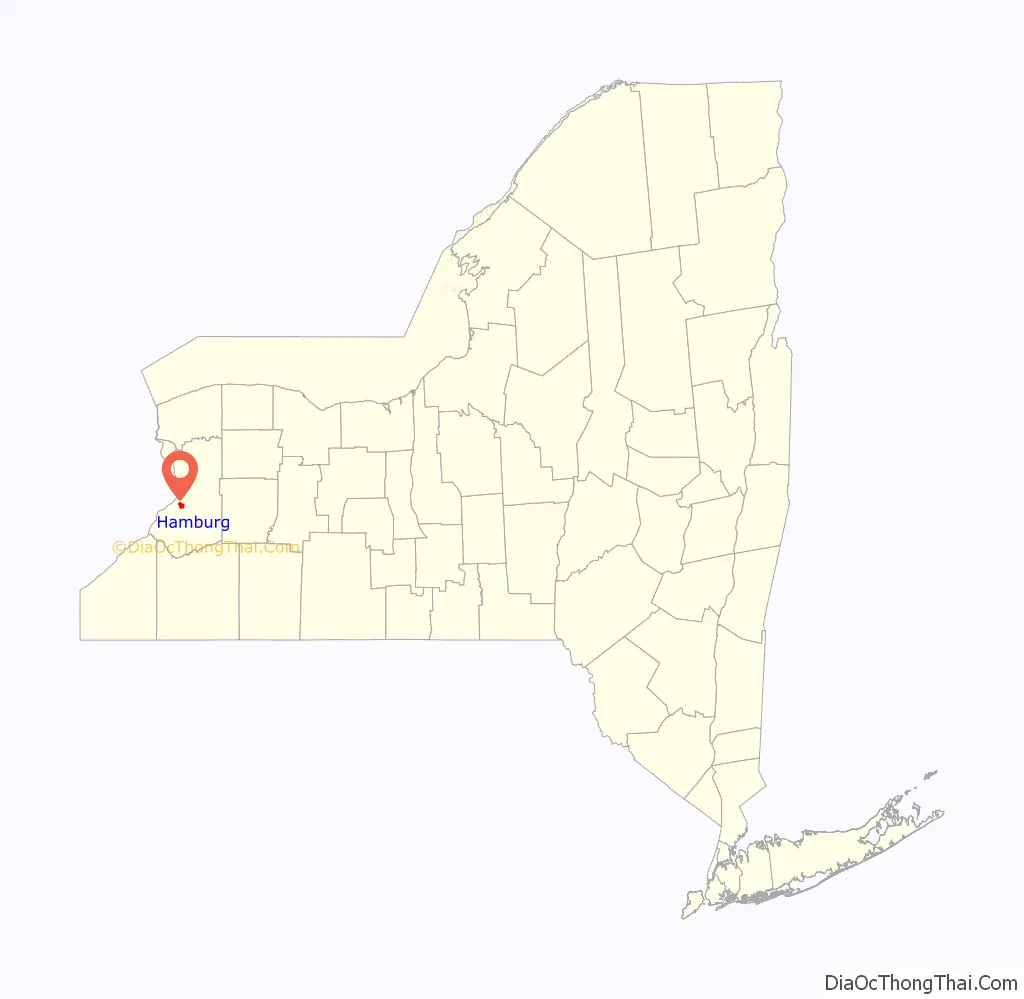
Hamburg location map. Where is Hamburg village?
History
The Village of Hamburg was incorporated in 1874 and had a population in 1880 of 758.
The Hamburg Downtown Historic District was listed on the National Register of Historic Places in 2012.
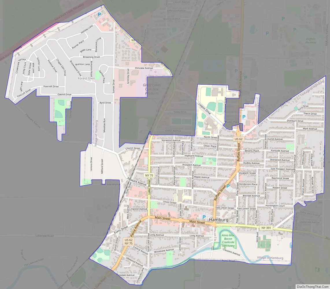
Hamburg Road Map
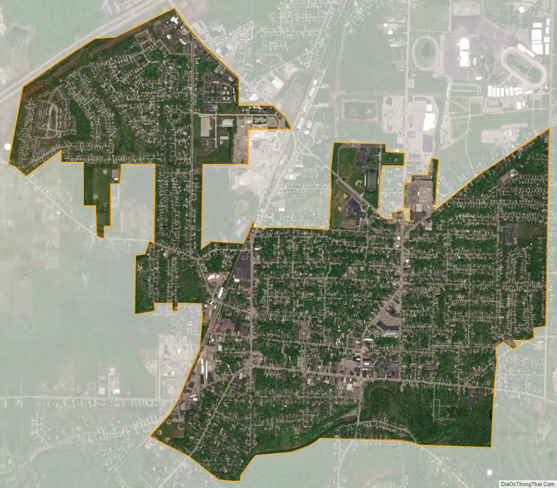
Hamburg city Satellite Map
Geography
Hamburg is located at 42°43′21″N 78°50′1″W / 42.72250°N 78.83361°W / 42.72250; -78.83361 (42.722759, -78.833853).
According to the United States Census Bureau, the village has a total area of 2.5 square miles (6.5 km), all land.
Hamburg lies at the junction of several major trucking roads, such as Lakeview Road, Boston State Road (Route 391), Sisson Highway (Route 75), South Park Avenue/Buffalo Street (U.S. Route 62), which becomes Gowanda State Road south of the village, and McKinley Parkway. Hamburg is east of the New York State Thruway (Interstate 90).
Eighteen Mile Creek flows south of the village to Lake Erie.
See also
Map of New York State and its subdivision:- Albany
- Allegany
- Bronx
- Broome
- Cattaraugus
- Cayuga
- Chautauqua
- Chemung
- Chenango
- Clinton
- Columbia
- Cortland
- Delaware
- Dutchess
- Erie
- Essex
- Franklin
- Fulton
- Genesee
- Greene
- Hamilton
- Herkimer
- Jefferson
- Kings
- Lake Ontario
- Lewis
- Livingston
- Madison
- Monroe
- Montgomery
- Nassau
- New York
- Niagara
- Oneida
- Onondaga
- Ontario
- Orange
- Orleans
- Oswego
- Otsego
- Putnam
- Queens
- Rensselaer
- Richmond
- Rockland
- Saint Lawrence
- Saratoga
- Schenectady
- Schoharie
- Schuyler
- Seneca
- Steuben
- Suffolk
- Sullivan
- Tioga
- Tompkins
- Ulster
- Warren
- Washington
- Wayne
- Westchester
- Wyoming
- Yates
- Alabama
- Alaska
- Arizona
- Arkansas
- California
- Colorado
- Connecticut
- Delaware
- District of Columbia
- Florida
- Georgia
- Hawaii
- Idaho
- Illinois
- Indiana
- Iowa
- Kansas
- Kentucky
- Louisiana
- Maine
- Maryland
- Massachusetts
- Michigan
- Minnesota
- Mississippi
- Missouri
- Montana
- Nebraska
- Nevada
- New Hampshire
- New Jersey
- New Mexico
- New York
- North Carolina
- North Dakota
- Ohio
- Oklahoma
- Oregon
- Pennsylvania
- Rhode Island
- South Carolina
- South Dakota
- Tennessee
- Texas
- Utah
- Vermont
- Virginia
- Washington
- West Virginia
- Wisconsin
- Wyoming