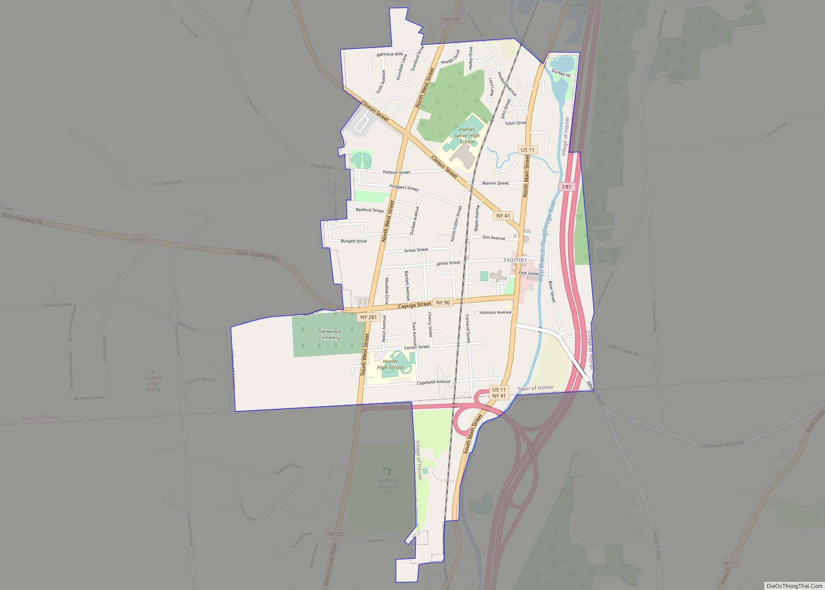
Homer is a village in Cortland County, New York, United States. The population was 3,291 at the 2010 census. The village name is derived from the surrounding town, which was named after the poet Homer.
The village of Homer lies mostly within the town of Homer, except for a small section on the south side which is in the town of Cortlandville. Homer is north of the city of Cortland.
| Name: | Homer village |
|---|---|
| LSAD Code: | 47 |
| LSAD Description: | village (suffix) |
| State: | New York |
| County: | Cortland County |
| Elevation: | 1,125 ft (343 m) |
| Total Area: | 1.94 sq mi (5.02 km²) |
| Land Area: | 1.93 sq mi (4.99 km²) |
| Water Area: | 0.01 sq mi (0.03 km²) |
| Total Population: | 3,210 |
| Population Density: | 1,667.53/sq mi (643.70/km²) |
| ZIP code: | 13077 |
| Area code: | 607 |
| FIPS code: | 3635276 |
| GNISfeature ID: | 0953124 |
| Website: | www.homerny.org |
Online Interactive Map
Click on ![]() to view map in "full screen" mode.
to view map in "full screen" mode.
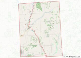
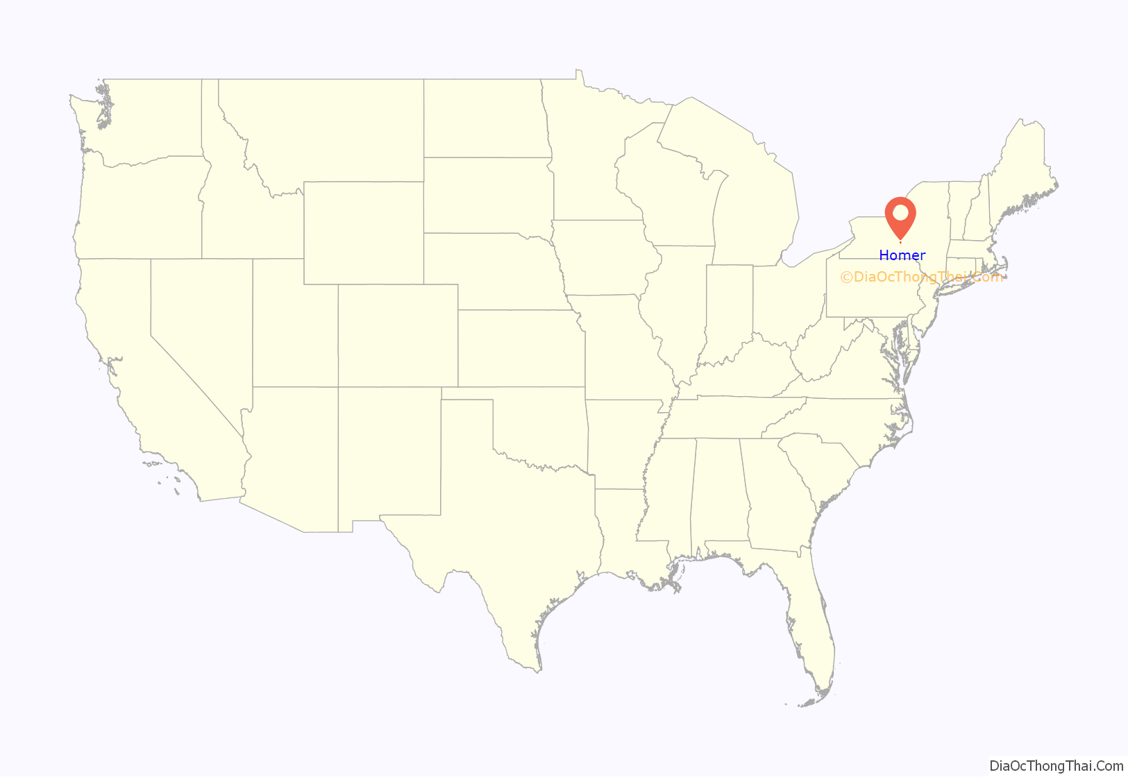
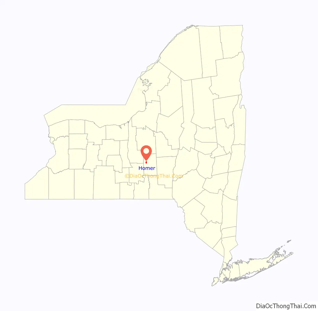
Homer location map. Where is Homer village?
History
Homer is in the former Central New York Military Tract and was within a Military Tract township which was assigned the name “Homer” by a clerk.
Amos Todd, his sister Rhoda Beebe, and her husband Joseph Beebe founded the community in 1791. The village was incorporated in 1835.
The town was the inspiration for “Homeville”, the small town in the novel David Harum by Edward Noyes Westcott.
The Old Homer Village Historic District, United States Post Office, and Water, Wall, and Pine Streets Lenticular Truss Bridges are listed on the National Register of Historic Places.
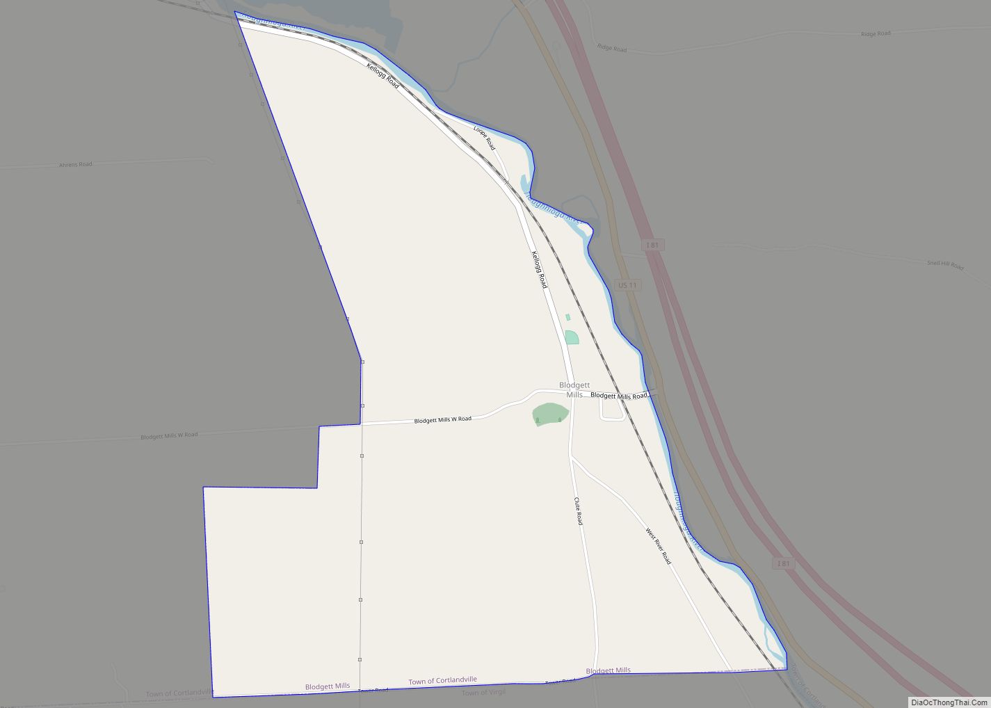
Homer Road Map
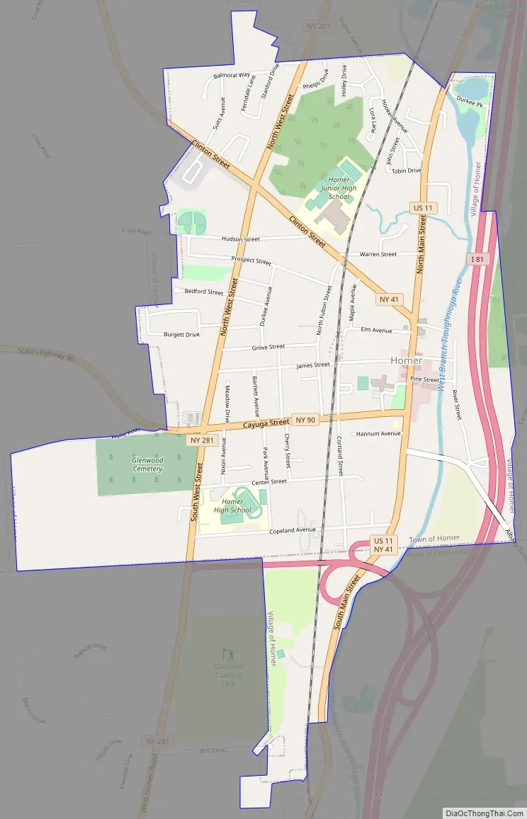
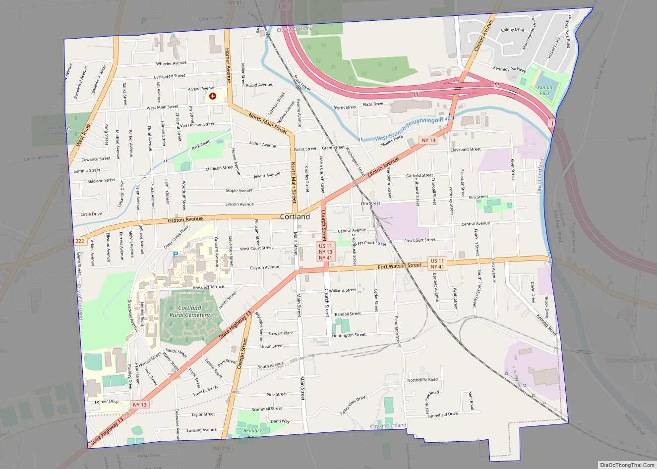
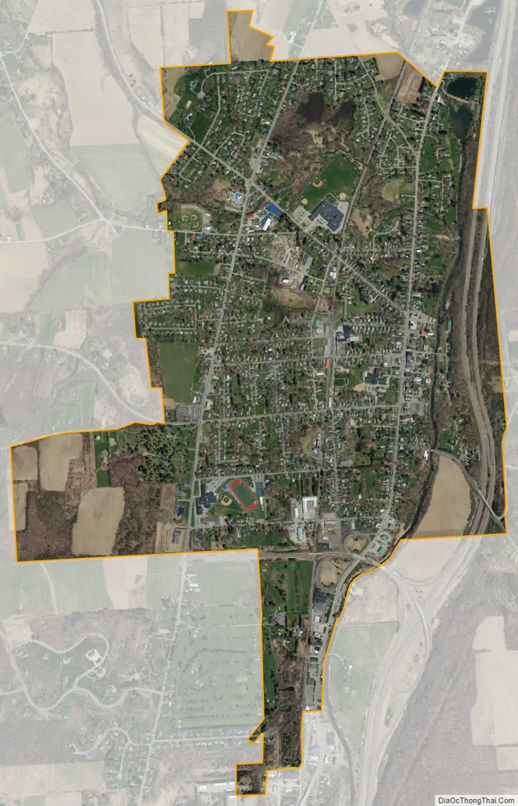
Homer city Satellite Map
Geography
Homer village is located along the southern border of the town of Homer at 42°38′27″N 76°10′55.22″W / 42.64083°N 76.1820056°W / 42.64083; -76.1820056 (42.640829,-76.182006).
According to the United States Census Bureau, the village has a total area of 1.9 square miles (5.0 km), of which 0.01 square miles (0.03 km), or 0.65%, is water.
New York State Route 41 and New York State Route 90 converge on north-south highways New York State Route 281 and U.S. Route 11 at Homer. Interstate 81 is east of the village, with access from Exit 12. Cortland is 2 miles (3 km) to the south, and Tully is 11 miles (18 km) to the north.
The West Branch of the Tioughnioga River, part of the Susquehanna River watershed, flows southward past the east side of the village.
See also
Map of New York State and its subdivision:- Albany
- Allegany
- Bronx
- Broome
- Cattaraugus
- Cayuga
- Chautauqua
- Chemung
- Chenango
- Clinton
- Columbia
- Cortland
- Delaware
- Dutchess
- Erie
- Essex
- Franklin
- Fulton
- Genesee
- Greene
- Hamilton
- Herkimer
- Jefferson
- Kings
- Lake Ontario
- Lewis
- Livingston
- Madison
- Monroe
- Montgomery
- Nassau
- New York
- Niagara
- Oneida
- Onondaga
- Ontario
- Orange
- Orleans
- Oswego
- Otsego
- Putnam
- Queens
- Rensselaer
- Richmond
- Rockland
- Saint Lawrence
- Saratoga
- Schenectady
- Schoharie
- Schuyler
- Seneca
- Steuben
- Suffolk
- Sullivan
- Tioga
- Tompkins
- Ulster
- Warren
- Washington
- Wayne
- Westchester
- Wyoming
- Yates
- Alabama
- Alaska
- Arizona
- Arkansas
- California
- Colorado
- Connecticut
- Delaware
- District of Columbia
- Florida
- Georgia
- Hawaii
- Idaho
- Illinois
- Indiana
- Iowa
- Kansas
- Kentucky
- Louisiana
- Maine
- Maryland
- Massachusetts
- Michigan
- Minnesota
- Mississippi
- Missouri
- Montana
- Nebraska
- Nevada
- New Hampshire
- New Jersey
- New Mexico
- New York
- North Carolina
- North Dakota
- Ohio
- Oklahoma
- Oregon
- Pennsylvania
- Rhode Island
- South Carolina
- South Dakota
- Tennessee
- Texas
- Utah
- Vermont
- Virginia
- Washington
- West Virginia
- Wisconsin
- Wyoming