Houghton is a hamlet (and census-designated place) located in the Town of Caneadea in Allegany County, western New York, United States. The population was 1,693 at the 2010 census.
| Name: | Houghton CDP |
|---|---|
| LSAD Code: | 57 |
| LSAD Description: | CDP (suffix) |
| State: | New York |
| County: | Allegany County |
| Elevation: | 1,207 ft (368 m) |
| Total Area: | 2.73 sq mi (7.07 km²) |
| Land Area: | 2.72 sq mi (7.05 km²) |
| Water Area: | 0.01 sq mi (0.03 km²) |
| Total Population: | 1,488 |
| Population Density: | 546.86/sq mi (211.16/km²) |
| ZIP code: | 14744 |
| Area code: | 585 |
| FIPS code: | 3635771 |
| GNISfeature ID: | 0953282 |
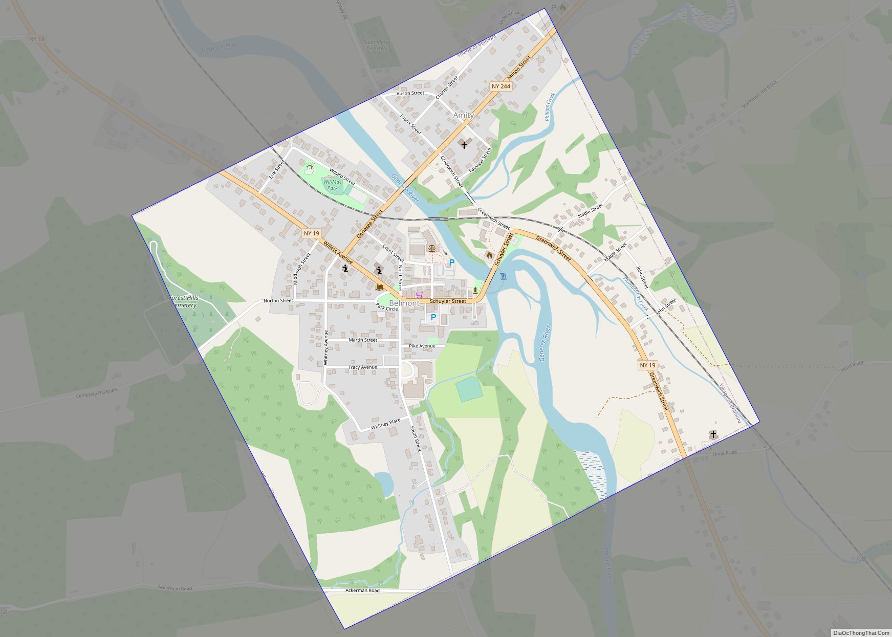
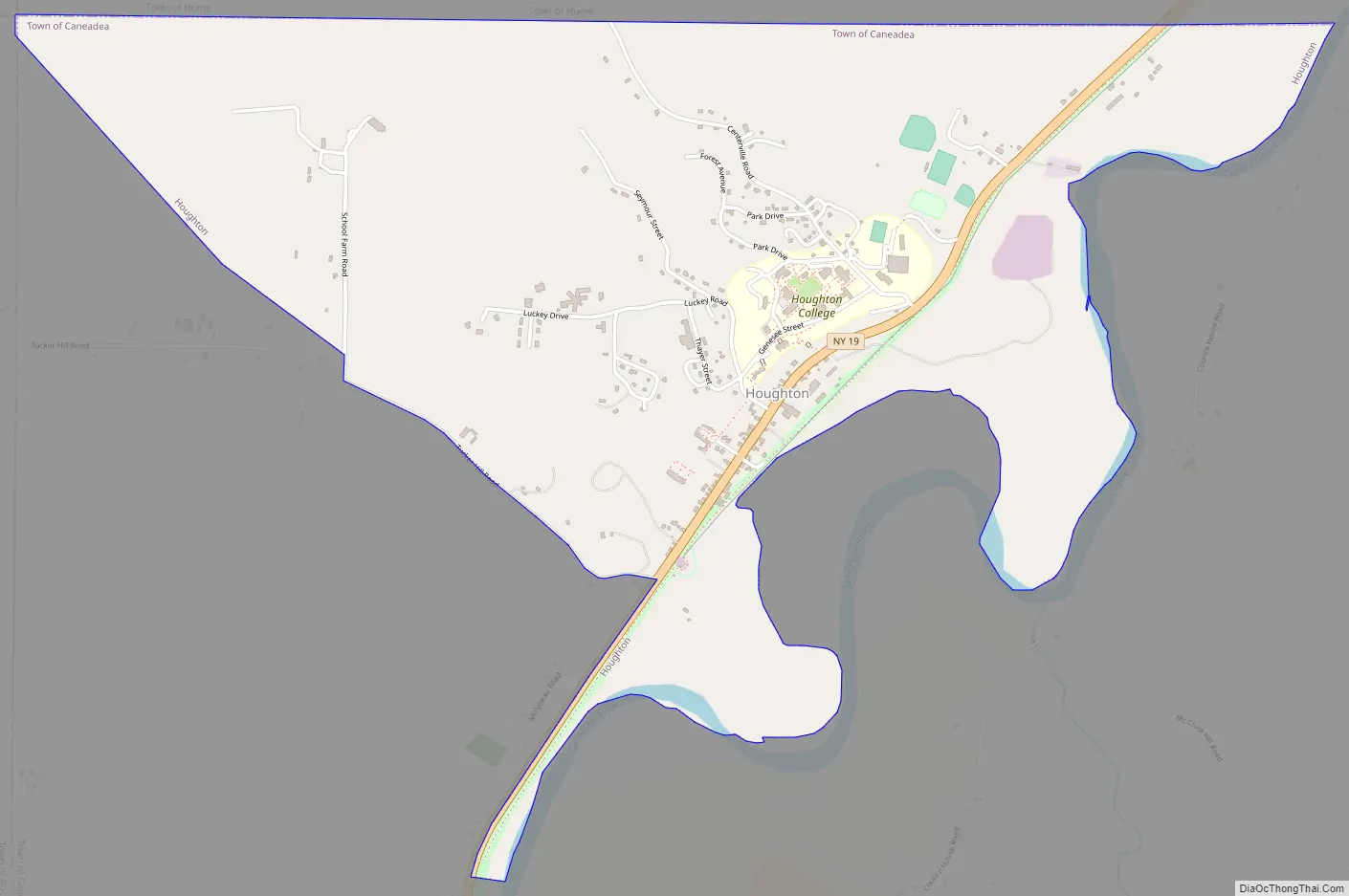
Online Interactive Map
Click on ![]() to view map in "full screen" mode.
to view map in "full screen" mode.
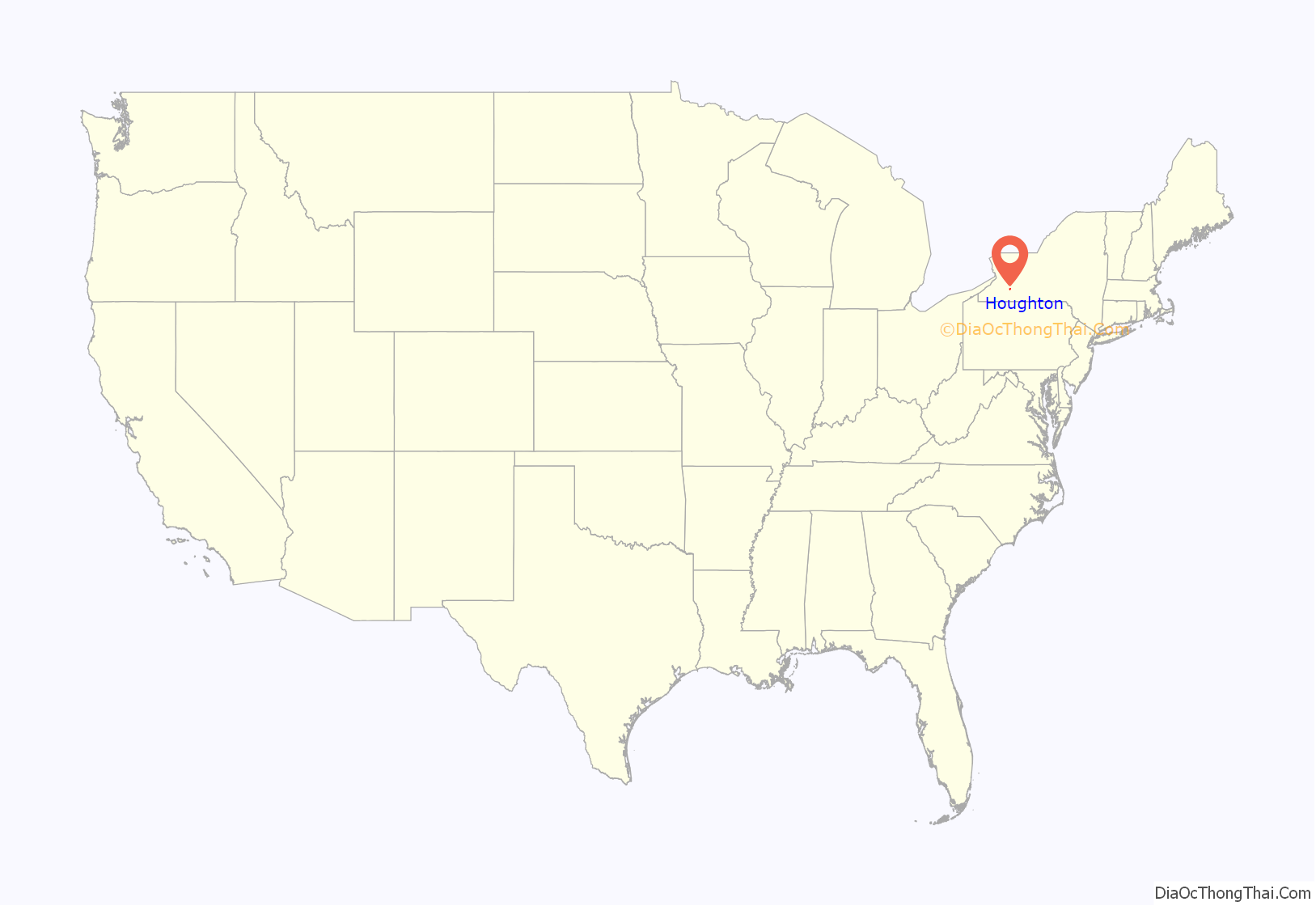
Houghton location map. Where is Houghton CDP?
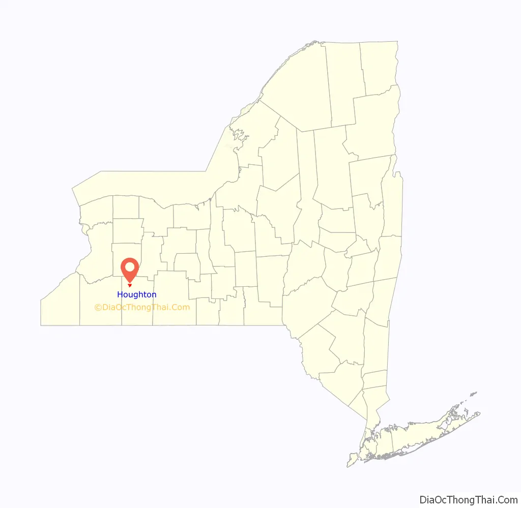
Houghton Road Map
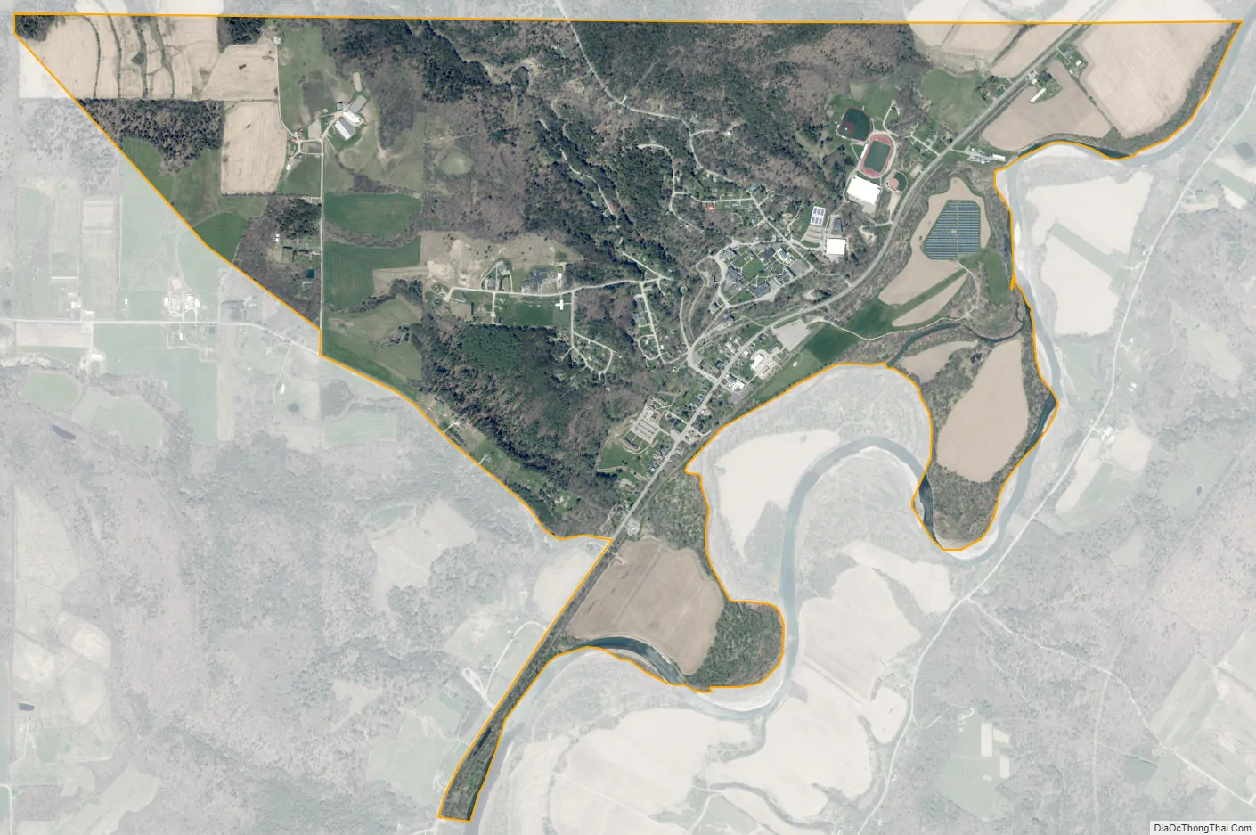
Houghton city Satellite Map
Geography
Houghton is located at 42°26′N 78°9′W / 42.433°N 78.150°W / 42.433; -78.150 (42.4270,-78.1557).
According to the United States Census Bureau, the hamlet has a total area of 2.5 square miles (6.4 km), of which 0.012 square miles (0.03 km), or 0.39%, is water.
Houghton is located on the west bank of the Genesee River. New York State Route 19 passes the hamlet and provides access.
Houghton College is a private, Christian, coeducational college located here. Houghton Academy is a traditional boarding and day secondary school located in Houghton.
See also
Map of New York State and its subdivision:- Albany
- Allegany
- Bronx
- Broome
- Cattaraugus
- Cayuga
- Chautauqua
- Chemung
- Chenango
- Clinton
- Columbia
- Cortland
- Delaware
- Dutchess
- Erie
- Essex
- Franklin
- Fulton
- Genesee
- Greene
- Hamilton
- Herkimer
- Jefferson
- Kings
- Lake Ontario
- Lewis
- Livingston
- Madison
- Monroe
- Montgomery
- Nassau
- New York
- Niagara
- Oneida
- Onondaga
- Ontario
- Orange
- Orleans
- Oswego
- Otsego
- Putnam
- Queens
- Rensselaer
- Richmond
- Rockland
- Saint Lawrence
- Saratoga
- Schenectady
- Schoharie
- Schuyler
- Seneca
- Steuben
- Suffolk
- Sullivan
- Tioga
- Tompkins
- Ulster
- Warren
- Washington
- Wayne
- Westchester
- Wyoming
- Yates
- Alabama
- Alaska
- Arizona
- Arkansas
- California
- Colorado
- Connecticut
- Delaware
- District of Columbia
- Florida
- Georgia
- Hawaii
- Idaho
- Illinois
- Indiana
- Iowa
- Kansas
- Kentucky
- Louisiana
- Maine
- Maryland
- Massachusetts
- Michigan
- Minnesota
- Mississippi
- Missouri
- Montana
- Nebraska
- Nevada
- New Hampshire
- New Jersey
- New Mexico
- New York
- North Carolina
- North Dakota
- Ohio
- Oklahoma
- Oregon
- Pennsylvania
- Rhode Island
- South Carolina
- South Dakota
- Tennessee
- Texas
- Utah
- Vermont
- Virginia
- Washington
- West Virginia
- Wisconsin
- Wyoming