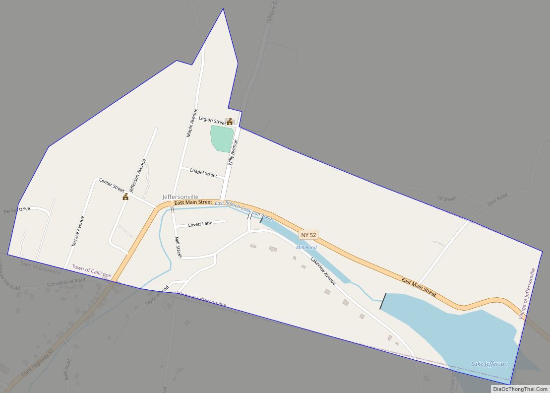
Jeffersonville is a village in Sullivan County, New York, United States. The population was 368 at the 2020 census. The name is derived indirectly from Thomas Jefferson.
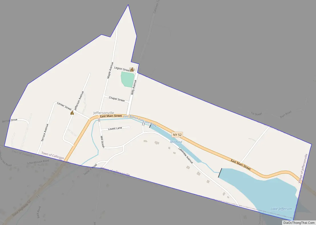
The Village of Jeffersonville is in the southeastern section of the Town of Callicoon on NY 52. The postal code is 12748. The Village of Jeffersonville is home to the Sullivan West Central School elementary school.
| Name: | Jeffersonville village |
|---|---|
| LSAD Code: | 47 |
| LSAD Description: | village (suffix) |
| State: | New York |
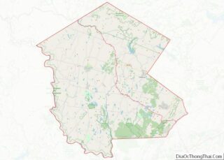
| County: | Sullivan County |
| Incorporated: | November 24, 1924; 98 years ago (1924-11-24) |
| Elevation: | 1,050 ft (320 m) |
| Total Area: | 0.44 sq mi (1.14 km²) |
| Land Area: | 0.41 sq mi (1.06 km²) |
| Water Area: | 0.03 sq mi (0.08 km²) |
| Total Population: | 368 |
| Population Density: | 901.96/sq mi (347.94/km²) |
| ZIP code: | 12748 |
| Area code: | 845 |
| FIPS code: | 3638506 |
| GNISfeature ID: | 0953977 |
Online Interactive Map
Click on ![]() to view map in "full screen" mode.
to view map in "full screen" mode.
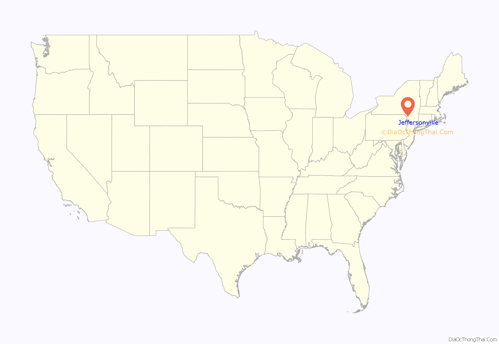
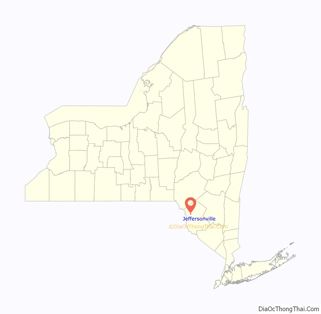
Jeffersonville location map. Where is Jeffersonville village?
History
The original settlers arrived c. 1830 and called the village Winkelried.
The first hotel in the village was The Jefferson House, named after President Jefferson, and the village was subsequently renamed to Jeffersonville. The hotel is now known as the Abel Building and still stands on Main St.
In 1897 and 1898, a total of bills from hotels and saloons in town showed that 3000 kegs of beer were consumed in a village with a population of 500.
The village was incorporated on November 24, 1924.
In June 1974, Patty Hearst was kept in a home in Jeffersonville that was rented by Nicki Scott, a Symbionese Liberation Army ally. Patty Hearst described Jeff as “remote and as near nowhere in particular.” (Times Herald Record, June 1974). During her days in captivity in Jeffersonville, it was rumored that she trained in guerrilla warfare.
The Jeffersonville School was listed on the National Register of Historic Places in 2008.
Jeffersonville Road Map
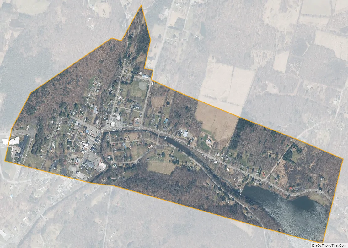
Jeffersonville city Satellite Map
Geography
Lake Jefferson is a small lake near the village.
Jeffersonville is located at 41°46′50″N 74°55′56″W / 41.78056°N 74.93222°W / 41.78056; -74.93222 (41.780417, -74.932281).
According to the United States Census Bureau, the village has a total area of 0.4 square miles (1.0 km), of which 0.4 square miles (1.0 km) is land and 0.04 square miles (0.10 km) (6.82%) is water.
See also
Map of New York State and its subdivision:- Albany
- Allegany
- Bronx
- Broome
- Cattaraugus
- Cayuga
- Chautauqua
- Chemung
- Chenango
- Clinton
- Columbia
- Cortland
- Delaware
- Dutchess
- Erie
- Essex
- Franklin
- Fulton
- Genesee
- Greene
- Hamilton
- Herkimer
- Jefferson
- Kings
- Lake Ontario
- Lewis
- Livingston
- Madison
- Monroe
- Montgomery
- Nassau
- New York
- Niagara
- Oneida
- Onondaga
- Ontario
- Orange
- Orleans
- Oswego
- Otsego
- Putnam
- Queens
- Rensselaer
- Richmond
- Rockland
- Saint Lawrence
- Saratoga
- Schenectady
- Schoharie
- Schuyler
- Seneca
- Steuben
- Suffolk
- Sullivan
- Tioga
- Tompkins
- Ulster
- Warren
- Washington
- Wayne
- Westchester
- Wyoming
- Yates
- Alabama
- Alaska
- Arizona
- Arkansas
- California
- Colorado
- Connecticut
- Delaware
- District of Columbia
- Florida
- Georgia
- Hawaii
- Idaho
- Illinois
- Indiana
- Iowa
- Kansas
- Kentucky
- Louisiana
- Maine
- Maryland
- Massachusetts
- Michigan
- Minnesota
- Mississippi
- Missouri
- Montana
- Nebraska
- Nevada
- New Hampshire
- New Jersey
- New Mexico
- New York
- North Carolina
- North Dakota
- Ohio
- Oklahoma
- Oregon
- Pennsylvania
- Rhode Island
- South Carolina
- South Dakota
- Tennessee
- Texas
- Utah
- Vermont
- Virginia
- Washington
- West Virginia
- Wisconsin
- Wyoming