Lima is a village in the town of Lima, Livingston County, New York, United States. The population of Lima village was 2,139 at the 2010 census, out of 4,305 in the entire town.
| Name: | Lima village |
|---|---|
| LSAD Code: | 47 |
| LSAD Description: | village (suffix) |
| State: | New York |
| County: | Livingston County |
| Elevation: | 827 ft (252 m) |
| Total Area: | 1.34 sq mi (3.48 km²) |
| Land Area: | 1.34 sq mi (3.48 km²) |
| Water Area: | 0.00 sq mi (0.00 km²) |
| Total Population: | 2,094 |
| Population Density: | 1,556.88/sq mi (600.94/km²) |
| ZIP code: | 14485 |
| Area code: | 585 |
| FIPS code: | 3642323 |
| GNISfeature ID: | 2390941 |
| Website: | villageoflima.us |
Online Interactive Map
Click on ![]() to view map in "full screen" mode.
to view map in "full screen" mode.
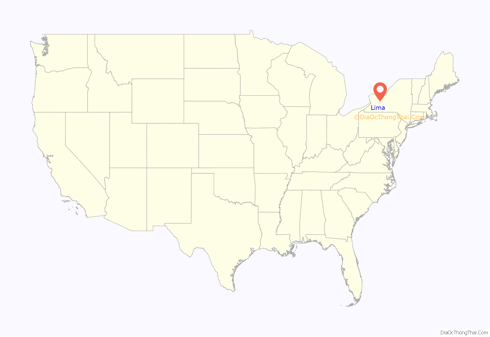
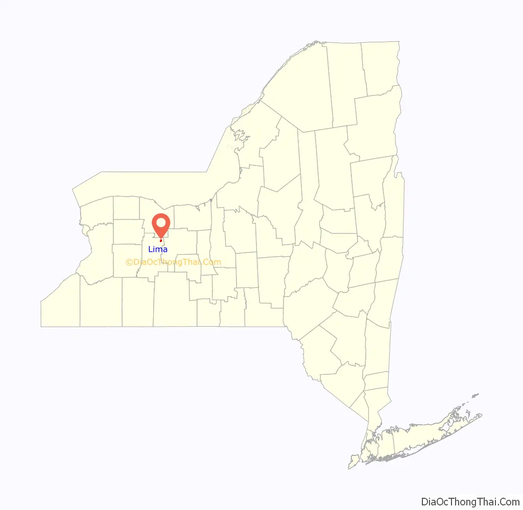
Lima location map. Where is Lima village?
History
The village was founded in 1788 by Paul Davison and Jonathan Gould, veterans of the Sullivan Campaign, who had seen the area during the American Revolution. The village of Lima was organized in 1797 as the “Village of Charleston”, but in 1808 the name was changed to “Lima”, after Old Lyme, Connecticut. (For that reason, the name of the village is currently pronounced like the name of the bean, not like the name of the city in Peru).
The Genesee Wesleyan Seminary (1830) / Genesee College (1849) was one of the first co-educational schools in the country when it opened in 1822. Eventually, determined by a Methodist-Episcopal convention in 1870, the college was shut in favor of the newly developed Syracuse University (1871), over the protests of the residents of Lima.
Notable people
- Belva Ann Lockwood, first female attorney to practice before the Supreme Court
- Kenneth Keating, U.S. representative, senator, and ambassador to Israel
- James Edward Quigley, former archbishop of Chicago
- W. W. Thayer, former governor of Oregon
- Henry Jarvis Raymond, founder of the New York Times
National Register of Historic Places
The following sites are listed on the National Register of Historic Places.
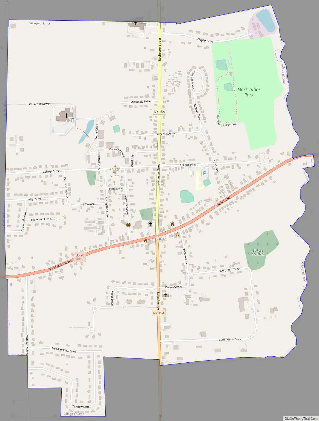
Lima Road Map
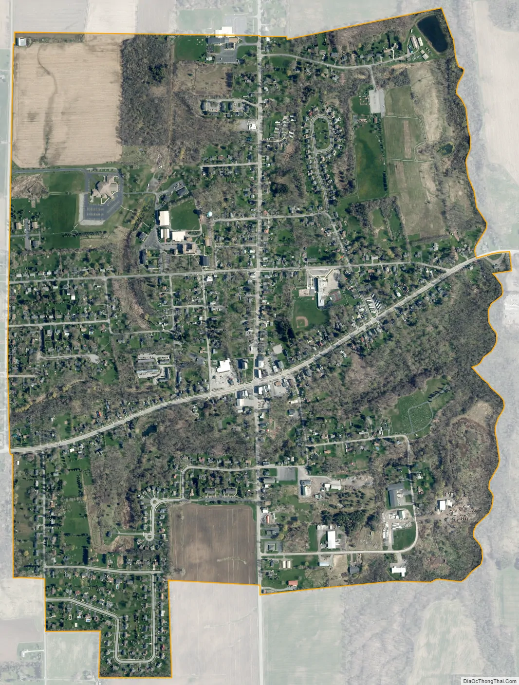
Lima city Satellite Map
Geography
Lima is located near the northeastern corner of Livingston County at 42°54′23″N 77°36′46″W / 42.90639°N 77.61278°W / 42.90639; -77.61278 (42.906511, -77.612808), at the center of the town of Lima. It is at the intersection of conjoined New York State Route 5/U.S. Route 20 (in part, Avon Lima Road and East Main Street) and New York State Route 15A (in part Rochester Road and Plank Road). The village is 4 miles (6 km) east of Interstate 390, 15 miles (24 km) northeast of Geneseo, the Livingston county seat, and 19 miles (31 km) south of Rochester.
According to the United States Census Bureau, the village has a total area of 1.4 square miles (3.5 km), all land. The eastern boundary of the village is formed by Spring Brook, a northward-flowing tributary of Honeoye Creek and part of the Genesee River watershed.
See also
Map of New York State and its subdivision:- Albany
- Allegany
- Bronx
- Broome
- Cattaraugus
- Cayuga
- Chautauqua
- Chemung
- Chenango
- Clinton
- Columbia
- Cortland
- Delaware
- Dutchess
- Erie
- Essex
- Franklin
- Fulton
- Genesee
- Greene
- Hamilton
- Herkimer
- Jefferson
- Kings
- Lake Ontario
- Lewis
- Livingston
- Madison
- Monroe
- Montgomery
- Nassau
- New York
- Niagara
- Oneida
- Onondaga
- Ontario
- Orange
- Orleans
- Oswego
- Otsego
- Putnam
- Queens
- Rensselaer
- Richmond
- Rockland
- Saint Lawrence
- Saratoga
- Schenectady
- Schoharie
- Schuyler
- Seneca
- Steuben
- Suffolk
- Sullivan
- Tioga
- Tompkins
- Ulster
- Warren
- Washington
- Wayne
- Westchester
- Wyoming
- Yates
- Alabama
- Alaska
- Arizona
- Arkansas
- California
- Colorado
- Connecticut
- Delaware
- District of Columbia
- Florida
- Georgia
- Hawaii
- Idaho
- Illinois
- Indiana
- Iowa
- Kansas
- Kentucky
- Louisiana
- Maine
- Maryland
- Massachusetts
- Michigan
- Minnesota
- Mississippi
- Missouri
- Montana
- Nebraska
- Nevada
- New Hampshire
- New Jersey
- New Mexico
- New York
- North Carolina
- North Dakota
- Ohio
- Oklahoma
- Oregon
- Pennsylvania
- Rhode Island
- South Carolina
- South Dakota
- Tennessee
- Texas
- Utah
- Vermont
- Virginia
- Washington
- West Virginia
- Wisconsin
- Wyoming


