Lime Lake is a hamlet and census-designated place (CDP) in the northeast part of the town of Machias, in Cattaraugus County, New York, United States. As of the 2010 census, it had a population of 867. Prior to the 2010 census, the area was delineated as part of the Lime Lake-Machias CDP.
| Name: | Lime Lake CDP |
|---|---|
| LSAD Code: | 57 |
| LSAD Description: | CDP (suffix) |
| State: | New York |
| County: | Cattaraugus County |
| Elevation: | 1,660 ft (510 m) |
| Total Area: | 2.64 sq mi (6.85 km²) |
| Land Area: | 2.38 sq mi (6.16 km²) |
| Water Area: | 0.27 sq mi (0.69 km²) |
| Total Population: | 836 |
| Population Density: | 351.56/sq mi (135.75/km²) |
| FIPS code: | 3642345 |
Online Interactive Map
Click on ![]() to view map in "full screen" mode.
to view map in "full screen" mode.
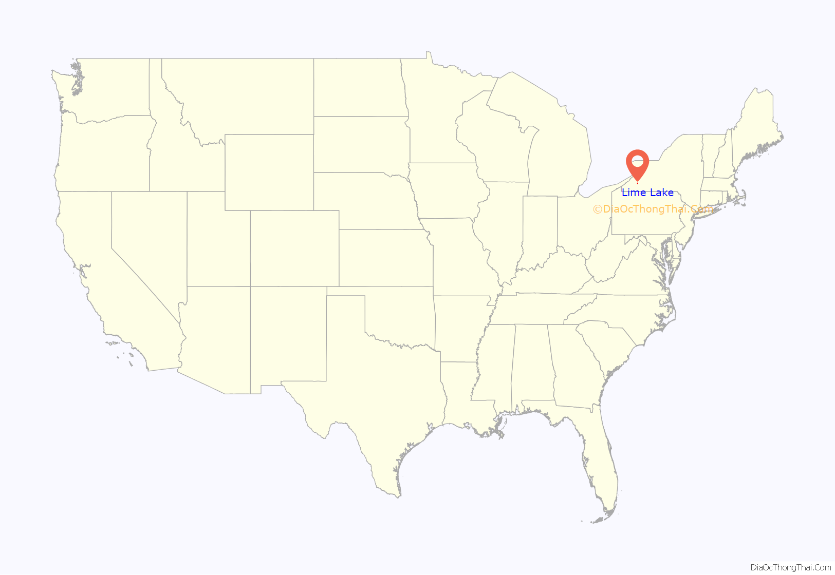
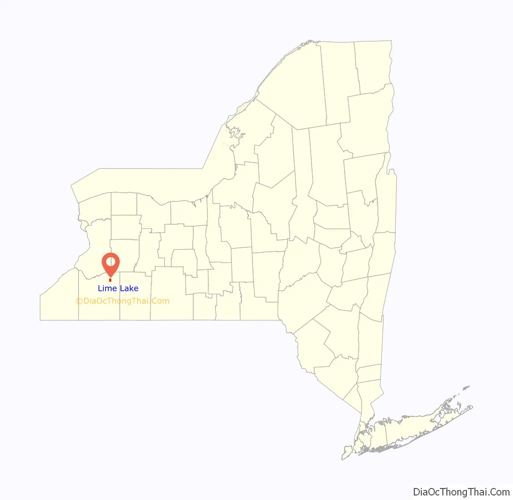
Lime Lake location map. Where is Lime Lake CDP?
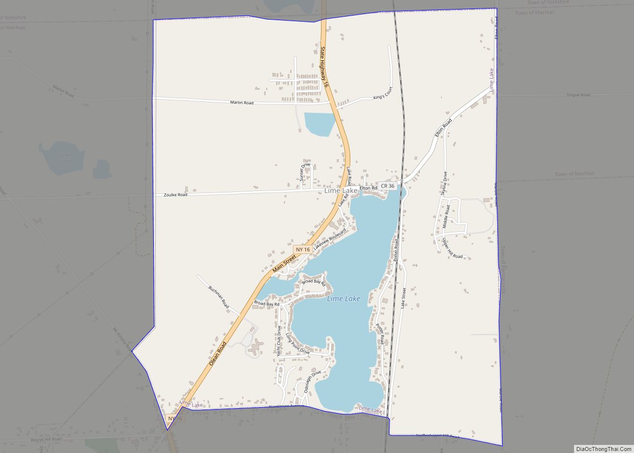
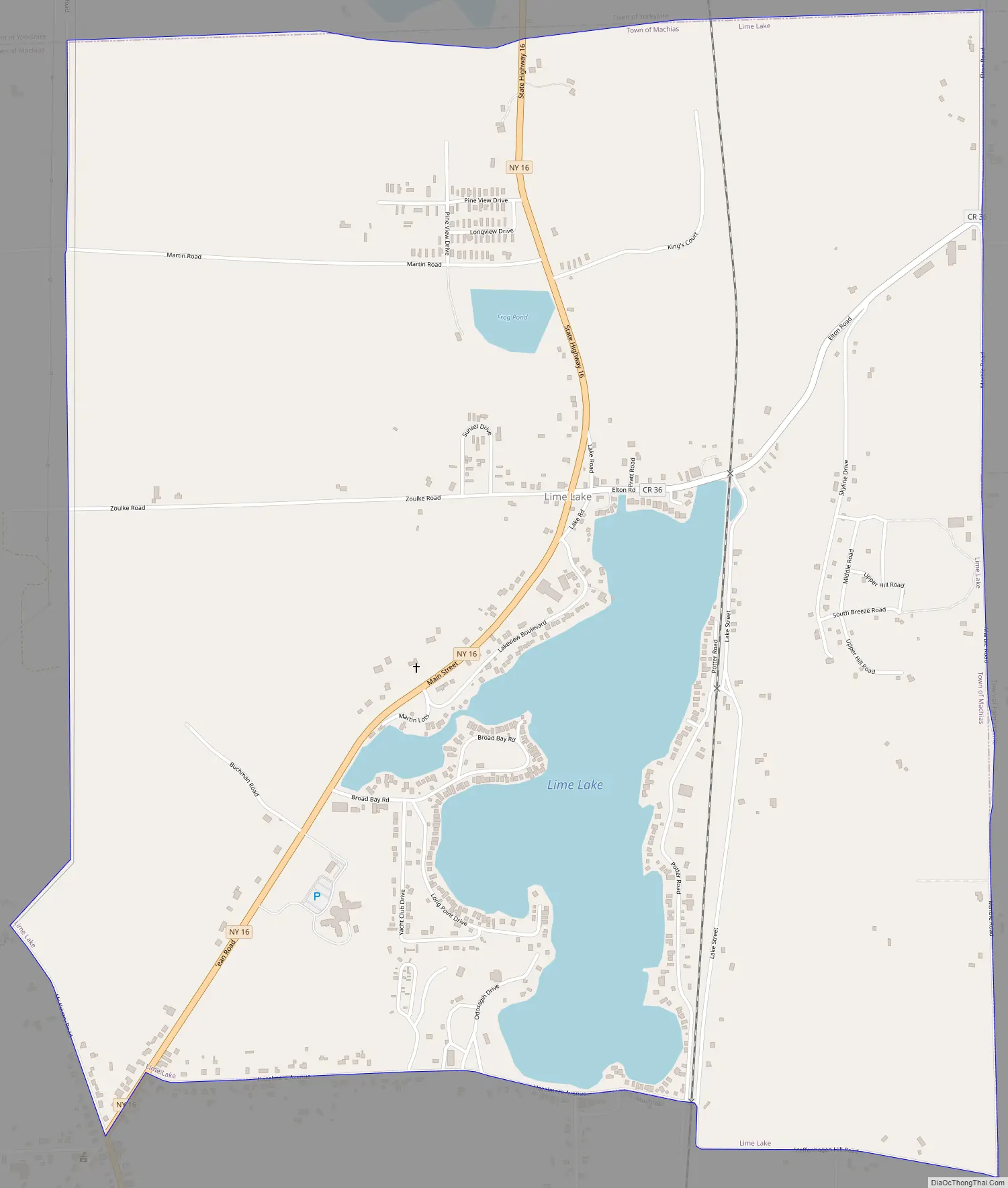
Lime Lake Road Map
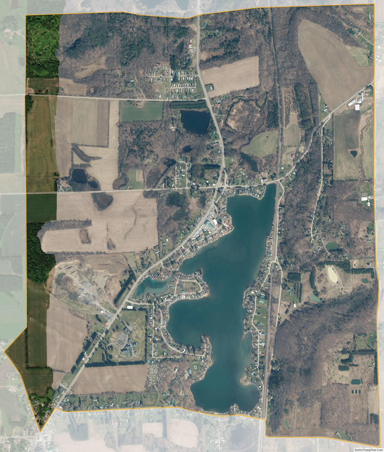
Lime Lake city Satellite Map
Geography
Lime Lake is located in the northeast corner of the town of Machias at 42°26′4″N 78°28′45″W / 42.43444°N 78.47917°W / 42.43444; -78.47917. It consists of development that surrounds a small water body named Lime Lake, about 1 mile (1.6 km) in diameter. The area is bordered to the south by the main hamlet of Machias.
According to the United States Census Bureau, the Lime Lake CDP has a total area of 2.6 square miles (6.8 km), of which 2.4 square miles (6.2 km) is land and 0.27 square miles (0.7 km), or 10.06%, is water. The outlet of Lime Lake flows north to Elton Creek in Delevan, which then continues north to Cattaraugus Creek, a west-flowing tributary of Lake Erie. Less than one mile south of Lime Lake and only a few feet higher is the drainage divide between the Great Lakes watershed to the north and the Mississippi River watershed to the south: Ischua Creek flows south to Olean Creek, a tributary of the Allegheny River, then the Ohio River, and finally the Mississippi.
New York State Route 16 and Cattaraugus County Route 70 connect Lime Lake to Machias.
See also
Map of New York State and its subdivision:- Albany
- Allegany
- Bronx
- Broome
- Cattaraugus
- Cayuga
- Chautauqua
- Chemung
- Chenango
- Clinton
- Columbia
- Cortland
- Delaware
- Dutchess
- Erie
- Essex
- Franklin
- Fulton
- Genesee
- Greene
- Hamilton
- Herkimer
- Jefferson
- Kings
- Lake Ontario
- Lewis
- Livingston
- Madison
- Monroe
- Montgomery
- Nassau
- New York
- Niagara
- Oneida
- Onondaga
- Ontario
- Orange
- Orleans
- Oswego
- Otsego
- Putnam
- Queens
- Rensselaer
- Richmond
- Rockland
- Saint Lawrence
- Saratoga
- Schenectady
- Schoharie
- Schuyler
- Seneca
- Steuben
- Suffolk
- Sullivan
- Tioga
- Tompkins
- Ulster
- Warren
- Washington
- Wayne
- Westchester
- Wyoming
- Yates
- Alabama
- Alaska
- Arizona
- Arkansas
- California
- Colorado
- Connecticut
- Delaware
- District of Columbia
- Florida
- Georgia
- Hawaii
- Idaho
- Illinois
- Indiana
- Iowa
- Kansas
- Kentucky
- Louisiana
- Maine
- Maryland
- Massachusetts
- Michigan
- Minnesota
- Mississippi
- Missouri
- Montana
- Nebraska
- Nevada
- New Hampshire
- New Jersey
- New Mexico
- New York
- North Carolina
- North Dakota
- Ohio
- Oklahoma
- Oregon
- Pennsylvania
- Rhode Island
- South Carolina
- South Dakota
- Tennessee
- Texas
- Utah
- Vermont
- Virginia
- Washington
- West Virginia
- Wisconsin
- Wyoming