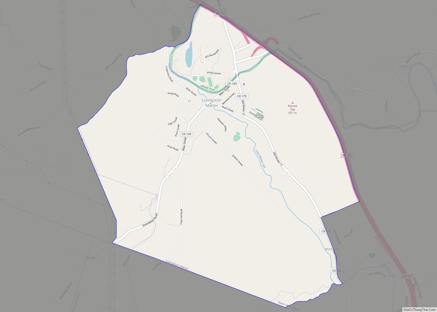
Livingston Manor is a hamlet (and a census-designated place) in Sullivan County, New York, United States. The population was 1,221 at the 2010 census.
Livingston Manor is located in the southern part of the town of Rockland. New York State Route 17 runs by it.
| Name: | Livingston Manor CDP |
|---|---|
| LSAD Code: | 57 |
| LSAD Description: | CDP (suffix) |
| State: | New York |
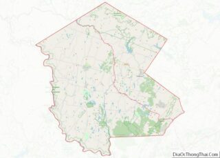
| County: | Sullivan County |
| Elevation: | 1,401 ft (427 m) |
| Total Area: | 3.26 sq mi (8.43 km²) |
| Land Area: | 3.25 sq mi (8.40 km²) |
| Water Area: | 0.01 sq mi (0.03 km²) |
| Total Population: | 1,053 |
| Population Density: | 324.50/sq mi (125.31/km²) |
| ZIP code: | 12758 |
| Area code: | 845 |
| FIPS code: | 3642928 |
| GNISfeature ID: | 0955750 |
| Website: | www.livingstonmanor.org |
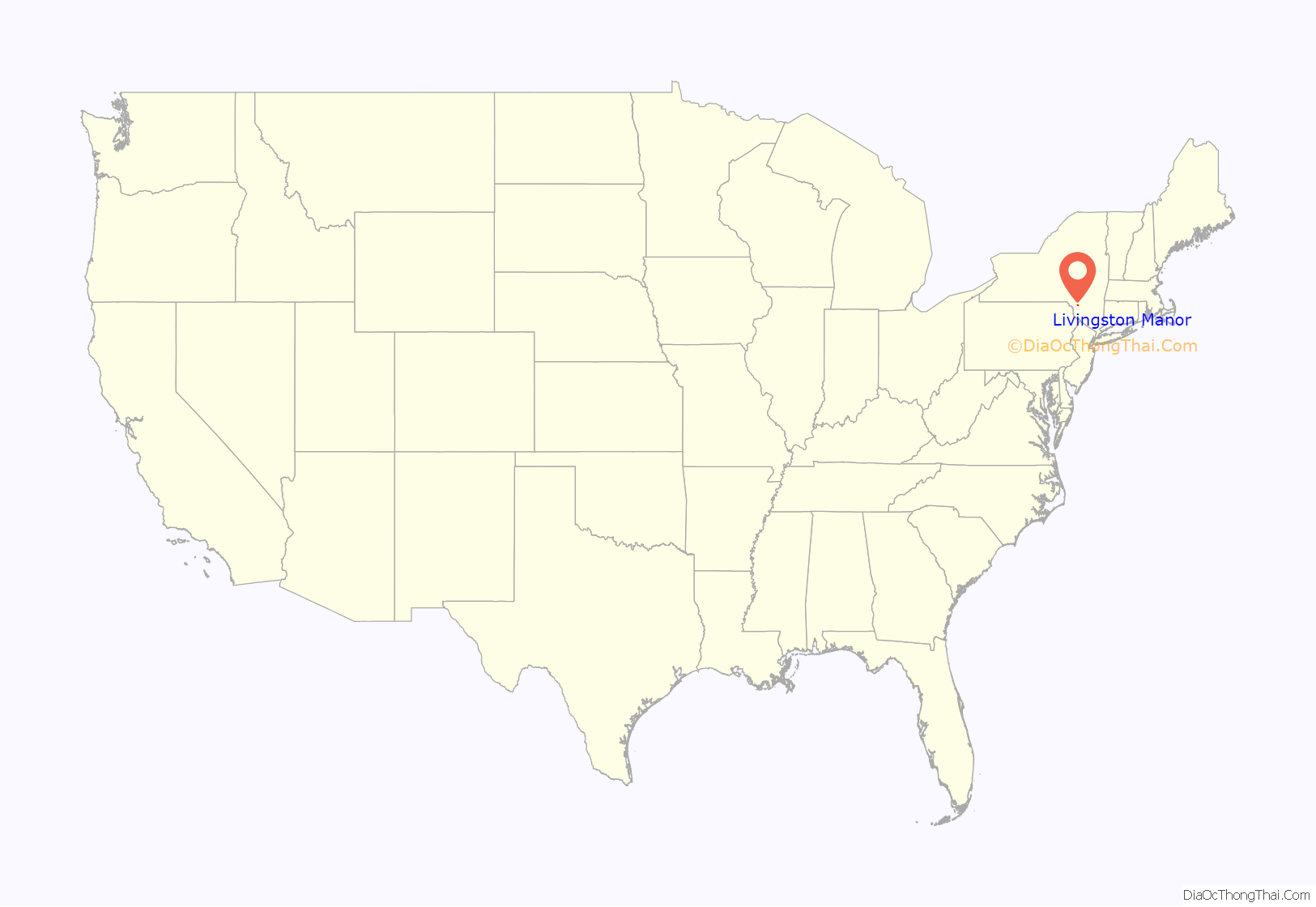
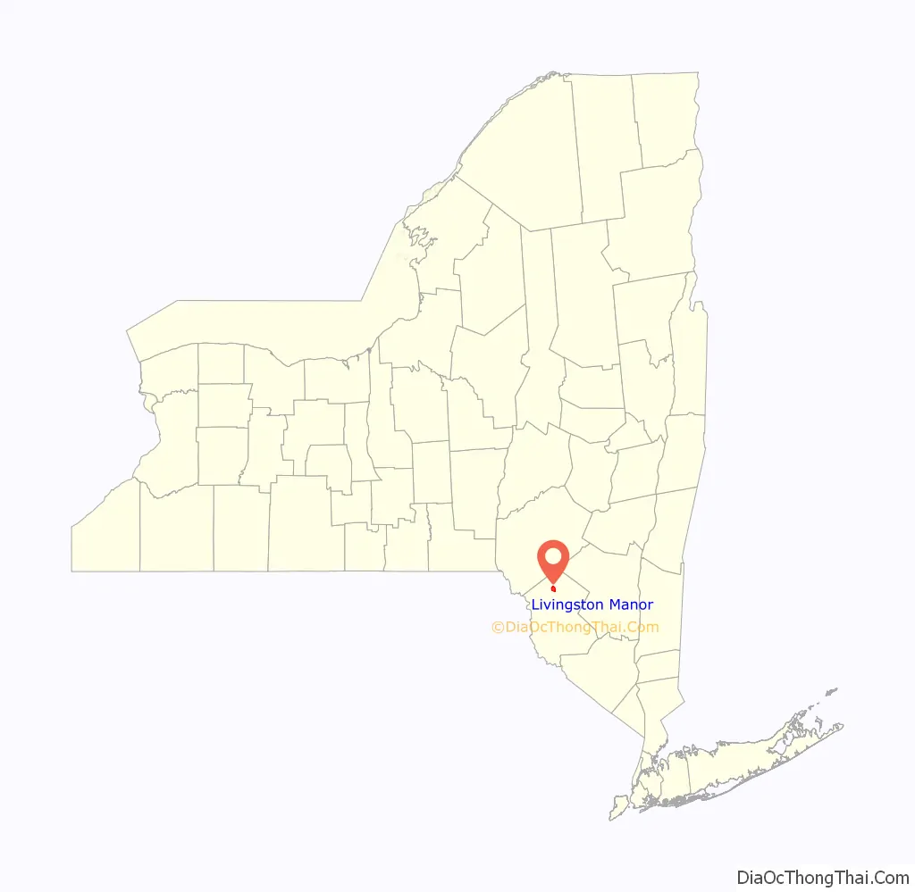
Online Interactive Map
Click on ![]() to view map in "full screen" mode.
to view map in "full screen" mode.
Livingston Manor location map. Where is Livingston Manor CDP?
History
In the late 19th century, this community renamed itself as Livingston Manor, after descendants of the prominent Livingston family who had a house there. But it was not part of the original manor, a huge estate granted by the English Crown about 60 miles (97 km) east in present-day Dutchess and Columbia counties that extended on both sides of the Hudson River. In the early 18th century, the original manor was the site of work camps along the Hudson, where Palatine German refugees worked off their passage to New York paid by the Crown. They produced timber and supplies for the English navy. Later they were allowed to settle in the Schoharie and Mohawk valleys.
The Sullivan County community was part of the Hardenbergh patent in 1716, which included much of the Catskill Mountains.
In 1750, Robert Livingston bought 95,000 acres (380 km) in this area, shortly after becoming the third (and final) Lord of the Manor of Livingston Manor. He sold or leased most of the land by 1780. Robert’s third son, John Robert Livingston (1775–1851), deeded 8,441 acres (34.16 km) to his nephew, Dr. Edward R. Livingston, in 1822 around the area then called Purvis, New York. Edward Livingston died in 1864.
In 1880, the New York, Ontario and Western Railway reached Livingston Manor. Many of its premier trains, such as the Livingston Manor Express, ended there. Passenger service ended in early September, 1953, and the railroad was abandoned on March 30, 1957.
Purvis residents in 1882 chose the new name of Livingston Manor. Edward Livingston’s residence, according to a sign in the village, was on a site now occupied by the village firehouse. Another town source says that it was on a site later developed as the Rockland, New York Town Hall.
In the 1930s, a Livingston descendant arrived in Livingston Manor claiming title to his ancestral land, which had previously been held by tenants under lease. He won his case in court. The people whose ancestors had been tenants had to purchase the property they had been living on for years.
Other early settlers were the Benton family. Their immigrant ancestors had come from Essex, England, in the mid-17th century, settling in Guilford, Connecticut. Records show some of their descendants migrated to in Sullivan County in the late 18th century from Connecticut, purchasing a large tract of land in what is now known as the Township of Liberty. They were likely Scots-Irish in ancestry. They took on many jobs in Sullivan County. Other families who acquired land and settled in the surrounding area were the Bascoms, Stewarts, Wests, Harringtons, Williams, Cochrans, Motts, Kimballs, Darbees, Woodards, Barnharts, and Joselyns. Some descendants of these families still reside in the area.
In the late 19th and early 20th centuries, the village attracted immigrants from eastern Europe. Ashkenazy Jewish immigrants founded the Agudas Achim Synagogue. It was listed on the National Register of Historic Places in 1998.
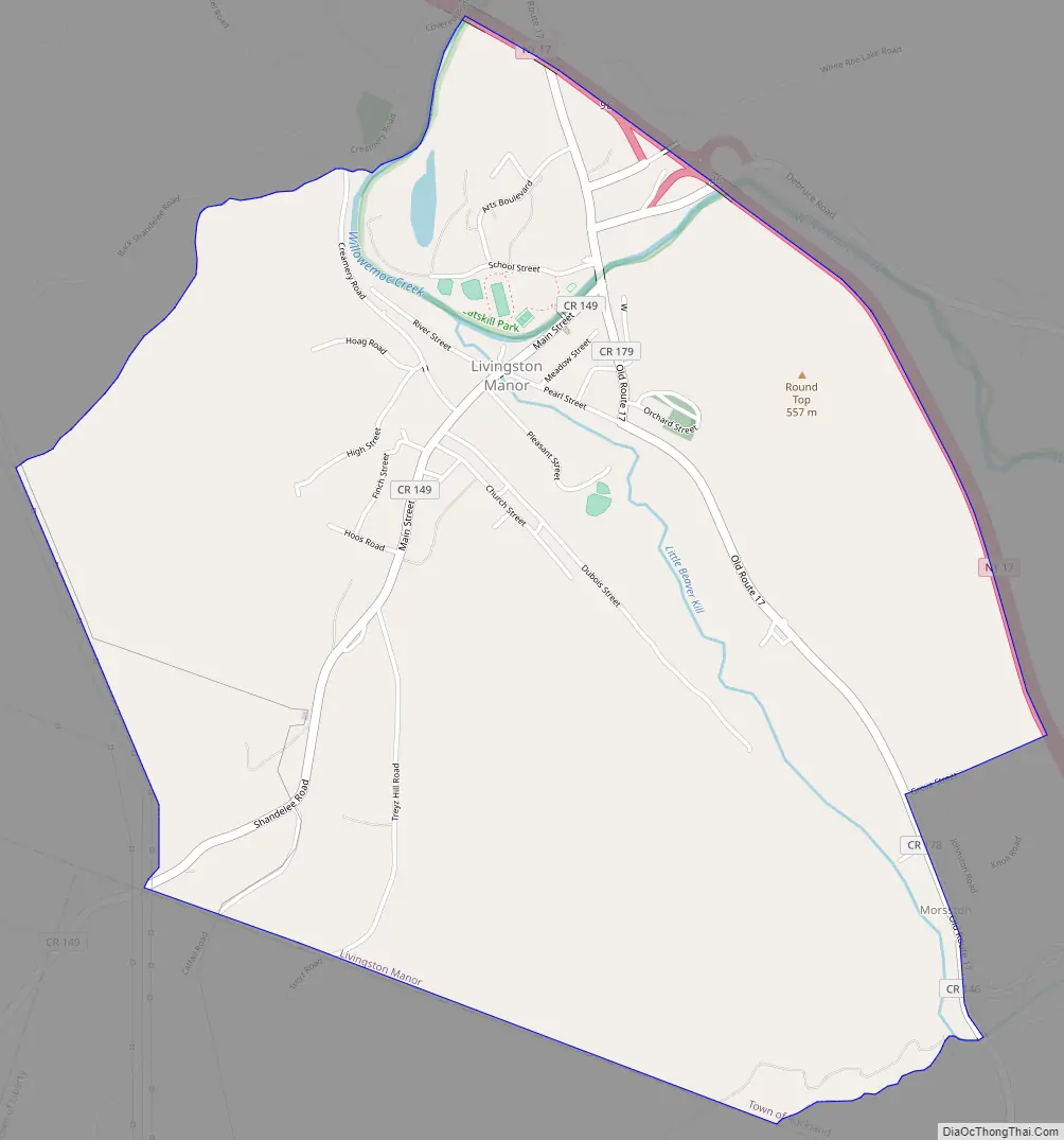
Livingston Manor Road Map
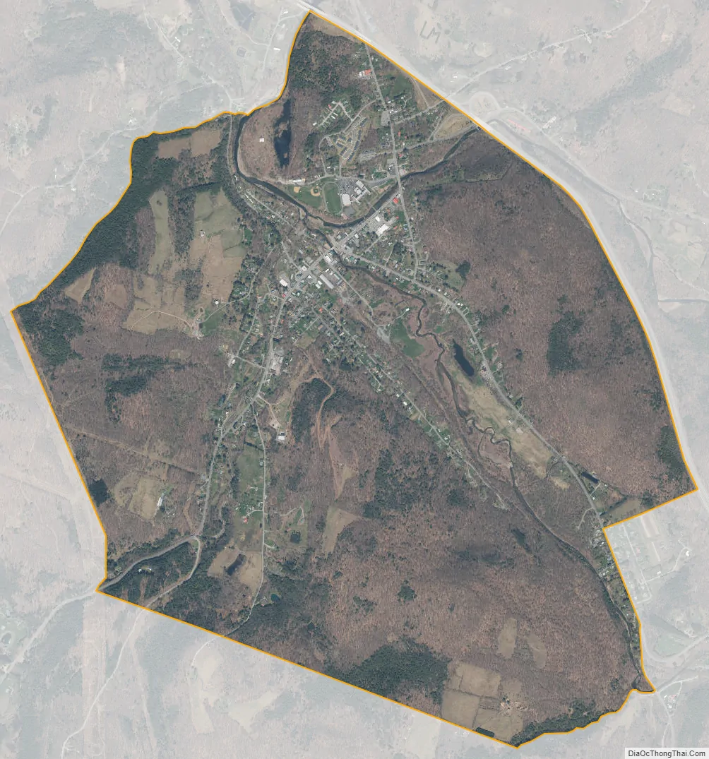
Livingston Manor city Satellite Map
Geography
Livingston Manor is located at 41°53′46″N 74°49′38″W / 41.89611°N 74.82722°W / 41.89611; -74.82722 (41.896061, -74.827348). According to the United States Census Bureau, the CDP has a total area of 3.1 square miles (8.0 km), all land.
See also
Map of New York State and its subdivision:- Albany
- Allegany
- Bronx
- Broome
- Cattaraugus
- Cayuga
- Chautauqua
- Chemung
- Chenango
- Clinton
- Columbia
- Cortland
- Delaware
- Dutchess
- Erie
- Essex
- Franklin
- Fulton
- Genesee
- Greene
- Hamilton
- Herkimer
- Jefferson
- Kings
- Lake Ontario
- Lewis
- Livingston
- Madison
- Monroe
- Montgomery
- Nassau
- New York
- Niagara
- Oneida
- Onondaga
- Ontario
- Orange
- Orleans
- Oswego
- Otsego
- Putnam
- Queens
- Rensselaer
- Richmond
- Rockland
- Saint Lawrence
- Saratoga
- Schenectady
- Schoharie
- Schuyler
- Seneca
- Steuben
- Suffolk
- Sullivan
- Tioga
- Tompkins
- Ulster
- Warren
- Washington
- Wayne
- Westchester
- Wyoming
- Yates
- Alabama
- Alaska
- Arizona
- Arkansas
- California
- Colorado
- Connecticut
- Delaware
- District of Columbia
- Florida
- Georgia
- Hawaii
- Idaho
- Illinois
- Indiana
- Iowa
- Kansas
- Kentucky
- Louisiana
- Maine
- Maryland
- Massachusetts
- Michigan
- Minnesota
- Mississippi
- Missouri
- Montana
- Nebraska
- Nevada
- New Hampshire
- New Jersey
- New Mexico
- New York
- North Carolina
- North Dakota
- Ohio
- Oklahoma
- Oregon
- Pennsylvania
- Rhode Island
- South Carolina
- South Dakota
- Tennessee
- Texas
- Utah
- Vermont
- Virginia
- Washington
- West Virginia
- Wisconsin
- Wyoming