Long Lake is a census-designated place (CDP) in the town of Long Lake, Hamilton County, New York, United States. The population was 596 at the 2020 census, out of 791 in the town of Long Lake as a whole.
Long Lake is within the Adirondack Park.
| Name: | Long Lake CDP |
|---|---|
| LSAD Code: | 57 |
| LSAD Description: | CDP (suffix) |
| State: | New York |
| County: | Hamilton County |
| Elevation: | 1,670 ft (510 m) |
| Total Area: | 11.80 sq mi (30.56 km²) |
| Land Area: | 9.35 sq mi (24.21 km²) |
| Water Area: | 2.45 sq mi (6.35 km²) 15.8% |
| Total Population: | 596 |
| Population Density: | 63.76/sq mi (24.62/km²) |
| ZIP code: | 12847 |
| Area code: | 518 |
| FIPS code: | 3643401 |
| GNISfeature ID: | 2628176 |
Online Interactive Map
Click on ![]() to view map in "full screen" mode.
to view map in "full screen" mode.
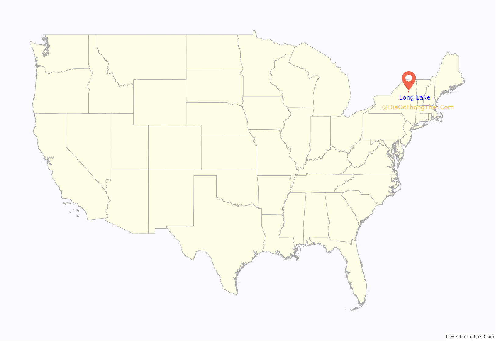
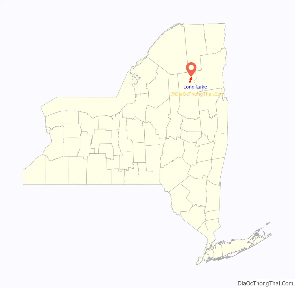
Long Lake location map. Where is Long Lake CDP?
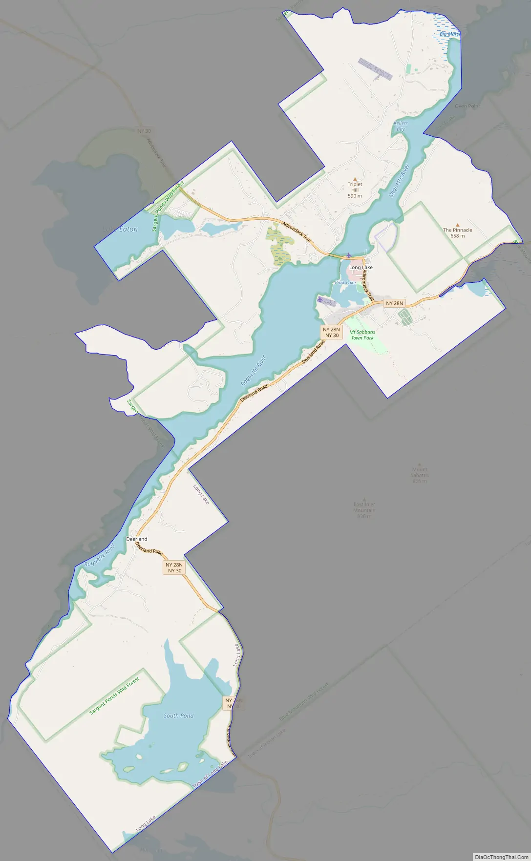
Long Lake Road Map
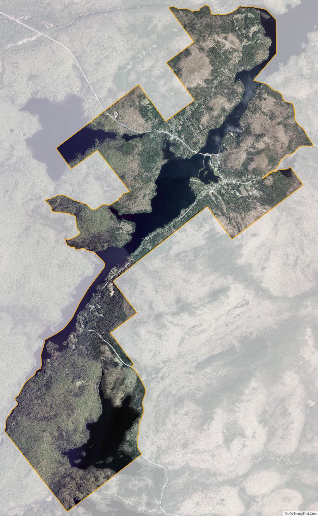
Long Lake city Satellite Map
Geography
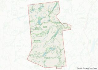
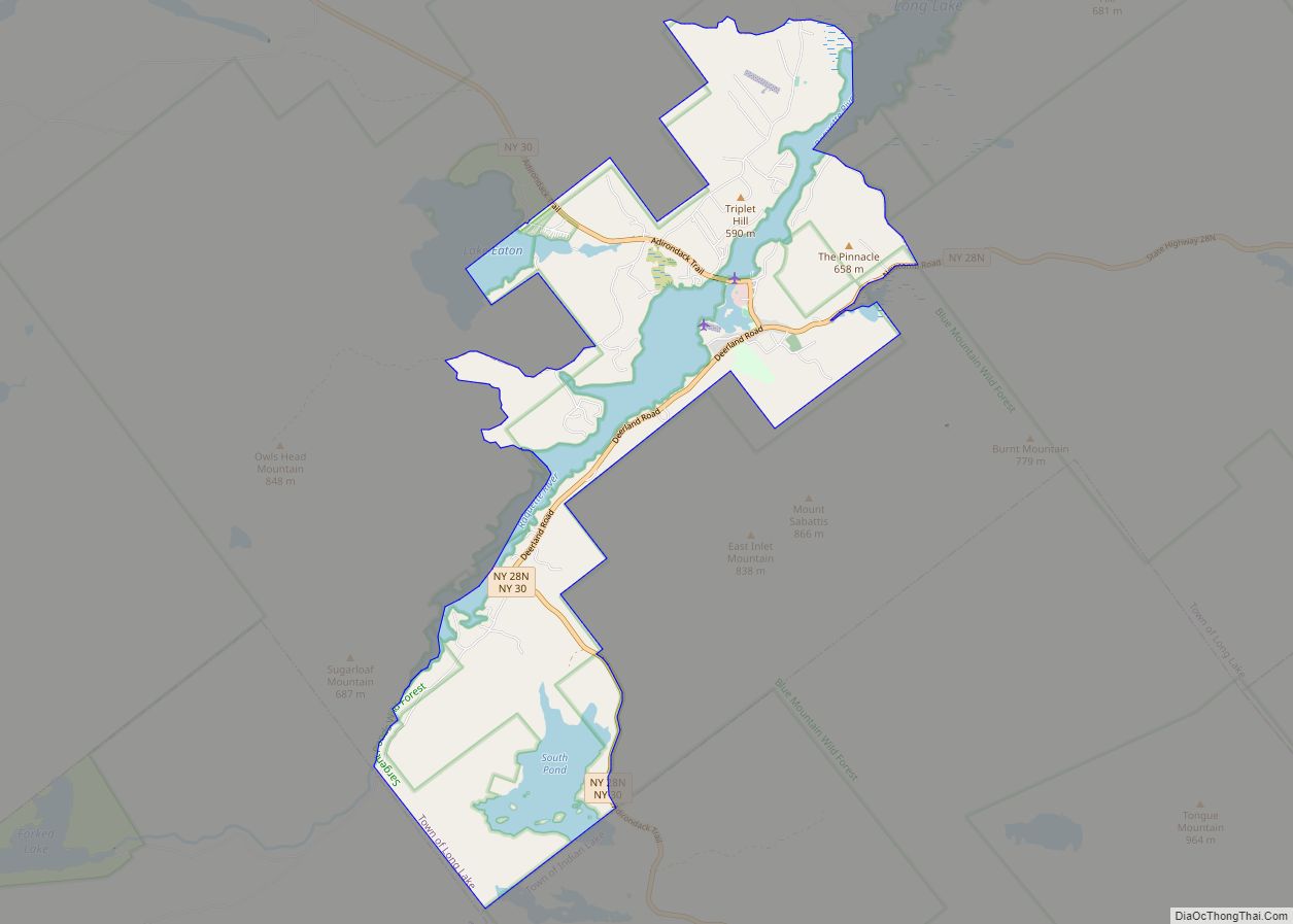
The community is located in the northeastern part of Hamilton County, surrounding the southwestern half of the water body Long Lake. The center of the community is on the southeastern side of the lake, where New York State Route 30 crosses. The community extends southwest along Long Lake to include the hamlet of Deerland. Route 30 leads north 21 miles (34 km) to Tupper Lake, and south 11 miles (18 km) to Blue Mountain Lake. New York State Route 28N runs east from Long Lake 14 miles (23 km) to Newcomb, and south with Route 30 to Blue Mountain Lake.
According to the United States Census Bureau, the CDP has a total area of 13.9 square miles (36.1 km), of which 11.7 square miles (30.4 km) are land and 2.2 square miles (5.7 km), or 15.86%, are water. Long Lake, the water body, runs northeastward from the Long Lake CDP and is drained by the Raquette River, a northward-flowing tributary of the St. Lawrence River.
See also
Map of New York State and its subdivision:- Albany
- Allegany
- Bronx
- Broome
- Cattaraugus
- Cayuga
- Chautauqua
- Chemung
- Chenango
- Clinton
- Columbia
- Cortland
- Delaware
- Dutchess
- Erie
- Essex
- Franklin
- Fulton
- Genesee
- Greene
- Hamilton
- Herkimer
- Jefferson
- Kings
- Lake Ontario
- Lewis
- Livingston
- Madison
- Monroe
- Montgomery
- Nassau
- New York
- Niagara
- Oneida
- Onondaga
- Ontario
- Orange
- Orleans
- Oswego
- Otsego
- Putnam
- Queens
- Rensselaer
- Richmond
- Rockland
- Saint Lawrence
- Saratoga
- Schenectady
- Schoharie
- Schuyler
- Seneca
- Steuben
- Suffolk
- Sullivan
- Tioga
- Tompkins
- Ulster
- Warren
- Washington
- Wayne
- Westchester
- Wyoming
- Yates
- Alabama
- Alaska
- Arizona
- Arkansas
- California
- Colorado
- Connecticut
- Delaware
- District of Columbia
- Florida
- Georgia
- Hawaii
- Idaho
- Illinois
- Indiana
- Iowa
- Kansas
- Kentucky
- Louisiana
- Maine
- Maryland
- Massachusetts
- Michigan
- Minnesota
- Mississippi
- Missouri
- Montana
- Nebraska
- Nevada
- New Hampshire
- New Jersey
- New Mexico
- New York
- North Carolina
- North Dakota
- Ohio
- Oklahoma
- Oregon
- Pennsylvania
- Rhode Island
- South Carolina
- South Dakota
- Tennessee
- Texas
- Utah
- Vermont
- Virginia
- Washington
- West Virginia
- Wisconsin
- Wyoming