Macedon is a hamlet (and census-designated place) located in the Town of Macedon in Wayne County, New York, United States. As of the 2010 census, the hamlet had a total population of 1,523. It is in the south-central part of the town and is southeast of Rochester.
Government offices for the Town of Macedon are located in the hamlet.
| Name: | Macedon CDP |
|---|---|
| LSAD Code: | 57 |
| LSAD Description: | CDP (suffix) |
| State: | New York |
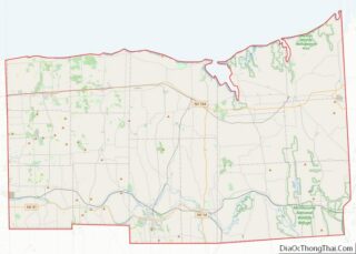
| County: | Wayne County |
| Incorporated: | November 1856 (1856-11) |
| Elevation: | 472 ft (144 m) |
| Total Area: | 2.21 sq mi (5.71 km²) |
| Land Area: | 2.18 sq mi (5.64 km²) |
| Water Area: | 0.03 sq mi (0.07 km²) |
| Total Population: | 2,092 |
| Population Density: | 961.40/sq mi (371.14/km²) |
| ZIP code: | 14502 |
| Area code: | 315 and 680 |
| FIPS code: | 3644149 |
| GNISfeature ID: | 0956224 |
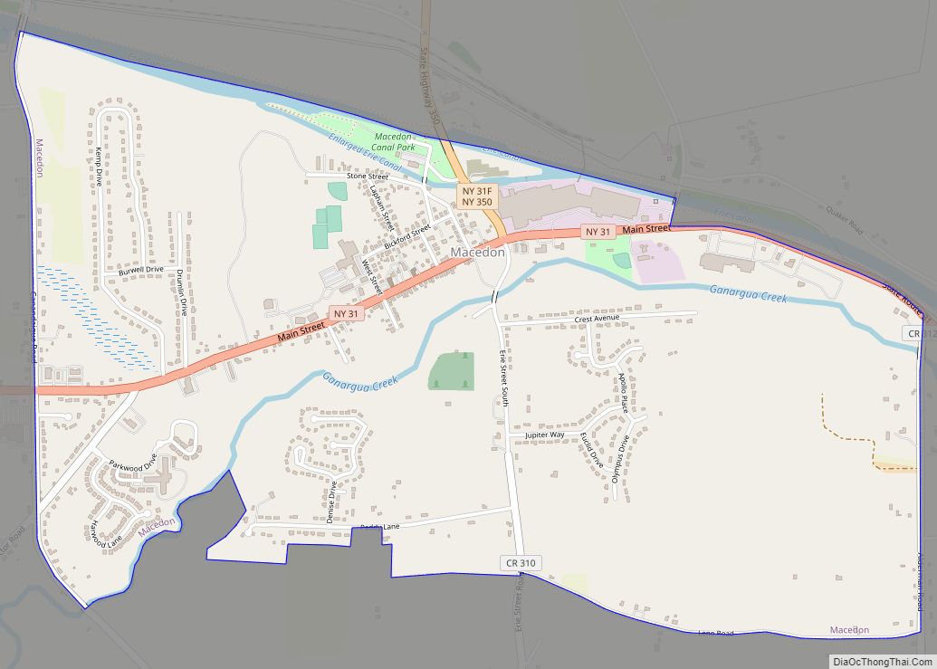
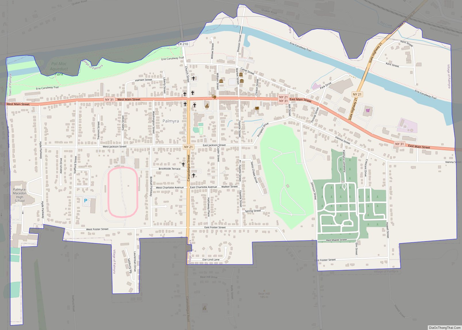
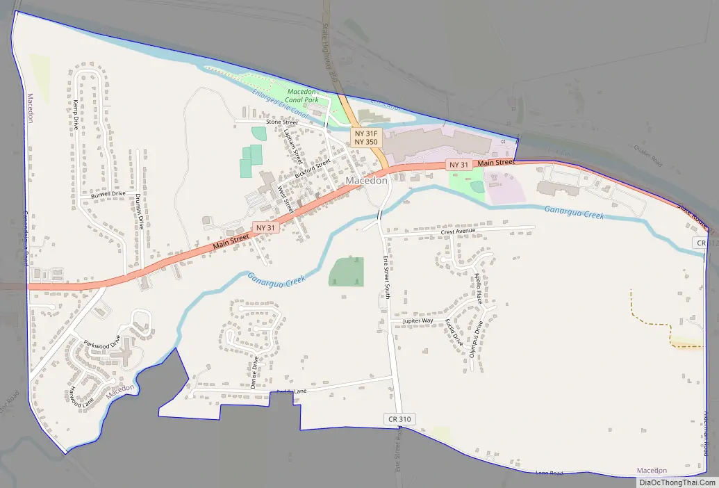
Online Interactive Map
Click on ![]() to view map in "full screen" mode.
to view map in "full screen" mode.
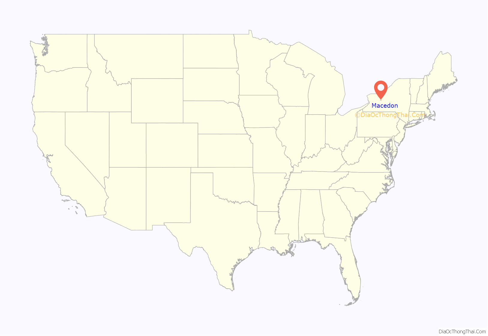
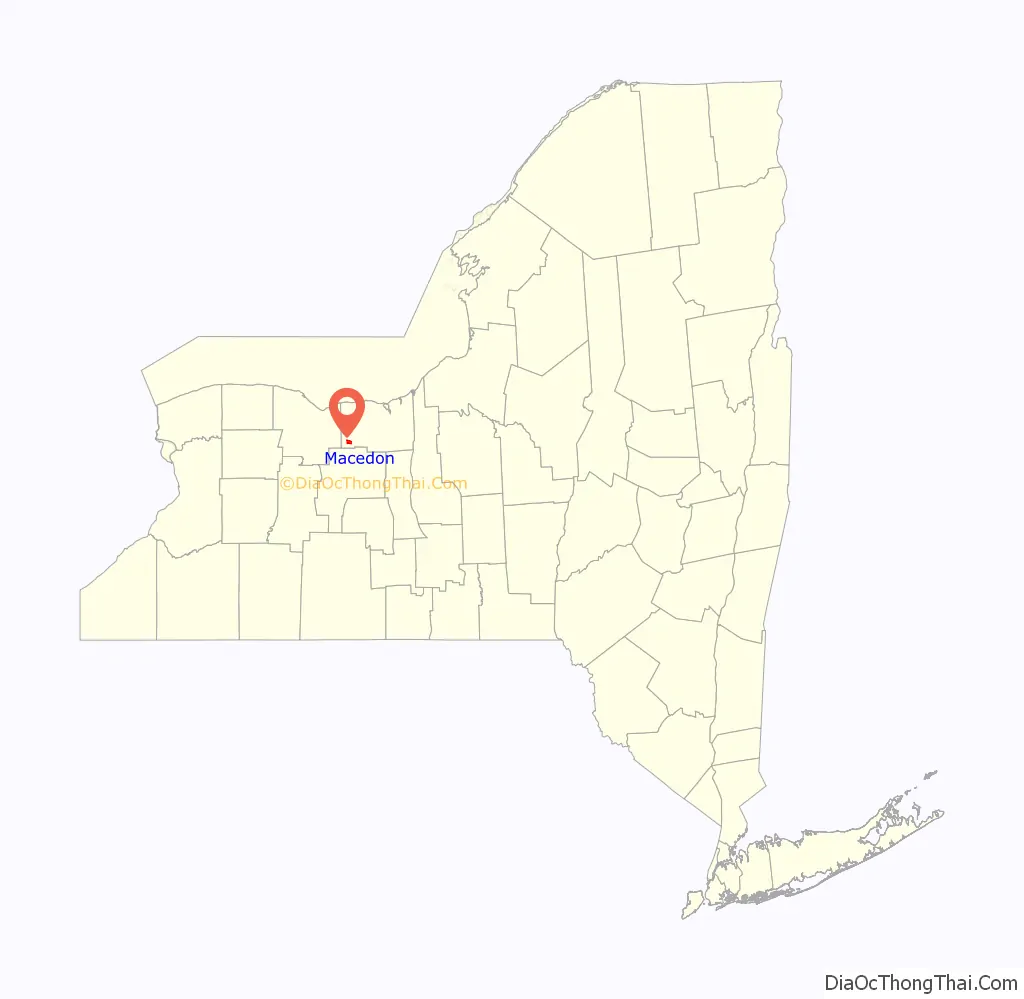
Macedon location map. Where is Macedon CDP?
History
Macedon became an inland port, located near Lock 30 on the Erie Canal (completed in 1825). The village was incorporated in 1856. Lock 30 of the canal is still in use. In the mid-late 19th century, Macedon was home of Bickford & Huffman, a manufacturer of grain drills which eventually became part of the Oliver Farm Equipment Company.
Remnants of the former Enlarged Erie Canal Lock 61 (also called the Upper Macedon Lock) are located off Route 31F and Route 350, across the road from the current Lock 30 behind Berry Plastics Corporation. It was a double-chamber lock built in 1842, and had a lift of 6.69 feet (2.04 m) to the west. The area now serves as a spillway for Lock 30 which is managed by the New York State Canal Corporation.
The village is part of the Erie Canalway National Heritage Corridor. Erie Canal Lock 30 is located beyond Macedon Fire Department at Canal Park, just off Route 31F and Route 350. It was built around 1914, and has a lift of 16.4 feet (5.0 m) to the west.
The village disincorporated on March 31, 2017. All administrative functions of the former village are now handled by the Town of Macedon.
Macedon Road Map
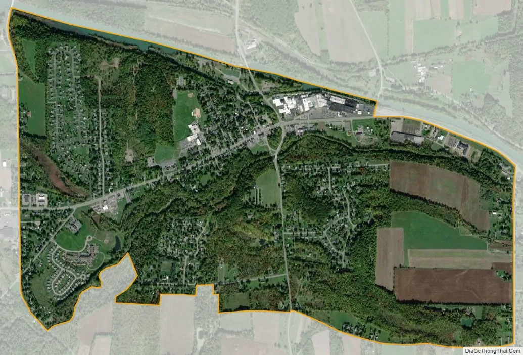
Macedon city Satellite Map
Geography
According to the United States Census Bureau, the village has a total area of 1.2 square miles (3.2 km), of which 1.2 square miles (3.2 km) is land and 0.81% is water.
The former village is located on the Erie Canal and the junction of state routes 31, 31F and 350.
See also
Map of New York State and its subdivision:- Albany
- Allegany
- Bronx
- Broome
- Cattaraugus
- Cayuga
- Chautauqua
- Chemung
- Chenango
- Clinton
- Columbia
- Cortland
- Delaware
- Dutchess
- Erie
- Essex
- Franklin
- Fulton
- Genesee
- Greene
- Hamilton
- Herkimer
- Jefferson
- Kings
- Lake Ontario
- Lewis
- Livingston
- Madison
- Monroe
- Montgomery
- Nassau
- New York
- Niagara
- Oneida
- Onondaga
- Ontario
- Orange
- Orleans
- Oswego
- Otsego
- Putnam
- Queens
- Rensselaer
- Richmond
- Rockland
- Saint Lawrence
- Saratoga
- Schenectady
- Schoharie
- Schuyler
- Seneca
- Steuben
- Suffolk
- Sullivan
- Tioga
- Tompkins
- Ulster
- Warren
- Washington
- Wayne
- Westchester
- Wyoming
- Yates
- Alabama
- Alaska
- Arizona
- Arkansas
- California
- Colorado
- Connecticut
- Delaware
- District of Columbia
- Florida
- Georgia
- Hawaii
- Idaho
- Illinois
- Indiana
- Iowa
- Kansas
- Kentucky
- Louisiana
- Maine
- Maryland
- Massachusetts
- Michigan
- Minnesota
- Mississippi
- Missouri
- Montana
- Nebraska
- Nevada
- New Hampshire
- New Jersey
- New Mexico
- New York
- North Carolina
- North Dakota
- Ohio
- Oklahoma
- Oregon
- Pennsylvania
- Rhode Island
- South Carolina
- South Dakota
- Tennessee
- Texas
- Utah
- Vermont
- Virginia
- Washington
- West Virginia
- Wisconsin
- Wyoming