Manhasset Hills is a hamlet and census-designated place (CDP) in the Town of North Hempstead in Nassau County, on Long Island, in New York, United States. The population was 3,592 at the 2010 census. Neighboring communities include Herricks, North Hills, North New Hyde Park, and Lake Success.
| Name: | Manhasset Hills CDP |
|---|---|
| LSAD Code: | 57 |
| LSAD Description: | CDP (suffix) |
| State: | New York |
| County: | Nassau County |
| Elevation: | 125 ft (38 m) |
| Total Area: | 0.59 sq mi (1.53 km²) |
| Land Area: | 0.59 sq mi (1.53 km²) |
| Water Area: | 0.00 sq mi (0.00 km²) |
| Total Population: | 3,649 |
| Population Density: | 6,174.28/sq mi (2,382.85/km²) |
| ZIP code: | 11040 |
| FIPS code: | 3644908 |
| GNISfeature ID: | 1867410 |
Online Interactive Map
Click on ![]() to view map in "full screen" mode.
to view map in "full screen" mode.
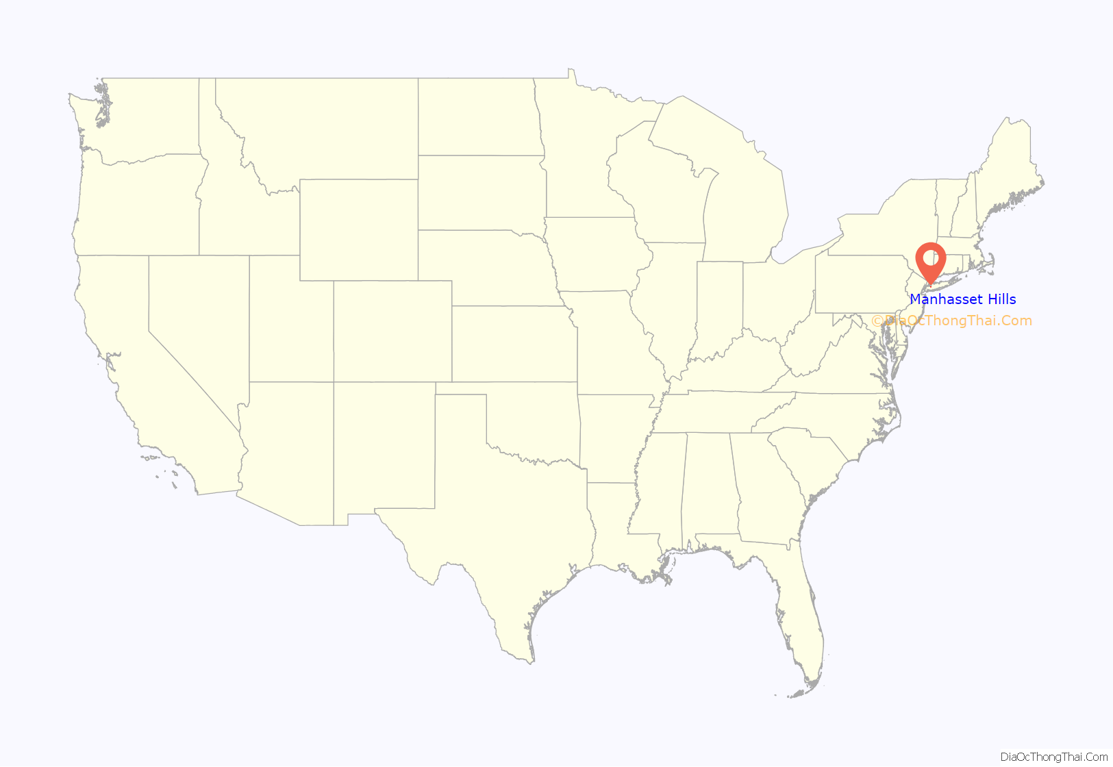
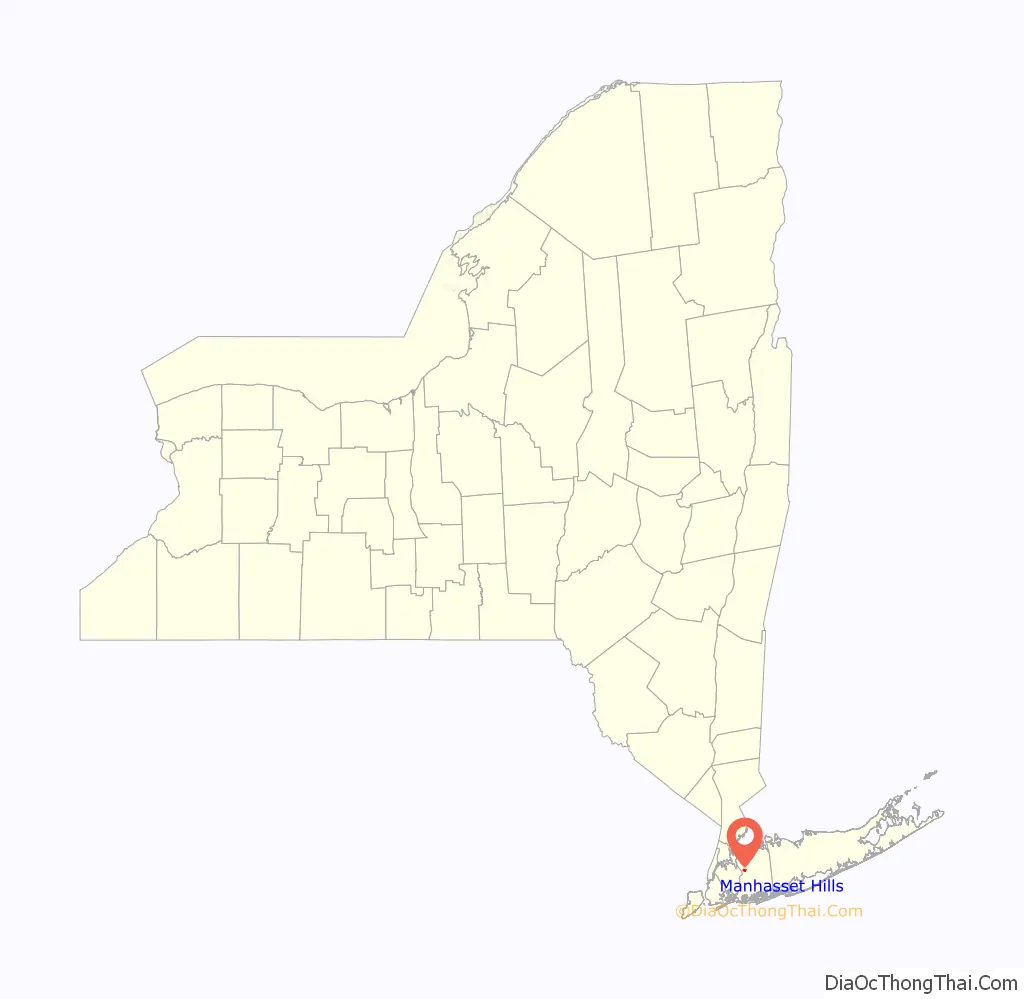
Manhasset Hills location map. Where is Manhasset Hills CDP?
History
By the late 1950s, much of the land in Manhasset Hills had been developed by developers. One of the last major developments to be built was the Cherrywood Homes development, which was built on a 24-acre tract by Barney and Martin Spiegel. The development was built with 88 split-level houses designed by A.H. Salkowitz, and was constructed on one of the last remaining major undeveloped tracts of land available in Manhasset Hills.
In the 1980s and 1990s, roughly 1,000 Manhasset Hills residents attempted to prevent the State of New York from placing a group home in their neighborhood for people with mental disabilities. Many were concerned that their property values would decrease because of the group home’s presence, and attempted to change a law in order to prevent the home from being established. The residents were successful in preventing the group home from being established in their community, and the home was instead established in nearby New Hyde Park.
The Long Island Motor Parkway used to run along the northern border of the hamlet.
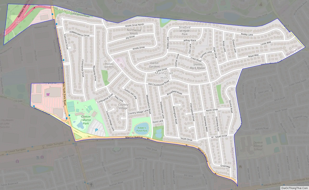
Manhasset Hills Road Map
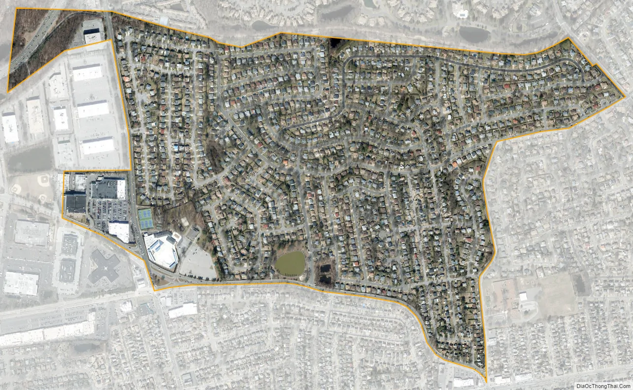
Manhasset Hills city Satellite Map
Geography
According to the United States Census Bureau, the CDP has a total area of 0.6 square miles (1.6 km), all land.
See also
Map of New York State and its subdivision:- Albany
- Allegany
- Bronx
- Broome
- Cattaraugus
- Cayuga
- Chautauqua
- Chemung
- Chenango
- Clinton
- Columbia
- Cortland
- Delaware
- Dutchess
- Erie
- Essex
- Franklin
- Fulton
- Genesee
- Greene
- Hamilton
- Herkimer
- Jefferson
- Kings
- Lake Ontario
- Lewis
- Livingston
- Madison
- Monroe
- Montgomery
- Nassau
- New York
- Niagara
- Oneida
- Onondaga
- Ontario
- Orange
- Orleans
- Oswego
- Otsego
- Putnam
- Queens
- Rensselaer
- Richmond
- Rockland
- Saint Lawrence
- Saratoga
- Schenectady
- Schoharie
- Schuyler
- Seneca
- Steuben
- Suffolk
- Sullivan
- Tioga
- Tompkins
- Ulster
- Warren
- Washington
- Wayne
- Westchester
- Wyoming
- Yates
- Alabama
- Alaska
- Arizona
- Arkansas
- California
- Colorado
- Connecticut
- Delaware
- District of Columbia
- Florida
- Georgia
- Hawaii
- Idaho
- Illinois
- Indiana
- Iowa
- Kansas
- Kentucky
- Louisiana
- Maine
- Maryland
- Massachusetts
- Michigan
- Minnesota
- Mississippi
- Missouri
- Montana
- Nebraska
- Nevada
- New Hampshire
- New Jersey
- New Mexico
- New York
- North Carolina
- North Dakota
- Ohio
- Oklahoma
- Oregon
- Pennsylvania
- Rhode Island
- South Carolina
- South Dakota
- Tennessee
- Texas
- Utah
- Vermont
- Virginia
- Washington
- West Virginia
- Wisconsin
- Wyoming


